{
	"@context": "https://project-open-data.cio.gov/v1.1/schema/catalog.jsonld",
	"@type": "dcat:Catalog",
	"conformsTo": "https://project-open-data.cio.gov/v1.1/schema",
	"describedBy": "https://project-open-data.cio.gov/v1.1/schema/catalog.json",
	"dataset": [
		{
			"@type": "dcat:Dataset",
			"identifier": "https://www.arcgis.com/home/item.html?id=ae3d1060c0fa4881a0838e4d3d235fa5&sublayer=0",
			"landingPage": "https://data-peoriacountygis.opendata.arcgis.com/datasets/peoriacountygis::peoria-promise-addresses",
			"title": "Peoria Promise Addresses",
			"description": "<div style='text-align:Left;font-size:12pt'><p><span>This feature class contains address points within Peoria County, Illinois for the Peoria Promise organization.  The purpose of the feature class is to list property owners that are eligible for the Peoria Promise scholarship program.  Please see the Peoria Promise website for more information:  </span><a href='http://www.peoriapromise.org/eligibility' style='text-decoration:underline;' rel='nofollow ugc'><span>http://www.peoriapromise.org/eligibility</span></a></p></div>",
			"keyword": [
				"peoria",
				"promise",
				"organization",
				"student",
				"students",
				"address",
				"addresses"
			],
			"issued": "2023-01-30T21:52:43.000Z",
			"modified": "2026-05-16T07:51:20.572Z",
			"publisher": {
				"name": "County of Peoria"
			},
			"contactPoint": {
				"@type": "vcard:Contact",
				"fn": "GISAdmin",
				"hasEmail": "mailto:gis@peoriacounty.org"
			},
			"accessLevel": "public",
			"spatial": "-89.9891,40.5217,-89.4510,40.9728",
			"license": "<div style='text-align:Left;font-size:12pt'><p><a href='https://data-peoriacountygis.opendata.arcgis.com/pages/peoria-county-gis-open-data-license-agreement' style='text-decoration:underline;' rel='nofollow ugc'><span>License Agreement</span></a></p></div>",
			"distribution": [
				{
					"@type": "dcat:Distribution",
					"title": "ArcGIS Hub Dataset",
					"format": "Web Page",
					"mediaType": "text/html",
					"accessURL": "https://data-peoriacountygis.opendata.arcgis.com/datasets/peoriacountygis::peoria-promise-addresses"
				},
				{
					"@type": "dcat:Distribution",
					"title": "ArcGIS GeoService",
					"format": "ArcGIS GeoServices REST API",
					"mediaType": "application/json",
					"accessURL": "https://services.arcgis.com/iPiPjILCMYxPZWTc/arcgis/rest/services/Peoria_Promise_Addresses/FeatureServer/0"
				},
				{
					"@type": "dcat:Distribution",
					"title": "CSV",
					"format": "CSV",
					"mediaType": "text/csv",
					"accessURL": "https://data-peoriacountygis.opendata.arcgis.com/api/download/v1/items/ae3d1060c0fa4881a0838e4d3d235fa5/csv?layers=0"
				},
				{
					"@type": "dcat:Distribution",
					"title": "Shapefile",
					"format": "ZIP",
					"mediaType": "application/zip",
					"accessURL": "https://data-peoriacountygis.opendata.arcgis.com/api/download/v1/items/ae3d1060c0fa4881a0838e4d3d235fa5/shapefile?layers=0"
				},
				{
					"@type": "dcat:Distribution",
					"title": "GeoJSON",
					"format": "GeoJSON",
					"mediaType": "application/vnd.geo+json",
					"accessURL": "https://data-peoriacountygis.opendata.arcgis.com/api/download/v1/items/ae3d1060c0fa4881a0838e4d3d235fa5/geojson?layers=0"
				},
				{
					"@type": "dcat:Distribution",
					"title": "KML",
					"format": "KML",
					"mediaType": "application/vnd.google-earth.kml+xml",
					"accessURL": "https://data-peoriacountygis.opendata.arcgis.com/api/download/v1/items/ae3d1060c0fa4881a0838e4d3d235fa5/kml?layers=0"
				},
				{
					"@type": "dcat:Distribution",
					"title": "File Geodatabase",
					"format": "ZIP",
					"mediaType": "application/zip",
					"accessURL": "https://data-peoriacountygis.opendata.arcgis.com/api/download/v1/items/ae3d1060c0fa4881a0838e4d3d235fa5/filegdb?layers=0"
				},
				{
					"@type": "dcat:Distribution",
					"title": "Feature Collection",
					"format": "TXT",
					"mediaType": "text/plain",
					"accessURL": "https://data-peoriacountygis.opendata.arcgis.com/api/download/v1/items/ae3d1060c0fa4881a0838e4d3d235fa5/featureCollection?layers=0"
				},
				{
					"@type": "dcat:Distribution",
					"title": "Excel",
					"format": "XLSX",
					"mediaType": "application/vnd.ms-excel",
					"accessURL": "https://data-peoriacountygis.opendata.arcgis.com/api/download/v1/items/ae3d1060c0fa4881a0838e4d3d235fa5/excel?layers=0"
				},
				{
					"@type": "dcat:Distribution",
					"title": "GeoPackage",
					"format": "GPKG",
					"mediaType": "application/geopackage+sqlite3",
					"accessURL": "https://data-peoriacountygis.opendata.arcgis.com/api/download/v1/items/ae3d1060c0fa4881a0838e4d3d235fa5/geoPackage?layers=0"
				},
				{
					"@type": "dcat:Distribution",
					"title": "SQLite Geodatabase",
					"format": "GDB",
					"mediaType": "application/geopackage+sqlite3",
					"accessURL": "https://data-peoriacountygis.opendata.arcgis.com/api/download/v1/items/ae3d1060c0fa4881a0838e4d3d235fa5/sqlite?layers=0"
				}
			],
			"theme": [
				"geospatial"
			]
		},
		{
			"@type": "dcat:Dataset",
			"identifier": "https://www.arcgis.com/home/item.html?id=57f3e9e900664aa48aaccb4d0b9e6f89&sublayer=0",
			"landingPage": "https://data-peoriacountygis.opendata.arcgis.com/datasets/peoriacountygis::polling-places-3",
			"title": "Polling Places",
			"description": "<div style='text-align:Left;font-size:12pt'><p><span>Point feature class containing polling places within Peoria County, Illinois. Attributes include: polling place, polling place address, polling place hours, handicap accessible (Yes/No), next election date, voter registration deadline, contact name, contact phone, contact email, polling place wait time (minutes), township, precinct names, precinct building photos.</span></p></div>",
			"keyword": [
				"polling",
				"place",
				"places",
				"voting",
				"vote",
				"elections"
			],
			"issued": "2020-11-10T15:45:19.000Z",
			"modified": "2026-05-16T07:50:07.727Z",
			"publisher": {
				"name": "County of Peoria"
			},
			"contactPoint": {
				"@type": "vcard:Contact",
				"fn": "GISAdmin",
				"hasEmail": "mailto:gis@peoriacounty.org"
			},
			"accessLevel": "public",
			"spatial": "-89.9799,40.5679,-89.4877,40.9399",
			"license": "<div style='text-align:Left;font-size:12pt'><p><a href='https://data-peoriacountygis.opendata.arcgis.com/pages/peoria-county-gis-open-data-license-agreement' rel='nofollow ugc' style='text-decoration:underline;'><span>License Agreement</span></a></p></div>",
			"distribution": [
				{
					"@type": "dcat:Distribution",
					"title": "ArcGIS Hub Dataset",
					"format": "Web Page",
					"mediaType": "text/html",
					"accessURL": "https://data-peoriacountygis.opendata.arcgis.com/datasets/peoriacountygis::polling-places-3"
				},
				{
					"@type": "dcat:Distribution",
					"title": "ArcGIS GeoService",
					"format": "ArcGIS GeoServices REST API",
					"mediaType": "application/json",
					"accessURL": "https://services.arcgis.com/iPiPjILCMYxPZWTc/arcgis/rest/services/Polling_Places/FeatureServer/0"
				},
				{
					"@type": "dcat:Distribution",
					"title": "CSV",
					"format": "CSV",
					"mediaType": "text/csv",
					"accessURL": "https://data-peoriacountygis.opendata.arcgis.com/api/download/v1/items/57f3e9e900664aa48aaccb4d0b9e6f89/csv?layers=0"
				},
				{
					"@type": "dcat:Distribution",
					"title": "Shapefile",
					"format": "ZIP",
					"mediaType": "application/zip",
					"accessURL": "https://data-peoriacountygis.opendata.arcgis.com/api/download/v1/items/57f3e9e900664aa48aaccb4d0b9e6f89/shapefile?layers=0"
				},
				{
					"@type": "dcat:Distribution",
					"title": "GeoJSON",
					"format": "GeoJSON",
					"mediaType": "application/vnd.geo+json",
					"accessURL": "https://data-peoriacountygis.opendata.arcgis.com/api/download/v1/items/57f3e9e900664aa48aaccb4d0b9e6f89/geojson?layers=0"
				},
				{
					"@type": "dcat:Distribution",
					"title": "KML",
					"format": "KML",
					"mediaType": "application/vnd.google-earth.kml+xml",
					"accessURL": "https://data-peoriacountygis.opendata.arcgis.com/api/download/v1/items/57f3e9e900664aa48aaccb4d0b9e6f89/kml?layers=0"
				},
				{
					"@type": "dcat:Distribution",
					"title": "File Geodatabase",
					"format": "ZIP",
					"mediaType": "application/zip",
					"accessURL": "https://data-peoriacountygis.opendata.arcgis.com/api/download/v1/items/57f3e9e900664aa48aaccb4d0b9e6f89/filegdb?layers=0"
				},
				{
					"@type": "dcat:Distribution",
					"title": "Feature Collection",
					"format": "TXT",
					"mediaType": "text/plain",
					"accessURL": "https://data-peoriacountygis.opendata.arcgis.com/api/download/v1/items/57f3e9e900664aa48aaccb4d0b9e6f89/featureCollection?layers=0"
				},
				{
					"@type": "dcat:Distribution",
					"title": "Excel",
					"format": "XLSX",
					"mediaType": "application/vnd.ms-excel",
					"accessURL": "https://data-peoriacountygis.opendata.arcgis.com/api/download/v1/items/57f3e9e900664aa48aaccb4d0b9e6f89/excel?layers=0"
				},
				{
					"@type": "dcat:Distribution",
					"title": "GeoPackage",
					"format": "GPKG",
					"mediaType": "application/geopackage+sqlite3",
					"accessURL": "https://data-peoriacountygis.opendata.arcgis.com/api/download/v1/items/57f3e9e900664aa48aaccb4d0b9e6f89/geoPackage?layers=0"
				},
				{
					"@type": "dcat:Distribution",
					"title": "SQLite Geodatabase",
					"format": "GDB",
					"mediaType": "application/geopackage+sqlite3",
					"accessURL": "https://data-peoriacountygis.opendata.arcgis.com/api/download/v1/items/57f3e9e900664aa48aaccb4d0b9e6f89/sqlite?layers=0"
				}
			],
			"theme": [
				"geospatial"
			]
		},
		{
			"@type": "dcat:Dataset",
			"identifier": "https://www.arcgis.com/home/item.html?id=a92470c713f64665a72fae7602bb6c9a&sublayer=0",
			"landingPage": "https://data-peoriacountygis.opendata.arcgis.com/datasets/peoriacountygis::tax-parcel-lines-history",
			"title": "Tax Parcel Lines History",
			"description": "<div style='text-align:Left;font-size:12pt'><div><div><p><span>The Peoria County Supervisor of Assessments department maintains all property tax boundaries in Peoria County, Illinois. This feature class contains boundary lines of retired properties (parcels) that have occurred since 2016. Attributes contained in this feature class include parcel line bearing and distance information.</span></p></div></div></div>",
			"keyword": [
				"parcel",
				"parcels",
				"boundary",
				"tax parcels",
				"property",
				"retired",
				"history"
			],
			"issued": "2024-07-05T13:06:23.000Z",
			"modified": "2026-05-16T07:49:24.487Z",
			"publisher": {
				"name": "County of Peoria"
			},
			"contactPoint": {
				"@type": "vcard:Contact",
				"fn": "GISAdmin",
				"hasEmail": "mailto:gis@peoriacounty.org"
			},
			"accessLevel": "public",
			"spatial": "-89.9890,40.5360,-89.4619,40.9727",
			"license": "<div style='text-align:Left;font-size:12pt'><p><a href='https://data-peoriacountygis.opendata.arcgis.com/pages/peoria-county-gis-open-data-license-agreement' style='text-decoration:underline;' rel='nofollow ugc'><span>License Agreement</span></a></p></div>",
			"distribution": [
				{
					"@type": "dcat:Distribution",
					"title": "ArcGIS Hub Dataset",
					"format": "Web Page",
					"mediaType": "text/html",
					"accessURL": "https://data-peoriacountygis.opendata.arcgis.com/datasets/peoriacountygis::tax-parcel-lines-history"
				},
				{
					"@type": "dcat:Distribution",
					"title": "ArcGIS GeoService",
					"format": "ArcGIS GeoServices REST API",
					"mediaType": "application/json",
					"accessURL": "https://services.arcgis.com/iPiPjILCMYxPZWTc/arcgis/rest/services/Tax_Parcel_Lines_History/FeatureServer/0"
				},
				{
					"@type": "dcat:Distribution",
					"title": "CSV",
					"format": "CSV",
					"mediaType": "text/csv",
					"accessURL": "https://data-peoriacountygis.opendata.arcgis.com/api/download/v1/items/a92470c713f64665a72fae7602bb6c9a/csv?layers=0"
				},
				{
					"@type": "dcat:Distribution",
					"title": "Shapefile",
					"format": "ZIP",
					"mediaType": "application/zip",
					"accessURL": "https://data-peoriacountygis.opendata.arcgis.com/api/download/v1/items/a92470c713f64665a72fae7602bb6c9a/shapefile?layers=0"
				},
				{
					"@type": "dcat:Distribution",
					"title": "GeoJSON",
					"format": "GeoJSON",
					"mediaType": "application/vnd.geo+json",
					"accessURL": "https://data-peoriacountygis.opendata.arcgis.com/api/download/v1/items/a92470c713f64665a72fae7602bb6c9a/geojson?layers=0"
				},
				{
					"@type": "dcat:Distribution",
					"title": "KML",
					"format": "KML",
					"mediaType": "application/vnd.google-earth.kml+xml",
					"accessURL": "https://data-peoriacountygis.opendata.arcgis.com/api/download/v1/items/a92470c713f64665a72fae7602bb6c9a/kml?layers=0"
				},
				{
					"@type": "dcat:Distribution",
					"title": "File Geodatabase",
					"format": "ZIP",
					"mediaType": "application/zip",
					"accessURL": "https://data-peoriacountygis.opendata.arcgis.com/api/download/v1/items/a92470c713f64665a72fae7602bb6c9a/filegdb?layers=0"
				},
				{
					"@type": "dcat:Distribution",
					"title": "Feature Collection",
					"format": "TXT",
					"mediaType": "text/plain",
					"accessURL": "https://data-peoriacountygis.opendata.arcgis.com/api/download/v1/items/a92470c713f64665a72fae7602bb6c9a/featureCollection?layers=0"
				},
				{
					"@type": "dcat:Distribution",
					"title": "Excel",
					"format": "XLSX",
					"mediaType": "application/vnd.ms-excel",
					"accessURL": "https://data-peoriacountygis.opendata.arcgis.com/api/download/v1/items/a92470c713f64665a72fae7602bb6c9a/excel?layers=0"
				},
				{
					"@type": "dcat:Distribution",
					"title": "GeoPackage",
					"format": "GPKG",
					"mediaType": "application/geopackage+sqlite3",
					"accessURL": "https://data-peoriacountygis.opendata.arcgis.com/api/download/v1/items/a92470c713f64665a72fae7602bb6c9a/geoPackage?layers=0"
				},
				{
					"@type": "dcat:Distribution",
					"title": "SQLite Geodatabase",
					"format": "GDB",
					"mediaType": "application/geopackage+sqlite3",
					"accessURL": "https://data-peoriacountygis.opendata.arcgis.com/api/download/v1/items/a92470c713f64665a72fae7602bb6c9a/sqlite?layers=0"
				}
			],
			"theme": [
				"geospatial"
			]
		},
		{
			"@type": "dcat:Dataset",
			"identifier": "https://www.arcgis.com/home/item.html?id=d2148bd9e083435bac1dca6ee8ba9fdf&sublayer=0",
			"landingPage": "https://data-peoriacountygis.opendata.arcgis.com/datasets/peoriacountygis::rural-enterprise-zones",
			"title": "Rural Enterprise Zones",
			"description": "<div style='text-align:Left;font-size:12pt'><p><span>Latest rural enterprise zone boundaries in Peoria County, Illinois.  This polygon feature class contains names of each zone, acres, and square miles.</span></p><p><p><span>City of Chillicothe:  Ordinance #15-12-25</span></p><p><span>Village of Princeville:  Ordinance #15-12-07</span></p><p><span>City of Elmwood:  Ordinance #2015-19</span></p><p><span>Village of Hanna City:  Ordinance #15-12-03</span></p></div></p>",
			"keyword": [
				"enterprise",
				"rural",
				"zones",
				"peoria",
				"county",
				"planning",
				"ArcGIS",
				"Service Definition",
				".sd"
			],
			"issued": "2017-10-13T21:04:13.000Z",
			"modified": "2026-05-16T07:48:35.045Z",
			"publisher": {
				"name": "County of Peoria"
			},
			"contactPoint": {
				"@type": "vcard:Contact",
				"fn": "GISAdmin",
				"hasEmail": "mailto:gis@peoriacounty.org"
			},
			"accessLevel": "public",
			"spatial": "-89.9857,40.6894,-89.4724,40.9571",
			"license": "https://data-peoriacountygis.opendata.arcgis.com/pages/peoria-county-gis-open-data-license-agreement",
			"distribution": [
				{
					"@type": "dcat:Distribution",
					"title": "ArcGIS Hub Dataset",
					"format": "Web Page",
					"mediaType": "text/html",
					"accessURL": "https://data-peoriacountygis.opendata.arcgis.com/datasets/peoriacountygis::rural-enterprise-zones"
				},
				{
					"@type": "dcat:Distribution",
					"title": "ArcGIS GeoService",
					"format": "ArcGIS GeoServices REST API",
					"mediaType": "application/json",
					"accessURL": "https://services.arcgis.com/iPiPjILCMYxPZWTc/arcgis/rest/services/Rural_Enterprise_Zones/FeatureServer/0"
				},
				{
					"@type": "dcat:Distribution",
					"title": "CSV",
					"format": "CSV",
					"mediaType": "text/csv",
					"accessURL": "https://data-peoriacountygis.opendata.arcgis.com/api/download/v1/items/d2148bd9e083435bac1dca6ee8ba9fdf/csv?layers=0"
				},
				{
					"@type": "dcat:Distribution",
					"title": "Shapefile",
					"format": "ZIP",
					"mediaType": "application/zip",
					"accessURL": "https://data-peoriacountygis.opendata.arcgis.com/api/download/v1/items/d2148bd9e083435bac1dca6ee8ba9fdf/shapefile?layers=0"
				},
				{
					"@type": "dcat:Distribution",
					"title": "GeoJSON",
					"format": "GeoJSON",
					"mediaType": "application/vnd.geo+json",
					"accessURL": "https://data-peoriacountygis.opendata.arcgis.com/api/download/v1/items/d2148bd9e083435bac1dca6ee8ba9fdf/geojson?layers=0"
				},
				{
					"@type": "dcat:Distribution",
					"title": "KML",
					"format": "KML",
					"mediaType": "application/vnd.google-earth.kml+xml",
					"accessURL": "https://data-peoriacountygis.opendata.arcgis.com/api/download/v1/items/d2148bd9e083435bac1dca6ee8ba9fdf/kml?layers=0"
				},
				{
					"@type": "dcat:Distribution",
					"title": "File Geodatabase",
					"format": "ZIP",
					"mediaType": "application/zip",
					"accessURL": "https://data-peoriacountygis.opendata.arcgis.com/api/download/v1/items/d2148bd9e083435bac1dca6ee8ba9fdf/filegdb?layers=0"
				},
				{
					"@type": "dcat:Distribution",
					"title": "Feature Collection",
					"format": "TXT",
					"mediaType": "text/plain",
					"accessURL": "https://data-peoriacountygis.opendata.arcgis.com/api/download/v1/items/d2148bd9e083435bac1dca6ee8ba9fdf/featureCollection?layers=0"
				},
				{
					"@type": "dcat:Distribution",
					"title": "Excel",
					"format": "XLSX",
					"mediaType": "application/vnd.ms-excel",
					"accessURL": "https://data-peoriacountygis.opendata.arcgis.com/api/download/v1/items/d2148bd9e083435bac1dca6ee8ba9fdf/excel?layers=0"
				},
				{
					"@type": "dcat:Distribution",
					"title": "GeoPackage",
					"format": "GPKG",
					"mediaType": "application/geopackage+sqlite3",
					"accessURL": "https://data-peoriacountygis.opendata.arcgis.com/api/download/v1/items/d2148bd9e083435bac1dca6ee8ba9fdf/geoPackage?layers=0"
				},
				{
					"@type": "dcat:Distribution",
					"title": "SQLite Geodatabase",
					"format": "GDB",
					"mediaType": "application/geopackage+sqlite3",
					"accessURL": "https://data-peoriacountygis.opendata.arcgis.com/api/download/v1/items/d2148bd9e083435bac1dca6ee8ba9fdf/sqlite?layers=0"
				}
			],
			"theme": [
				"geospatial"
			]
		},
		{
			"@type": "dcat:Dataset",
			"identifier": "https://www.arcgis.com/home/item.html?id=641c9a05c9d74b9687f66ca2039681dc&sublayer=0",
			"landingPage": "https://data-peoriacountygis.opendata.arcgis.com/datasets/peoriacountygis::residential-sales",
			"title": "Residential Sales",
			"description": "<div style='text-align:Left;font-size:12pt'><p><span>Point feature class contains residential home sales (Valid Sales Only) from January 2012 through July 1, 2017.  Information includes parcel number, document number, property address, property type, tax year, lot values, improvements, total assessed values, acreage, and building attributes from the CAMA system.</span></p></div>",
			"keyword": [
				"residential",
				"sale",
				"sales",
				"property"
			],
			"issued": "2023-06-21T02:18:39.000Z",
			"modified": "2026-05-16T07:47:50.825Z",
			"publisher": {
				"name": "County of Peoria"
			},
			"contactPoint": {
				"@type": "vcard:Contact",
				"fn": "GISAdmin",
				"hasEmail": "mailto:gis@peoriacounty.org"
			},
			"accessLevel": "public",
			"spatial": "-89.9839,40.5356,-89.4721,40.9723",
			"license": "<div style='text-align:Left;font-size:12pt'><p><a href='https://data-peoriacountygis.opendata.arcgis.com/pages/peoria-county-gis-open-data-license-agreement' style='text-decoration:underline;' rel='nofollow ugc'><span>License Agreement</span></a></p></div>",
			"distribution": [
				{
					"@type": "dcat:Distribution",
					"title": "ArcGIS Hub Dataset",
					"format": "Web Page",
					"mediaType": "text/html",
					"accessURL": "https://data-peoriacountygis.opendata.arcgis.com/datasets/peoriacountygis::residential-sales"
				},
				{
					"@type": "dcat:Distribution",
					"title": "ArcGIS GeoService",
					"format": "ArcGIS GeoServices REST API",
					"mediaType": "application/json",
					"accessURL": "https://services.arcgis.com/iPiPjILCMYxPZWTc/arcgis/rest/services/Residential_Sales/FeatureServer/0"
				},
				{
					"@type": "dcat:Distribution",
					"title": "CSV",
					"format": "CSV",
					"mediaType": "text/csv",
					"accessURL": "https://data-peoriacountygis.opendata.arcgis.com/api/download/v1/items/641c9a05c9d74b9687f66ca2039681dc/csv?layers=0"
				},
				{
					"@type": "dcat:Distribution",
					"title": "Shapefile",
					"format": "ZIP",
					"mediaType": "application/zip",
					"accessURL": "https://data-peoriacountygis.opendata.arcgis.com/api/download/v1/items/641c9a05c9d74b9687f66ca2039681dc/shapefile?layers=0"
				},
				{
					"@type": "dcat:Distribution",
					"title": "GeoJSON",
					"format": "GeoJSON",
					"mediaType": "application/vnd.geo+json",
					"accessURL": "https://data-peoriacountygis.opendata.arcgis.com/api/download/v1/items/641c9a05c9d74b9687f66ca2039681dc/geojson?layers=0"
				},
				{
					"@type": "dcat:Distribution",
					"title": "KML",
					"format": "KML",
					"mediaType": "application/vnd.google-earth.kml+xml",
					"accessURL": "https://data-peoriacountygis.opendata.arcgis.com/api/download/v1/items/641c9a05c9d74b9687f66ca2039681dc/kml?layers=0"
				},
				{
					"@type": "dcat:Distribution",
					"title": "File Geodatabase",
					"format": "ZIP",
					"mediaType": "application/zip",
					"accessURL": "https://data-peoriacountygis.opendata.arcgis.com/api/download/v1/items/641c9a05c9d74b9687f66ca2039681dc/filegdb?layers=0"
				},
				{
					"@type": "dcat:Distribution",
					"title": "Feature Collection",
					"format": "TXT",
					"mediaType": "text/plain",
					"accessURL": "https://data-peoriacountygis.opendata.arcgis.com/api/download/v1/items/641c9a05c9d74b9687f66ca2039681dc/featureCollection?layers=0"
				},
				{
					"@type": "dcat:Distribution",
					"title": "Excel",
					"format": "XLSX",
					"mediaType": "application/vnd.ms-excel",
					"accessURL": "https://data-peoriacountygis.opendata.arcgis.com/api/download/v1/items/641c9a05c9d74b9687f66ca2039681dc/excel?layers=0"
				},
				{
					"@type": "dcat:Distribution",
					"title": "GeoPackage",
					"format": "GPKG",
					"mediaType": "application/geopackage+sqlite3",
					"accessURL": "https://data-peoriacountygis.opendata.arcgis.com/api/download/v1/items/641c9a05c9d74b9687f66ca2039681dc/geoPackage?layers=0"
				},
				{
					"@type": "dcat:Distribution",
					"title": "SQLite Geodatabase",
					"format": "GDB",
					"mediaType": "application/geopackage+sqlite3",
					"accessURL": "https://data-peoriacountygis.opendata.arcgis.com/api/download/v1/items/641c9a05c9d74b9687f66ca2039681dc/sqlite?layers=0"
				}
			],
			"theme": [
				"geospatial"
			]
		},
		{
			"@type": "dcat:Dataset",
			"identifier": "https://www.arcgis.com/home/item.html?id=ac1cf2092bd9444b95769d79609070b7&sublayer=0",
			"landingPage": "https://data-peoriacountygis.opendata.arcgis.com/datasets/peoriacountygis::urban-enterprise-zones",
			"title": "Urban Enterprise Zones",
			"description": "<div style='text-align:Left;font-size:12pt'><div><div><p><span>Urban enterprise zone boundaries in Peoria County, Illinois.  This polygon feature class contains names of each enterprise zone, acres, and square miles.  This feature class was updated on August 8, 2019 to include amendment 6.</span></p></div></div></div>",
			"keyword": [
				"enterprise",
				"zone",
				"zones",
				"peoria",
				"county",
				"planning"
			],
			"issued": "2023-06-20T14:44:33.000Z",
			"modified": "2026-05-16T07:47:00.784Z",
			"publisher": {
				"name": "County of Peoria"
			},
			"contactPoint": {
				"@type": "vcard:Contact",
				"fn": "GISAdmin",
				"hasEmail": "mailto:gis@peoriacounty.org"
			},
			"accessLevel": "public",
			"spatial": "-89.7510,40.5572,-89.5467,40.8645",
			"license": "<div style='text-align:Left;font-size:12pt'><p><a href='https://data-peoriacountygis.opendata.arcgis.com/pages/peoria-county-gis-open-data-license-agreement' style='text-decoration:underline;' rel='nofollow ugc'><span>License Agreement</span></a></p></div>",
			"distribution": [
				{
					"@type": "dcat:Distribution",
					"title": "ArcGIS Hub Dataset",
					"format": "Web Page",
					"mediaType": "text/html",
					"accessURL": "https://data-peoriacountygis.opendata.arcgis.com/datasets/peoriacountygis::urban-enterprise-zones"
				},
				{
					"@type": "dcat:Distribution",
					"title": "ArcGIS GeoService",
					"format": "ArcGIS GeoServices REST API",
					"mediaType": "application/json",
					"accessURL": "https://services.arcgis.com/iPiPjILCMYxPZWTc/arcgis/rest/services/Urban_Enterprise_Zones/FeatureServer/0"
				},
				{
					"@type": "dcat:Distribution",
					"title": "CSV",
					"format": "CSV",
					"mediaType": "text/csv",
					"accessURL": "https://data-peoriacountygis.opendata.arcgis.com/api/download/v1/items/ac1cf2092bd9444b95769d79609070b7/csv?layers=0"
				},
				{
					"@type": "dcat:Distribution",
					"title": "Shapefile",
					"format": "ZIP",
					"mediaType": "application/zip",
					"accessURL": "https://data-peoriacountygis.opendata.arcgis.com/api/download/v1/items/ac1cf2092bd9444b95769d79609070b7/shapefile?layers=0"
				},
				{
					"@type": "dcat:Distribution",
					"title": "GeoJSON",
					"format": "GeoJSON",
					"mediaType": "application/vnd.geo+json",
					"accessURL": "https://data-peoriacountygis.opendata.arcgis.com/api/download/v1/items/ac1cf2092bd9444b95769d79609070b7/geojson?layers=0"
				},
				{
					"@type": "dcat:Distribution",
					"title": "KML",
					"format": "KML",
					"mediaType": "application/vnd.google-earth.kml+xml",
					"accessURL": "https://data-peoriacountygis.opendata.arcgis.com/api/download/v1/items/ac1cf2092bd9444b95769d79609070b7/kml?layers=0"
				},
				{
					"@type": "dcat:Distribution",
					"title": "File Geodatabase",
					"format": "ZIP",
					"mediaType": "application/zip",
					"accessURL": "https://data-peoriacountygis.opendata.arcgis.com/api/download/v1/items/ac1cf2092bd9444b95769d79609070b7/filegdb?layers=0"
				},
				{
					"@type": "dcat:Distribution",
					"title": "Feature Collection",
					"format": "TXT",
					"mediaType": "text/plain",
					"accessURL": "https://data-peoriacountygis.opendata.arcgis.com/api/download/v1/items/ac1cf2092bd9444b95769d79609070b7/featureCollection?layers=0"
				},
				{
					"@type": "dcat:Distribution",
					"title": "Excel",
					"format": "XLSX",
					"mediaType": "application/vnd.ms-excel",
					"accessURL": "https://data-peoriacountygis.opendata.arcgis.com/api/download/v1/items/ac1cf2092bd9444b95769d79609070b7/excel?layers=0"
				},
				{
					"@type": "dcat:Distribution",
					"title": "GeoPackage",
					"format": "GPKG",
					"mediaType": "application/geopackage+sqlite3",
					"accessURL": "https://data-peoriacountygis.opendata.arcgis.com/api/download/v1/items/ac1cf2092bd9444b95769d79609070b7/geoPackage?layers=0"
				},
				{
					"@type": "dcat:Distribution",
					"title": "SQLite Geodatabase",
					"format": "GDB",
					"mediaType": "application/geopackage+sqlite3",
					"accessURL": "https://data-peoriacountygis.opendata.arcgis.com/api/download/v1/items/ac1cf2092bd9444b95769d79609070b7/sqlite?layers=0"
				}
			],
			"theme": [
				"geospatial"
			]
		},
		{
			"@type": "dcat:Dataset",
			"identifier": "https://www.arcgis.com/home/item.html?id=31b3fc88769a433db23b8ec7020aa43c&sublayer=0",
			"landingPage": "https://data-peoriacountygis.opendata.arcgis.com/datasets/peoriacountygis::tax-parcel-history",
			"title": "Tax Parcel History",
			"description": "<div style='text-align:Left;font-size:12pt'><div><div><p><span>The Peoria County Supervisor of Assessments department maintains all property tax boundaries in Peoria County, Illinois. This feature class contains retired properties (parcels) that have occurred since 2016. Attributes contained in this feature class include parcel numbers (PINs), deed acres, and calculated GIS acres.</span></p></div></div></div>",
			"keyword": [
				"parcel",
				"parcels",
				"boundary",
				"tax parcels",
				"property",
				"retired",
				"history"
			],
			"issued": "2024-07-05T13:03:39.000Z",
			"modified": "2026-05-16T07:46:21.496Z",
			"publisher": {
				"name": "County of Peoria"
			},
			"contactPoint": {
				"@type": "vcard:Contact",
				"fn": "GISAdmin",
				"hasEmail": "mailto:gis@peoriacounty.org"
			},
			"accessLevel": "public",
			"spatial": "-89.9890,40.5360,-89.4619,40.9727",
			"license": "<div style='text-align:Left;font-size:12pt'><p><a href='https://data-peoriacountygis.opendata.arcgis.com/pages/peoria-county-gis-open-data-license-agreement' style='text-decoration:underline;' rel='nofollow ugc'><span>License Agreement</span></a></p></div>",
			"distribution": [
				{
					"@type": "dcat:Distribution",
					"title": "ArcGIS Hub Dataset",
					"format": "Web Page",
					"mediaType": "text/html",
					"accessURL": "https://data-peoriacountygis.opendata.arcgis.com/datasets/peoriacountygis::tax-parcel-history"
				},
				{
					"@type": "dcat:Distribution",
					"title": "ArcGIS GeoService",
					"format": "ArcGIS GeoServices REST API",
					"mediaType": "application/json",
					"accessURL": "https://services.arcgis.com/iPiPjILCMYxPZWTc/arcgis/rest/services/Tax_Parcel_History/FeatureServer/0"
				},
				{
					"@type": "dcat:Distribution",
					"title": "CSV",
					"format": "CSV",
					"mediaType": "text/csv",
					"accessURL": "https://data-peoriacountygis.opendata.arcgis.com/api/download/v1/items/31b3fc88769a433db23b8ec7020aa43c/csv?layers=0"
				},
				{
					"@type": "dcat:Distribution",
					"title": "Shapefile",
					"format": "ZIP",
					"mediaType": "application/zip",
					"accessURL": "https://data-peoriacountygis.opendata.arcgis.com/api/download/v1/items/31b3fc88769a433db23b8ec7020aa43c/shapefile?layers=0"
				},
				{
					"@type": "dcat:Distribution",
					"title": "GeoJSON",
					"format": "GeoJSON",
					"mediaType": "application/vnd.geo+json",
					"accessURL": "https://data-peoriacountygis.opendata.arcgis.com/api/download/v1/items/31b3fc88769a433db23b8ec7020aa43c/geojson?layers=0"
				},
				{
					"@type": "dcat:Distribution",
					"title": "KML",
					"format": "KML",
					"mediaType": "application/vnd.google-earth.kml+xml",
					"accessURL": "https://data-peoriacountygis.opendata.arcgis.com/api/download/v1/items/31b3fc88769a433db23b8ec7020aa43c/kml?layers=0"
				},
				{
					"@type": "dcat:Distribution",
					"title": "File Geodatabase",
					"format": "ZIP",
					"mediaType": "application/zip",
					"accessURL": "https://data-peoriacountygis.opendata.arcgis.com/api/download/v1/items/31b3fc88769a433db23b8ec7020aa43c/filegdb?layers=0"
				},
				{
					"@type": "dcat:Distribution",
					"title": "Feature Collection",
					"format": "TXT",
					"mediaType": "text/plain",
					"accessURL": "https://data-peoriacountygis.opendata.arcgis.com/api/download/v1/items/31b3fc88769a433db23b8ec7020aa43c/featureCollection?layers=0"
				},
				{
					"@type": "dcat:Distribution",
					"title": "Excel",
					"format": "XLSX",
					"mediaType": "application/vnd.ms-excel",
					"accessURL": "https://data-peoriacountygis.opendata.arcgis.com/api/download/v1/items/31b3fc88769a433db23b8ec7020aa43c/excel?layers=0"
				},
				{
					"@type": "dcat:Distribution",
					"title": "GeoPackage",
					"format": "GPKG",
					"mediaType": "application/geopackage+sqlite3",
					"accessURL": "https://data-peoriacountygis.opendata.arcgis.com/api/download/v1/items/31b3fc88769a433db23b8ec7020aa43c/geoPackage?layers=0"
				},
				{
					"@type": "dcat:Distribution",
					"title": "SQLite Geodatabase",
					"format": "GDB",
					"mediaType": "application/geopackage+sqlite3",
					"accessURL": "https://data-peoriacountygis.opendata.arcgis.com/api/download/v1/items/31b3fc88769a433db23b8ec7020aa43c/sqlite?layers=0"
				}
			],
			"theme": [
				"geospatial"
			]
		},
		{
			"@type": "dcat:Dataset",
			"identifier": "https://www.arcgis.com/home/item.html?id=7af3b3fb88e64f4cbc28db86ae2e975a&sublayer=1",
			"landingPage": "https://data-peoriacountygis.opendata.arcgis.com/datasets/peoriacountygis::municipality",
			"title": "Municipality",
			"description": "<div style='text-align:Left;font-size:12pt'><p><span>Municipality boundaries within Peoria County, IL.  Boundaries are continually updated using recorded legal documents.</span></p></div>",
			"keyword": [
				"peoria",
				"peoria county",
				"municipality",
				"municipalities",
				"corporate",
				"limit",
				"limits",
				"legal",
				"boundary",
				"boundaries",
				"administrative"
			],
			"issued": "2023-06-16T04:41:19.000Z",
			"modified": "2026-05-16T07:45:38.409Z",
			"publisher": {
				"name": "County of Peoria"
			},
			"contactPoint": {
				"@type": "vcard:Contact",
				"fn": "GISAdmin",
				"hasEmail": "mailto:gis@peoriacounty.org"
			},
			"accessLevel": "public",
			"spatial": "-89.9871,40.5500,-89.4639,40.9507",
			"license": "<div style='text-align:Left;font-size:12pt'><div><div><p><a href='https://data-peoriacountygis.opendata.arcgis.com/pages/peoria-county-gis-open-data-license-agreement' style='text-decoration:underline;' rel='nofollow ugc'><span>License Agreement</span></a></p></div></div></div>",
			"distribution": [
				{
					"@type": "dcat:Distribution",
					"title": "ArcGIS Hub Dataset",
					"format": "Web Page",
					"mediaType": "text/html",
					"accessURL": "https://data-peoriacountygis.opendata.arcgis.com/datasets/peoriacountygis::municipality"
				},
				{
					"@type": "dcat:Distribution",
					"title": "ArcGIS GeoService",
					"format": "ArcGIS GeoServices REST API",
					"mediaType": "application/json",
					"accessURL": "https://services.arcgis.com/iPiPjILCMYxPZWTc/arcgis/rest/services/Municipality/FeatureServer/1"
				},
				{
					"@type": "dcat:Distribution",
					"title": "CSV",
					"format": "CSV",
					"mediaType": "text/csv",
					"accessURL": "https://data-peoriacountygis.opendata.arcgis.com/api/download/v1/items/7af3b3fb88e64f4cbc28db86ae2e975a/csv?layers=1"
				},
				{
					"@type": "dcat:Distribution",
					"title": "Shapefile",
					"format": "ZIP",
					"mediaType": "application/zip",
					"accessURL": "https://data-peoriacountygis.opendata.arcgis.com/api/download/v1/items/7af3b3fb88e64f4cbc28db86ae2e975a/shapefile?layers=1"
				},
				{
					"@type": "dcat:Distribution",
					"title": "GeoJSON",
					"format": "GeoJSON",
					"mediaType": "application/vnd.geo+json",
					"accessURL": "https://data-peoriacountygis.opendata.arcgis.com/api/download/v1/items/7af3b3fb88e64f4cbc28db86ae2e975a/geojson?layers=1"
				},
				{
					"@type": "dcat:Distribution",
					"title": "KML",
					"format": "KML",
					"mediaType": "application/vnd.google-earth.kml+xml",
					"accessURL": "https://data-peoriacountygis.opendata.arcgis.com/api/download/v1/items/7af3b3fb88e64f4cbc28db86ae2e975a/kml?layers=1"
				},
				{
					"@type": "dcat:Distribution",
					"title": "File Geodatabase",
					"format": "ZIP",
					"mediaType": "application/zip",
					"accessURL": "https://data-peoriacountygis.opendata.arcgis.com/api/download/v1/items/7af3b3fb88e64f4cbc28db86ae2e975a/filegdb?layers=1"
				},
				{
					"@type": "dcat:Distribution",
					"title": "Feature Collection",
					"format": "TXT",
					"mediaType": "text/plain",
					"accessURL": "https://data-peoriacountygis.opendata.arcgis.com/api/download/v1/items/7af3b3fb88e64f4cbc28db86ae2e975a/featureCollection?layers=1"
				},
				{
					"@type": "dcat:Distribution",
					"title": "Excel",
					"format": "XLSX",
					"mediaType": "application/vnd.ms-excel",
					"accessURL": "https://data-peoriacountygis.opendata.arcgis.com/api/download/v1/items/7af3b3fb88e64f4cbc28db86ae2e975a/excel?layers=1"
				},
				{
					"@type": "dcat:Distribution",
					"title": "GeoPackage",
					"format": "GPKG",
					"mediaType": "application/geopackage+sqlite3",
					"accessURL": "https://data-peoriacountygis.opendata.arcgis.com/api/download/v1/items/7af3b3fb88e64f4cbc28db86ae2e975a/geoPackage?layers=1"
				},
				{
					"@type": "dcat:Distribution",
					"title": "SQLite Geodatabase",
					"format": "GDB",
					"mediaType": "application/geopackage+sqlite3",
					"accessURL": "https://data-peoriacountygis.opendata.arcgis.com/api/download/v1/items/7af3b3fb88e64f4cbc28db86ae2e975a/sqlite?layers=1"
				}
			],
			"theme": [
				"geospatial"
			]
		},
		{
			"@type": "dcat:Dataset",
			"identifier": "https://www.arcgis.com/home/item.html?id=7b1ebdf15c0145be8d54f8deb1662465&sublayer=0",
			"landingPage": "https://data-peoriacountygis.opendata.arcgis.com/datasets/peoriacountygis::2020-voting-precincts",
			"title": "2020 Voting Precincts",
			"description": "<div style='text-align:Left;'><div><p><span>A precinct is generally the smallest level of geography established for purposes of conducting elections. Each precinct has a specific polling place where its residents go to vote.</span></p></div></div>",
			"keyword": [
				"Elections",
				"Voting"
			],
			"issued": "2022-03-04T14:41:04.000Z",
			"modified": "2026-05-16T07:44:51.153Z",
			"publisher": {
				"name": "County of Peoria"
			},
			"contactPoint": {
				"@type": "vcard:Contact",
				"fn": "GISAdmin",
				"hasEmail": "mailto:gis@peoriacounty.org"
			},
			"accessLevel": "public",
			"spatial": "-89.9893,40.5135,-89.4478,40.9732",
			"license": "<div style='text-align:Left;'><div><p><a href='https://data-peoriacountygis.opendata.arcgis.com/pages/peoria-county-gis-open-data-license-agreement' rel='nofollow ugc'><span>Peoria County GIS Open Data License Agreement</span></a></p></div></div>",
			"distribution": [
				{
					"@type": "dcat:Distribution",
					"title": "ArcGIS Hub Dataset",
					"format": "Web Page",
					"mediaType": "text/html",
					"accessURL": "https://data-peoriacountygis.opendata.arcgis.com/datasets/peoriacountygis::2020-voting-precincts"
				},
				{
					"@type": "dcat:Distribution",
					"title": "ArcGIS GeoService",
					"format": "ArcGIS GeoServices REST API",
					"mediaType": "application/json",
					"accessURL": "https://services.arcgis.com/iPiPjILCMYxPZWTc/arcgis/rest/services/2020_Voting_Precincts/FeatureServer/0"
				},
				{
					"@type": "dcat:Distribution",
					"title": "CSV",
					"format": "CSV",
					"mediaType": "text/csv",
					"accessURL": "https://data-peoriacountygis.opendata.arcgis.com/api/download/v1/items/7b1ebdf15c0145be8d54f8deb1662465/csv?layers=0"
				},
				{
					"@type": "dcat:Distribution",
					"title": "Shapefile",
					"format": "ZIP",
					"mediaType": "application/zip",
					"accessURL": "https://data-peoriacountygis.opendata.arcgis.com/api/download/v1/items/7b1ebdf15c0145be8d54f8deb1662465/shapefile?layers=0"
				},
				{
					"@type": "dcat:Distribution",
					"title": "GeoJSON",
					"format": "GeoJSON",
					"mediaType": "application/vnd.geo+json",
					"accessURL": "https://data-peoriacountygis.opendata.arcgis.com/api/download/v1/items/7b1ebdf15c0145be8d54f8deb1662465/geojson?layers=0"
				},
				{
					"@type": "dcat:Distribution",
					"title": "KML",
					"format": "KML",
					"mediaType": "application/vnd.google-earth.kml+xml",
					"accessURL": "https://data-peoriacountygis.opendata.arcgis.com/api/download/v1/items/7b1ebdf15c0145be8d54f8deb1662465/kml?layers=0"
				},
				{
					"@type": "dcat:Distribution",
					"title": "File Geodatabase",
					"format": "ZIP",
					"mediaType": "application/zip",
					"accessURL": "https://data-peoriacountygis.opendata.arcgis.com/api/download/v1/items/7b1ebdf15c0145be8d54f8deb1662465/filegdb?layers=0"
				},
				{
					"@type": "dcat:Distribution",
					"title": "Feature Collection",
					"format": "TXT",
					"mediaType": "text/plain",
					"accessURL": "https://data-peoriacountygis.opendata.arcgis.com/api/download/v1/items/7b1ebdf15c0145be8d54f8deb1662465/featureCollection?layers=0"
				},
				{
					"@type": "dcat:Distribution",
					"title": "Excel",
					"format": "XLSX",
					"mediaType": "application/vnd.ms-excel",
					"accessURL": "https://data-peoriacountygis.opendata.arcgis.com/api/download/v1/items/7b1ebdf15c0145be8d54f8deb1662465/excel?layers=0"
				},
				{
					"@type": "dcat:Distribution",
					"title": "GeoPackage",
					"format": "GPKG",
					"mediaType": "application/geopackage+sqlite3",
					"accessURL": "https://data-peoriacountygis.opendata.arcgis.com/api/download/v1/items/7b1ebdf15c0145be8d54f8deb1662465/geoPackage?layers=0"
				},
				{
					"@type": "dcat:Distribution",
					"title": "SQLite Geodatabase",
					"format": "GDB",
					"mediaType": "application/geopackage+sqlite3",
					"accessURL": "https://data-peoriacountygis.opendata.arcgis.com/api/download/v1/items/7b1ebdf15c0145be8d54f8deb1662465/sqlite?layers=0"
				}
			],
			"theme": [
				"geospatial"
			]
		},
		{
			"@type": "dcat:Dataset",
			"identifier": "https://www.arcgis.com/home/item.html?id=00b0e55fe72d414395418dd76691daf4&sublayer=5",
			"landingPage": "https://data-peoriacountygis.opendata.arcgis.com/datasets/peoriacountygis::tax-parcels",
			"title": "Tax Parcels",
			"description": "<div style='text-align:Left;font-size:12pt'><p><span>The Peoria County Supervisor of Assessments department maintains all property tax boundaries in Peoria County, Illinois. This feature class contains property tax boundaries known as parcel boundaries. Attributes contained in this feature class include parcel numbers (PINs) and GIS acres.</span></p></div>",
			"keyword": [
				"parcel",
				"parcels",
				"boundary",
				"tax parcels",
				"property"
			],
			"issued": "2023-06-16T03:02:10.000Z",
			"modified": "2026-05-16T07:44:11.961Z",
			"publisher": {
				"name": "County of Peoria"
			},
			"contactPoint": {
				"@type": "vcard:Contact",
				"fn": "GISAdmin",
				"hasEmail": "mailto:gis@peoriacounty.org"
			},
			"accessLevel": "public",
			"spatial": "-89.9893,40.5145,-89.4493,40.9732",
			"license": "<div style='text-align:Left;font-size:12pt'><p><a href='https://data-peoriacountygis.opendata.arcgis.com/pages/peoria-county-gis-open-data-license-agreement' style='text-decoration:underline;' rel='nofollow ugc'><span>License Agreement</span></a></p></div>",
			"distribution": [
				{
					"@type": "dcat:Distribution",
					"title": "ArcGIS Hub Dataset",
					"format": "Web Page",
					"mediaType": "text/html",
					"accessURL": "https://data-peoriacountygis.opendata.arcgis.com/datasets/peoriacountygis::tax-parcels"
				},
				{
					"@type": "dcat:Distribution",
					"title": "ArcGIS GeoService",
					"format": "ArcGIS GeoServices REST API",
					"mediaType": "application/json",
					"accessURL": "https://services.arcgis.com/iPiPjILCMYxPZWTc/arcgis/rest/services/Tax_Parcels/FeatureServer/5"
				},
				{
					"@type": "dcat:Distribution",
					"title": "CSV",
					"format": "CSV",
					"mediaType": "text/csv",
					"accessURL": "https://data-peoriacountygis.opendata.arcgis.com/api/download/v1/items/00b0e55fe72d414395418dd76691daf4/csv?layers=5"
				},
				{
					"@type": "dcat:Distribution",
					"title": "Shapefile",
					"format": "ZIP",
					"mediaType": "application/zip",
					"accessURL": "https://data-peoriacountygis.opendata.arcgis.com/api/download/v1/items/00b0e55fe72d414395418dd76691daf4/shapefile?layers=5"
				},
				{
					"@type": "dcat:Distribution",
					"title": "GeoJSON",
					"format": "GeoJSON",
					"mediaType": "application/vnd.geo+json",
					"accessURL": "https://data-peoriacountygis.opendata.arcgis.com/api/download/v1/items/00b0e55fe72d414395418dd76691daf4/geojson?layers=5"
				},
				{
					"@type": "dcat:Distribution",
					"title": "KML",
					"format": "KML",
					"mediaType": "application/vnd.google-earth.kml+xml",
					"accessURL": "https://data-peoriacountygis.opendata.arcgis.com/api/download/v1/items/00b0e55fe72d414395418dd76691daf4/kml?layers=5"
				},
				{
					"@type": "dcat:Distribution",
					"title": "File Geodatabase",
					"format": "ZIP",
					"mediaType": "application/zip",
					"accessURL": "https://data-peoriacountygis.opendata.arcgis.com/api/download/v1/items/00b0e55fe72d414395418dd76691daf4/filegdb?layers=5"
				},
				{
					"@type": "dcat:Distribution",
					"title": "Feature Collection",
					"format": "TXT",
					"mediaType": "text/plain",
					"accessURL": "https://data-peoriacountygis.opendata.arcgis.com/api/download/v1/items/00b0e55fe72d414395418dd76691daf4/featureCollection?layers=5"
				},
				{
					"@type": "dcat:Distribution",
					"title": "Excel",
					"format": "XLSX",
					"mediaType": "application/vnd.ms-excel",
					"accessURL": "https://data-peoriacountygis.opendata.arcgis.com/api/download/v1/items/00b0e55fe72d414395418dd76691daf4/excel?layers=5"
				},
				{
					"@type": "dcat:Distribution",
					"title": "GeoPackage",
					"format": "GPKG",
					"mediaType": "application/geopackage+sqlite3",
					"accessURL": "https://data-peoriacountygis.opendata.arcgis.com/api/download/v1/items/00b0e55fe72d414395418dd76691daf4/geoPackage?layers=5"
				},
				{
					"@type": "dcat:Distribution",
					"title": "SQLite Geodatabase",
					"format": "GDB",
					"mediaType": "application/geopackage+sqlite3",
					"accessURL": "https://data-peoriacountygis.opendata.arcgis.com/api/download/v1/items/00b0e55fe72d414395418dd76691daf4/sqlite?layers=5"
				}
			],
			"theme": [
				"geospatial"
			]
		},
		{
			"@type": "dcat:Dataset",
			"identifier": "https://www.arcgis.com/home/item.html?id=e719ae39a7f84210a2b5489e02055424&sublayer=1",
			"landingPage": "https://data-peoriacountygis.opendata.arcgis.com/datasets/peoriacountygis::air-and-mineral-rights",
			"title": "Air and Mineral Rights",
			"description": "<div style='text-align:Left;font-size:12pt'><p><span>The Peoria County Supervisor of Assessments department maintains the air and mineral rights feature class. Attributes contained in this feature class include parcel number, type, and separated right type.</span></p></div>",
			"keyword": [
				"air",
				"mineral",
				"rights",
				"property"
			],
			"issued": "2023-06-16T03:00:58.000Z",
			"modified": "2026-05-16T07:41:57.674Z",
			"publisher": {
				"name": "County of Peoria"
			},
			"contactPoint": {
				"@type": "vcard:Contact",
				"fn": "GISAdmin",
				"hasEmail": "mailto:gis@peoriacounty.org"
			},
			"accessLevel": "public",
			"spatial": "-89.9873,40.5513,-89.5363,40.9641",
			"license": "<div style='text-align:Left;font-size:12pt'><div><div><p><a href='https://data-peoriacountygis.opendata.arcgis.com/pages/peoria-county-gis-open-data-license-agreement' style='text-decoration:underline;' rel='nofollow ugc'><span>License Agreement</span></a></p></div></div></div>",
			"distribution": [
				{
					"@type": "dcat:Distribution",
					"title": "ArcGIS Hub Dataset",
					"format": "Web Page",
					"mediaType": "text/html",
					"accessURL": "https://data-peoriacountygis.opendata.arcgis.com/datasets/peoriacountygis::air-and-mineral-rights"
				},
				{
					"@type": "dcat:Distribution",
					"title": "ArcGIS GeoService",
					"format": "ArcGIS GeoServices REST API",
					"mediaType": "application/json",
					"accessURL": "https://services.arcgis.com/iPiPjILCMYxPZWTc/arcgis/rest/services/Air_and_Mineral_Rights/FeatureServer/1"
				},
				{
					"@type": "dcat:Distribution",
					"title": "CSV",
					"format": "CSV",
					"mediaType": "text/csv",
					"accessURL": "https://data-peoriacountygis.opendata.arcgis.com/api/download/v1/items/e719ae39a7f84210a2b5489e02055424/csv?layers=1"
				},
				{
					"@type": "dcat:Distribution",
					"title": "Shapefile",
					"format": "ZIP",
					"mediaType": "application/zip",
					"accessURL": "https://data-peoriacountygis.opendata.arcgis.com/api/download/v1/items/e719ae39a7f84210a2b5489e02055424/shapefile?layers=1"
				},
				{
					"@type": "dcat:Distribution",
					"title": "GeoJSON",
					"format": "GeoJSON",
					"mediaType": "application/vnd.geo+json",
					"accessURL": "https://data-peoriacountygis.opendata.arcgis.com/api/download/v1/items/e719ae39a7f84210a2b5489e02055424/geojson?layers=1"
				},
				{
					"@type": "dcat:Distribution",
					"title": "KML",
					"format": "KML",
					"mediaType": "application/vnd.google-earth.kml+xml",
					"accessURL": "https://data-peoriacountygis.opendata.arcgis.com/api/download/v1/items/e719ae39a7f84210a2b5489e02055424/kml?layers=1"
				},
				{
					"@type": "dcat:Distribution",
					"title": "File Geodatabase",
					"format": "ZIP",
					"mediaType": "application/zip",
					"accessURL": "https://data-peoriacountygis.opendata.arcgis.com/api/download/v1/items/e719ae39a7f84210a2b5489e02055424/filegdb?layers=1"
				},
				{
					"@type": "dcat:Distribution",
					"title": "Feature Collection",
					"format": "TXT",
					"mediaType": "text/plain",
					"accessURL": "https://data-peoriacountygis.opendata.arcgis.com/api/download/v1/items/e719ae39a7f84210a2b5489e02055424/featureCollection?layers=1"
				},
				{
					"@type": "dcat:Distribution",
					"title": "Excel",
					"format": "XLSX",
					"mediaType": "application/vnd.ms-excel",
					"accessURL": "https://data-peoriacountygis.opendata.arcgis.com/api/download/v1/items/e719ae39a7f84210a2b5489e02055424/excel?layers=1"
				},
				{
					"@type": "dcat:Distribution",
					"title": "GeoPackage",
					"format": "GPKG",
					"mediaType": "application/geopackage+sqlite3",
					"accessURL": "https://data-peoriacountygis.opendata.arcgis.com/api/download/v1/items/e719ae39a7f84210a2b5489e02055424/geoPackage?layers=1"
				},
				{
					"@type": "dcat:Distribution",
					"title": "SQLite Geodatabase",
					"format": "GDB",
					"mediaType": "application/geopackage+sqlite3",
					"accessURL": "https://data-peoriacountygis.opendata.arcgis.com/api/download/v1/items/e719ae39a7f84210a2b5489e02055424/sqlite?layers=1"
				}
			],
			"theme": [
				"geospatial"
			]
		},
		{
			"@type": "dcat:Dataset",
			"identifier": "https://www.arcgis.com/home/item.html?id=b8045e96cd6146a884e556a01543196a&sublayer=0",
			"landingPage": "https://data-peoriacountygis.opendata.arcgis.com/datasets/peoriacountygis::public-right-of-way-1",
			"title": "Public Right of Way",
			"description": "<div style='text-align:Left;font-size:12pt'><p><span>Polygon feature class containing all street right-of-ways (ROWs) within Peoria County, Illinois.</span></p></div>",
			"keyword": [
				"public",
				"row",
				"road",
				"street",
				"transportation"
			],
			"issued": "2023-06-16T02:58:00.000Z",
			"modified": "2026-05-16T07:41:16.794Z",
			"publisher": {
				"name": "County of Peoria"
			},
			"contactPoint": {
				"@type": "vcard:Contact",
				"fn": "GISAdmin",
				"hasEmail": "mailto:gis@peoriacounty.org"
			},
			"accessLevel": "public",
			"spatial": "-89.9892,40.5322,-89.4563,40.9732",
			"license": "<div style='text-align:Left;font-size:12pt'><div><div><p><a href='https://data-peoriacountygis.opendata.arcgis.com/pages/peoria-county-gis-open-data-license-agreement' style='text-decoration:underline;' rel='nofollow ugc'><span>License Agreement</span></a></p></div></div></div>",
			"distribution": [
				{
					"@type": "dcat:Distribution",
					"title": "ArcGIS Hub Dataset",
					"format": "Web Page",
					"mediaType": "text/html",
					"accessURL": "https://data-peoriacountygis.opendata.arcgis.com/datasets/peoriacountygis::public-right-of-way-1"
				},
				{
					"@type": "dcat:Distribution",
					"title": "ArcGIS GeoService",
					"format": "ArcGIS GeoServices REST API",
					"mediaType": "application/json",
					"accessURL": "https://services.arcgis.com/iPiPjILCMYxPZWTc/arcgis/rest/services/Public_Right_of_Way/FeatureServer/0"
				},
				{
					"@type": "dcat:Distribution",
					"title": "CSV",
					"format": "CSV",
					"mediaType": "text/csv",
					"accessURL": "https://data-peoriacountygis.opendata.arcgis.com/api/download/v1/items/b8045e96cd6146a884e556a01543196a/csv?layers=0"
				},
				{
					"@type": "dcat:Distribution",
					"title": "Shapefile",
					"format": "ZIP",
					"mediaType": "application/zip",
					"accessURL": "https://data-peoriacountygis.opendata.arcgis.com/api/download/v1/items/b8045e96cd6146a884e556a01543196a/shapefile?layers=0"
				},
				{
					"@type": "dcat:Distribution",
					"title": "GeoJSON",
					"format": "GeoJSON",
					"mediaType": "application/vnd.geo+json",
					"accessURL": "https://data-peoriacountygis.opendata.arcgis.com/api/download/v1/items/b8045e96cd6146a884e556a01543196a/geojson?layers=0"
				},
				{
					"@type": "dcat:Distribution",
					"title": "KML",
					"format": "KML",
					"mediaType": "application/vnd.google-earth.kml+xml",
					"accessURL": "https://data-peoriacountygis.opendata.arcgis.com/api/download/v1/items/b8045e96cd6146a884e556a01543196a/kml?layers=0"
				},
				{
					"@type": "dcat:Distribution",
					"title": "File Geodatabase",
					"format": "ZIP",
					"mediaType": "application/zip",
					"accessURL": "https://data-peoriacountygis.opendata.arcgis.com/api/download/v1/items/b8045e96cd6146a884e556a01543196a/filegdb?layers=0"
				},
				{
					"@type": "dcat:Distribution",
					"title": "Feature Collection",
					"format": "TXT",
					"mediaType": "text/plain",
					"accessURL": "https://data-peoriacountygis.opendata.arcgis.com/api/download/v1/items/b8045e96cd6146a884e556a01543196a/featureCollection?layers=0"
				},
				{
					"@type": "dcat:Distribution",
					"title": "Excel",
					"format": "XLSX",
					"mediaType": "application/vnd.ms-excel",
					"accessURL": "https://data-peoriacountygis.opendata.arcgis.com/api/download/v1/items/b8045e96cd6146a884e556a01543196a/excel?layers=0"
				},
				{
					"@type": "dcat:Distribution",
					"title": "GeoPackage",
					"format": "GPKG",
					"mediaType": "application/geopackage+sqlite3",
					"accessURL": "https://data-peoriacountygis.opendata.arcgis.com/api/download/v1/items/b8045e96cd6146a884e556a01543196a/geoPackage?layers=0"
				},
				{
					"@type": "dcat:Distribution",
					"title": "SQLite Geodatabase",
					"format": "GDB",
					"mediaType": "application/geopackage+sqlite3",
					"accessURL": "https://data-peoriacountygis.opendata.arcgis.com/api/download/v1/items/b8045e96cd6146a884e556a01543196a/sqlite?layers=0"
				}
			],
			"theme": [
				"geospatial"
			]
		},
		{
			"@type": "dcat:Dataset",
			"identifier": "https://www.arcgis.com/home/item.html?id=9f0308e776ed4a52b5a30435e9c61e48&sublayer=0",
			"landingPage": "https://data-peoriacountygis.opendata.arcgis.com/datasets/peoriacountygis::subdivisions-and-condos-1",
			"title": "Subdivisions and Condos",
			"description": "<div style='text-align:Left;font-size:12pt'><p><span>The Peoria County Supervisor of Assessments department maintains subdivision and condo boundaries using recorded plats. Attributes contained in this feature class include subdivision and condo plat names, type, plat number, and page.</span></p></div>",
			"keyword": [
				"subdivision",
				"subdivisions",
				"condo",
				"condos",
				"plat",
				"plats",
				"boundary",
				"boundaries",
				"property"
			],
			"issued": "2023-06-16T02:56:44.000Z",
			"modified": "2026-05-16T07:39:59.449Z",
			"publisher": {
				"name": "County of Peoria"
			},
			"contactPoint": {
				"@type": "vcard:Contact",
				"fn": "GISAdmin",
				"hasEmail": "mailto:gis@peoriacounty.org"
			},
			"accessLevel": "public",
			"spatial": "-89.9885,40.5521,-89.4669,40.9728",
			"license": "<div style='text-align:Left;font-size:12pt'><div><div><p><a href='https://data-peoriacountygis.opendata.arcgis.com/pages/peoria-county-gis-open-data-license-agreement' style='text-decoration:underline;' rel='nofollow ugc'><span>License Agreement</span></a></p></div></div></div>",
			"distribution": [
				{
					"@type": "dcat:Distribution",
					"title": "ArcGIS Hub Dataset",
					"format": "Web Page",
					"mediaType": "text/html",
					"accessURL": "https://data-peoriacountygis.opendata.arcgis.com/datasets/peoriacountygis::subdivisions-and-condos-1"
				},
				{
					"@type": "dcat:Distribution",
					"title": "ArcGIS GeoService",
					"format": "ArcGIS GeoServices REST API",
					"mediaType": "application/json",
					"accessURL": "https://services.arcgis.com/iPiPjILCMYxPZWTc/arcgis/rest/services/Subdivisions_and_Condos/FeatureServer/0"
				},
				{
					"@type": "dcat:Distribution",
					"title": "CSV",
					"format": "CSV",
					"mediaType": "text/csv",
					"accessURL": "https://data-peoriacountygis.opendata.arcgis.com/api/download/v1/items/9f0308e776ed4a52b5a30435e9c61e48/csv?layers=0"
				},
				{
					"@type": "dcat:Distribution",
					"title": "Shapefile",
					"format": "ZIP",
					"mediaType": "application/zip",
					"accessURL": "https://data-peoriacountygis.opendata.arcgis.com/api/download/v1/items/9f0308e776ed4a52b5a30435e9c61e48/shapefile?layers=0"
				},
				{
					"@type": "dcat:Distribution",
					"title": "GeoJSON",
					"format": "GeoJSON",
					"mediaType": "application/vnd.geo+json",
					"accessURL": "https://data-peoriacountygis.opendata.arcgis.com/api/download/v1/items/9f0308e776ed4a52b5a30435e9c61e48/geojson?layers=0"
				},
				{
					"@type": "dcat:Distribution",
					"title": "KML",
					"format": "KML",
					"mediaType": "application/vnd.google-earth.kml+xml",
					"accessURL": "https://data-peoriacountygis.opendata.arcgis.com/api/download/v1/items/9f0308e776ed4a52b5a30435e9c61e48/kml?layers=0"
				},
				{
					"@type": "dcat:Distribution",
					"title": "File Geodatabase",
					"format": "ZIP",
					"mediaType": "application/zip",
					"accessURL": "https://data-peoriacountygis.opendata.arcgis.com/api/download/v1/items/9f0308e776ed4a52b5a30435e9c61e48/filegdb?layers=0"
				},
				{
					"@type": "dcat:Distribution",
					"title": "Feature Collection",
					"format": "TXT",
					"mediaType": "text/plain",
					"accessURL": "https://data-peoriacountygis.opendata.arcgis.com/api/download/v1/items/9f0308e776ed4a52b5a30435e9c61e48/featureCollection?layers=0"
				},
				{
					"@type": "dcat:Distribution",
					"title": "Excel",
					"format": "XLSX",
					"mediaType": "application/vnd.ms-excel",
					"accessURL": "https://data-peoriacountygis.opendata.arcgis.com/api/download/v1/items/9f0308e776ed4a52b5a30435e9c61e48/excel?layers=0"
				},
				{
					"@type": "dcat:Distribution",
					"title": "GeoPackage",
					"format": "GPKG",
					"mediaType": "application/geopackage+sqlite3",
					"accessURL": "https://data-peoriacountygis.opendata.arcgis.com/api/download/v1/items/9f0308e776ed4a52b5a30435e9c61e48/geoPackage?layers=0"
				},
				{
					"@type": "dcat:Distribution",
					"title": "SQLite Geodatabase",
					"format": "GDB",
					"mediaType": "application/geopackage+sqlite3",
					"accessURL": "https://data-peoriacountygis.opendata.arcgis.com/api/download/v1/items/9f0308e776ed4a52b5a30435e9c61e48/sqlite?layers=0"
				}
			],
			"theme": [
				"geospatial"
			]
		},
		{
			"@type": "dcat:Dataset",
			"identifier": "https://www.arcgis.com/home/item.html?id=ae5a8148745747e4ab334541ed7e1b6d&sublayer=0",
			"landingPage": "https://data-peoriacountygis.opendata.arcgis.com/datasets/peoriacountygis::peoria-county-zoning-3",
			"title": "Peoria County Zoning",
			"description": "<div style='text-align:Left;font-size:12pt'><p><span>Peoria County zoning boundaries within Peoria County, Illinois.</span></p></div>",
			"keyword": [
				"peoria",
				"county",
				"zoning",
				"planning",
				"boundary",
				"boundaries"
			],
			"issued": "2023-06-16T02:54:53.000Z",
			"modified": "2026-05-16T07:39:05.605Z",
			"publisher": {
				"name": "County of Peoria"
			},
			"contactPoint": {
				"@type": "vcard:Contact",
				"fn": "GISAdmin",
				"hasEmail": "mailto:gis@peoriacounty.org"
			},
			"accessLevel": "public",
			"spatial": "-89.9893,40.5135,-89.4478,40.9732",
			"license": "<div style='text-align:Left;font-size:12pt'><div><div><p><a href='https://data-peoriacountygis.opendata.arcgis.com/pages/peoria-county-gis-open-data-license-agreement' style='text-decoration:underline;' rel='nofollow ugc'><span>License Agreement</span></a></p></div></div></div>",
			"distribution": [
				{
					"@type": "dcat:Distribution",
					"title": "ArcGIS Hub Dataset",
					"format": "Web Page",
					"mediaType": "text/html",
					"accessURL": "https://data-peoriacountygis.opendata.arcgis.com/datasets/peoriacountygis::peoria-county-zoning-3"
				},
				{
					"@type": "dcat:Distribution",
					"title": "ArcGIS GeoService",
					"format": "ArcGIS GeoServices REST API",
					"mediaType": "application/json",
					"accessURL": "https://services.arcgis.com/iPiPjILCMYxPZWTc/arcgis/rest/services/Peoria_County_Zoning/FeatureServer/0"
				},
				{
					"@type": "dcat:Distribution",
					"title": "CSV",
					"format": "CSV",
					"mediaType": "text/csv",
					"accessURL": "https://data-peoriacountygis.opendata.arcgis.com/api/download/v1/items/ae5a8148745747e4ab334541ed7e1b6d/csv?layers=0"
				},
				{
					"@type": "dcat:Distribution",
					"title": "Shapefile",
					"format": "ZIP",
					"mediaType": "application/zip",
					"accessURL": "https://data-peoriacountygis.opendata.arcgis.com/api/download/v1/items/ae5a8148745747e4ab334541ed7e1b6d/shapefile?layers=0"
				},
				{
					"@type": "dcat:Distribution",
					"title": "GeoJSON",
					"format": "GeoJSON",
					"mediaType": "application/vnd.geo+json",
					"accessURL": "https://data-peoriacountygis.opendata.arcgis.com/api/download/v1/items/ae5a8148745747e4ab334541ed7e1b6d/geojson?layers=0"
				},
				{
					"@type": "dcat:Distribution",
					"title": "KML",
					"format": "KML",
					"mediaType": "application/vnd.google-earth.kml+xml",
					"accessURL": "https://data-peoriacountygis.opendata.arcgis.com/api/download/v1/items/ae5a8148745747e4ab334541ed7e1b6d/kml?layers=0"
				},
				{
					"@type": "dcat:Distribution",
					"title": "File Geodatabase",
					"format": "ZIP",
					"mediaType": "application/zip",
					"accessURL": "https://data-peoriacountygis.opendata.arcgis.com/api/download/v1/items/ae5a8148745747e4ab334541ed7e1b6d/filegdb?layers=0"
				},
				{
					"@type": "dcat:Distribution",
					"title": "Feature Collection",
					"format": "TXT",
					"mediaType": "text/plain",
					"accessURL": "https://data-peoriacountygis.opendata.arcgis.com/api/download/v1/items/ae5a8148745747e4ab334541ed7e1b6d/featureCollection?layers=0"
				},
				{
					"@type": "dcat:Distribution",
					"title": "Excel",
					"format": "XLSX",
					"mediaType": "application/vnd.ms-excel",
					"accessURL": "https://data-peoriacountygis.opendata.arcgis.com/api/download/v1/items/ae5a8148745747e4ab334541ed7e1b6d/excel?layers=0"
				},
				{
					"@type": "dcat:Distribution",
					"title": "GeoPackage",
					"format": "GPKG",
					"mediaType": "application/geopackage+sqlite3",
					"accessURL": "https://data-peoriacountygis.opendata.arcgis.com/api/download/v1/items/ae5a8148745747e4ab334541ed7e1b6d/geoPackage?layers=0"
				},
				{
					"@type": "dcat:Distribution",
					"title": "SQLite Geodatabase",
					"format": "GDB",
					"mediaType": "application/geopackage+sqlite3",
					"accessURL": "https://data-peoriacountygis.opendata.arcgis.com/api/download/v1/items/ae5a8148745747e4ab334541ed7e1b6d/sqlite?layers=0"
				}
			],
			"theme": [
				"geospatial"
			]
		},
		{
			"@type": "dcat:Dataset",
			"identifier": "https://www.arcgis.com/home/item.html?id=3c34b421aed744519d659d37d795bf6b&sublayer=1",
			"landingPage": "https://data-peoriacountygis.opendata.arcgis.com/datasets/peoriacountygis::leaseholds",
			"title": "Leaseholds",
			"description": "<div style='text-align:Left;font-size:12pt'><p><span>Farmland leaseholds within Peoria County, Illinois.</span></p></div>",
			"keyword": [
				"leasehold",
				"leaseholds",
				"farm",
				"property"
			],
			"issued": "2023-06-16T02:53:49.000Z",
			"modified": "2026-05-16T07:38:22.636Z",
			"publisher": {
				"name": "County of Peoria"
			},
			"contactPoint": {
				"@type": "vcard:Contact",
				"fn": "GISAdmin",
				"hasEmail": "mailto:gis@peoriacounty.org"
			},
			"accessLevel": "public",
			"spatial": "-89.9617,40.5441,-89.4650,40.9586",
			"license": "<div style='text-align:Left;font-size:12pt'><div><div><p><a href='https://data-peoriacountygis.opendata.arcgis.com/pages/peoria-county-gis-open-data-license-agreement' style='text-decoration:underline;' rel='nofollow ugc'><span>License Agreement</span></a></p></div></div></div>",
			"distribution": [
				{
					"@type": "dcat:Distribution",
					"title": "ArcGIS Hub Dataset",
					"format": "Web Page",
					"mediaType": "text/html",
					"accessURL": "https://data-peoriacountygis.opendata.arcgis.com/datasets/peoriacountygis::leaseholds"
				},
				{
					"@type": "dcat:Distribution",
					"title": "ArcGIS GeoService",
					"format": "ArcGIS GeoServices REST API",
					"mediaType": "application/json",
					"accessURL": "https://services.arcgis.com/iPiPjILCMYxPZWTc/arcgis/rest/services/Leaseholds/FeatureServer/1"
				},
				{
					"@type": "dcat:Distribution",
					"title": "CSV",
					"format": "CSV",
					"mediaType": "text/csv",
					"accessURL": "https://data-peoriacountygis.opendata.arcgis.com/api/download/v1/items/3c34b421aed744519d659d37d795bf6b/csv?layers=1"
				},
				{
					"@type": "dcat:Distribution",
					"title": "Shapefile",
					"format": "ZIP",
					"mediaType": "application/zip",
					"accessURL": "https://data-peoriacountygis.opendata.arcgis.com/api/download/v1/items/3c34b421aed744519d659d37d795bf6b/shapefile?layers=1"
				},
				{
					"@type": "dcat:Distribution",
					"title": "GeoJSON",
					"format": "GeoJSON",
					"mediaType": "application/vnd.geo+json",
					"accessURL": "https://data-peoriacountygis.opendata.arcgis.com/api/download/v1/items/3c34b421aed744519d659d37d795bf6b/geojson?layers=1"
				},
				{
					"@type": "dcat:Distribution",
					"title": "KML",
					"format": "KML",
					"mediaType": "application/vnd.google-earth.kml+xml",
					"accessURL": "https://data-peoriacountygis.opendata.arcgis.com/api/download/v1/items/3c34b421aed744519d659d37d795bf6b/kml?layers=1"
				},
				{
					"@type": "dcat:Distribution",
					"title": "File Geodatabase",
					"format": "ZIP",
					"mediaType": "application/zip",
					"accessURL": "https://data-peoriacountygis.opendata.arcgis.com/api/download/v1/items/3c34b421aed744519d659d37d795bf6b/filegdb?layers=1"
				},
				{
					"@type": "dcat:Distribution",
					"title": "Feature Collection",
					"format": "TXT",
					"mediaType": "text/plain",
					"accessURL": "https://data-peoriacountygis.opendata.arcgis.com/api/download/v1/items/3c34b421aed744519d659d37d795bf6b/featureCollection?layers=1"
				},
				{
					"@type": "dcat:Distribution",
					"title": "Excel",
					"format": "XLSX",
					"mediaType": "application/vnd.ms-excel",
					"accessURL": "https://data-peoriacountygis.opendata.arcgis.com/api/download/v1/items/3c34b421aed744519d659d37d795bf6b/excel?layers=1"
				},
				{
					"@type": "dcat:Distribution",
					"title": "GeoPackage",
					"format": "GPKG",
					"mediaType": "application/geopackage+sqlite3",
					"accessURL": "https://data-peoriacountygis.opendata.arcgis.com/api/download/v1/items/3c34b421aed744519d659d37d795bf6b/geoPackage?layers=1"
				},
				{
					"@type": "dcat:Distribution",
					"title": "SQLite Geodatabase",
					"format": "GDB",
					"mediaType": "application/geopackage+sqlite3",
					"accessURL": "https://data-peoriacountygis.opendata.arcgis.com/api/download/v1/items/3c34b421aed744519d659d37d795bf6b/sqlite?layers=1"
				}
			],
			"theme": [
				"geospatial"
			]
		},
		{
			"@type": "dcat:Dataset",
			"identifier": "https://www.arcgis.com/home/item.html?id=e5adc0472386426bb8c7e836a7d12412&sublayer=0",
			"landingPage": "https://data-peoriacountygis.opendata.arcgis.com/datasets/peoriacountygis::e-911-addresses",
			"title": "E 911 Addresses",
			"description": "<div style='text-align:Left;font-size:12pt'><div><div><p><span>This feature class contains emergency 911 address points within Peoria County, Illinois.</span></p></div></div></div>",
			"keyword": [
				"address",
				"addresses",
				"911",
				"emergency",
				"county",
				"peoria county",
				"peoria"
			],
			"issued": "2023-01-30T20:55:37.000Z",
			"modified": "2026-05-16T07:35:30.126Z",
			"publisher": {
				"name": "County of Peoria"
			},
			"contactPoint": {
				"@type": "vcard:Contact",
				"fn": "GISAdmin",
				"hasEmail": "mailto:gis@peoriacounty.org"
			},
			"accessLevel": "public",
			"spatial": "-89.9890,40.5350,-89.4579,40.9737",
			"license": "<div style='text-align:Left;font-size:12pt'><div><div><p><a href='https://data-peoriacountygis.opendata.arcgis.com/pages/peoria-county-gis-open-data-license-agreement' style='text-decoration:underline;' rel='nofollow ugc'><span>License Agreement</span></a></p></div></div></div>",
			"distribution": [
				{
					"@type": "dcat:Distribution",
					"title": "ArcGIS Hub Dataset",
					"format": "Web Page",
					"mediaType": "text/html",
					"accessURL": "https://data-peoriacountygis.opendata.arcgis.com/datasets/peoriacountygis::e-911-addresses"
				},
				{
					"@type": "dcat:Distribution",
					"title": "ArcGIS GeoService",
					"format": "ArcGIS GeoServices REST API",
					"mediaType": "application/json",
					"accessURL": "https://services.arcgis.com/iPiPjILCMYxPZWTc/arcgis/rest/services/E_911_Addresses/FeatureServer/0"
				},
				{
					"@type": "dcat:Distribution",
					"title": "CSV",
					"format": "CSV",
					"mediaType": "text/csv",
					"accessURL": "https://data-peoriacountygis.opendata.arcgis.com/api/download/v1/items/e5adc0472386426bb8c7e836a7d12412/csv?layers=0"
				},
				{
					"@type": "dcat:Distribution",
					"title": "Shapefile",
					"format": "ZIP",
					"mediaType": "application/zip",
					"accessURL": "https://data-peoriacountygis.opendata.arcgis.com/api/download/v1/items/e5adc0472386426bb8c7e836a7d12412/shapefile?layers=0"
				},
				{
					"@type": "dcat:Distribution",
					"title": "GeoJSON",
					"format": "GeoJSON",
					"mediaType": "application/vnd.geo+json",
					"accessURL": "https://data-peoriacountygis.opendata.arcgis.com/api/download/v1/items/e5adc0472386426bb8c7e836a7d12412/geojson?layers=0"
				},
				{
					"@type": "dcat:Distribution",
					"title": "KML",
					"format": "KML",
					"mediaType": "application/vnd.google-earth.kml+xml",
					"accessURL": "https://data-peoriacountygis.opendata.arcgis.com/api/download/v1/items/e5adc0472386426bb8c7e836a7d12412/kml?layers=0"
				},
				{
					"@type": "dcat:Distribution",
					"title": "File Geodatabase",
					"format": "ZIP",
					"mediaType": "application/zip",
					"accessURL": "https://data-peoriacountygis.opendata.arcgis.com/api/download/v1/items/e5adc0472386426bb8c7e836a7d12412/filegdb?layers=0"
				},
				{
					"@type": "dcat:Distribution",
					"title": "Feature Collection",
					"format": "TXT",
					"mediaType": "text/plain",
					"accessURL": "https://data-peoriacountygis.opendata.arcgis.com/api/download/v1/items/e5adc0472386426bb8c7e836a7d12412/featureCollection?layers=0"
				},
				{
					"@type": "dcat:Distribution",
					"title": "Excel",
					"format": "XLSX",
					"mediaType": "application/vnd.ms-excel",
					"accessURL": "https://data-peoriacountygis.opendata.arcgis.com/api/download/v1/items/e5adc0472386426bb8c7e836a7d12412/excel?layers=0"
				},
				{
					"@type": "dcat:Distribution",
					"title": "GeoPackage",
					"format": "GPKG",
					"mediaType": "application/geopackage+sqlite3",
					"accessURL": "https://data-peoriacountygis.opendata.arcgis.com/api/download/v1/items/e5adc0472386426bb8c7e836a7d12412/geoPackage?layers=0"
				},
				{
					"@type": "dcat:Distribution",
					"title": "SQLite Geodatabase",
					"format": "GDB",
					"mediaType": "application/geopackage+sqlite3",
					"accessURL": "https://data-peoriacountygis.opendata.arcgis.com/api/download/v1/items/e5adc0472386426bb8c7e836a7d12412/sqlite?layers=0"
				}
			],
			"theme": [
				"geospatial"
			]
		},
		{
			"@type": "dcat:Dataset",
			"identifier": "https://www.arcgis.com/home/item.html?id=d7f2e1585e104c54bcaf090c7cc08fa1&sublayer=1",
			"landingPage": "https://data-peoriacountygis.opendata.arcgis.com/datasets/peoriacountygis::e-911-street-centerlines",
			"title": "E 911 Street Centerlines",
			"description": "<div style='text-align:Left;font-size:12pt'><p><span>Emergency 911 street centerlines within Peoria County, Illinois. The street centerlines include street names and addresses ranges. This feature class is used for emergency response and addressing.</span></p></div>",
			"keyword": [
				"street",
				"road",
				"centerline",
				"centerlines",
				"address",
				"addressing",
				"transportation",
				"ArcGIS",
				"Service Definition",
				".sd"
			],
			"issued": "2017-10-30T16:08:31.000Z",
			"modified": "2026-05-16T07:34:08.280Z",
			"publisher": {
				"name": "County of Peoria"
			},
			"contactPoint": {
				"@type": "vcard:Contact",
				"fn": "GISAdmin",
				"hasEmail": "mailto:gis@peoriacounty.org"
			},
			"accessLevel": "public",
			"spatial": "-89.9893,40.5324,-89.4564,40.9732",
			"license": "https://data-peoriacountygis.opendata.arcgis.com/pages/peoria-county-gis-open-data-license-agreement",
			"distribution": [
				{
					"@type": "dcat:Distribution",
					"title": "ArcGIS Hub Dataset",
					"format": "Web Page",
					"mediaType": "text/html",
					"accessURL": "https://data-peoriacountygis.opendata.arcgis.com/datasets/peoriacountygis::e-911-street-centerlines"
				},
				{
					"@type": "dcat:Distribution",
					"title": "ArcGIS GeoService",
					"format": "ArcGIS GeoServices REST API",
					"mediaType": "application/json",
					"accessURL": "https://services.arcgis.com/iPiPjILCMYxPZWTc/arcgis/rest/services/E_911_Street_Centerlines/FeatureServer/1"
				},
				{
					"@type": "dcat:Distribution",
					"title": "CSV",
					"format": "CSV",
					"mediaType": "text/csv",
					"accessURL": "https://data-peoriacountygis.opendata.arcgis.com/api/download/v1/items/d7f2e1585e104c54bcaf090c7cc08fa1/csv?layers=1"
				},
				{
					"@type": "dcat:Distribution",
					"title": "Shapefile",
					"format": "ZIP",
					"mediaType": "application/zip",
					"accessURL": "https://data-peoriacountygis.opendata.arcgis.com/api/download/v1/items/d7f2e1585e104c54bcaf090c7cc08fa1/shapefile?layers=1"
				},
				{
					"@type": "dcat:Distribution",
					"title": "GeoJSON",
					"format": "GeoJSON",
					"mediaType": "application/vnd.geo+json",
					"accessURL": "https://data-peoriacountygis.opendata.arcgis.com/api/download/v1/items/d7f2e1585e104c54bcaf090c7cc08fa1/geojson?layers=1"
				},
				{
					"@type": "dcat:Distribution",
					"title": "KML",
					"format": "KML",
					"mediaType": "application/vnd.google-earth.kml+xml",
					"accessURL": "https://data-peoriacountygis.opendata.arcgis.com/api/download/v1/items/d7f2e1585e104c54bcaf090c7cc08fa1/kml?layers=1"
				},
				{
					"@type": "dcat:Distribution",
					"title": "File Geodatabase",
					"format": "ZIP",
					"mediaType": "application/zip",
					"accessURL": "https://data-peoriacountygis.opendata.arcgis.com/api/download/v1/items/d7f2e1585e104c54bcaf090c7cc08fa1/filegdb?layers=1"
				},
				{
					"@type": "dcat:Distribution",
					"title": "Feature Collection",
					"format": "TXT",
					"mediaType": "text/plain",
					"accessURL": "https://data-peoriacountygis.opendata.arcgis.com/api/download/v1/items/d7f2e1585e104c54bcaf090c7cc08fa1/featureCollection?layers=1"
				},
				{
					"@type": "dcat:Distribution",
					"title": "Excel",
					"format": "XLSX",
					"mediaType": "application/vnd.ms-excel",
					"accessURL": "https://data-peoriacountygis.opendata.arcgis.com/api/download/v1/items/d7f2e1585e104c54bcaf090c7cc08fa1/excel?layers=1"
				},
				{
					"@type": "dcat:Distribution",
					"title": "GeoPackage",
					"format": "GPKG",
					"mediaType": "application/geopackage+sqlite3",
					"accessURL": "https://data-peoriacountygis.opendata.arcgis.com/api/download/v1/items/d7f2e1585e104c54bcaf090c7cc08fa1/geoPackage?layers=1"
				},
				{
					"@type": "dcat:Distribution",
					"title": "SQLite Geodatabase",
					"format": "GDB",
					"mediaType": "application/geopackage+sqlite3",
					"accessURL": "https://data-peoriacountygis.opendata.arcgis.com/api/download/v1/items/d7f2e1585e104c54bcaf090c7cc08fa1/sqlite?layers=1"
				}
			],
			"theme": [
				"geospatial"
			]
		},
		{
			"@type": "dcat:Dataset",
			"identifier": "https://www.arcgis.com/home/item.html?id=bb3dd85153c146d8b87a6027121fe8fd&sublayer=0",
			"landingPage": "https://data-peoriacountygis.opendata.arcgis.com/datasets/peoriacountygis::lots",
			"title": "Lots",
			"description": "<div style='text-align:Left;font-size:12pt'><div><p><span>The Peoria County Supervisor of Assessments department maintains lot boundaries in Peoria County, Illinois. Attributes contained in this feature class include lot numbers.</span></p></div></div>",
			"keyword": [
				"lot",
				"lots",
				"boundary",
				"boundaries",
				"property"
			],
			"issued": "2023-06-16T02:15:14.000Z",
			"modified": "2026-05-16T07:32:48.986Z",
			"publisher": {
				"name": "County of Peoria"
			},
			"contactPoint": {
				"@type": "vcard:Contact",
				"fn": "GISAdmin",
				"hasEmail": "mailto:gis@peoriacounty.org"
			},
			"accessLevel": "public",
			"spatial": "-89.9885,40.5385,-89.4669,40.9727",
			"license": "<div style='text-align:Left;font-size:12pt'><div><div><p><a href='https://data-peoriacountygis.opendata.arcgis.com/pages/peoria-county-gis-open-data-license-agreement' style='text-decoration:underline;' rel='nofollow ugc'><span>License Agreement</span></a></p></div></div></div>",
			"distribution": [
				{
					"@type": "dcat:Distribution",
					"title": "ArcGIS Hub Dataset",
					"format": "Web Page",
					"mediaType": "text/html",
					"accessURL": "https://data-peoriacountygis.opendata.arcgis.com/datasets/peoriacountygis::lots"
				},
				{
					"@type": "dcat:Distribution",
					"title": "ArcGIS GeoService",
					"format": "ArcGIS GeoServices REST API",
					"mediaType": "application/json",
					"accessURL": "https://services.arcgis.com/iPiPjILCMYxPZWTc/arcgis/rest/services/Lots/FeatureServer/0"
				},
				{
					"@type": "dcat:Distribution",
					"title": "CSV",
					"format": "CSV",
					"mediaType": "text/csv",
					"accessURL": "https://data-peoriacountygis.opendata.arcgis.com/api/download/v1/items/bb3dd85153c146d8b87a6027121fe8fd/csv?layers=0"
				},
				{
					"@type": "dcat:Distribution",
					"title": "Shapefile",
					"format": "ZIP",
					"mediaType": "application/zip",
					"accessURL": "https://data-peoriacountygis.opendata.arcgis.com/api/download/v1/items/bb3dd85153c146d8b87a6027121fe8fd/shapefile?layers=0"
				},
				{
					"@type": "dcat:Distribution",
					"title": "GeoJSON",
					"format": "GeoJSON",
					"mediaType": "application/vnd.geo+json",
					"accessURL": "https://data-peoriacountygis.opendata.arcgis.com/api/download/v1/items/bb3dd85153c146d8b87a6027121fe8fd/geojson?layers=0"
				},
				{
					"@type": "dcat:Distribution",
					"title": "KML",
					"format": "KML",
					"mediaType": "application/vnd.google-earth.kml+xml",
					"accessURL": "https://data-peoriacountygis.opendata.arcgis.com/api/download/v1/items/bb3dd85153c146d8b87a6027121fe8fd/kml?layers=0"
				},
				{
					"@type": "dcat:Distribution",
					"title": "File Geodatabase",
					"format": "ZIP",
					"mediaType": "application/zip",
					"accessURL": "https://data-peoriacountygis.opendata.arcgis.com/api/download/v1/items/bb3dd85153c146d8b87a6027121fe8fd/filegdb?layers=0"
				},
				{
					"@type": "dcat:Distribution",
					"title": "Feature Collection",
					"format": "TXT",
					"mediaType": "text/plain",
					"accessURL": "https://data-peoriacountygis.opendata.arcgis.com/api/download/v1/items/bb3dd85153c146d8b87a6027121fe8fd/featureCollection?layers=0"
				},
				{
					"@type": "dcat:Distribution",
					"title": "Excel",
					"format": "XLSX",
					"mediaType": "application/vnd.ms-excel",
					"accessURL": "https://data-peoriacountygis.opendata.arcgis.com/api/download/v1/items/bb3dd85153c146d8b87a6027121fe8fd/excel?layers=0"
				},
				{
					"@type": "dcat:Distribution",
					"title": "GeoPackage",
					"format": "GPKG",
					"mediaType": "application/geopackage+sqlite3",
					"accessURL": "https://data-peoriacountygis.opendata.arcgis.com/api/download/v1/items/bb3dd85153c146d8b87a6027121fe8fd/geoPackage?layers=0"
				},
				{
					"@type": "dcat:Distribution",
					"title": "SQLite Geodatabase",
					"format": "GDB",
					"mediaType": "application/geopackage+sqlite3",
					"accessURL": "https://data-peoriacountygis.opendata.arcgis.com/api/download/v1/items/bb3dd85153c146d8b87a6027121fe8fd/sqlite?layers=0"
				}
			],
			"theme": [
				"geospatial"
			]
		},
		{
			"@type": "dcat:Dataset",
			"identifier": "https://www.arcgis.com/home/item.html?id=c20ec99805004240b9ce351c50f39d7b",
			"landingPage": "https://data-peoriacountygis.opendata.arcgis.com/apps/peoriacountygis::village-of-bellevue-2",
			"title": "Village of Bellevue",
			"description": "<p>An application that details the Zoning and TIF district boundaries within the Village of Bellevue.</p>",
			"keyword": [
				"village",
				"peoria county",
				"bellevue",
				"county",
				"zoning",
				"serve",
				"tif"
			],
			"issued": "2025-06-05T23:15:17.000Z",
			"modified": "2026-04-20T14:40:31.000Z",
			"publisher": {
				"name": "County of Peoria"
			},
			"contactPoint": {
				"@type": "vcard:Contact",
				"fn": "GISAdmin",
				"hasEmail": "mailto:gis@peoriacounty.org"
			},
			"accessLevel": "public",
			"spatial": "",
			"license": "<p>Peoria County GIS uses Esri's ArcGIS Online website and ArcGIS Pro desktop software to develop interactive web maps, hub websites, open data, and digital maps. &nbsp;Regarding accessibility, please see <a target='_blank' href='https://www.esri.com/content/dam/esrisites/en-us/media/legal/vpats/arcgis-experience-builder-10-25-23-vpat.pdf' rel='nofollow ugc noopener noreferrer'>ESRI’s Accessibility Conformance Report for the Experience Builder platform</a> to fully explore WCAG 2.1 Level AA criteria. &nbsp;For more information on Esri's commitment to accessible technology, please visit<a target='_blank' href='https://www.esri.com/en-us/accessibility/overview' rel='nofollow ugc noopener noreferrer'> Esri Accessibility</a>. &nbsp;To review Esri's legal information on accessibility, please visit<a target='_blank' href='https://www.esri.com/en-us/legal/accessibility/accessibility-overview' rel='nofollow ugc noopener noreferrer'> Esri Legal</a>. &nbsp;To learn more about our committment to accessibility, please visit Peoria County's <a target='_blank' href='https://www.peoriacounty.gov/1268/Accessibility' rel='nofollow ugc noopener noreferrer'>Accessibility</a> website.</p>",
			"distribution": [
				{
					"@type": "dcat:Distribution",
					"title": "ArcGIS Hub Dataset",
					"format": "Web Page",
					"mediaType": "text/html",
					"accessURL": "https://data-peoriacountygis.opendata.arcgis.com/apps/peoriacountygis::village-of-bellevue-2"
				},
				{
					"@type": "dcat:Distribution",
					"title": "ArcGIS GeoService",
					"format": "ArcGIS GeoServices REST API",
					"mediaType": "application/json",
					"accessURL": "https://experience.arcgis.com/experience/c20ec99805004240b9ce351c50f39d7b"
				}
			],
			"theme": ""
		},
		{
			"@type": "dcat:Dataset",
			"identifier": "https://www.arcgis.com/home/item.html?id=da449eb93c6c43338537dd3d682e220e",
			"landingPage": "https://data-peoriacountygis.opendata.arcgis.com/apps/peoriacountygis::village-of-bartonville-2",
			"title": "Village of Bartonville",
			"description": "<p><span style='background-color:rgb(255,255,255); color:rgb(74,74,74); font-family:&quot;Avenir Next&quot;, Avenir, &quot;Helvetica Neue&quot;, sans-serif; font-size:16px;'><span style='display:inline !important; float:none; font-style:normal; font-variant-caps:normal; font-variant-ligatures:normal; font-weight:400; letter-spacing:normal; text-align:start; text-decoration-color:initial; text-decoration-style:initial; text-indent:0px; text-transform:none; word-spacing:0px;'>Map displays zoning, storm structures, and street improvements within the Village of Bartonville.</span></span></p>",
			"keyword": [
				"village",
				"Bartonville",
				"peoria",
				"county",
				"serve"
			],
			"issued": "2025-06-05T22:50:00.000Z",
			"modified": "2026-04-20T14:35:37.000Z",
			"publisher": {
				"name": "County of Peoria"
			},
			"contactPoint": {
				"@type": "vcard:Contact",
				"fn": "GISAdmin",
				"hasEmail": "mailto:gis@peoriacounty.org"
			},
			"accessLevel": "public",
			"spatial": "",
			"license": "<p>Peoria County GIS uses Esri's ArcGIS Online website and ArcGIS Pro desktop software to develop interactive web maps, hub websites, open data, and digital maps. &nbsp;Regarding accessibility, please see <a target='_blank' href='https://www.esri.com/content/dam/esrisites/en-us/media/legal/vpats/arcgis-experience-builder-10-25-23-vpat.pdf' rel='nofollow ugc noopener noreferrer'>ESRI’s Accessibility Conformance Report for the Experience Builder platform</a> to fully explore WCAG 2.1 Level AA criteria. &nbsp;For more information on Esri's commitment to accessible technology, please visit<a target='_blank' href='https://www.esri.com/en-us/accessibility/overview' rel='nofollow ugc noopener noreferrer'> Esri Accessibility</a>. &nbsp;To review Esri's legal information on accessibility, please visit<a target='_blank' href='https://www.esri.com/en-us/legal/accessibility/accessibility-overview' rel='nofollow ugc noopener noreferrer'> Esri Legal</a>. &nbsp;To learn more about our committment to accessibility, please visit Peoria County's <a target='_blank' href='https://www.peoriacounty.gov/1268/Accessibility' rel='nofollow ugc noopener noreferrer'>Accessibility</a> website.</p>",
			"distribution": [
				{
					"@type": "dcat:Distribution",
					"title": "ArcGIS Hub Dataset",
					"format": "Web Page",
					"mediaType": "text/html",
					"accessURL": "https://data-peoriacountygis.opendata.arcgis.com/apps/peoriacountygis::village-of-bartonville-2"
				},
				{
					"@type": "dcat:Distribution",
					"title": "ArcGIS GeoService",
					"format": "ArcGIS GeoServices REST API",
					"mediaType": "application/json",
					"accessURL": "https://experience.arcgis.com/experience/da449eb93c6c43338537dd3d682e220e"
				}
			],
			"theme": ""
		},
		{
			"@type": "dcat:Dataset",
			"identifier": "https://www.arcgis.com/home/item.html?id=f743f934c63647c29b2b28ceedce110c",
			"landingPage": "https://data-peoriacountygis.opendata.arcgis.com/apps/peoriacountygis::tax-parcel-viewer-3",
			"title": "Tax Parcel Viewer",
			"description": "<p><span style='background-color:rgb(255,255,255); color:rgb(74,74,74); font-family:&quot;Avenir Next&quot;, Avenir, &quot;Helvetica Neue&quot;, sans-serif; font-size:16px;'><span style='display:inline !important; float:none; font-style:normal; font-variant-caps:normal; font-variant-ligatures:normal; font-weight:400; letter-spacing:normal; text-align:start; text-decoration-color:initial; text-decoration-style:initial; text-indent:0px; text-transform:none; word-spacing:0px;'>The Peoria County tax parcel viewer application is used by citizens to access property tax and property charateristic information in Peoria County, Illinois. &nbsp;The application can be accessed on smartphones, tablets, and desktop computers. &nbsp;To view more details and layers, please use the </span></span><a target='_blank' href='https://gis.peoriacounty.gov/PeoriaCountyGIS' rel='nofollow ugc noopener noreferrer'><span style='color:#4169e1; font-family:&quot;Avenir Next&quot;, Avenir, &quot;Helvetica Neue&quot;, sans-serif; font-size:16px;'><span style='display:inline !important; float:none; font-style:normal; font-variant-caps:normal; font-variant-ligatures:normal; font-weight:400; letter-spacing:normal; text-align:start; text-decoration-color:initial; text-decoration-style:initial; text-indent:0px; text-transform:none; word-spacing:0px;'>front desk application</span></span></a><span style='background-color:rgb(255,255,255); color:rgb(74,74,74); font-family:&quot;Avenir Next&quot;, Avenir, &quot;Helvetica Neue&quot;, sans-serif; font-size:16px;'><span style='display:inline !important; float:none; font-style:normal; font-variant-caps:normal; font-variant-ligatures:normal; font-weight:400; letter-spacing:normal; text-align:start; text-decoration-color:initial; text-decoration-style:initial; text-indent:0px; text-transform:none; word-spacing:0px;'>.</span></span></p>",
			"keyword": [
				"ArcGIS for Local Government",
				"Land Records",
				"Assessment",
				"Taxation",
				"Tax Parcel Viewer",
				"Parcels"
			],
			"issued": "2025-03-11T13:53:41.000Z",
			"modified": "2026-04-20T14:15:43.000Z",
			"publisher": {
				"name": "County of Peoria"
			},
			"contactPoint": {
				"@type": "vcard:Contact",
				"fn": "GISAdmin",
				"hasEmail": "mailto:gis@peoriacounty.org"
			},
			"accessLevel": "public",
			"spatial": "",
			"license": "<p>Peoria County GIS uses Esri's ArcGIS Online website and ArcGIS Pro desktop software to develop interactive web maps, hub websites, open data, and digital maps. &nbsp;Regarding accessibility, please see <a target='_blank' href='https://www.esri.com/content/dam/esrisites/en-us/media/legal/vpats/arcgis-experience-builder-10-25-23-vpat.pdf' rel='nofollow ugc noopener noreferrer'>ESRI’s Accessibility Conformance Report for the Experience Builder platform</a> to fully explore WCAG 2.1 Level AA criteria. &nbsp;For more information on Esri's commitment to accessible technology, please visit<a target='_blank' href='https://www.esri.com/en-us/accessibility/overview' rel='nofollow ugc noopener noreferrer'> Esri Accessibility</a>. &nbsp;To review Esri's legal information on accessibility, please visit<a target='_blank' href='https://www.esri.com/en-us/legal/accessibility/accessibility-overview' rel='nofollow ugc noopener noreferrer'> Esri Legal</a>. &nbsp;To learn more about our committment to accessibility, please visit Peoria County's <a target='_blank' href='https://www.peoriacounty.gov/1268/Accessibility' rel='nofollow ugc noopener noreferrer'>Accessibility</a> website.</p>",
			"distribution": [
				{
					"@type": "dcat:Distribution",
					"title": "ArcGIS Hub Dataset",
					"format": "Web Page",
					"mediaType": "text/html",
					"accessURL": "https://data-peoriacountygis.opendata.arcgis.com/apps/peoriacountygis::tax-parcel-viewer-3"
				},
				{
					"@type": "dcat:Distribution",
					"title": "ArcGIS GeoService",
					"format": "ArcGIS GeoServices REST API",
					"mediaType": "application/json",
					"accessURL": "https://experience.arcgis.com/experience/f743f934c63647c29b2b28ceedce110c"
				}
			],
			"theme": ""
		},
		{
			"@type": "dcat:Dataset",
			"identifier": "https://www.arcgis.com/home/item.html?id=bc8425c9916e48899bdfc4b2d9927c90",
			"landingPage": "https://data-peoriacountygis.opendata.arcgis.com/apps/peoriacountygis::peoria-parks-and-recreation-2",
			"title": "Peoria Parks and Recreation",
			"description": "<p><span style='background-color:rgb(255,255,255); color:rgb(74,74,74); font-family:&quot;Avenir Next&quot;, Avenir, &quot;Helvetica Neue&quot;, sans-serif; font-size:16px;'><span style='display:inline !important; float:none; font-style:normal; font-variant-caps:normal; font-variant-ligatures:normal; font-weight:400; letter-spacing:normal; text-align:start; text-decoration-color:initial; text-decoration-style:initial; text-indent:0px; text-transform:none; word-spacing:0px;'>This map contains the parks and recreational areas within Peoria County along with several bike/walking trails.</span></span></p>",
			"keyword": [
				"peoria",
				"park",
				"recreation",
				"peoria county",
				"serve",
				"trail",
				"bike",
				"walk",
				"golf course",
				"country club"
			],
			"issued": "2025-06-13T19:56:28.000Z",
			"modified": "2026-04-20T14:07:25.000Z",
			"publisher": {
				"name": "County of Peoria"
			},
			"contactPoint": {
				"@type": "vcard:Contact",
				"fn": "GISAdmin",
				"hasEmail": "mailto:gis@peoriacounty.org"
			},
			"accessLevel": "public",
			"spatial": "",
			"license": "<p>Peoria County GIS uses Esri's ArcGIS Online website and ArcGIS Pro desktop software to develop interactive web maps, hub websites, open data, and digital maps. &nbsp;Regarding accessibility, please see <a target='_blank' href='https://www.esri.com/content/dam/esrisites/en-us/media/legal/vpats/arcgis-experience-builder-10-25-23-vpat.pdf' rel='nofollow ugc noopener noreferrer'>ESRI’s Accessibility Conformance Report for the Experience Builder platform</a> to fully explore WCAG 2.1 Level AA criteria. &nbsp;For more information on Esri's commitment to accessible technology, please visit<a target='_blank' href='https://www.esri.com/en-us/accessibility/overview' rel='nofollow ugc noopener noreferrer'> Esri Accessibility</a>. &nbsp;To review Esri's legal information on accessibility, please visit<a target='_blank' href='https://www.esri.com/en-us/legal/accessibility/accessibility-overview' rel='nofollow ugc noopener noreferrer'> Esri Legal</a>. &nbsp;To learn more about our committment to accessibility, please visit Peoria County's <a target='_blank' href='https://www.peoriacounty.gov/1268/Accessibility' rel='nofollow ugc noopener noreferrer'>Accessibility</a> website.</p>",
			"distribution": [
				{
					"@type": "dcat:Distribution",
					"title": "ArcGIS Hub Dataset",
					"format": "Web Page",
					"mediaType": "text/html",
					"accessURL": "https://data-peoriacountygis.opendata.arcgis.com/apps/peoriacountygis::peoria-parks-and-recreation-2"
				},
				{
					"@type": "dcat:Distribution",
					"title": "ArcGIS GeoService",
					"format": "ArcGIS GeoServices REST API",
					"mediaType": "application/json",
					"accessURL": "https://experience.arcgis.com/experience/bc8425c9916e48899bdfc4b2d9927c90"
				}
			],
			"theme": ""
		},
		{
			"@type": "dcat:Dataset",
			"identifier": "https://www.arcgis.com/home/item.html?id=4c11ad2d0ec44bd1bee070d01431113d",
			"landingPage": "https://data-peoriacountygis.opendata.arcgis.com/apps/peoriacountygis::peoria-county-tax-rates-1",
			"title": "Peoria County Tax Rates",
			"description": "<p><span style='background-color:rgb(255,255,255); color:rgb(20,20,20); font-family:&quot;Avenir Next&quot;, Avenir, &quot;Helvetica Neue&quot;, sans-serif; font-size:16px;'><span style='display:inline !important; float:none; font-style:normal; font-variant-caps:normal; font-variant-ligatures:normal; font-weight:400; letter-spacing:normal; text-align:start; text-decoration-color:initial; text-decoration-style:initial; text-indent:0px; text-transform:none; word-spacing:0px;'>This map will show you the areas in Peoria County that contain the highest and the lowest tax rates. You can click on the map to look at the tax code and the districts associated with that tax code.</span></span></p>",
			"keyword": [
				"peoria",
				"peoria county",
				"tax",
				"district",
				"tax codes",
				"tax rates"
			],
			"issued": "2025-06-13T15:22:54.000Z",
			"modified": "2026-04-20T14:02:03.000Z",
			"publisher": {
				"name": "County of Peoria"
			},
			"contactPoint": {
				"@type": "vcard:Contact",
				"fn": "GISAdmin",
				"hasEmail": "mailto:gis@peoriacounty.org"
			},
			"accessLevel": "public",
			"spatial": "",
			"license": "<p>Peoria County GIS uses Esri's ArcGIS Online website and ArcGIS Pro desktop software to develop interactive web maps, hub websites, open data, and digital maps. &nbsp;Regarding accessibility, please see <a target='_blank' href='https://www.esri.com/content/dam/esrisites/en-us/media/legal/vpats/arcgis-experience-builder-10-25-23-vpat.pdf' rel='nofollow ugc noopener noreferrer'>ESRI’s Accessibility Conformance Report for the Experience Builder platform</a> to fully explore WCAG 2.1 Level AA criteria. &nbsp;For more information on Esri's commitment to accessible technology, please visit<a target='_blank' href='https://www.esri.com/en-us/accessibility/overview' rel='nofollow ugc noopener noreferrer'> Esri Accessibility</a>. &nbsp;To review Esri's legal information on accessibility, please visit<a target='_blank' href='https://www.esri.com/en-us/legal/accessibility/accessibility-overview' rel='nofollow ugc noopener noreferrer'> Esri Legal</a>. &nbsp;To learn more about our committment to accessibility, please visit Peoria County's <a target='_blank' href='https://www.peoriacounty.gov/1268/Accessibility' rel='nofollow ugc noopener noreferrer'>Accessibility</a> website.</p>",
			"distribution": [
				{
					"@type": "dcat:Distribution",
					"title": "ArcGIS Hub Dataset",
					"format": "Web Page",
					"mediaType": "text/html",
					"accessURL": "https://data-peoriacountygis.opendata.arcgis.com/apps/peoriacountygis::peoria-county-tax-rates-1"
				},
				{
					"@type": "dcat:Distribution",
					"title": "ArcGIS GeoService",
					"format": "ArcGIS GeoServices REST API",
					"mediaType": "application/json",
					"accessURL": "https://experience.arcgis.com/experience/4c11ad2d0ec44bd1bee070d01431113d"
				}
			],
			"theme": ""
		},
		{
			"@type": "dcat:Dataset",
			"identifier": "https://www.arcgis.com/home/item.html?id=808020b6a11d4e7b80e6579f67099176",
			"landingPage": "https://data-peoriacountygis.opendata.arcgis.com/apps/peoriacountygis::peoria-county-reference-2",
			"title": "Peoria County Reference",
			"description": "<p><span style='background-color:rgb(255,255,255); color:rgb(74,74,74); font-family:&quot;Avenir Next&quot;, Avenir, &quot;Helvetica Neue&quot;, sans-serif; font-size:16px;'><span style='display:inline !important; float:none; font-style:normal; font-variant-caps:normal; font-variant-ligatures:normal; font-weight:400; letter-spacing:normal; text-align:start; text-decoration-color:initial; text-decoration-style:initial; text-indent:0px; text-transform:none; word-spacing:0px;'>This map contains the sections, townships, municipalities, and hamlets throughout Peoria County for reference.&nbsp; It can help in locating areas nearby or if you are not familiar with the area.</span></span></p>",
			"keyword": [
				"peoria"
			],
			"issued": "2025-06-13T15:05:23.000Z",
			"modified": "2026-04-20T13:57:54.000Z",
			"publisher": {
				"name": "County of Peoria"
			},
			"contactPoint": {
				"@type": "vcard:Contact",
				"fn": "GISAdmin",
				"hasEmail": "mailto:gis@peoriacounty.org"
			},
			"accessLevel": "public",
			"spatial": "",
			"license": "<p>Peoria County GIS uses Esri's ArcGIS Online website and ArcGIS Pro desktop software to develop interactive web maps, hub websites, open data, and digital maps. &nbsp;Regarding accessibility, please see <a target='_blank' href='https://www.esri.com/content/dam/esrisites/en-us/media/legal/vpats/arcgis-experience-builder-10-25-23-vpat.pdf' rel='nofollow ugc noopener noreferrer'>ESRI’s Accessibility Conformance Report for the Experience Builder platform</a> to fully explore WCAG 2.1 Level AA criteria. &nbsp;For more information on Esri's commitment to accessible technology, please visit<a target='_blank' href='https://www.esri.com/en-us/accessibility/overview' rel='nofollow ugc noopener noreferrer'> Esri Accessibility</a>. &nbsp;To review Esri's legal information on accessibility, please visit<a target='_blank' href='https://www.esri.com/en-us/legal/accessibility/accessibility-overview' rel='nofollow ugc noopener noreferrer'> Esri Legal</a>. &nbsp;To learn more about our committment to accessibility, please visit Peoria County's <a target='_blank' href='https://www.peoriacounty.gov/1268/Accessibility' rel='nofollow ugc noopener noreferrer'>Accessibility</a> website.</p>",
			"distribution": [
				{
					"@type": "dcat:Distribution",
					"title": "ArcGIS Hub Dataset",
					"format": "Web Page",
					"mediaType": "text/html",
					"accessURL": "https://data-peoriacountygis.opendata.arcgis.com/apps/peoriacountygis::peoria-county-reference-2"
				},
				{
					"@type": "dcat:Distribution",
					"title": "ArcGIS GeoService",
					"format": "ArcGIS GeoServices REST API",
					"mediaType": "application/json",
					"accessURL": "https://experience.arcgis.com/experience/808020b6a11d4e7b80e6579f67099176"
				}
			],
			"theme": ""
		},
		{
			"@type": "dcat:Dataset",
			"identifier": "https://www.arcgis.com/home/item.html?id=85f654fd9c76492a8002aaea6a8d05fd",
			"landingPage": "https://data-peoriacountygis.opendata.arcgis.com/apps/peoriacountygis::limestone-township-3",
			"title": "Limestone Township",
			"description": "<p>This interactive map displays stormwater structures, property boundaries, property owner information, and more in Limestone Township. &nbsp;Limestone Township is located in Peoria County, Illinois.</p>",
			"keyword": [
				"county",
				"limestone",
				"township",
				"peoria",
				"improvement",
				"storm",
				"outfall",
				"pipe",
				"structure",
				"structures",
				"pipes",
				"outfalls",
				"streets",
				"serve",
				"street"
			],
			"issued": "2025-06-05T14:35:24.000Z",
			"modified": "2026-04-20T13:18:05.000Z",
			"publisher": {
				"name": "County of Peoria"
			},
			"contactPoint": {
				"@type": "vcard:Contact",
				"fn": "GISAdmin",
				"hasEmail": "mailto:gis@peoriacounty.org"
			},
			"accessLevel": "public",
			"spatial": "",
			"license": "<p>Peoria County GIS uses Esri's ArcGIS Online website and ArcGIS Pro desktop software to develop interactive web maps, hub websites, open data, and digital maps. &nbsp;Regarding accessibility, please see <a target='_blank' href='https://www.esri.com/content/dam/esrisites/en-us/media/legal/vpats/arcgis-experience-builder-10-25-23-vpat.pdf' rel='nofollow ugc noopener noreferrer'>ESRI’s Accessibility Conformance Report for the Experience Builder platform</a> to fully explore WCAG 2.1 Level AA criteria. &nbsp;For more information on Esri's commitment to accessible technology, please visit<a target='_blank' href='https://www.esri.com/en-us/accessibility/overview' rel='nofollow ugc noopener noreferrer'> Esri Accessibility</a>. &nbsp;To review Esri's legal information on accessibility, please visit<a target='_blank' href='https://www.esri.com/en-us/legal/accessibility/accessibility-overview' rel='nofollow ugc noopener noreferrer'> Esri Legal</a>. &nbsp;To learn more about our committment to accessibility, please visit Peoria County's <a target='_blank' href='https://www.peoriacounty.gov/1268/Accessibility' rel='nofollow ugc noopener noreferrer'>Accessibility</a> website.</p>",
			"distribution": [
				{
					"@type": "dcat:Distribution",
					"title": "ArcGIS Hub Dataset",
					"format": "Web Page",
					"mediaType": "text/html",
					"accessURL": "https://data-peoriacountygis.opendata.arcgis.com/apps/peoriacountygis::limestone-township-3"
				},
				{
					"@type": "dcat:Distribution",
					"title": "ArcGIS GeoService",
					"format": "ArcGIS GeoServices REST API",
					"mediaType": "application/json",
					"accessURL": "https://experience.arcgis.com/experience/85f654fd9c76492a8002aaea6a8d05fd"
				}
			],
			"theme": ""
		},
		{
			"@type": "dcat:Dataset",
			"identifier": "https://www.arcgis.com/home/item.html?id=cdb91cb7136945c383d91eb1a938c8f9",
			"landingPage": "https://data-peoriacountygis.opendata.arcgis.com/apps/peoriacountygis::city-of-west-peoria-2",
			"title": "City of West Peoria",
			"description": "<p style='background-color:rgb(255, 255, 255); border:0px solid currentcolor; box-sizing:border-box; color:rgb(20, 20, 20); font-family:&quot;Avenir Next&quot;, Avenir, &quot;Helvetica Neue&quot;, sans-serif; font-size:medium; font-style:normal; font-variant-caps:normal; font-variant-ligatures:normal; font-weight:400; letter-spacing:normal; line-height:1.375; margin:0.5rem 0px 0px; text-align:start; text-decoration-color:initial; text-decoration-style:initial; text-indent:0px; text-transform:none; word-spacing:0px;'>A web mapping application detailing the TIF districts and zoning boundaries of the City of West Peoria</p><div style='background-color:rgb(255, 255, 255); border:0px solid currentcolor; box-sizing:border-box; color:rgb(74, 74, 74); font-family:&quot;Avenir Next&quot;, Avenir, &quot;Helvetica Neue&quot;, sans-serif; font-size:medium; font-style:normal; font-variant-caps:normal; font-variant-ligatures:normal; font-weight:400; letter-spacing:normal; margin-top:1.25rem; text-align:start; text-decoration-color:initial; text-decoration-style:initial; text-indent:0px; text-transform:none; word-spacing:0px;'><div style='align-items:center; border:0px solid currentcolor; box-sizing:border-box; display:flex; flex-wrap:wrap; gap:0.75rem 1rem; margin-bottom:1rem; overflow:hidden;'><br />&nbsp;</div></div>",
			"keyword": [
				"Zoning"
			],
			"issued": "2025-01-23T22:10:13.000Z",
			"modified": "2026-04-20T12:58:35.000Z",
			"publisher": {
				"name": "County of Peoria"
			},
			"contactPoint": {
				"@type": "vcard:Contact",
				"fn": "GISAdmin",
				"hasEmail": "mailto:gis@peoriacounty.org"
			},
			"accessLevel": "public",
			"spatial": "",
			"license": "<p>Peoria County GIS uses Esri's ArcGIS Online website and ArcGIS Pro desktop software to develop interactive web maps, hub websites, open data, and digital maps. &nbsp;Regarding accessibility, please see <a target='_blank' href='https://www.esri.com/content/dam/esrisites/en-us/media/legal/vpats/arcgis-experience-builder-10-25-23-vpat.pdf' rel='nofollow ugc noopener noreferrer'>ESRI’s Accessibility Conformance Report for the Experience Builder platform</a> to fully explore WCAG 2.1 Level AA criteria. &nbsp;For more information on Esri's commitment to accessible technology, please visit<a target='_blank' href='https://www.esri.com/en-us/accessibility/overview' rel='nofollow ugc noopener noreferrer'> Esri Accessibility</a>. &nbsp;To review Esri's legal information on accessibility, please visit<a target='_blank' href='https://www.esri.com/en-us/legal/accessibility/accessibility-overview' rel='nofollow ugc noopener noreferrer'> Esri Legal</a>. &nbsp;To learn more about our committment to accessibility, please visit Peoria County's <a target='_blank' href='https://www.peoriacounty.gov/1268/Accessibility' rel='nofollow ugc noopener noreferrer'>Accessibility</a> website.</p>",
			"distribution": [
				{
					"@type": "dcat:Distribution",
					"title": "ArcGIS Hub Dataset",
					"format": "Web Page",
					"mediaType": "text/html",
					"accessURL": "https://data-peoriacountygis.opendata.arcgis.com/apps/peoriacountygis::city-of-west-peoria-2"
				},
				{
					"@type": "dcat:Distribution",
					"title": "ArcGIS GeoService",
					"format": "ArcGIS GeoServices REST API",
					"mediaType": "application/json",
					"accessURL": "https://experience.arcgis.com/experience/cdb91cb7136945c383d91eb1a938c8f9"
				}
			],
			"theme": ""
		},
		{
			"@type": "dcat:Dataset",
			"identifier": "https://www.arcgis.com/home/item.html?id=c1c79126d04d473eb54feb4a1fae9f16",
			"landingPage": "https://data-peoriacountygis.opendata.arcgis.com/apps/peoriacountygis::city-of-elmwood-2",
			"title": "City of Elmwood",
			"description": "<p>An interactive map application for the Elmwood, Illinois. &nbsp;The application displays zoning, land use, parcel, and lot boundaries for City of Elmwood staff and the public.</p>",
			"keyword": [
				"peoria",
				"village",
				"elmwood",
				"county",
				"zoning",
				"city",
				"land use",
				"land",
				"improvement",
				"serve"
			],
			"issued": "2025-06-05T22:37:59.000Z",
			"modified": "2026-04-19T21:49:42.000Z",
			"publisher": {
				"name": "County of Peoria"
			},
			"contactPoint": {
				"@type": "vcard:Contact",
				"fn": "GISAdmin",
				"hasEmail": "mailto:gis@peoriacounty.org"
			},
			"accessLevel": "public",
			"spatial": "",
			"license": "<p>Peoria County GIS uses Esri's ArcGIS Online website and ArcGIS Pro desktop software to develop interactive web maps, hub websites, open data, and digital maps. &nbsp;Regarding accessibility, please see <a target='_blank' href='https://www.esri.com/content/dam/esrisites/en-us/media/legal/vpats/arcgis-experience-builder-10-25-23-vpat.pdf' rel='nofollow ugc noopener noreferrer'>ESRI’s Accessibility Conformance Report for the Experience Builder platform</a> to fully explore WCAG 2.1 Level AA criteria. &nbsp;For more information on Esri's commitment to accessible technology, please visit<a target='_blank' href='https://www.esri.com/en-us/accessibility/overview' rel='nofollow ugc noopener noreferrer'> Esri Accessibility</a>. &nbsp;To review Esri's legal information on accessibility, please visit<a target='_blank' href='https://www.esri.com/en-us/legal/accessibility/accessibility-overview' rel='nofollow ugc noopener noreferrer'> Esri Legal</a>. &nbsp;To learn more about our committment to accessibility, please visit Peoria County's <a target='_blank' href='https://www.peoriacounty.gov/1268/Accessibility' rel='nofollow ugc noopener noreferrer'>Accessibility</a> website.</p>",
			"distribution": [
				{
					"@type": "dcat:Distribution",
					"title": "ArcGIS Hub Dataset",
					"format": "Web Page",
					"mediaType": "text/html",
					"accessURL": "https://data-peoriacountygis.opendata.arcgis.com/apps/peoriacountygis::city-of-elmwood-2"
				},
				{
					"@type": "dcat:Distribution",
					"title": "ArcGIS GeoService",
					"format": "ArcGIS GeoServices REST API",
					"mediaType": "application/json",
					"accessURL": "https://experience.arcgis.com/experience/c1c79126d04d473eb54feb4a1fae9f16"
				}
			],
			"theme": ""
		},
		{
			"@type": "dcat:Dataset",
			"identifier": "https://www.arcgis.com/home/item.html?id=4d15d5aaf84b47dfbf2835be475ad9aa",
			"landingPage": "https://data-peoriacountygis.opendata.arcgis.com/apps/peoriacountygis::2010-peoria-county-census-viewer",
			"title": "2010 Peoria County Census Viewer",
			"description": "<p><span style='background-color:rgb(255,255,255); color:rgb(74,74,74); font-family:&quot;Avenir Next&quot;, Avenir, &quot;Helvetica Neue&quot;, sans-serif; font-size:16px;'><span style='display:inline !important; float:none; font-style:normal; font-variant-caps:normal; font-variant-ligatures:normal; font-weight:400; letter-spacing:normal; text-align:start; text-decoration-color:initial; text-decoration-style:initial; text-indent:0px; text-transform:none; word-spacing:0px;'>This map spatially shows data from the 2010 census for the county of Peoria.</span></span></p>",
			"keyword": [
				"census",
				"peoria",
				"county",
				"population",
				"2010",
				"race",
				"age",
				"median"
			],
			"issued": "2025-06-13T14:37:18.000Z",
			"modified": "2026-04-19T21:23:56.000Z",
			"publisher": {
				"name": "County of Peoria"
			},
			"contactPoint": {
				"@type": "vcard:Contact",
				"fn": "GISAdmin",
				"hasEmail": "mailto:gis@peoriacounty.org"
			},
			"accessLevel": "public",
			"spatial": "",
			"license": "<p>Peoria County GIS uses Esri's ArcGIS Online website and ArcGIS Pro desktop software to develop interactive web maps, hub websites, open data, and digital maps. &nbsp;Regarding accessibility, please see <a target='_blank' href='https://www.esri.com/content/dam/esrisites/en-us/media/legal/vpats/arcgis-experience-builder-10-25-23-vpat.pdf' rel='nofollow ugc noopener noreferrer'>ESRI’s Accessibility Conformance Report for the Experience Builder platform</a> to fully explore WCAG 2.1 Level AA criteria. &nbsp;For more information on Esri's commitment to accessible technology, please visit<a target='_blank' href='https://www.esri.com/en-us/accessibility/overview' rel='nofollow ugc noopener noreferrer'> Esri Accessibility</a>. &nbsp;To review Esri's legal information on accessibility, please visit<a target='_blank' href='https://www.esri.com/en-us/legal/accessibility/accessibility-overview' rel='nofollow ugc noopener noreferrer'> Esri Legal</a>. &nbsp;To learn more about our committment to accessibility, please visit Peoria County's <a target='_blank' href='https://www.peoriacounty.gov/1268/Accessibility' rel='nofollow ugc noopener noreferrer'>Accessibility</a> website.</p>",
			"distribution": [
				{
					"@type": "dcat:Distribution",
					"title": "ArcGIS Hub Dataset",
					"format": "Web Page",
					"mediaType": "text/html",
					"accessURL": "https://data-peoriacountygis.opendata.arcgis.com/apps/peoriacountygis::2010-peoria-county-census-viewer"
				},
				{
					"@type": "dcat:Distribution",
					"title": "ArcGIS GeoService",
					"format": "ArcGIS GeoServices REST API",
					"mediaType": "application/json",
					"accessURL": "https://experience.arcgis.com/experience/4d15d5aaf84b47dfbf2835be475ad9aa"
				}
			],
			"theme": ""
		},
		{
			"@type": "dcat:Dataset",
			"identifier": "https://www.arcgis.com/home/item.html?id=60acc9b7a6294ad8a782a39787606a24",
			"landingPage": "https://data-peoriacountygis.opendata.arcgis.com/apps/peoriacountygis::county-city-districts-1",
			"title": "County/City Districts",
			"description": "<p>This application allows you to explore the City Council and County Board District boundaries in Peoria County.</p>",
			"keyword": [],
			"issued": "2025-09-05T19:19:57.000Z",
			"modified": "2026-04-19T20:20:22.000Z",
			"publisher": {
				"name": "County of Peoria"
			},
			"contactPoint": {
				"@type": "vcard:Contact",
				"fn": "istearns_peoriacountygis",
				"hasEmail": "mailto:gis@peoriacounty.org"
			},
			"accessLevel": "public",
			"spatial": "",
			"license": "<div><section style='border-color:rgba(0, 0, 0, 0); display:block; padding:20px 16px; text-align:initial;'><div style='border:0px solid currentcolor; box-sizing:border-box; padding:0.75rem;'><div style='border:0px solid currentcolor; box-sizing:border-box;'><div style='border:0px solid currentcolor; box-sizing:border-box; color:rgb(74, 74, 74); min-height:4rem; overflow:auto; padding-bottom:0.25rem; word-break:break-word;'><p style='border:0px solid currentcolor; box-sizing:border-box; margin:0px 0px 1rem;'>Peoria County GIS uses Esri's ArcGIS Online website and ArcGIS Pro desktop software to develop interactive web maps, hub websites, open data, and digital maps. &nbsp;Regarding accessibility, please see <a style='border:0px solid currentcolor; box-sizing:border-box; color:rgb(0, 97, 155); font-family:inherit; line-height:1.5; text-decoration:none;' target='_blank' href='https://www.esri.com/content/dam/esrisites/en-us/media/legal/vpats/arcgis-experience-builder-10-25-23-vpat.pdf' rel='nofollow ugc noopener noreferrer'>ESRI’s Accessibility Conformance Report for the Experience Builder platform</a> to fully explore WCAG 2.1 Level AA criteria. &nbsp;For more information on Esri's commitment to accessible technology, please visit<a style='border:0px solid currentcolor; box-sizing:border-box; color:rgb(0, 97, 155); font-family:inherit; line-height:1.5; text-decoration:none;' target='_blank' href='https://www.esri.com/en-us/accessibility/overview' rel='nofollow ugc noopener noreferrer'> Esri Accessibility</a>. &nbsp;To review Esri's legal information on accessibility, please visit<a style='border:0px solid currentcolor; box-sizing:border-box; color:rgb(0, 97, 155); font-family:inherit; line-height:1.5; text-decoration:none;' target='_blank' href='https://www.esri.com/en-us/legal/accessibility/accessibility-overview' rel='nofollow ugc noopener noreferrer'> Esri Legal</a>. &nbsp;To learn more about our committment to accessibility, please visit Peoria County's <a style='border:0px solid currentcolor; box-sizing:border-box; color:rgb(0, 97, 155); font-family:inherit; line-height:1.5; text-decoration:none;' target='_blank' href='https://www.peoriacounty.gov/1268/Accessibility' rel='nofollow ugc noopener noreferrer'>Accessibility</a> website.</p></div></div></div></section></div>",
			"distribution": [
				{
					"@type": "dcat:Distribution",
					"title": "ArcGIS Hub Dataset",
					"format": "Web Page",
					"mediaType": "text/html",
					"accessURL": "https://data-peoriacountygis.opendata.arcgis.com/apps/peoriacountygis::county-city-districts-1"
				},
				{
					"@type": "dcat:Distribution",
					"title": "ArcGIS GeoService",
					"format": "ArcGIS GeoServices REST API",
					"mediaType": "application/json",
					"accessURL": "https://experience.arcgis.com/experience/60acc9b7a6294ad8a782a39787606a24"
				}
			],
			"theme": ""
		},
		{
			"@type": "dcat:Dataset",
			"identifier": "https://www.arcgis.com/home/item.html?id=4f22b72fc3604d4da23aab81d00fd23f",
			"landingPage": "https://data-peoriacountygis.opendata.arcgis.com/apps/peoriacountygis::find-road-jurisdiction-1",
			"title": "Find Road Jurisdiction",
			"description": "<p><span style='background-color:rgb(255,255,255); color:rgb(74,74,74); font-family:&quot;Avenir Next&quot;, Avenir, &quot;Helvetica Neue&quot;, sans-serif; font-size:16px;'><span style='display:inline !important; float:none; font-style:normal; font-variant-caps:normal; font-variant-ligatures:normal; font-weight:400; letter-spacing:normal; text-align:start; text-decoration-color:initial; text-decoration-style:initial; text-indent:0px; text-transform:none; word-spacing:0px;'>Find out which jurisdiction owns and maintains your street in Peoria County.</span></span></p>",
			"keyword": [
				"infrastructure"
			],
			"issued": "2025-01-23T14:54:27.000Z",
			"modified": "2026-04-19T15:11:04.000Z",
			"publisher": {
				"name": "County of Peoria"
			},
			"contactPoint": {
				"@type": "vcard:Contact",
				"fn": "GISAdmin",
				"hasEmail": "mailto:gis@peoriacounty.org"
			},
			"accessLevel": "public",
			"spatial": "",
			"license": "<p>Peoria County GIS uses Esri's ArcGIS Online website and ArcGIS Pro desktop software to develop interactive web maps, hub websites, open data, and digital maps. &nbsp;Regarding accessibility, please see <a target='_blank' href='https://www.esri.com/content/dam/esrisites/en-us/media/legal/vpats/arcgis-experience-builder-10-25-23-vpat.pdf' rel='nofollow ugc noopener noreferrer'>ESRI’s Accessibility Conformance Report for the Experience Builder platform</a> to fully explore WCAG 2.1 Level AA criteria. &nbsp;For more information on Esri's commitment to accessible technology, please visit<a target='_blank' href='https://www.esri.com/en-us/accessibility/overview' rel='nofollow ugc noopener noreferrer'> Esri Accessibility</a>. &nbsp;To review Esri's legal information on accessibility, please visit<a target='_blank' href='https://www.esri.com/en-us/legal/accessibility/accessibility-overview' rel='nofollow ugc noopener noreferrer'> Esri Legal</a>. &nbsp;To learn more about our committment to accessibility, please visit Peoria County's <a target='_blank' href='https://www.peoriacounty.gov/1268/Accessibility' rel='nofollow ugc noopener noreferrer'>Accessibility</a> website.</p>",
			"distribution": [
				{
					"@type": "dcat:Distribution",
					"title": "ArcGIS Hub Dataset",
					"format": "Web Page",
					"mediaType": "text/html",
					"accessURL": "https://data-peoriacountygis.opendata.arcgis.com/apps/peoriacountygis::find-road-jurisdiction-1"
				},
				{
					"@type": "dcat:Distribution",
					"title": "ArcGIS GeoService",
					"format": "ArcGIS GeoServices REST API",
					"mediaType": "application/json",
					"accessURL": "https://experience.arcgis.com/experience/4f22b72fc3604d4da23aab81d00fd23f"
				}
			],
			"theme": ""
		},
		{
			"@type": "dcat:Dataset",
			"identifier": "https://www.arcgis.com/home/item.html?id=2756c3799a3e4c2a88a7cab7242b2df3",
			"landingPage": "https://data-peoriacountygis.opendata.arcgis.com/apps/peoriacountygis::election-polling-places",
			"title": "Election Polling Places",
			"description": "<p><span style='font-family:&quot;Avenir Next W01&quot;, &quot;Avenir Next W00&quot;, &quot;Avenir Next&quot;, Avenir, &quot;Helvetica Neue&quot;, Helvetica, Arial, sans-serif; font-size:17px;'>A map used in the Election Polling Places application to locate the polling place where ballots can be cast on election day. &nbsp;Search the nearest polling place from an address in Peoria County, Illinois.</span></p>",
			"keyword": [],
			"issued": "2024-09-24T16:07:51.000Z",
			"modified": "2026-04-19T15:08:59.000Z",
			"publisher": {
				"name": "County of Peoria"
			},
			"contactPoint": {
				"@type": "vcard:Contact",
				"fn": "GISAdmin",
				"hasEmail": "mailto:gis@peoriacounty.org"
			},
			"accessLevel": "public",
			"spatial": "",
			"license": "<p>Peoria County GIS uses Esri's ArcGIS Online website and ArcGIS Pro desktop software to develop interactive web maps, hub websites, open data, and digital maps. &nbsp;Regarding accessibility, please see <a target='_blank' href='https://www.esri.com/content/dam/esrisites/en-us/media/legal/vpats/arcgis-experience-builder-10-25-23-vpat.pdf' rel='nofollow ugc noopener noreferrer'>ESRI’s Accessibility Conformance Report for the Experience Builder platform</a> to fully explore WCAG 2.1 Level AA criteria. &nbsp;For more information on Esri's commitment to accessible technology, please visit<a target='_blank' href='https://www.esri.com/en-us/accessibility/overview' rel='nofollow ugc noopener noreferrer'> Esri Accessibility</a>. &nbsp;To review Esri's legal information on accessibility, please visit<a target='_blank' href='https://www.esri.com/en-us/legal/accessibility/accessibility-overview' rel='nofollow ugc noopener noreferrer'> Esri Legal</a>. &nbsp;To learn more about our committment to accessibility, please visit Peoria County's <a target='_blank' href='https://www.peoriacounty.gov/1268/Accessibility' rel='nofollow ugc noopener noreferrer'>Accessibility</a> website.</p>",
			"distribution": [
				{
					"@type": "dcat:Distribution",
					"title": "ArcGIS Hub Dataset",
					"format": "Web Page",
					"mediaType": "text/html",
					"accessURL": "https://data-peoriacountygis.opendata.arcgis.com/apps/peoriacountygis::election-polling-places"
				},
				{
					"@type": "dcat:Distribution",
					"title": "ArcGIS GeoService",
					"format": "ArcGIS GeoServices REST API",
					"mediaType": "application/json",
					"accessURL": "https://experience.arcgis.com/experience/2756c3799a3e4c2a88a7cab7242b2df3"
				}
			],
			"theme": ""
		},
		{
			"@type": "dcat:Dataset",
			"identifier": "https://www.arcgis.com/home/item.html?id=358f55e073aa412a891d8b2f109441bb",
			"landingPage": "https://data-peoriacountygis.opendata.arcgis.com/apps/peoriacountygis::peoria-promise-qualification-finder",
			"title": "Peoria Promise Qualification Finder",
			"description": "<p><span style='background-color:rgb(255,255,255); color:rgb(74,74,74); font-family:&quot;Avenir Next&quot;, Avenir, &quot;Helvetica Neue&quot;, sans-serif; font-size:16px;'><span style='display:inline !important; float:none; font-style:normal; font-variant-caps:normal; font-variant-ligatures:normal; font-weight:400; letter-spacing:normal; text-align:start; text-decoration-color:initial; text-decoration-style:initial; text-indent:0px; text-transform:none; word-spacing:0px;'>The Peoria Promise&nbsp;Foundation&nbsp;provides a&nbsp;scholarship program&nbsp;for City of Peoria&nbsp;public&nbsp;high school graduates.&nbsp; The Peoria Promise Qualification Finder map was developed to&nbsp;assist the local community in determining their eligibility based on geographic location, school,&nbsp;and school district.&nbsp;&nbsp;For more&nbsp;information about the&nbsp;scholarship program and eligibility&nbsp;please visit the </span></span><a target='_blank' href='https://www.peoriapromise.org/eligibility' rel='nofollow ugc noopener noreferrer'><span style='background-color:rgb(255,255,255); color:#4169e1; font-family:&quot;Avenir Next&quot;, Avenir, &quot;Helvetica Neue&quot;, sans-serif; font-size:16px;'><span style='display:inline !important; float:none; font-style:normal; font-variant-caps:normal; font-variant-ligatures:normal; font-weight:400; letter-spacing:normal; text-align:start; text-decoration-color:initial; text-decoration-style:initial; text-indent:0px; text-transform:none; word-spacing:0px;'>Peoria Promise website</span></span></a><span style='background-color:rgb(255,255,255); color:rgb(74,74,74); font-family:&quot;Avenir Next&quot;, Avenir, &quot;Helvetica Neue&quot;, sans-serif; font-size:16px;'><span style='display:inline !important; float:none; font-style:normal; font-variant-caps:normal; font-variant-ligatures:normal; font-weight:400; letter-spacing:normal; text-align:start; text-decoration-color:initial; text-decoration-style:initial; text-indent:0px; text-transform:none; word-spacing:0px;'>.</span></span></p>",
			"keyword": [
				"peoria promise",
				"peoria county",
				"peoria",
				"city",
				"USD 150",
				"school districts",
				"serve",
				"schools"
			],
			"issued": "2025-06-05T20:01:04.000Z",
			"modified": "2026-04-18T22:59:43.000Z",
			"publisher": {
				"name": "County of Peoria"
			},
			"contactPoint": {
				"@type": "vcard:Contact",
				"fn": "GISAdmin",
				"hasEmail": "mailto:gis@peoriacounty.org"
			},
			"accessLevel": "public",
			"spatial": "",
			"license": "<p>Peoria County GIS uses Esri's ArcGIS Online website and ArcGIS Pro desktop software to develop interactive web maps, hub websites, open data, and digital maps. &nbsp;Regarding accessibility, please see <a target='_blank' href='https://www.esri.com/content/dam/esrisites/en-us/media/legal/vpats/arcgis-instant-apps-10-25-23-vpat.pdf' rel='nofollow ugc noopener noreferrer'>ESRI’s Accessibility Conformance Report for the ArcGIS Instant Apps platform</a> to fully explore WCAG 2.1 Level AA criteria. &nbsp;For more information on Esri's commitment to accessible technology, please visit<a target='_blank' href='https://www.esri.com/en-us/accessibility/overview' rel='nofollow ugc noopener noreferrer'> Esri Accessibility</a>. &nbsp;To review Esri's legal information on accessibility, please visit<a target='_blank' href='https://www.esri.com/en-us/legal/accessibility/accessibility-overview' rel='nofollow ugc noopener noreferrer'> Esri Legal</a>. &nbsp;To learn more about our committment to accessibility, please visit Peoria County's <a target='_blank' href='https://www.peoriacounty.gov/1268/Accessibility' rel='nofollow ugc noopener noreferrer'>Accessibility</a> website.</p>",
			"distribution": [
				{
					"@type": "dcat:Distribution",
					"title": "ArcGIS Hub Dataset",
					"format": "Web Page",
					"mediaType": "text/html",
					"accessURL": "https://data-peoriacountygis.opendata.arcgis.com/apps/peoriacountygis::peoria-promise-qualification-finder"
				},
				{
					"@type": "dcat:Distribution",
					"title": "ArcGIS GeoService",
					"format": "ArcGIS GeoServices REST API",
					"mediaType": "application/json",
					"accessURL": "https://peoriacountygis.maps.arcgis.com/apps/instant/lookup/index.html?appid=358f55e073aa412a891d8b2f109441bb"
				}
			],
			"theme": ""
		},
		{
			"@type": "dcat:Dataset",
			"identifier": "https://www.arcgis.com/home/item.html?id=d4e44dc2ee624fc1a7736b77883d6b55",
			"landingPage": "https://data-peoriacountygis.opendata.arcgis.com/pages/peoriacountygis::administrative-services",
			"title": "Administrative Services",
			"description": "View interactive maps developed for Peoria County administration and the community.",
			"keyword": [
				""
			],
			"issued": "2025-12-03T19:40:21.000Z",
			"modified": "2026-04-18T22:12:08.000Z",
			"publisher": {
				"name": "County of Peoria"
			},
			"contactPoint": {
				"@type": "vcard:Contact",
				"fn": "GISAdmin",
				"hasEmail": "mailto:gis@peoriacounty.org"
			},
			"accessLevel": "public",
			"spatial": "",
			"license": "",
			"distribution": [
				{
					"@type": "dcat:Distribution",
					"title": "ArcGIS Hub Dataset",
					"format": "Web Page",
					"mediaType": "text/html",
					"accessURL": "https://data-peoriacountygis.opendata.arcgis.com/pages/peoriacountygis::administrative-services"
				}
			],
			"theme": ""
		},
		{
			"@type": "dcat:Dataset",
			"identifier": "https://www.arcgis.com/home/item.html?id=0a49bc8a83e747c9ae754ecd6c17dc3d",
			"landingPage": "https://data-peoriacountygis.opendata.arcgis.com/apps/peoriacountygis::tax-district-search-application",
			"title": "Tax District Search Application",
			"description": "<p><span style='background-color:rgb(255,255,255); color:rgb(74,74,74); font-family:&quot;Avenir Next&quot;, Avenir, &quot;Helvetica Neue&quot;, sans-serif; font-size:16px;'><span style='display:inline !important; float:none; font-style:normal; font-variant-caps:normal; font-variant-ligatures:normal; font-weight:400; letter-spacing:normal; text-align:start; text-decoration-color:initial; text-decoration-style:initial; text-indent:0px; text-transform:none; word-spacing:0px;'>Find tax district information paid through property taxes in Peoria County using a property address search.&nbsp; Enter an address and click the magnify glass symbol.&nbsp; The map will zoom to that location and display tax district information.</span></span></p>",
			"keyword": [
				"peoria",
				"peoria county",
				"tax district",
				"community"
			],
			"issued": "2025-06-05T18:25:06.000Z",
			"modified": "2026-04-14T23:21:28.000Z",
			"publisher": {
				"name": "County of Peoria"
			},
			"contactPoint": {
				"@type": "vcard:Contact",
				"fn": "GISAdmin",
				"hasEmail": "mailto:gis@peoriacounty.org"
			},
			"accessLevel": "public",
			"spatial": "",
			"license": "<p>Peoria County GIS uses Esri's ArcGIS Online website and ArcGIS Pro desktop software to develop interactive web maps, hub websites, open data, and digital maps. &nbsp;Regarding accessibility, please see <a target='_blank' href='https://www.esri.com/content/dam/esrisites/en-us/media/legal/vpats/arcgis-instant-apps-10-25-23-vpat.pdf' rel='nofollow ugc noopener noreferrer'>ESRI’s Accessibility Conformance Report for the ArcGIS Instant Apps platform</a> to fully explore WCAG 2.1 Level AA criteria. &nbsp;For more information on Esri's commitment to accessible technology, please visit<a target='_blank' href='https://www.esri.com/en-us/accessibility/overview' rel='nofollow ugc noopener noreferrer'> Esri Accessibility</a>. &nbsp;To review Esri's legal information on accessibility, please visit<a target='_blank' href='https://www.esri.com/en-us/legal/accessibility/accessibility-overview' rel='nofollow ugc noopener noreferrer'> Esri Legal</a>. &nbsp;To learn more about our committment to accessibility, please visit Peoria County's <a target='_blank' href='https://www.peoriacounty.gov/1268/Accessibility' rel='nofollow ugc noopener noreferrer'>Accessibility</a> website.</p>",
			"distribution": [
				{
					"@type": "dcat:Distribution",
					"title": "ArcGIS Hub Dataset",
					"format": "Web Page",
					"mediaType": "text/html",
					"accessURL": "https://data-peoriacountygis.opendata.arcgis.com/apps/peoriacountygis::tax-district-search-application"
				},
				{
					"@type": "dcat:Distribution",
					"title": "ArcGIS GeoService",
					"format": "ArcGIS GeoServices REST API",
					"mediaType": "application/json",
					"accessURL": "https://peoriacountygis.maps.arcgis.com/apps/instant/lookup/index.html?appid=0a49bc8a83e747c9ae754ecd6c17dc3d"
				}
			],
			"theme": ""
		},
		{
			"@type": "dcat:Dataset",
			"identifier": "https://www.arcgis.com/home/item.html?id=dd7652e8e591428c8c16593b0d0f2b58",
			"landingPage": "https://data-peoriacountygis.opendata.arcgis.com/apps/peoriacountygis::peoria-county-flashback-1",
			"title": "Peoria County Flashback",
			"description": "<p><span style='font-size:medium;'>This map contains two separate aerial photos; one from 2019 and one from 1939.&nbsp; Use the slider bar in the middle of the map to compare the different years. You will be able to see how much Peoria County has changed in such a short amount of time.</span><br />&nbsp;</p><p style='background-color:white;'><span style='color:rgb(51,51,51); font-size:12pt;'>This map only further proves that the world is not static, but a dynamic environment that never ceases to change.</span></p>",
			"keyword": [
				"peoria"
			],
			"issued": "2025-06-19T14:55:58.000Z",
			"modified": "2026-04-13T18:41:20.000Z",
			"publisher": {
				"name": "County of Peoria"
			},
			"contactPoint": {
				"@type": "vcard:Contact",
				"fn": "GISAdmin",
				"hasEmail": "mailto:gis@peoriacounty.org"
			},
			"accessLevel": "public",
			"spatial": "",
			"license": "<p>Peoria County GIS uses Esri's ArcGIS Online website and ArcGIS Pro desktop software to develop interactive web maps, hub websites, open data, and digital maps. &nbsp;Regarding accessibility, please see <a target='_blank' href='https://www.esri.com/content/dam/esrisites/en-us/media/legal/vpats/arcgis-instant-apps-10-25-23-vpat.pdf' rel='nofollow ugc noopener noreferrer'>ESRI’s Accessibility Conformance Report for the ArcGIS Instant Apps platform</a> to fully explore WCAG 2.1 Level AA criteria. &nbsp;For more information on Esri's commitment to accessible technology, please visit<a target='_blank' href='https://www.esri.com/en-us/accessibility/overview' rel='nofollow ugc noopener noreferrer'> Esri Accessibility</a>. &nbsp;To review Esri's legal information on accessibility, please visit<a target='_blank' href='https://www.esri.com/en-us/legal/accessibility/accessibility-overview' rel='nofollow ugc noopener noreferrer'> Esri Legal</a>. &nbsp;To learn more about our committment to accessibility, please visit Peoria County's <a target='_blank' href='https://www.peoriacounty.gov/1268/Accessibility' rel='nofollow ugc noopener noreferrer'>Accessibility</a> website.</p>",
			"distribution": [
				{
					"@type": "dcat:Distribution",
					"title": "ArcGIS Hub Dataset",
					"format": "Web Page",
					"mediaType": "text/html",
					"accessURL": "https://data-peoriacountygis.opendata.arcgis.com/apps/peoriacountygis::peoria-county-flashback-1"
				},
				{
					"@type": "dcat:Distribution",
					"title": "ArcGIS GeoService",
					"format": "ArcGIS GeoServices REST API",
					"mediaType": "application/json",
					"accessURL": "https://peoriacountygis.maps.arcgis.com/apps/instant/media/index.html?appid=dd7652e8e591428c8c16593b0d0f2b58"
				}
			],
			"theme": ""
		},
		{
			"@type": "dcat:Dataset",
			"identifier": "https://www.arcgis.com/home/item.html?id=0829d2162fa241bb86b94ef4f51299a6",
			"landingPage": "https://data-peoriacountygis.opendata.arcgis.com/apps/peoriacountygis::pchd-monument-benchmarks-1",
			"title": "PCHD Monument Benchmarks",
			"description": "<p><span style='background-color:rgb(255,255,255); color:rgb(20,20,20); font-family:&quot;Avenir Next&quot;, Avenir, &quot;Helvetica Neue&quot;, sans-serif; font-size:16px;'><span style='display:inline !important; float:none; font-style:normal; font-variant-caps:normal; font-variant-ligatures:normal; font-weight:400; letter-spacing:normal; text-align:start; text-decoration-color:initial; text-decoration-style:initial; text-indent:0px; text-transform:none; word-spacing:0px;'>Monument benchmarks in Peoria County</span></span></p>",
			"keyword": [
				"monument",
				"peoria county",
				"peoria",
				"illinois",
				"infrastructure"
			],
			"issued": "2025-02-13T19:26:55.000Z",
			"modified": "2026-04-13T18:40:00.000Z",
			"publisher": {
				"name": "County of Peoria"
			},
			"contactPoint": {
				"@type": "vcard:Contact",
				"fn": "GISAdmin",
				"hasEmail": "mailto:gis@peoriacounty.org"
			},
			"accessLevel": "public",
			"spatial": "",
			"license": "<p>Peoria County GIS uses Esri's ArcGIS Online website and ArcGIS Pro desktop software to develop interactive web maps, hub websites, open data, and digital maps. &nbsp;Regarding accessibility, please see <a target='_blank' href='https://www.esri.com/content/dam/esrisites/en-us/media/legal/vpats/arcgis-instant-apps-10-25-23-vpat.pdf' rel='nofollow ugc noopener noreferrer'>ESRI’s Accessibility Conformance Report for the ArcGIS Instant Apps platform</a> to fully explore WCAG 2.1 Level AA criteria. &nbsp;For more information on Esri's commitment to accessible technology, please visit<a target='_blank' href='https://www.esri.com/en-us/accessibility/overview' rel='nofollow ugc noopener noreferrer'> Esri Accessibility</a>. &nbsp;To review Esri's legal information on accessibility, please visit<a target='_blank' href='https://www.esri.com/en-us/legal/accessibility/accessibility-overview' rel='nofollow ugc noopener noreferrer'> Esri Legal</a>. &nbsp;To learn more about our committment to accessibility, please visit Peoria County's <a target='_blank' href='https://www.peoriacounty.gov/1268/Accessibility' rel='nofollow ugc noopener noreferrer'>Accessibility</a> website.</p>",
			"distribution": [
				{
					"@type": "dcat:Distribution",
					"title": "ArcGIS Hub Dataset",
					"format": "Web Page",
					"mediaType": "text/html",
					"accessURL": "https://data-peoriacountygis.opendata.arcgis.com/apps/peoriacountygis::pchd-monument-benchmarks-1"
				},
				{
					"@type": "dcat:Distribution",
					"title": "ArcGIS GeoService",
					"format": "ArcGIS GeoServices REST API",
					"mediaType": "application/json",
					"accessURL": "https://peoriacountygis.maps.arcgis.com/apps/instant/sidebar/index.html?appid=0829d2162fa241bb86b94ef4f51299a6"
				}
			],
			"theme": ""
		},
		{
			"@type": "dcat:Dataset",
			"identifier": "https://www.arcgis.com/home/item.html?id=6dd074dc4d894d17a11cc3e3dc18f5dc",
			"landingPage": "https://data-peoriacountygis.opendata.arcgis.com/apps/peoriacountygis::zoning-finder",
			"title": "Zoning Finder",
			"description": "<p><span style='background-color:rgb(255,255,255); color:rgb(74,74,74); font-family:&quot;Avenir Next&quot;, Avenir, &quot;Helvetica Neue&quot;, sans-serif; font-size:16px;'><span style='display:inline !important; float:none; font-style:normal; font-variant-caps:normal; font-variant-ligatures:normal; font-weight:400; letter-spacing:normal; text-align:start; text-decoration-color:initial; text-decoration-style:initial; text-indent:0px; text-transform:none; word-spacing:0px;'>Zoning information and boundaries throughout Peoria County.</span></span></p>",
			"keyword": [
				"peoria",
				"county",
				"zoning",
				"roads",
				"centerlines",
				"infrastructure"
			],
			"issued": "2025-06-09T20:04:22.000Z",
			"modified": "2026-04-13T18:39:27.000Z",
			"publisher": {
				"name": "County of Peoria"
			},
			"contactPoint": {
				"@type": "vcard:Contact",
				"fn": "GISAdmin",
				"hasEmail": "mailto:gis@peoriacounty.org"
			},
			"accessLevel": "public",
			"spatial": "",
			"license": "<p>Peoria County GIS uses Esri's ArcGIS Online website and ArcGIS Pro desktop software to develop interactive web maps, hub websites, open data, and digital maps. &nbsp;Regarding accessibility, please see <a target='_blank' href='https://www.esri.com/content/dam/esrisites/en-us/media/legal/vpats/arcgis-instant-apps-10-25-23-vpat.pdf' rel='nofollow ugc noopener noreferrer'>ESRI’s Accessibility Conformance Report for the ArcGIS Instant Apps platform</a> to fully explore WCAG 2.1 Level AA criteria. &nbsp;For more information on Esri's commitment to accessible technology, please visit<a target='_blank' href='https://www.esri.com/en-us/accessibility/overview' rel='nofollow ugc noopener noreferrer'> Esri Accessibility</a>. &nbsp;To review Esri's legal information on accessibility, please visit<a target='_blank' href='https://www.esri.com/en-us/legal/accessibility/accessibility-overview' rel='nofollow ugc noopener noreferrer'> Esri Legal</a>. &nbsp;To learn more about our committment to accessibility, please visit Peoria County's <a target='_blank' href='https://www.peoriacounty.gov/1268/Accessibility' rel='nofollow ugc noopener noreferrer'>Accessibility</a> website.</p>",
			"distribution": [
				{
					"@type": "dcat:Distribution",
					"title": "ArcGIS Hub Dataset",
					"format": "Web Page",
					"mediaType": "text/html",
					"accessURL": "https://data-peoriacountygis.opendata.arcgis.com/apps/peoriacountygis::zoning-finder"
				},
				{
					"@type": "dcat:Distribution",
					"title": "ArcGIS GeoService",
					"format": "ArcGIS GeoServices REST API",
					"mediaType": "application/json",
					"accessURL": "https://peoriacountygis.maps.arcgis.com/apps/instant/lookup/index.html?appid=6dd074dc4d894d17a11cc3e3dc18f5dc"
				}
			],
			"theme": ""
		},
		{
			"@type": "dcat:Dataset",
			"identifier": "https://www.arcgis.com/home/item.html?id=256ea9346a124935b971896c9267094c",
			"landingPage": "https://data-peoriacountygis.opendata.arcgis.com/apps/peoriacountygis::central-illinois-region-cooling-centers",
			"title": "Central Illinois Region Cooling Centers",
			"description": "",
			"keyword": [
				"central",
				"Illinois",
				"cooling",
				"center",
				"serve"
			],
			"issued": "2025-02-12T21:12:49.000Z",
			"modified": "2026-04-13T18:36:07.000Z",
			"publisher": {
				"name": "County of Peoria"
			},
			"contactPoint": {
				"@type": "vcard:Contact",
				"fn": "GISAdmin",
				"hasEmail": "mailto:gis@peoriacounty.org"
			},
			"accessLevel": "public",
			"spatial": "",
			"license": "<p>Peoria County GIS uses Esri's ArcGIS Online website and ArcGIS Pro desktop software to develop interactive web maps, hub websites, open data, and digital maps. &nbsp;Regarding accessibility, please see <a target='_blank' href='https://www.esri.com/content/dam/esrisites/en-us/media/legal/vpats/arcgis-instant-apps-10-25-23-vpat.pdf' rel='nofollow ugc noopener noreferrer'>ESRI’s Accessibility Conformance Report for the ArcGIS Instant Apps platform</a> to fully explore WCAG 2.1 Level AA criteria. &nbsp;For more information on Esri's commitment to accessible technology, please visit<a target='_blank' href='https://www.esri.com/en-us/accessibility/overview' rel='nofollow ugc noopener noreferrer'> Esri Accessibility</a>. &nbsp;To review Esri's legal information on accessibility, please visit<a target='_blank' href='https://www.esri.com/en-us/legal/accessibility/accessibility-overview' rel='nofollow ugc noopener noreferrer'> Esri Legal</a>. &nbsp;To learn more about our committment to accessibility, please visit Peoria County's <a target='_blank' href='https://www.peoriacounty.gov/1268/Accessibility' rel='nofollow ugc noopener noreferrer'>Accessibility</a> website.</p>",
			"distribution": [
				{
					"@type": "dcat:Distribution",
					"title": "ArcGIS Hub Dataset",
					"format": "Web Page",
					"mediaType": "text/html",
					"accessURL": "https://data-peoriacountygis.opendata.arcgis.com/apps/peoriacountygis::central-illinois-region-cooling-centers"
				},
				{
					"@type": "dcat:Distribution",
					"title": "ArcGIS GeoService",
					"format": "ArcGIS GeoServices REST API",
					"mediaType": "application/json",
					"accessURL": "https://peoriacountygis.maps.arcgis.com/apps/instant/nearby/index.html?appid=256ea9346a124935b971896c9267094c"
				}
			],
			"theme": ""
		},
		{
			"@type": "dcat:Dataset",
			"identifier": "https://www.arcgis.com/home/item.html?id=1ca2c38a33934c1aa1677ae7d0081fe2",
			"landingPage": "https://data-peoriacountygis.opendata.arcgis.com/apps/peoriacountygis::central-illinois-region-warming-centers",
			"title": "Central Illinois Region Warming Centers",
			"description": "",
			"keyword": [
				"central",
				"Illinois",
				"cooling",
				"center",
				"serve",
				"community"
			],
			"issued": "2025-02-12T20:54:25.000Z",
			"modified": "2026-04-13T18:35:28.000Z",
			"publisher": {
				"name": "County of Peoria"
			},
			"contactPoint": {
				"@type": "vcard:Contact",
				"fn": "GISAdmin",
				"hasEmail": "mailto:gis@peoriacounty.org"
			},
			"accessLevel": "public",
			"spatial": "",
			"license": "<p>Peoria County GIS uses Esri's ArcGIS Online website and ArcGIS Pro desktop software to develop interactive web maps, hub websites, open data, and digital maps. &nbsp;Regarding accessibility, please see <a target='_blank' href='https://www.esri.com/content/dam/esrisites/en-us/media/legal/vpats/arcgis-instant-apps-10-25-23-vpat.pdf' rel='nofollow ugc noopener noreferrer'>ESRI’s Accessibility Conformance Report for the ArcGIS Instant Apps platform</a> to fully explore WCAG 2.1 Level AA criteria. &nbsp;For more information on Esri's commitment to accessible technology, please visit<a target='_blank' href='https://www.esri.com/en-us/accessibility/overview' rel='nofollow ugc noopener noreferrer'> Esri Accessibility</a>. &nbsp;To review Esri's legal information on accessibility, please visit<a target='_blank' href='https://www.esri.com/en-us/legal/accessibility/accessibility-overview' rel='nofollow ugc noopener noreferrer'> Esri Legal</a>. &nbsp;To learn more about our committment to accessibility, please visit Peoria County's <a target='_blank' href='https://www.peoriacounty.gov/1268/Accessibility' rel='nofollow ugc noopener noreferrer'>Accessibility</a> website.</p>",
			"distribution": [
				{
					"@type": "dcat:Distribution",
					"title": "ArcGIS Hub Dataset",
					"format": "Web Page",
					"mediaType": "text/html",
					"accessURL": "https://data-peoriacountygis.opendata.arcgis.com/apps/peoriacountygis::central-illinois-region-warming-centers"
				},
				{
					"@type": "dcat:Distribution",
					"title": "ArcGIS GeoService",
					"format": "ArcGIS GeoServices REST API",
					"mediaType": "application/json",
					"accessURL": "https://peoriacountygis.maps.arcgis.com/apps/instant/nearby/index.html?appid=1ca2c38a33934c1aa1677ae7d0081fe2"
				}
			],
			"theme": ""
		},
		{
			"@type": "dcat:Dataset",
			"identifier": "https://www.arcgis.com/home/item.html?id=2729e694b9b34738a59075aed367dedd",
			"landingPage": "https://data-peoriacountygis.opendata.arcgis.com/datasets/esri::terrain-elevation-tinted-hillshade-1",
			"title": "Terrain: Elevation Tinted Hillshade",
			"description": "This map provides an elevation tinted hillshade surface generated dynamically using a chain of <span style='background-color:rgb(255, 255, 255);'>server-side functions </span>on a <a href='https://www.arcgis.com/home/item.html?id=58a541efc59545e6b7137f961d7de883' rel='nofollow ugc' target='_blank'>Terrain layer</a>. A tinted hillshade is a combination of a hillshade applied to the Terrain, fused to a colormap applied to the same Terrain to represent elevation. The hillshading is based on a solar altitude angle of 45 degrees, and solar aspect angle of 315 degrees.  The z factor is varied based on scale so that a suitable hillshade is visible at all scales. <div><br /></div><div><img src='https://downloads.esri.com/esri_content_doc/landscape/DTMElevTintLegend_V8_wCorrectLabel.png' /><br /><div><br /></div><div><div><font size='4'>What can you do with this layer?
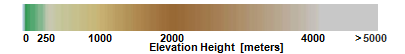
</font></div><div><b><br /></b></div><div><b>Use for Visualization:</b>  Yes. This is appropriate for visualizing the shape and height of the terrain at a range of map scales.  The image service can be added to applications or maps to enhance a users’ contextual understanding.  </div><div><br /></div><div><b>Use for Analysis:</b>  No. </div><div><br /></div><div>To learn more about the technique used in this map to fuse the elevation tint with hillshade, refer <a href='https://www.cartogis.org/docs/proceedings/2012/Nagi_AutoCarto2012.pdf' rel='nofollow ugc' target='_blank'>NAGI fusion method</a>.</div><div><br /></div><div><p style='background-image:initial; background-position:initial; background-size:initial; background-repeat:initial; background-attachment:initial; background-origin:initial; background-clip:initial;'></p><p style='margin-top:12.0pt; margin-right:0in; margin-bottom:12.0pt; margin-left:0in;'><span>For more details such as Data\nSources, Mosaic method used in this layer, please see the <a href='https://www.arcgis.com/home/item.html?id=58a541efc59545e6b7137f961d7de883' rel='nofollow ugc' target='_blank'>Terrain layer</a>. This layer allows query, identify, and\nexport image requests. The layer is restricted to a 5,000 x 5,000 pixel limit\nin a single export image request.</span></p>\n\n<p style='margin:0in 0in 0.0001pt; text-decoration-style:initial; text-decoration-color:initial; background-image:initial; background-position:initial; background-size:initial; background-repeat:initial; background-attachment:initial; background-origin:initial; background-clip:initial;'>This layer is part of a larger collection of <a href='https://www.arcgis.com/home/group.html?owner=esri&amp;title=Elevation%20Layers' rel='nofollow ugc' target='_blank'>elevation layers</a> that you can use to perform a variety\nof mapping analysis tasks.</p><br /><p></p></div></div></div>",
			"keyword": [
				"DEM",
				"Elevation",
				"esri_elevation",
				"land",
				"topography",
				"topographic",
				"elevation tinted hillshade",
				"NAGI Fusion",
				"world_elevation",
				"world elevation"
			],
			"issued": "2013-12-30T22:39:45.000Z",
			"modified": "2024-04-05T03:22:06.000Z",
			"publisher": {
				"name": "Esri"
			},
			"contactPoint": {
				"@type": "vcard:Contact",
				"fn": "esri",
				"hasEmail": "{{orgContactEmail}}"
			},
			"accessLevel": "public",
			"spatial": "-180.0000,-89.0000,180.0000,85.0511",
			"license": "<img alt='' src='https://downloads.esri.com/blogs/arcgisonline/esrilogo_new.png' />This work is licensed under the Esri Master License Agreement. <br /><div><a href='https://goto.arcgis.com/termsofuse/viewsummary' target='_blank'><b>View Summary</b></a> | <a href='https://goto.arcgis.com/termsofuse/viewtermsofuse' target='_blank'><b>View Terms of Use</b></a> </div><div><span style='line-height: 16.05px;'><br /></span></div><div><font color='#b22222'>Important Note:</font> This item requires an ArcGIS Online organizational subscription or an ArcGIS Developer account and does not consume credits. To access this item, you'll need to do one of the following: </div><div><ul><li>Sign in with an account that is a member of an organizational subscription </li><li>Sign in with a developer account </li><li><a href='https://goto.arcgis.com/termsofuse/registeranapplication' target='_blank'>Register an application</a> and use your application's credentials.</li></ul>If you don't have an account, you can sign up for a <a href='https://goto.arcgis.com/features/trial' target='_blank'>free trial of ArcGIS</a> or a <a href='https://goto.arcgis.com/developers/signup' target='_blank'>free ArcGIS Developer account</a>.</div>",
			"distribution": [
				{
					"@type": "dcat:Distribution",
					"title": "ArcGIS Hub Dataset",
					"format": "Web Page",
					"mediaType": "text/html",
					"accessURL": "https://data-peoriacountygis.opendata.arcgis.com/datasets/esri::terrain-elevation-tinted-hillshade-1"
				},
				{
					"@type": "dcat:Distribution",
					"title": "ArcGIS GeoService",
					"format": "ArcGIS GeoServices REST API",
					"mediaType": "application/json",
					"accessURL": "https://elevation.arcgis.com/arcgis/rest/services/WorldElevation/Terrain/ImageServer"
				}
			],
			"theme": [
				"geospatial"
			]
		},
		{
			"@type": "dcat:Dataset",
			"identifier": "https://www.arcgis.com/home/item.html?id=9cd1bee5f6df483eaefdd7fa2c04e520",
			"landingPage": "https://data-peoriacountygis.opendata.arcgis.com/pages/peoriacountygis::health-and-human-services-2",
			"title": "Health and Human Services",
			"description": "Interactive maps and information created for the Peoria County Health and Human Services department and citizens.",
			"keyword": [
				""
			],
			"issued": "2025-12-02T22:49:12.000Z",
			"modified": "2026-03-12T18:23:37.000Z",
			"publisher": {
				"name": "County of Peoria"
			},
			"contactPoint": {
				"@type": "vcard:Contact",
				"fn": "GISAdmin",
				"hasEmail": "mailto:gis@peoriacounty.org"
			},
			"accessLevel": "public",
			"spatial": "",
			"license": "",
			"distribution": [
				{
					"@type": "dcat:Distribution",
					"title": "ArcGIS Hub Dataset",
					"format": "Web Page",
					"mediaType": "text/html",
					"accessURL": "https://data-peoriacountygis.opendata.arcgis.com/pages/peoriacountygis::health-and-human-services-2"
				}
			],
			"theme": ""
		},
		{
			"@type": "dcat:Dataset",
			"identifier": "https://www.arcgis.com/home/item.html?id=4234d219bfc44f68ba485c98b6e41e92",
			"landingPage": "https://data-peoriacountygis.opendata.arcgis.com/pages/peoriacountygis::gis-day-2024",
			"title": "GIS Day 2024",
			"description": "{{description}}",
			"keyword": [
				""
			],
			"issued": "2024-11-01T15:46:11.000Z",
			"modified": "2026-02-03T20:40:42.000Z",
			"publisher": {
				"name": "County of Peoria"
			},
			"contactPoint": {
				"@type": "vcard:Contact",
				"fn": "istearns_peoriacountygis",
				"hasEmail": "mailto:gis@peoriacounty.org"
			},
			"accessLevel": "public",
			"spatial": "",
			"license": "",
			"distribution": [
				{
					"@type": "dcat:Distribution",
					"title": "ArcGIS Hub Dataset",
					"format": "Web Page",
					"mediaType": "text/html",
					"accessURL": "https://data-peoriacountygis.opendata.arcgis.com/pages/peoriacountygis::gis-day-2024"
				}
			],
			"theme": ""
		},
		{
			"@type": "dcat:Dataset",
			"identifier": "https://www.arcgis.com/home/item.html?id=25fdcc15be7d4e0fadabc6690c4a4333",
			"landingPage": "https://data-peoriacountygis.opendata.arcgis.com/pages/peoriacountygis::gis-day-2022",
			"title": "GIS Day 2022",
			"description": "{{description}}",
			"keyword": [
				""
			],
			"issued": "2024-11-01T15:49:25.000Z",
			"modified": "2026-02-03T20:33:27.000Z",
			"publisher": {
				"name": "County of Peoria"
			},
			"contactPoint": {
				"@type": "vcard:Contact",
				"fn": "istearns_peoriacountygis",
				"hasEmail": "mailto:gis@peoriacounty.org"
			},
			"accessLevel": "public",
			"spatial": "",
			"license": "",
			"distribution": [
				{
					"@type": "dcat:Distribution",
					"title": "ArcGIS Hub Dataset",
					"format": "Web Page",
					"mediaType": "text/html",
					"accessURL": "https://data-peoriacountygis.opendata.arcgis.com/pages/peoriacountygis::gis-day-2022"
				}
			],
			"theme": ""
		},
		{
			"@type": "dcat:Dataset",
			"identifier": "https://www.arcgis.com/home/item.html?id=c1ace3a9265149a9b86702b088e2cfb8",
			"landingPage": "https://data-peoriacountygis.opendata.arcgis.com/pages/peoriacountygis::real-estate-tax-cycle",
			"title": "Real Estate Tax Cycle",
			"description": "Explore property tax boundaries, owner information, building characteristics, and aerial imagery.  ",
			"keyword": [
				""
			],
			"issued": "2025-12-03T14:59:12.000Z",
			"modified": "2026-01-27T22:07:10.000Z",
			"publisher": {
				"name": "County of Peoria"
			},
			"contactPoint": {
				"@type": "vcard:Contact",
				"fn": "GISAdmin",
				"hasEmail": "mailto:gis@peoriacounty.org"
			},
			"accessLevel": "public",
			"spatial": "",
			"license": "",
			"distribution": [
				{
					"@type": "dcat:Distribution",
					"title": "ArcGIS Hub Dataset",
					"format": "Web Page",
					"mediaType": "text/html",
					"accessURL": "https://data-peoriacountygis.opendata.arcgis.com/pages/peoriacountygis::real-estate-tax-cycle"
				}
			],
			"theme": ""
		},
		{
			"@type": "dcat:Dataset",
			"identifier": "https://www.arcgis.com/home/item.html?id=4fb33af5f114444f9d02a659617e002c",
			"landingPage": "https://data-peoriacountygis.opendata.arcgis.com/pages/peoriacountygis::2020-voting-precinct-maps",
			"title": "2020 Voting Precinct Maps",
			"description": "Voting Precincts by Political Township. These maps show the current boundaries, as established by the 2020 Census.",
			"keyword": [
				"vote"
			],
			"issued": "2023-03-29T14:06:27.000Z",
			"modified": "2025-12-19T20:55:07.000Z",
			"publisher": {
				"name": "County of Peoria"
			},
			"contactPoint": {
				"@type": "vcard:Contact",
				"fn": "GISAdmin",
				"hasEmail": "mailto:gis@peoriacounty.org"
			},
			"accessLevel": "public",
			"spatial": "",
			"license": "",
			"distribution": [
				{
					"@type": "dcat:Distribution",
					"title": "ArcGIS Hub Dataset",
					"format": "Web Page",
					"mediaType": "text/html",
					"accessURL": "https://data-peoriacountygis.opendata.arcgis.com/pages/peoriacountygis::2020-voting-precinct-maps"
				}
			],
			"theme": ""
		},
		{
			"@type": "dcat:Dataset",
			"identifier": "https://www.arcgis.com/home/item.html?id=bb1a6e8e99af4116a6c68481ab44bb43",
			"landingPage": "https://data-peoriacountygis.opendata.arcgis.com/pages/peoriacountygis::2010-voting-precinct-maps",
			"title": "2010 Voting Precinct Maps",
			"description": "Voting precincts by political township. These maps show the 2010 boundaries, which are no longer current.",
			"keyword": [
				"vote"
			],
			"issued": "2020-07-30T18:10:54.000Z",
			"modified": "2025-12-19T20:50:06.000Z",
			"publisher": {
				"name": "County of Peoria"
			},
			"contactPoint": {
				"@type": "vcard:Contact",
				"fn": "GISAdmin",
				"hasEmail": "mailto:gis@peoriacounty.org"
			},
			"accessLevel": "public",
			"spatial": "",
			"license": "",
			"distribution": [
				{
					"@type": "dcat:Distribution",
					"title": "ArcGIS Hub Dataset",
					"format": "Web Page",
					"mediaType": "text/html",
					"accessURL": "https://data-peoriacountygis.opendata.arcgis.com/pages/peoriacountygis::2010-voting-precinct-maps"
				}
			],
			"theme": ""
		},
		{
			"@type": "dcat:Dataset",
			"identifier": "https://www.arcgis.com/home/item.html?id=785e426cc7304b24a8c71f1ca0006fd4",
			"landingPage": "https://data-peoriacountygis.opendata.arcgis.com/pages/peoriacountygis::voting-precinct-maps",
			"title": "Voting Precinct Maps",
			"description": "2010 and 2020 voting precinct maps in PDF format.",
			"keyword": [
				""
			],
			"issued": "2025-11-14T16:44:02.000Z",
			"modified": "2025-12-19T20:47:55.000Z",
			"publisher": {
				"name": "County of Peoria"
			},
			"contactPoint": {
				"@type": "vcard:Contact",
				"fn": "GISAdmin",
				"hasEmail": "mailto:gis@peoriacounty.org"
			},
			"accessLevel": "public",
			"spatial": "",
			"license": "",
			"distribution": [
				{
					"@type": "dcat:Distribution",
					"title": "ArcGIS Hub Dataset",
					"format": "Web Page",
					"mediaType": "text/html",
					"accessURL": "https://data-peoriacountygis.opendata.arcgis.com/pages/peoriacountygis::voting-precinct-maps"
				}
			],
			"theme": ""
		},
		{
			"@type": "dcat:Dataset",
			"identifier": "https://www.arcgis.com/home/item.html?id=c79a374f2f6949759be7d539710fb685",
			"landingPage": "https://data-peoriacountygis.opendata.arcgis.com/pages/peoriacountygis::reference-maps",
			"title": "Reference Maps",
			"description": "Township and section boundary maps.",
			"keyword": [
				""
			],
			"issued": "2020-07-30T17:47:41.000Z",
			"modified": "2025-12-19T20:42:09.000Z",
			"publisher": {
				"name": "County of Peoria"
			},
			"contactPoint": {
				"@type": "vcard:Contact",
				"fn": "GISAdmin",
				"hasEmail": "mailto:gis@peoriacounty.org"
			},
			"accessLevel": "public",
			"spatial": "",
			"license": "",
			"distribution": [
				{
					"@type": "dcat:Distribution",
					"title": "ArcGIS Hub Dataset",
					"format": "Web Page",
					"mediaType": "text/html",
					"accessURL": "https://data-peoriacountygis.opendata.arcgis.com/pages/peoriacountygis::reference-maps"
				}
			],
			"theme": ""
		},
		{
			"@type": "dcat:Dataset",
			"identifier": "https://www.arcgis.com/home/item.html?id=702ea370ee3d40c888f21444e1880d67",
			"landingPage": "https://data-peoriacountygis.opendata.arcgis.com/pages/peoriacountygis::tax-district-maps",
			"title": "Tax District Maps",
			"description": "Tax district boundary maps in PDF format for the 2024 Tax Year.",
			"keyword": [
				""
			],
			"issued": "2020-07-30T19:26:39.000Z",
			"modified": "2025-12-19T20:40:08.000Z",
			"publisher": {
				"name": "County of Peoria"
			},
			"contactPoint": {
				"@type": "vcard:Contact",
				"fn": "GISAdmin",
				"hasEmail": "mailto:gis@peoriacounty.org"
			},
			"accessLevel": "public",
			"spatial": "",
			"license": "",
			"distribution": [
				{
					"@type": "dcat:Distribution",
					"title": "ArcGIS Hub Dataset",
					"format": "Web Page",
					"mediaType": "text/html",
					"accessURL": "https://data-peoriacountygis.opendata.arcgis.com/pages/peoriacountygis::tax-district-maps"
				}
			],
			"theme": ""
		},
		{
			"@type": "dcat:Dataset",
			"identifier": "https://www.arcgis.com/home/item.html?id=da46cec655dc492381cc76e09841a511",
			"landingPage": "https://data-peoriacountygis.opendata.arcgis.com/pages/peoriacountygis::public-safety-and-9-1-1-addressing",
			"title": "Public Safety and 9-1-1 Addressing",
			"description": "View public safety interactive maps and access the 9-1-1 address request form.",
			"keyword": [
				""
			],
			"issued": "2019-12-26T16:28:35.000Z",
			"modified": "2025-12-19T20:09:17.000Z",
			"publisher": {
				"name": "County of Peoria"
			},
			"contactPoint": {
				"@type": "vcard:Contact",
				"fn": "GISAdmin",
				"hasEmail": "mailto:gis@peoriacounty.org"
			},
			"accessLevel": "public",
			"spatial": "",
			"license": "",
			"distribution": [
				{
					"@type": "dcat:Distribution",
					"title": "ArcGIS Hub Dataset",
					"format": "Web Page",
					"mediaType": "text/html",
					"accessURL": "https://data-peoriacountygis.opendata.arcgis.com/pages/peoriacountygis::public-safety-and-9-1-1-addressing"
				}
			],
			"theme": ""
		},
		{
			"@type": "dcat:Dataset",
			"identifier": "https://www.arcgis.com/home/item.html?id=3ee56f4c139f4c5eadfd389d9e5a3683",
			"landingPage": "https://data-peoriacountygis.opendata.arcgis.com/pages/peoriacountygis::2020-legislative-maps",
			"title": "2020 Legislative Maps",
			"description": "{{description}}",
			"keyword": [
				""
			],
			"issued": "2025-11-14T20:45:04.000Z",
			"modified": "2025-12-19T20:03:12.000Z",
			"publisher": {
				"name": "County of Peoria"
			},
			"contactPoint": {
				"@type": "vcard:Contact",
				"fn": "GISAdmin",
				"hasEmail": "mailto:gis@peoriacounty.org"
			},
			"accessLevel": "public",
			"spatial": "-89.9930,40.5150,-89.4540,40.9790",
			"license": "",
			"distribution": [
				{
					"@type": "dcat:Distribution",
					"title": "ArcGIS Hub Dataset",
					"format": "Web Page",
					"mediaType": "text/html",
					"accessURL": "https://data-peoriacountygis.opendata.arcgis.com/pages/peoriacountygis::2020-legislative-maps"
				}
			],
			"theme": [
				"geospatial"
			]
		},
		{
			"@type": "dcat:Dataset",
			"identifier": "https://www.arcgis.com/home/item.html?id=35162bd3532e4795b1077578a03cc02f",
			"landingPage": "https://data-peoriacountygis.opendata.arcgis.com/pages/peoriacountygis::2010-legislative-maps",
			"title": "2010 Legislative Maps",
			"description": "{{description}}",
			"keyword": [
				""
			],
			"issued": "2025-11-14T20:40:17.000Z",
			"modified": "2025-12-19T20:00:55.000Z",
			"publisher": {
				"name": "County of Peoria"
			},
			"contactPoint": {
				"@type": "vcard:Contact",
				"fn": "GISAdmin",
				"hasEmail": "mailto:gis@peoriacounty.org"
			},
			"accessLevel": "public",
			"spatial": "",
			"license": "",
			"distribution": [
				{
					"@type": "dcat:Distribution",
					"title": "ArcGIS Hub Dataset",
					"format": "Web Page",
					"mediaType": "text/html",
					"accessURL": "https://data-peoriacountygis.opendata.arcgis.com/pages/peoriacountygis::2010-legislative-maps"
				}
			],
			"theme": ""
		},
		{
			"@type": "dcat:Dataset",
			"identifier": "https://www.arcgis.com/home/item.html?id=6ffbf5f46d48477a8cf3a5a51fef572e",
			"landingPage": "https://data-peoriacountygis.opendata.arcgis.com/pages/peoriacountygis::legislative-maps",
			"title": "Legislative Maps",
			"description": "Congressional, representative, and senate district maps in central Illinois.",
			"keyword": [
				""
			],
			"issued": "2020-07-30T18:37:24.000Z",
			"modified": "2025-12-19T19:58:34.000Z",
			"publisher": {
				"name": "County of Peoria"
			},
			"contactPoint": {
				"@type": "vcard:Contact",
				"fn": "GISAdmin",
				"hasEmail": "mailto:gis@peoriacounty.org"
			},
			"accessLevel": "public",
			"spatial": "",
			"license": "",
			"distribution": [
				{
					"@type": "dcat:Distribution",
					"title": "ArcGIS Hub Dataset",
					"format": "Web Page",
					"mediaType": "text/html",
					"accessURL": "https://data-peoriacountygis.opendata.arcgis.com/pages/peoriacountygis::legislative-maps"
				}
			],
			"theme": ""
		},
		{
			"@type": "dcat:Dataset",
			"identifier": "https://www.arcgis.com/home/item.html?id=bc53b7f93bc94e59aa8b623f741a3c16",
			"landingPage": "https://data-peoriacountygis.opendata.arcgis.com/pages/peoriacountygis::election-services",
			"title": "Election Services",
			"description": "View interactive election maps and related information.",
			"keyword": [
				""
			],
			"issued": "2025-12-04T20:56:08.000Z",
			"modified": "2025-12-19T18:44:55.000Z",
			"publisher": {
				"name": "County of Peoria"
			},
			"contactPoint": {
				"@type": "vcard:Contact",
				"fn": "GISAdmin",
				"hasEmail": "mailto:gis@peoriacounty.org"
			},
			"accessLevel": "public",
			"spatial": "",
			"license": "",
			"distribution": [
				{
					"@type": "dcat:Distribution",
					"title": "ArcGIS Hub Dataset",
					"format": "Web Page",
					"mediaType": "text/html",
					"accessURL": "https://data-peoriacountygis.opendata.arcgis.com/pages/peoriacountygis::election-services"
				}
			],
			"theme": ""
		},
		{
			"@type": "dcat:Dataset",
			"identifier": "https://www.arcgis.com/home/item.html?id=8db043df316d4dc396e84cc55b41febe",
			"landingPage": "https://data-peoriacountygis.opendata.arcgis.com/pages/peoriacountygis::infrastructure",
			"title": "Infrastructure",
			"description": "Explore who maintains your road and identify property zoning information and boundaries.",
			"keyword": [
				""
			],
			"issued": "2019-12-20T14:53:47.000Z",
			"modified": "2025-12-19T18:18:29.000Z",
			"publisher": {
				"name": "County of Peoria"
			},
			"contactPoint": {
				"@type": "vcard:Contact",
				"fn": "GISAdmin",
				"hasEmail": "mailto:gis@peoriacounty.org"
			},
			"accessLevel": "public",
			"spatial": "",
			"license": "",
			"distribution": [
				{
					"@type": "dcat:Distribution",
					"title": "ArcGIS Hub Dataset",
					"format": "Web Page",
					"mediaType": "text/html",
					"accessURL": "https://data-peoriacountygis.opendata.arcgis.com/pages/peoriacountygis::infrastructure"
				}
			],
			"theme": ""
		},
		{
			"@type": "dcat:Dataset",
			"identifier": "https://www.arcgis.com/home/item.html?id=2073cfdf4705491aa154b45893515c95",
			"landingPage": "https://data-peoriacountygis.opendata.arcgis.com/pages/peoriacountygis::countywide-maps",
			"title": "Countywide Maps",
			"description": "Various countywide reference maps in PDF format.",
			"keyword": [
				""
			],
			"issued": "2020-07-30T18:54:57.000Z",
			"modified": "2025-12-19T17:58:41.000Z",
			"publisher": {
				"name": "County of Peoria"
			},
			"contactPoint": {
				"@type": "vcard:Contact",
				"fn": "GISAdmin",
				"hasEmail": "mailto:gis@peoriacounty.org"
			},
			"accessLevel": "public",
			"spatial": "",
			"license": "",
			"distribution": [
				{
					"@type": "dcat:Distribution",
					"title": "ArcGIS Hub Dataset",
					"format": "Web Page",
					"mediaType": "text/html",
					"accessURL": "https://data-peoriacountygis.opendata.arcgis.com/pages/peoriacountygis::countywide-maps"
				}
			],
			"theme": ""
		},
		{
			"@type": "dcat:Dataset",
			"identifier": "https://www.arcgis.com/home/item.html?id=f225d60cac7a4e9394ec3406c431011e",
			"landingPage": "https://data-peoriacountygis.opendata.arcgis.com/pages/peoriacountygis::2020-county-board-districts-1",
			"title": "2020 County Board Districts",
			"description": "Download 2020 Peoria County Board District boundary maps in PDF format.  Districts officially changed with the general election on November 8, 2022.",
			"keyword": [
				""
			],
			"issued": "2023-01-04T20:27:51.000Z",
			"modified": "2025-12-19T17:49:32.000Z",
			"publisher": {
				"name": "County of Peoria"
			},
			"contactPoint": {
				"@type": "vcard:Contact",
				"fn": "GISAdmin",
				"hasEmail": "mailto:gis@peoriacounty.org"
			},
			"accessLevel": "public",
			"spatial": "",
			"license": "",
			"distribution": [
				{
					"@type": "dcat:Distribution",
					"title": "ArcGIS Hub Dataset",
					"format": "Web Page",
					"mediaType": "text/html",
					"accessURL": "https://data-peoriacountygis.opendata.arcgis.com/pages/peoriacountygis::2020-county-board-districts-1"
				}
			],
			"theme": ""
		},
		{
			"@type": "dcat:Dataset",
			"identifier": "https://www.arcgis.com/home/item.html?id=8304ddbffe09468dae294a0d48eab114",
			"landingPage": "https://data-peoriacountygis.opendata.arcgis.com/pages/peoriacountygis::2010-county-board-districts-3",
			"title": "2010 County Board Districts",
			"description": "Download the 2010 Peoria County Board District boundary maps in PDF format.",
			"keyword": [
				""
			],
			"issued": "2023-01-04T19:58:05.000Z",
			"modified": "2025-12-19T17:33:49.000Z",
			"publisher": {
				"name": "County of Peoria"
			},
			"contactPoint": {
				"@type": "vcard:Contact",
				"fn": "GISAdmin",
				"hasEmail": "mailto:gis@peoriacounty.org"
			},
			"accessLevel": "public",
			"spatial": "",
			"license": "",
			"distribution": [
				{
					"@type": "dcat:Distribution",
					"title": "ArcGIS Hub Dataset",
					"format": "Web Page",
					"mediaType": "text/html",
					"accessURL": "https://data-peoriacountygis.opendata.arcgis.com/pages/peoriacountygis::2010-county-board-districts-3"
				}
			],
			"theme": ""
		},
		{
			"@type": "dcat:Dataset",
			"identifier": "https://www.arcgis.com/home/item.html?id=9c8b37baf7ce4472a1bafc9beedb0130",
			"landingPage": "https://data-peoriacountygis.opendata.arcgis.com/pages/peoriacountygis::county-board-district-maps",
			"title": "County Board District Maps",
			"description": "Peoria County board district boundaries in PDF format.",
			"keyword": [
				""
			],
			"issued": "2020-07-30T15:32:11.000Z",
			"modified": "2025-12-19T15:15:06.000Z",
			"publisher": {
				"name": "County of Peoria"
			},
			"contactPoint": {
				"@type": "vcard:Contact",
				"fn": "GISAdmin",
				"hasEmail": "mailto:gis@peoriacounty.org"
			},
			"accessLevel": "public",
			"spatial": "",
			"license": "",
			"distribution": [
				{
					"@type": "dcat:Distribution",
					"title": "ArcGIS Hub Dataset",
					"format": "Web Page",
					"mediaType": "text/html",
					"accessURL": "https://data-peoriacountygis.opendata.arcgis.com/pages/peoriacountygis::county-board-district-maps"
				}
			],
			"theme": ""
		},
		{
			"@type": "dcat:Dataset",
			"identifier": "https://www.arcgis.com/home/item.html?id=1ebaeda94a43452f8a14a942ee2d154c",
			"landingPage": "https://data-peoriacountygis.opendata.arcgis.com/pages/peoriacountygis::community",
			"title": "Community",
			"description": "Interactive maps and information for Peoria County municipalities and residents.",
			"keyword": [
				""
			],
			"issued": "2025-12-01T22:23:18.000Z",
			"modified": "2025-12-19T14:48:14.000Z",
			"publisher": {
				"name": "County of Peoria"
			},
			"contactPoint": {
				"@type": "vcard:Contact",
				"fn": "GISAdmin",
				"hasEmail": "mailto:gis@peoriacounty.org"
			},
			"accessLevel": "public",
			"spatial": "",
			"license": "",
			"distribution": [
				{
					"@type": "dcat:Distribution",
					"title": "ArcGIS Hub Dataset",
					"format": "Web Page",
					"mediaType": "text/html",
					"accessURL": "https://data-peoriacountygis.opendata.arcgis.com/pages/peoriacountygis::community"
				}
			],
			"theme": ""
		},
		{
			"@type": "dcat:Dataset",
			"identifier": "https://www.arcgis.com/home/item.html?id=c7ad0361bfa5456da1517b20ebfcd84e",
			"landingPage": "https://data-peoriacountygis.opendata.arcgis.com/pages/peoriacountygis::gis-day-2021",
			"title": "GIS Day 2021",
			"description": "{{description}}",
			"keyword": [
				""
			],
			"issued": "2021-11-09T21:12:15.000Z",
			"modified": "2025-12-18T19:42:47.000Z",
			"publisher": {
				"name": "County of Peoria"
			},
			"contactPoint": {
				"@type": "vcard:Contact",
				"fn": "GISAdmin",
				"hasEmail": "mailto:gis@peoriacounty.org"
			},
			"accessLevel": "public",
			"spatial": "",
			"license": "",
			"distribution": [
				{
					"@type": "dcat:Distribution",
					"title": "ArcGIS Hub Dataset",
					"format": "Web Page",
					"mediaType": "text/html",
					"accessURL": "https://data-peoriacountygis.opendata.arcgis.com/pages/peoriacountygis::gis-day-2021"
				}
			],
			"theme": ""
		},
		{
			"@type": "dcat:Dataset",
			"identifier": "https://www.arcgis.com/home/item.html?id=45563d8cce8d42d5b8593fc4f386ad21",
			"landingPage": "https://data-peoriacountygis.opendata.arcgis.com/pages/peoriacountygis::gis-day-2020",
			"title": "GIS Day 2020",
			"description": "This page provides the information and files from Peoria County's GIS day event 2020.",
			"keyword": [
				""
			],
			"issued": "2020-10-22T18:30:40.000Z",
			"modified": "2025-12-18T19:30:13.000Z",
			"publisher": {
				"name": "County of Peoria"
			},
			"contactPoint": {
				"@type": "vcard:Contact",
				"fn": "GISAdmin",
				"hasEmail": "mailto:gis@peoriacounty.org"
			},
			"accessLevel": "public",
			"spatial": "",
			"license": "",
			"distribution": [
				{
					"@type": "dcat:Distribution",
					"title": "ArcGIS Hub Dataset",
					"format": "Web Page",
					"mediaType": "text/html",
					"accessURL": "https://data-peoriacountygis.opendata.arcgis.com/pages/peoriacountygis::gis-day-2020"
				}
			],
			"theme": ""
		},
		{
			"@type": "dcat:Dataset",
			"identifier": "https://www.arcgis.com/home/item.html?id=a6c8117963ce4ce299fb3579c425479c",
			"landingPage": "https://data-peoriacountygis.opendata.arcgis.com/pages/peoriacountygis::elections-website",
			"title": "Elections Website",
			"description": "An elections website containing interactive maps and information.",
			"keyword": [
				""
			],
			"issued": "2021-02-26T14:14:51.000Z",
			"modified": "2025-12-18T18:51:38.000Z",
			"publisher": {
				"name": "County of Peoria"
			},
			"contactPoint": {
				"@type": "vcard:Contact",
				"fn": "GISAdmin",
				"hasEmail": "mailto:gis@peoriacounty.org"
			},
			"accessLevel": "public",
			"spatial": "",
			"license": "",
			"distribution": [
				{
					"@type": "dcat:Distribution",
					"title": "ArcGIS Hub Dataset",
					"format": "Web Page",
					"mediaType": "text/html",
					"accessURL": "https://data-peoriacountygis.opendata.arcgis.com/pages/peoriacountygis::elections-website"
				}
			],
			"theme": ""
		},
		{
			"@type": "dcat:Dataset",
			"identifier": "https://www.arcgis.com/home/item.html?id=0de4ce94d2f245229fe6f106f8eb4ec2",
			"landingPage": "https://data-peoriacountygis.opendata.arcgis.com/pages/peoriacountygis::gis-data-and-services",
			"title": "GIS Data and Services",
			"description": "GIS data and services on Peoria County GIS website.",
			"keyword": [
				""
			],
			"issued": "2020-01-02T17:24:51.000Z",
			"modified": "2025-12-18T15:38:40.000Z",
			"publisher": {
				"name": "County of Peoria"
			},
			"contactPoint": {
				"@type": "vcard:Contact",
				"fn": "GISAdmin",
				"hasEmail": "mailto:gis@peoriacounty.org"
			},
			"accessLevel": "public",
			"spatial": "",
			"license": "",
			"distribution": [
				{
					"@type": "dcat:Distribution",
					"title": "ArcGIS Hub Dataset",
					"format": "Web Page",
					"mediaType": "text/html",
					"accessURL": "https://data-peoriacountygis.opendata.arcgis.com/pages/peoriacountygis::gis-data-and-services"
				}
			],
			"theme": ""
		},
		{
			"@type": "dcat:Dataset",
			"identifier": "https://www.arcgis.com/home/item.html?id=0d4e8330f15a4b028ed28e520fdc3331",
			"landingPage": "https://data-peoriacountygis.opendata.arcgis.com/documents/peoriacountygis::open-data-license-agreement-for-peoria-county",
			"title": "Open Data License Agreement for Peoria County",
			"description": "<p>The Peoria County GIS open data website provides GIS data, interactive maps, and digital maps free of charge under the <a target='_blank' href='https://data-peoriacountygis.opendata.arcgis.com/pages/license~a979f2ceac8d4fffb7ea1e5712f45bd6' rel='nofollow ugc noopener noreferrer'><u>Peoria County GIS&nbsp;open data license agreement</u></a>.&nbsp; Please click the&nbsp;download&nbsp;button to download and view the current Peoria County GIS open data license agreement.</p><div><div>&nbsp;</div><div><div><span style='background-color:rgb(255,255,255); color:#000000; font-size:large;'><strong>Contact Information</strong></span></div><div><a href='mailto:gis@peoriacounty.org' rel='nofollow ugc'><u>Email Peoria County GIS</u></a><br />&nbsp;</div><div>&nbsp;</div><div><span style='font-size:large;'><strong>Physical Address</strong></span></div><div><div>Peoria County Courthouse</div><div>IT Services Department - GIS Division</div></div><div>324 Main St.</div><div>Room G11</div><div>Peoria,&nbsp;IL&nbsp;61602</div><div>&nbsp;</div></div></div>",
			"keyword": [
				"license",
				"agreement",
				"policy",
				"gis",
				"data",
				"open",
				"services"
			],
			"issued": "2017-09-14T13:13:11.000Z",
			"modified": "2025-12-18T14:39:51.000Z",
			"publisher": {
				"name": "County of Peoria"
			},
			"contactPoint": {
				"@type": "vcard:Contact",
				"fn": "GISAdmin",
				"hasEmail": "mailto:gis@peoriacounty.org"
			},
			"accessLevel": "public",
			"spatial": "",
			"license": "<p>Please refer to the <a target='_blank' href='https://data-peoriacountygis.opendata.arcgis.com/pages/license~a979f2ceac8d4fffb7ea1e5712f45bd6' rel='nofollow ugc noopener noreferrer'><u>Peoria County GIS open data license agreement</u></a>.</p>",
			"distribution": [
				{
					"@type": "dcat:Distribution",
					"title": "ArcGIS Hub Dataset",
					"format": "Web Page",
					"mediaType": "text/html",
					"accessURL": "https://data-peoriacountygis.opendata.arcgis.com/documents/peoriacountygis::open-data-license-agreement-for-peoria-county"
				}
			],
			"theme": ""
		},
		{
			"@type": "dcat:Dataset",
			"identifier": "https://www.arcgis.com/home/item.html?id=42f426b1cf664e7fa54ce9a4be0abb7c",
			"landingPage": "https://data-peoriacountygis.opendata.arcgis.com/documents/peoriacountygis::custom-services-gis-pricing-guide",
			"title": "Custom Services GIS Pricing Guide",
			"description": "<div>The Peoria County GIS open data website provides GIS data, interactive maps, and digital maps free of charge under the <a target='_blank' href='https://data-peoriacountygis.opendata.arcgis.com/pages/license~a979f2ceac8d4fffb7ea1e5712f45bd6' rel='nofollow ugc noopener noreferrer'><u>Peoria County GIS&nbsp;open data license agreement</u></a>.&nbsp; Peoria County GIS also provides custom GIS services upon request for GIS data and digital maps not available on the open data website.&nbsp; Please click the download button to download and view the current custom GIS services pricing guide.&nbsp; All custom services are charged at $60 per hour.</div><div>&nbsp;</div><div><span style='background-color:rgb(255,255,255); color:#000000; font-size:large;'><strong>Contact Information</strong></span></div><div><a href='mailto:gis@peoriacounty.org' rel='nofollow ugc'><u>Email Peoria County GIS</u></a><br />&nbsp;</div><div>&nbsp;</div><div><span style='font-size:large;'><strong>Physical Address</strong></span></div><div><div>Peoria County Courthouse</div><div>IT Services Department - GIS Division</div></div><div>324 Main St.</div><div>Room G11</div><div><span>Peoria</span>, <span>IL</span> <span>61602</span></div><div>&nbsp;</div><div>&nbsp;</div>",
			"keyword": [
				"pricing",
				"guide",
				"custom",
				"gis",
				"services"
			],
			"issued": "2017-09-14T13:08:26.000Z",
			"modified": "2025-12-18T14:39:08.000Z",
			"publisher": {
				"name": "County of Peoria"
			},
			"contactPoint": {
				"@type": "vcard:Contact",
				"fn": "GISAdmin",
				"hasEmail": "mailto:gis@peoriacounty.org"
			},
			"accessLevel": "public",
			"spatial": "",
			"license": "<p>Please refer to the <a target='_blank' href='https://data-peoriacountygis.opendata.arcgis.com/pages/license~a979f2ceac8d4fffb7ea1e5712f45bd6' rel='nofollow ugc noopener noreferrer'><u>Peoria County GIS open data license agreement</u></a>.</p>",
			"distribution": [
				{
					"@type": "dcat:Distribution",
					"title": "ArcGIS Hub Dataset",
					"format": "Web Page",
					"mediaType": "text/html",
					"accessURL": "https://data-peoriacountygis.opendata.arcgis.com/documents/peoriacountygis::custom-services-gis-pricing-guide"
				}
			],
			"theme": ""
		},
		{
			"@type": "dcat:Dataset",
			"identifier": "https://www.arcgis.com/home/item.html?id=ba48f75e648544fb9b11be34c97ff7d1",
			"landingPage": "https://data-peoriacountygis.opendata.arcgis.com/pages/peoriacountygis::tutorial-videos-1",
			"title": "Tutorial Videos",
			"description": "{{description}}",
			"keyword": [
				""
			],
			"issued": "2020-09-17T21:34:13.000Z",
			"modified": "2025-12-17T19:39:33.000Z",
			"publisher": {
				"name": "County of Peoria"
			},
			"contactPoint": {
				"@type": "vcard:Contact",
				"fn": "GISAdmin",
				"hasEmail": "mailto:gis@peoriacounty.org"
			},
			"accessLevel": "public",
			"spatial": "",
			"license": "",
			"distribution": [
				{
					"@type": "dcat:Distribution",
					"title": "ArcGIS Hub Dataset",
					"format": "Web Page",
					"mediaType": "text/html",
					"accessURL": "https://data-peoriacountygis.opendata.arcgis.com/pages/peoriacountygis::tutorial-videos-1"
				}
			],
			"theme": ""
		},
		{
			"@type": "dcat:Dataset",
			"identifier": "https://www.arcgis.com/home/item.html?id=c995139334f549ce863882f7f6f17375",
			"landingPage": "https://data-peoriacountygis.opendata.arcgis.com/pages/peoriacountygis::peoria-county-geospatial-strategic-plan-2026-2028-1",
			"title": "Peoria County Geospatial Strategic Plan 2026-2028",
			"description": "The Peoria County Geospatial Plan aligns with Peoria County's Strategic Plan through serving the needs of county departments, organizations, and citizens using geographic information systems (GIS) technology.",
			"keyword": [
				"Plan"
			],
			"issued": "2025-11-25T19:08:45.000Z",
			"modified": "2025-12-17T15:36:29.000Z",
			"publisher": {
				"name": "County of Peoria"
			},
			"contactPoint": {
				"@type": "vcard:Contact",
				"fn": "GISAdmin",
				"hasEmail": "mailto:gis@peoriacounty.org"
			},
			"accessLevel": "public",
			"spatial": "",
			"license": "",
			"distribution": [
				{
					"@type": "dcat:Distribution",
					"title": "ArcGIS Hub Dataset",
					"format": "Web Page",
					"mediaType": "text/html",
					"accessURL": "https://data-peoriacountygis.opendata.arcgis.com/pages/peoriacountygis::peoria-county-geospatial-strategic-plan-2026-2028-1"
				}
			],
			"theme": ""
		},
		{
			"@type": "dcat:Dataset",
			"identifier": "https://www.arcgis.com/home/item.html?id=634be682e5bc42f58434b577688160da",
			"landingPage": "https://data-peoriacountygis.opendata.arcgis.com/apps/peoriacountygis::election-results-2018",
			"title": "Election Results 2018",
			"description": "Election Results is a configuration of Operations Dashboard for ArcGIS that can be used by the general public to view results tabulated on election night, and historical results shared after each election.<br /><br />Learn More: <a href='http://links.esri.com/localgovernment/help/ElectionResults/' rel='nofollow ugc' target='_blank'>Local Government</a>, <a href='http://links.esri.com/stategovernment/help/ElectionResultsDashboard/' rel='nofollow ugc' target='_blank'>State Government</a>",
			"keyword": [
				"Elections",
				"Voting",
				"Precincts",
				"Elected Officials",
				"Propositions",
				"Voter Turnout",
				"Ballots",
				"Secretary of State",
				"Election Day",
				"Election Officials",
				"Clerks",
				"Election Results",
				"serve"
			],
			"issued": "2019-07-01T18:46:27.000Z",
			"modified": "2025-12-04T15:30:50.000Z",
			"publisher": {
				"name": "County of Peoria"
			},
			"contactPoint": {
				"@type": "vcard:Contact",
				"fn": "GISAdmin",
				"hasEmail": "mailto:gis@peoriacounty.org"
			},
			"accessLevel": "public",
			"spatial": "",
			"license": "",
			"distribution": [
				{
					"@type": "dcat:Distribution",
					"title": "ArcGIS Hub Dataset",
					"format": "Web Page",
					"mediaType": "text/html",
					"accessURL": "https://data-peoriacountygis.opendata.arcgis.com/apps/peoriacountygis::election-results-2018"
				}
			],
			"theme": ""
		},
		{
			"@type": "dcat:Dataset",
			"identifier": "https://www.arcgis.com/home/item.html?id=a979f2ceac8d4fffb7ea1e5712f45bd6",
			"landingPage": "https://data-peoriacountygis.opendata.arcgis.com/pages/peoriacountygis::peoria-county-gis-open-data-license-agreement",
			"title": "Peoria County GIS Open Data License Agreement",
			"description": "Peoria County GIS Open Data License Agreement",
			"keyword": [
				""
			],
			"issued": "2017-09-12T14:03:37.000Z",
			"modified": "2025-12-01T22:05:32.000Z",
			"publisher": {
				"name": "County of Peoria"
			},
			"contactPoint": {
				"@type": "vcard:Contact",
				"fn": "GISAdmin",
				"hasEmail": "mailto:gis@peoriacounty.org"
			},
			"accessLevel": "public",
			"spatial": "",
			"license": "null",
			"distribution": [
				{
					"@type": "dcat:Distribution",
					"title": "ArcGIS Hub Dataset",
					"format": "Web Page",
					"mediaType": "text/html",
					"accessURL": "https://data-peoriacountygis.opendata.arcgis.com/pages/peoriacountygis::peoria-county-gis-open-data-license-agreement"
				},
				{
					"@type": "dcat:Distribution",
					"title": "ArcGIS GeoService",
					"format": "ArcGIS GeoServices REST API",
					"mediaType": "application/json",
					"accessURL": "https://opendata.arcgis.com/admin/"
				}
			],
			"theme": ""
		},
		{
			"@type": "dcat:Dataset",
			"identifier": "https://www.arcgis.com/home/item.html?id=604092eea8df41a6be397e0b1144576b",
			"landingPage": "https://data-peoriacountygis.opendata.arcgis.com/documents/peoriacountygis::custom-gis-services-request-form",
			"title": "Custom GIS Services Request Form",
			"description": "<p>The Peoria County GIS open data website provides GIS data, interactive maps, and digital maps free of charge under the <a target='_blank' href='https://data-peoriacountygis.opendata.arcgis.com/pages/license~a979f2ceac8d4fffb7ea1e5712f45bd6' rel='nofollow ugc noopener noreferrer'><u>Peoria County GIS open data license agreement</u></a>.&nbsp; Peoria County GIS also provides custom GIS services upon request for GIS data and digital maps not available on the open data website.&nbsp; Please click the download button to download and view the current request form for custom GIS services.&nbsp; All custom services are charged at $60 per hour.</p><div>&nbsp;</div><div><div><span style='background-color:rgb(255,255,255); color:#000000; font-size:large;'><strong>Contact Information</strong></span></div><div><a href='mailto:gis@peoriacounty.org' rel='nofollow ugc'><u>Email Peoria County GIS</u></a><br />&nbsp;</div><div>&nbsp;</div><div><span style='font-size:large;'><strong>Physical Address</strong></span></div><div>Peoria County Courthouse</div><div>IT Services Department - GIS Division</div><div>324 Main St.</div><div>Room G11</div><div>Peoria,&nbsp;IL&nbsp;61602</div><div>&nbsp;</div></div>",
			"keyword": [
				"request",
				"form",
				"data",
				"gis",
				"services",
				"custom",
				"maps"
			],
			"issued": "2017-09-14T13:02:28.000Z",
			"modified": "2025-12-01T21:55:46.000Z",
			"publisher": {
				"name": "County of Peoria"
			},
			"contactPoint": {
				"@type": "vcard:Contact",
				"fn": "GISAdmin",
				"hasEmail": "mailto:gis@peoriacounty.org"
			},
			"accessLevel": "public",
			"spatial": "",
			"license": "<p>Please refer to the <a target='_blank' href='https://data-peoriacountygis.opendata.arcgis.com/pages/license~a979f2ceac8d4fffb7ea1e5712f45bd6' rel='nofollow ugc noopener noreferrer'><u>Peoria County GIS open data license agreement</u></a>.</p>",
			"distribution": [
				{
					"@type": "dcat:Distribution",
					"title": "ArcGIS Hub Dataset",
					"format": "Web Page",
					"mediaType": "text/html",
					"accessURL": "https://data-peoriacountygis.opendata.arcgis.com/documents/peoriacountygis::custom-gis-services-request-form"
				}
			],
			"theme": ""
		},
		{
			"@type": "dcat:Dataset",
			"identifier": "https://www.arcgis.com/home/item.html?id=6751b22f9afe4beaae12788b41479c61",
			"landingPage": "https://data-peoriacountygis.opendata.arcgis.com/pages/peoriacountygis::explore-peoria-county",
			"title": "Explore Peoria County",
			"description": "Explore Peoria County's Parks and History.",
			"keyword": [
				""
			],
			"issued": "2020-02-04T14:47:52.000Z",
			"modified": "2025-12-01T20:15:40.000Z",
			"publisher": {
				"name": "County of Peoria"
			},
			"contactPoint": {
				"@type": "vcard:Contact",
				"fn": "GISAdmin",
				"hasEmail": "mailto:gis@peoriacounty.org"
			},
			"accessLevel": "public",
			"spatial": "",
			"license": "",
			"distribution": [
				{
					"@type": "dcat:Distribution",
					"title": "ArcGIS Hub Dataset",
					"format": "Web Page",
					"mediaType": "text/html",
					"accessURL": "https://data-peoriacountygis.opendata.arcgis.com/pages/peoriacountygis::explore-peoria-county"
				}
			],
			"theme": ""
		},
		{
			"@type": "dcat:Dataset",
			"identifier": "https://www.arcgis.com/home/item.html?id=3b76b6b7afd1499cba643b7689b9515e",
			"landingPage": "https://data-peoriacountygis.opendata.arcgis.com/pages/peoriacountygis::downloadable-maps-and-forms",
			"title": "Downloadable Maps and Forms",
			"description": "{{description}}",
			"keyword": [
				""
			],
			"issued": "2021-07-28T20:48:33.000Z",
			"modified": "2025-12-01T20:12:14.000Z",
			"publisher": {
				"name": "County of Peoria"
			},
			"contactPoint": {
				"@type": "vcard:Contact",
				"fn": "GISAdmin",
				"hasEmail": "mailto:gis@peoriacounty.org"
			},
			"accessLevel": "public",
			"spatial": "",
			"license": "",
			"distribution": [
				{
					"@type": "dcat:Distribution",
					"title": "ArcGIS Hub Dataset",
					"format": "Web Page",
					"mediaType": "text/html",
					"accessURL": "https://data-peoriacountygis.opendata.arcgis.com/pages/peoriacountygis::downloadable-maps-and-forms"
				}
			],
			"theme": ""
		},
		{
			"@type": "dcat:Dataset",
			"identifier": "https://www.arcgis.com/home/item.html?id=28b0e702a1ce44238dded7ef56205d80",
			"landingPage": "https://data-peoriacountygis.opendata.arcgis.com/documents/peoriacountygis::2020-senate-district-46-map",
			"title": "2020 Senate District 46 Map",
			"description": "<p>The 11 x 17 map displays the 2020 Illinois senate district 46 boundary and can be downloaded in PDF format.&nbsp; The district boundary was created by the State of Illinois using the 2020 census information.</p>",
			"keyword": [
				"Election"
			],
			"issued": "2021-12-29T15:36:55.000Z",
			"modified": "2025-11-17T13:43:16.000Z",
			"publisher": {
				"name": "County of Peoria"
			},
			"contactPoint": {
				"@type": "vcard:Contact",
				"fn": "GISAdmin",
				"hasEmail": "mailto:gis@peoriacounty.org"
			},
			"accessLevel": "public",
			"spatial": "",
			"license": "",
			"distribution": [
				{
					"@type": "dcat:Distribution",
					"title": "ArcGIS Hub Dataset",
					"format": "Web Page",
					"mediaType": "text/html",
					"accessURL": "https://data-peoriacountygis.opendata.arcgis.com/documents/peoriacountygis::2020-senate-district-46-map"
				}
			],
			"theme": ""
		},
		{
			"@type": "dcat:Dataset",
			"identifier": "https://www.arcgis.com/home/item.html?id=ee1910ad822d4162af3d2a010d95cacd",
			"landingPage": "https://data-peoriacountygis.opendata.arcgis.com/documents/peoriacountygis::2020-representative-district-73-map",
			"title": "2020 Representative District 73 Map",
			"description": "<p>The 11 x 17 map displays the 2020 Illinois representative district 73 boundary and can be downloaded in PDF format.&nbsp; The district boundary was created by the State of Illinois using the 2020 census information.</p>",
			"keyword": [
				"Election"
			],
			"issued": "2021-12-29T15:46:14.000Z",
			"modified": "2025-11-14T20:38:20.000Z",
			"publisher": {
				"name": "County of Peoria"
			},
			"contactPoint": {
				"@type": "vcard:Contact",
				"fn": "GISAdmin",
				"hasEmail": "mailto:gis@peoriacounty.org"
			},
			"accessLevel": "public",
			"spatial": "",
			"license": "",
			"distribution": [
				{
					"@type": "dcat:Distribution",
					"title": "ArcGIS Hub Dataset",
					"format": "Web Page",
					"mediaType": "text/html",
					"accessURL": "https://data-peoriacountygis.opendata.arcgis.com/documents/peoriacountygis::2020-representative-district-73-map"
				}
			],
			"theme": ""
		},
		{
			"@type": "dcat:Dataset",
			"identifier": "https://www.arcgis.com/home/item.html?id=f5c1f1f4040d4ab79932f20e62bd30e4",
			"landingPage": "https://data-peoriacountygis.opendata.arcgis.com/documents/peoriacountygis::2020-senate-district-37-map",
			"title": "2020 Senate District 37 Map",
			"description": "<p>The 11 x 17 map displays the 2020 Illinois senate district 37 boundary and can be downloaded in PDF format.<span>&nbsp; The district boundary</span> was created by the State of Illinois using the 2020 census information.</p>",
			"keyword": [
				"Election"
			],
			"issued": "2021-12-29T15:34:55.000Z",
			"modified": "2025-11-14T20:35:04.000Z",
			"publisher": {
				"name": "County of Peoria"
			},
			"contactPoint": {
				"@type": "vcard:Contact",
				"fn": "GISAdmin",
				"hasEmail": "mailto:gis@peoriacounty.org"
			},
			"accessLevel": "public",
			"spatial": "",
			"license": "",
			"distribution": [
				{
					"@type": "dcat:Distribution",
					"title": "ArcGIS Hub Dataset",
					"format": "Web Page",
					"mediaType": "text/html",
					"accessURL": "https://data-peoriacountygis.opendata.arcgis.com/documents/peoriacountygis::2020-senate-district-37-map"
				}
			],
			"theme": ""
		},
		{
			"@type": "dcat:Dataset",
			"identifier": "https://www.arcgis.com/home/item.html?id=d16b417cc44d4149ae5f2036a1fbfb52",
			"landingPage": "https://data-peoriacountygis.opendata.arcgis.com/documents/peoriacountygis::2020-senate-district-53-map",
			"title": "2020 Senate District 53 Map",
			"description": "<p>The 11 x 17 map displays the 2020 Illinois senate district 53 boundary and can be downloaded in PDF format.&nbsp; The district boundary was created by the State of Illinois using the 2020 census information.</p>",
			"keyword": [
				"Election"
			],
			"issued": "2021-12-29T15:44:00.000Z",
			"modified": "2025-11-14T20:34:13.000Z",
			"publisher": {
				"name": "County of Peoria"
			},
			"contactPoint": {
				"@type": "vcard:Contact",
				"fn": "GISAdmin",
				"hasEmail": "mailto:gis@peoriacounty.org"
			},
			"accessLevel": "public",
			"spatial": "",
			"license": "",
			"distribution": [
				{
					"@type": "dcat:Distribution",
					"title": "ArcGIS Hub Dataset",
					"format": "Web Page",
					"mediaType": "text/html",
					"accessURL": "https://data-peoriacountygis.opendata.arcgis.com/documents/peoriacountygis::2020-senate-district-53-map"
				}
			],
			"theme": ""
		},
		{
			"@type": "dcat:Dataset",
			"identifier": "https://www.arcgis.com/home/item.html?id=3d9e25f2c34247d99afcdd8672231b85",
			"landingPage": "https://data-peoriacountygis.opendata.arcgis.com/documents/peoriacountygis::2020-senate-district-47-map",
			"title": "2020 Senate District 47 Map",
			"description": "<p>The 11 x 17 map displays the 2020 Illinois senate district 47 boundary and can be downloaded in PDF format.&nbsp; The district boundary was created by the State of Illinois using the 2020 census information.</p>",
			"keyword": [
				"Election"
			],
			"issued": "2021-12-29T15:43:20.000Z",
			"modified": "2025-11-14T20:32:59.000Z",
			"publisher": {
				"name": "County of Peoria"
			},
			"contactPoint": {
				"@type": "vcard:Contact",
				"fn": "GISAdmin",
				"hasEmail": "mailto:gis@peoriacounty.org"
			},
			"accessLevel": "public",
			"spatial": "",
			"license": "",
			"distribution": [
				{
					"@type": "dcat:Distribution",
					"title": "ArcGIS Hub Dataset",
					"format": "Web Page",
					"mediaType": "text/html",
					"accessURL": "https://data-peoriacountygis.opendata.arcgis.com/documents/peoriacountygis::2020-senate-district-47-map"
				}
			],
			"theme": ""
		},
		{
			"@type": "dcat:Dataset",
			"identifier": "https://www.arcgis.com/home/item.html?id=5c4889beb5a1445ab910b2f294ee5d27",
			"landingPage": "https://data-peoriacountygis.opendata.arcgis.com/documents/peoriacountygis::2020-congressional-district-17-map",
			"title": "2020 Congressional District 17 Map",
			"description": "<p>The 11 x 17 map displays the 2020 congressional district 17 boundary and can be downloaded in PDF format.&nbsp; The district boundary was created by the State of Illinois using the 2020 census information.</p>",
			"keyword": [
				"Election"
			],
			"issued": "2021-12-29T15:32:39.000Z",
			"modified": "2025-11-14T20:25:43.000Z",
			"publisher": {
				"name": "County of Peoria"
			},
			"contactPoint": {
				"@type": "vcard:Contact",
				"fn": "GISAdmin",
				"hasEmail": "mailto:gis@peoriacounty.org"
			},
			"accessLevel": "public",
			"spatial": "",
			"license": "",
			"distribution": [
				{
					"@type": "dcat:Distribution",
					"title": "ArcGIS Hub Dataset",
					"format": "Web Page",
					"mediaType": "text/html",
					"accessURL": "https://data-peoriacountygis.opendata.arcgis.com/documents/peoriacountygis::2020-congressional-district-17-map"
				}
			],
			"theme": ""
		},
		{
			"@type": "dcat:Dataset",
			"identifier": "https://www.arcgis.com/home/item.html?id=e790fc17943f451ebd275e15e3af27e0",
			"landingPage": "https://data-peoriacountygis.opendata.arcgis.com/documents/peoriacountygis::2020-congressional-district-16-map",
			"title": "2020 Congressional District 16 Map",
			"description": "<p>The 11 x 17 map displays the 2020 congressional district 16 boundary and can be downloaded in PDF format.<span>&nbsp; </span>The district boundary was created by the State of Illinois using the 2020 census information.</p>",
			"keyword": [
				"Election"
			],
			"issued": "2021-12-29T15:26:45.000Z",
			"modified": "2025-11-14T20:21:27.000Z",
			"publisher": {
				"name": "County of Peoria"
			},
			"contactPoint": {
				"@type": "vcard:Contact",
				"fn": "GISAdmin",
				"hasEmail": "mailto:gis@peoriacounty.org"
			},
			"accessLevel": "public",
			"spatial": "",
			"license": "",
			"distribution": [
				{
					"@type": "dcat:Distribution",
					"title": "ArcGIS Hub Dataset",
					"format": "Web Page",
					"mediaType": "text/html",
					"accessURL": "https://data-peoriacountygis.opendata.arcgis.com/documents/peoriacountygis::2020-congressional-district-16-map"
				}
			],
			"theme": ""
		},
		{
			"@type": "dcat:Dataset",
			"identifier": "https://www.arcgis.com/home/item.html?id=6e463f6a4279454ab430f5582c44791b",
			"landingPage": "https://data-peoriacountygis.opendata.arcgis.com/documents/peoriacountygis::2020-representative-district-105-map",
			"title": "2020 Representative District 105 Map",
			"description": "<p>The 11 x 17 map displays the 2020 Illinois representative district 105 boundary and can be downloaded in PDF format.<span>&nbsp; </span>The district boundary was created by the State of Illinois using the 2020 census information.</p>",
			"keyword": [
				"Election"
			],
			"issued": "2021-12-29T15:49:40.000Z",
			"modified": "2025-11-14T20:18:21.000Z",
			"publisher": {
				"name": "County of Peoria"
			},
			"contactPoint": {
				"@type": "vcard:Contact",
				"fn": "GISAdmin",
				"hasEmail": "mailto:gis@peoriacounty.org"
			},
			"accessLevel": "public",
			"spatial": "",
			"license": "",
			"distribution": [
				{
					"@type": "dcat:Distribution",
					"title": "ArcGIS Hub Dataset",
					"format": "Web Page",
					"mediaType": "text/html",
					"accessURL": "https://data-peoriacountygis.opendata.arcgis.com/documents/peoriacountygis::2020-representative-district-105-map"
				}
			],
			"theme": ""
		},
		{
			"@type": "dcat:Dataset",
			"identifier": "https://www.arcgis.com/home/item.html?id=9121921421ff4436bd548c75c16cddfd",
			"landingPage": "https://data-peoriacountygis.opendata.arcgis.com/documents/peoriacountygis::2020-representative-district-93-map",
			"title": "2020 Representative District 93 Map",
			"description": "<p>The 11 x 17 map displays the 2020 Illinois representative district 93 boundary and can be downloaded in PDF format.&nbsp; The district boundary was created by the State of Illinois using the 2020 census information.</p>",
			"keyword": [
				"Election"
			],
			"issued": "2021-12-29T15:47:25.000Z",
			"modified": "2025-11-14T20:16:40.000Z",
			"publisher": {
				"name": "County of Peoria"
			},
			"contactPoint": {
				"@type": "vcard:Contact",
				"fn": "GISAdmin",
				"hasEmail": "mailto:gis@peoriacounty.org"
			},
			"accessLevel": "public",
			"spatial": "",
			"license": "",
			"distribution": [
				{
					"@type": "dcat:Distribution",
					"title": "ArcGIS Hub Dataset",
					"format": "Web Page",
					"mediaType": "text/html",
					"accessURL": "https://data-peoriacountygis.opendata.arcgis.com/documents/peoriacountygis::2020-representative-district-93-map"
				}
			],
			"theme": ""
		},
		{
			"@type": "dcat:Dataset",
			"identifier": "https://www.arcgis.com/home/item.html?id=a8409de4fb594b3683f74a45c2b17df7",
			"landingPage": "https://data-peoriacountygis.opendata.arcgis.com/documents/peoriacountygis::2020-representative-district-94-map",
			"title": "2020 Representative District 94 Map",
			"description": "<p>The 11 x 17 map displays the 2020 Illinois representative district 94 boundary and can be downloaded in PDF format.&nbsp; The district boundary was created by the State of Illinois using the 2020 census information.</p>",
			"keyword": [
				"Election"
			],
			"issued": "2021-12-29T15:49:13.000Z",
			"modified": "2025-11-14T20:14:07.000Z",
			"publisher": {
				"name": "County of Peoria"
			},
			"contactPoint": {
				"@type": "vcard:Contact",
				"fn": "GISAdmin",
				"hasEmail": "mailto:gis@peoriacounty.org"
			},
			"accessLevel": "public",
			"spatial": "",
			"license": "",
			"distribution": [
				{
					"@type": "dcat:Distribution",
					"title": "ArcGIS Hub Dataset",
					"format": "Web Page",
					"mediaType": "text/html",
					"accessURL": "https://data-peoriacountygis.opendata.arcgis.com/documents/peoriacountygis::2020-representative-district-94-map"
				}
			],
			"theme": ""
		},
		{
			"@type": "dcat:Dataset",
			"identifier": "https://www.arcgis.com/home/item.html?id=3ec0769f5545433781261e45be4d62b2",
			"landingPage": "https://data-peoriacountygis.opendata.arcgis.com/documents/peoriacountygis::2020-representative-district-92-map",
			"title": "2020 Representative District 92 Map",
			"description": "<p>The 11 x 17 map displays the 2020 Illinois representative district 92 boundary and can be downloaded in PDF format.&nbsp; The district boundary was created by the State of Illinois using the 2020 census information.</p>",
			"keyword": [
				"Election"
			],
			"issued": "2021-12-29T15:47:02.000Z",
			"modified": "2025-11-14T20:12:17.000Z",
			"publisher": {
				"name": "County of Peoria"
			},
			"contactPoint": {
				"@type": "vcard:Contact",
				"fn": "GISAdmin",
				"hasEmail": "mailto:gis@peoriacounty.org"
			},
			"accessLevel": "public",
			"spatial": "",
			"license": "",
			"distribution": [
				{
					"@type": "dcat:Distribution",
					"title": "ArcGIS Hub Dataset",
					"format": "Web Page",
					"mediaType": "text/html",
					"accessURL": "https://data-peoriacountygis.opendata.arcgis.com/documents/peoriacountygis::2020-representative-district-92-map"
				}
			],
			"theme": ""
		},
		{
			"@type": "dcat:Dataset",
			"identifier": "https://www.arcgis.com/home/item.html?id=1e550580cde6476d93e5edb39068a086",
			"landingPage": "https://data-peoriacountygis.opendata.arcgis.com/documents/peoriacountygis::2020-representative-district-91-map",
			"title": "2020 Representative District 91 Map",
			"description": "<p>The 11 x 17 map displays the 2020 Illinois representative district 91 boundary and can be downloaded in PDF format.&nbsp; The district boundary was created by the State of Illinois using the 2020 census information.</p>",
			"keyword": [
				"Election"
			],
			"issued": "2021-12-29T15:46:39.000Z",
			"modified": "2025-11-14T20:07:58.000Z",
			"publisher": {
				"name": "County of Peoria"
			},
			"contactPoint": {
				"@type": "vcard:Contact",
				"fn": "GISAdmin",
				"hasEmail": "mailto:gis@peoriacounty.org"
			},
			"accessLevel": "public",
			"spatial": "",
			"license": "",
			"distribution": [
				{
					"@type": "dcat:Distribution",
					"title": "ArcGIS Hub Dataset",
					"format": "Web Page",
					"mediaType": "text/html",
					"accessURL": "https://data-peoriacountygis.opendata.arcgis.com/documents/peoriacountygis::2020-representative-district-91-map"
				}
			],
			"theme": ""
		},
		{
			"@type": "dcat:Dataset",
			"identifier": "https://www.arcgis.com/home/item.html?id=2914866b325c4c4998cfc92c120b48e1&sublayer=0",
			"landingPage": "https://data-peoriacountygis.opendata.arcgis.com/datasets/peoriacountygis::2010-voting-precincts",
			"title": "2010 Voting Precincts",
			"description": "<div style='text-align:Left;font-size:12pt'><div><div><p><span>2010 voting precincts in Peoria County, Illinois.  The voting precincts were drawn based on state laws and the 2010 census information.</span></p></div></div></div>",
			"keyword": [
				"precinct",
				"voting",
				"elections"
			],
			"issued": "2022-10-27T15:23:19.000Z",
			"modified": "2022-10-27T15:23:22.645Z",
			"publisher": {
				"name": "County of Peoria"
			},
			"contactPoint": {
				"@type": "vcard:Contact",
				"fn": "GISAdmin",
				"hasEmail": "mailto:gis@peoriacounty.org"
			},
			"accessLevel": "public",
			"spatial": "-89.9893,40.5135,-89.4478,40.9732",
			"license": "<div style='text-align:Left;font-size:12pt'><p><a href='https://data-peoriacountygis.opendata.arcgis.com/pages/peoria-county-gis-open-data-license-agreement' style='text-decoration:underline;' rel='nofollow ugc'><span>License Agreement</span></a></p></div>",
			"distribution": [
				{
					"@type": "dcat:Distribution",
					"title": "ArcGIS Hub Dataset",
					"format": "Web Page",
					"mediaType": "text/html",
					"accessURL": "https://data-peoriacountygis.opendata.arcgis.com/datasets/peoriacountygis::2010-voting-precincts"
				},
				{
					"@type": "dcat:Distribution",
					"title": "ArcGIS GeoService",
					"format": "ArcGIS GeoServices REST API",
					"mediaType": "application/json",
					"accessURL": "https://services.arcgis.com/iPiPjILCMYxPZWTc/arcgis/rest/services/2010_Voting_Precincts/FeatureServer/0"
				},
				{
					"@type": "dcat:Distribution",
					"title": "CSV",
					"format": "CSV",
					"mediaType": "text/csv",
					"accessURL": "https://data-peoriacountygis.opendata.arcgis.com/api/download/v1/items/2914866b325c4c4998cfc92c120b48e1/csv?layers=0"
				},
				{
					"@type": "dcat:Distribution",
					"title": "Shapefile",
					"format": "ZIP",
					"mediaType": "application/zip",
					"accessURL": "https://data-peoriacountygis.opendata.arcgis.com/api/download/v1/items/2914866b325c4c4998cfc92c120b48e1/shapefile?layers=0"
				},
				{
					"@type": "dcat:Distribution",
					"title": "GeoJSON",
					"format": "GeoJSON",
					"mediaType": "application/vnd.geo+json",
					"accessURL": "https://data-peoriacountygis.opendata.arcgis.com/api/download/v1/items/2914866b325c4c4998cfc92c120b48e1/geojson?layers=0"
				},
				{
					"@type": "dcat:Distribution",
					"title": "KML",
					"format": "KML",
					"mediaType": "application/vnd.google-earth.kml+xml",
					"accessURL": "https://data-peoriacountygis.opendata.arcgis.com/api/download/v1/items/2914866b325c4c4998cfc92c120b48e1/kml?layers=0"
				},
				{
					"@type": "dcat:Distribution",
					"title": "File Geodatabase",
					"format": "ZIP",
					"mediaType": "application/zip",
					"accessURL": "https://data-peoriacountygis.opendata.arcgis.com/api/download/v1/items/2914866b325c4c4998cfc92c120b48e1/filegdb?layers=0"
				},
				{
					"@type": "dcat:Distribution",
					"title": "Feature Collection",
					"format": "TXT",
					"mediaType": "text/plain",
					"accessURL": "https://data-peoriacountygis.opendata.arcgis.com/api/download/v1/items/2914866b325c4c4998cfc92c120b48e1/featureCollection?layers=0"
				},
				{
					"@type": "dcat:Distribution",
					"title": "Excel",
					"format": "XLSX",
					"mediaType": "application/vnd.ms-excel",
					"accessURL": "https://data-peoriacountygis.opendata.arcgis.com/api/download/v1/items/2914866b325c4c4998cfc92c120b48e1/excel?layers=0"
				},
				{
					"@type": "dcat:Distribution",
					"title": "GeoPackage",
					"format": "GPKG",
					"mediaType": "application/geopackage+sqlite3",
					"accessURL": "https://data-peoriacountygis.opendata.arcgis.com/api/download/v1/items/2914866b325c4c4998cfc92c120b48e1/geoPackage?layers=0"
				},
				{
					"@type": "dcat:Distribution",
					"title": "SQLite Geodatabase",
					"format": "GDB",
					"mediaType": "application/geopackage+sqlite3",
					"accessURL": "https://data-peoriacountygis.opendata.arcgis.com/api/download/v1/items/2914866b325c4c4998cfc92c120b48e1/sqlite?layers=0"
				}
			],
			"theme": [
				"geospatial"
			]
		},
		{
			"@type": "dcat:Dataset",
			"identifier": "https://www.arcgis.com/home/item.html?id=0f5ac9a2460e4582969dabf805c0ae0f",
			"landingPage": "https://data-peoriacountygis.opendata.arcgis.com/documents/peoriacountygis::2020-county-board-district-18-map",
			"title": "2020 County Board District 18 Map",
			"description": "<p>The 2020 Peoria County board district 18 boundary map is 18x24 in size and can be downloaded in PDF format. &nbsp;This map displays the current Peoria County board district 18 boundary.</p><p>The Peoria County Board approved the new Peoria County board district boundaries at their special board meeting on November 30, 2021. The district boundaries officially changed at the general election on November 8, 2022. &nbsp;These boundaries were created using the 2020 census information.</p>",
			"keyword": [
				"Election"
			],
			"issued": "2021-12-15T19:27:17.000Z",
			"modified": "2025-10-28T15:30:09.000Z",
			"publisher": {
				"name": "County of Peoria"
			},
			"contactPoint": {
				"@type": "vcard:Contact",
				"fn": "GISAdmin",
				"hasEmail": "mailto:gis@peoriacounty.org"
			},
			"accessLevel": "public",
			"spatial": "",
			"license": "",
			"distribution": [
				{
					"@type": "dcat:Distribution",
					"title": "ArcGIS Hub Dataset",
					"format": "Web Page",
					"mediaType": "text/html",
					"accessURL": "https://data-peoriacountygis.opendata.arcgis.com/documents/peoriacountygis::2020-county-board-district-18-map"
				}
			],
			"theme": ""
		},
		{
			"@type": "dcat:Dataset",
			"identifier": "https://www.arcgis.com/home/item.html?id=7c83ca7d57374f4c9a821f9bc0cf279f",
			"landingPage": "https://data-peoriacountygis.opendata.arcgis.com/documents/peoriacountygis::2020-county-board-district-17-map",
			"title": "2020 County Board District 17 Map",
			"description": "<p>The 2020 Peoria County board district 17 boundary map is 24x18 in size and can be downloaded in PDF format. &nbsp;This map displays the current Peoria County board district 17 boundary.</p><p>The Peoria County Board approved the new Peoria County board district boundaries at their special board meeting on November 30, 2021. The district boundaries officially changed at the general election on November 8, 2022. &nbsp;These boundaries were created using the 2020 census information.</p>",
			"keyword": [
				"Election"
			],
			"issued": "2021-12-15T19:22:52.000Z",
			"modified": "2025-10-28T15:27:56.000Z",
			"publisher": {
				"name": "County of Peoria"
			},
			"contactPoint": {
				"@type": "vcard:Contact",
				"fn": "GISAdmin",
				"hasEmail": "mailto:gis@peoriacounty.org"
			},
			"accessLevel": "public",
			"spatial": "",
			"license": "",
			"distribution": [
				{
					"@type": "dcat:Distribution",
					"title": "ArcGIS Hub Dataset",
					"format": "Web Page",
					"mediaType": "text/html",
					"accessURL": "https://data-peoriacountygis.opendata.arcgis.com/documents/peoriacountygis::2020-county-board-district-17-map"
				}
			],
			"theme": ""
		},
		{
			"@type": "dcat:Dataset",
			"identifier": "https://www.arcgis.com/home/item.html?id=8111512aca934614abbf908701a7b5f1",
			"landingPage": "https://data-peoriacountygis.opendata.arcgis.com/documents/peoriacountygis::2020-county-board-district-16-map",
			"title": "2020 County Board District 16 Map",
			"description": "<p>The 2020 Peoria County board district 16 boundary map is 18x24 in size and can be downloaded in PDF format. &nbsp;This map displays the current Peoria County board district 16 boundary.</p><p>The Peoria County Board approved the new Peoria County board district boundaries at their special board meeting on November 30, 2021. The district boundaries officially changed at the general election on November 8, 2022. &nbsp;These boundaries were created using the 2020 census information.</p>",
			"keyword": [
				"Election"
			],
			"issued": "2021-12-15T19:21:48.000Z",
			"modified": "2025-10-28T15:25:27.000Z",
			"publisher": {
				"name": "County of Peoria"
			},
			"contactPoint": {
				"@type": "vcard:Contact",
				"fn": "GISAdmin",
				"hasEmail": "mailto:gis@peoriacounty.org"
			},
			"accessLevel": "public",
			"spatial": "",
			"license": "",
			"distribution": [
				{
					"@type": "dcat:Distribution",
					"title": "ArcGIS Hub Dataset",
					"format": "Web Page",
					"mediaType": "text/html",
					"accessURL": "https://data-peoriacountygis.opendata.arcgis.com/documents/peoriacountygis::2020-county-board-district-16-map"
				}
			],
			"theme": ""
		},
		{
			"@type": "dcat:Dataset",
			"identifier": "https://www.arcgis.com/home/item.html?id=720aa80afe874693aa55ad2253b65686",
			"landingPage": "https://data-peoriacountygis.opendata.arcgis.com/documents/peoriacountygis::2020-county-board-district-15-map",
			"title": "2020 County Board District 15 Map",
			"description": "<p>The 2020 Peoria County board district 15 boundary map is 24x18 in size and can be downloaded in PDF format. &nbsp;This map displays the current Peoria County board district 15 boundary.</p><p>The Peoria County Board approved the new Peoria County board district boundaries at their special board meeting on November 30, 2021. The district boundaries officially changed at the general election on November 8, 2022. &nbsp;These boundaries were created using the 2020 census information.</p>",
			"keyword": [
				"Election"
			],
			"issued": "2021-12-15T19:20:22.000Z",
			"modified": "2025-10-28T15:22:39.000Z",
			"publisher": {
				"name": "County of Peoria"
			},
			"contactPoint": {
				"@type": "vcard:Contact",
				"fn": "GISAdmin",
				"hasEmail": "mailto:gis@peoriacounty.org"
			},
			"accessLevel": "public",
			"spatial": "",
			"license": "",
			"distribution": [
				{
					"@type": "dcat:Distribution",
					"title": "ArcGIS Hub Dataset",
					"format": "Web Page",
					"mediaType": "text/html",
					"accessURL": "https://data-peoriacountygis.opendata.arcgis.com/documents/peoriacountygis::2020-county-board-district-15-map"
				}
			],
			"theme": ""
		},
		{
			"@type": "dcat:Dataset",
			"identifier": "https://www.arcgis.com/home/item.html?id=d95c8f92dab14fbf9382fc9f81c8ec4a",
			"landingPage": "https://data-peoriacountygis.opendata.arcgis.com/documents/peoriacountygis::2020-county-board-district-14-map",
			"title": "2020 County Board District 14 Map",
			"description": "<p>The 2020 Peoria County board district 14 boundary map is 24x18 in size and can be downloaded in PDF format. &nbsp;This map displays the current Peoria County board district 14 boundary.</p><p>The Peoria County Board approved the new Peoria County board district boundaries at their special board meeting on November 30, 2021. The district boundaries officially changed at the general election on November 8, 2022. &nbsp;These boundaries were created using the 2020 census information.</p>",
			"keyword": [
				"Election"
			],
			"issued": "2021-12-15T19:19:21.000Z",
			"modified": "2025-10-28T15:21:06.000Z",
			"publisher": {
				"name": "County of Peoria"
			},
			"contactPoint": {
				"@type": "vcard:Contact",
				"fn": "GISAdmin",
				"hasEmail": "mailto:gis@peoriacounty.org"
			},
			"accessLevel": "public",
			"spatial": "",
			"license": "",
			"distribution": [
				{
					"@type": "dcat:Distribution",
					"title": "ArcGIS Hub Dataset",
					"format": "Web Page",
					"mediaType": "text/html",
					"accessURL": "https://data-peoriacountygis.opendata.arcgis.com/documents/peoriacountygis::2020-county-board-district-14-map"
				}
			],
			"theme": ""
		},
		{
			"@type": "dcat:Dataset",
			"identifier": "https://www.arcgis.com/home/item.html?id=9957794ad3984f11a969975dc5ffedd3",
			"landingPage": "https://data-peoriacountygis.opendata.arcgis.com/documents/peoriacountygis::2020-county-board-district-13-map",
			"title": "2020 County Board District 13 Map",
			"description": "<p>The 2020 Peoria County board district 13 boundary map is 18x24 in size and can be downloaded in PDF format. &nbsp;This map displays the current Peoria County board district 13 boundary.</p><p>The Peoria County Board approved the new Peoria County board district boundaries at their special board meeting on November 30, 2021. The district boundaries officially changed at the general election on November 8, 2022. &nbsp;These boundaries were created using the 2020 census information.</p>",
			"keyword": [
				"Election"
			],
			"issued": "2021-12-15T19:18:41.000Z",
			"modified": "2025-10-28T15:06:39.000Z",
			"publisher": {
				"name": "County of Peoria"
			},
			"contactPoint": {
				"@type": "vcard:Contact",
				"fn": "GISAdmin",
				"hasEmail": "mailto:gis@peoriacounty.org"
			},
			"accessLevel": "public",
			"spatial": "",
			"license": "",
			"distribution": [
				{
					"@type": "dcat:Distribution",
					"title": "ArcGIS Hub Dataset",
					"format": "Web Page",
					"mediaType": "text/html",
					"accessURL": "https://data-peoriacountygis.opendata.arcgis.com/documents/peoriacountygis::2020-county-board-district-13-map"
				}
			],
			"theme": ""
		},
		{
			"@type": "dcat:Dataset",
			"identifier": "https://www.arcgis.com/home/item.html?id=775534d6a8594c2a8562a980eb4001e3",
			"landingPage": "https://data-peoriacountygis.opendata.arcgis.com/documents/peoriacountygis::2020-county-board-district-12-map",
			"title": "2020 County Board District 12 Map",
			"description": "<p>The 2020 Peoria County board district 12 boundary map is 18x24 in size and can be downloaded in PDF format. &nbsp;This map displays the current Peoria County board district 12 boundary.</p><p>The Peoria County Board approved the new Peoria County board district boundaries at their special board meeting on November 30, 2021. The district boundaries officially changed at the general election on November 8, 2022. &nbsp;These boundaries were created using the 2020 census information.</p>",
			"keyword": [
				"Election"
			],
			"issued": "2021-12-15T19:17:45.000Z",
			"modified": "2025-10-28T14:34:10.000Z",
			"publisher": {
				"name": "County of Peoria"
			},
			"contactPoint": {
				"@type": "vcard:Contact",
				"fn": "GISAdmin",
				"hasEmail": "mailto:gis@peoriacounty.org"
			},
			"accessLevel": "public",
			"spatial": "",
			"license": "",
			"distribution": [
				{
					"@type": "dcat:Distribution",
					"title": "ArcGIS Hub Dataset",
					"format": "Web Page",
					"mediaType": "text/html",
					"accessURL": "https://data-peoriacountygis.opendata.arcgis.com/documents/peoriacountygis::2020-county-board-district-12-map"
				}
			],
			"theme": ""
		},
		{
			"@type": "dcat:Dataset",
			"identifier": "https://www.arcgis.com/home/item.html?id=21fd234043124ec68ca1427eead303f7",
			"landingPage": "https://data-peoriacountygis.opendata.arcgis.com/documents/peoriacountygis::2020-county-board-district-11-map",
			"title": "2020 County Board District 11 Map",
			"description": "<p>The 2020 Peoria County board district 11 boundary map is 24x18 in size and can be downloaded in PDF format. &nbsp;This map displays the current Peoria County board district 11 boundary.</p><p>The Peoria County Board approved the new Peoria County board district boundaries at their special board meeting on November 30, 2021. The district boundaries officially changed at the general election on November 8, 2022. &nbsp;These boundaries were created using the 2020 census information.</p>",
			"keyword": [
				"Election"
			],
			"issued": "2021-12-15T19:16:40.000Z",
			"modified": "2025-10-28T13:55:10.000Z",
			"publisher": {
				"name": "County of Peoria"
			},
			"contactPoint": {
				"@type": "vcard:Contact",
				"fn": "GISAdmin",
				"hasEmail": "mailto:gis@peoriacounty.org"
			},
			"accessLevel": "public",
			"spatial": "",
			"license": "",
			"distribution": [
				{
					"@type": "dcat:Distribution",
					"title": "ArcGIS Hub Dataset",
					"format": "Web Page",
					"mediaType": "text/html",
					"accessURL": "https://data-peoriacountygis.opendata.arcgis.com/documents/peoriacountygis::2020-county-board-district-11-map"
				}
			],
			"theme": ""
		},
		{
			"@type": "dcat:Dataset",
			"identifier": "https://www.arcgis.com/home/item.html?id=2808ab8f44d8438d86938a2b8cbded95",
			"landingPage": "https://data-peoriacountygis.opendata.arcgis.com/documents/peoriacountygis::2020-county-board-district-10-map",
			"title": "2020 County Board District 10 Map",
			"description": "<p>The 2020 Peoria County board district 10 boundary map is 18x24 in size and can be downloaded in PDF format. &nbsp;This map displays the current Peoria County board district 10 boundary.</p><p>The Peoria County Board approved the new Peoria County board district boundaries at their special board meeting on November 30, 2021. The district boundaries officially changed at the general election on November 8, 2022. &nbsp;These boundaries were created using the 2020 census information.</p>",
			"keyword": [
				"Election"
			],
			"issued": "2021-12-15T18:23:50.000Z",
			"modified": "2025-10-28T13:38:13.000Z",
			"publisher": {
				"name": "County of Peoria"
			},
			"contactPoint": {
				"@type": "vcard:Contact",
				"fn": "GISAdmin",
				"hasEmail": "mailto:gis@peoriacounty.org"
			},
			"accessLevel": "public",
			"spatial": "",
			"license": "",
			"distribution": [
				{
					"@type": "dcat:Distribution",
					"title": "ArcGIS Hub Dataset",
					"format": "Web Page",
					"mediaType": "text/html",
					"accessURL": "https://data-peoriacountygis.opendata.arcgis.com/documents/peoriacountygis::2020-county-board-district-10-map"
				}
			],
			"theme": ""
		},
		{
			"@type": "dcat:Dataset",
			"identifier": "https://www.arcgis.com/home/item.html?id=849c221877d4440597f718a4638410dd",
			"landingPage": "https://data-peoriacountygis.opendata.arcgis.com/documents/peoriacountygis::2020-county-board-district-9-map",
			"title": "2020 County Board District 9 Map",
			"description": "<p>The 2020 Peoria County board district 9 boundary map is 18x24 in size and can be downloaded in PDF format. &nbsp;This map displays the current Peoria County board district 9 boundary.</p><p>The Peoria County Board approved the new Peoria County board district boundaries at their special board meeting on November 30, 2021. The district boundaries officially changed at the general election on November 8, 2022. &nbsp;These boundaries were created using the 2020 census information.</p>",
			"keyword": [
				"Election"
			],
			"issued": "2021-12-15T18:22:31.000Z",
			"modified": "2025-10-28T13:34:06.000Z",
			"publisher": {
				"name": "County of Peoria"
			},
			"contactPoint": {
				"@type": "vcard:Contact",
				"fn": "GISAdmin",
				"hasEmail": "mailto:gis@peoriacounty.org"
			},
			"accessLevel": "public",
			"spatial": "",
			"license": "",
			"distribution": [
				{
					"@type": "dcat:Distribution",
					"title": "ArcGIS Hub Dataset",
					"format": "Web Page",
					"mediaType": "text/html",
					"accessURL": "https://data-peoriacountygis.opendata.arcgis.com/documents/peoriacountygis::2020-county-board-district-9-map"
				}
			],
			"theme": ""
		},
		{
			"@type": "dcat:Dataset",
			"identifier": "https://www.arcgis.com/home/item.html?id=998701df3bc64530bb71f791b11364f2",
			"landingPage": "https://data-peoriacountygis.opendata.arcgis.com/documents/peoriacountygis::2020-county-board-district-8-map",
			"title": "2020 County Board District 8 Map",
			"description": "<p>The 2020 Peoria County board district 8 boundary map is 18x24 in size and can be downloaded in PDF format. &nbsp;This map displays the current Peoria County board district 8 boundary.</p><p>The Peoria County Board approved the new Peoria County board district boundaries at their special board meeting on November 30, 2021. The district boundaries officially changed at the general election on November 8, 2022. &nbsp;These boundaries were created using the 2020 census information.</p>",
			"keyword": [
				"Election"
			],
			"issued": "2021-12-15T16:46:59.000Z",
			"modified": "2025-10-28T13:29:28.000Z",
			"publisher": {
				"name": "County of Peoria"
			},
			"contactPoint": {
				"@type": "vcard:Contact",
				"fn": "GISAdmin",
				"hasEmail": "mailto:gis@peoriacounty.org"
			},
			"accessLevel": "public",
			"spatial": "",
			"license": "",
			"distribution": [
				{
					"@type": "dcat:Distribution",
					"title": "ArcGIS Hub Dataset",
					"format": "Web Page",
					"mediaType": "text/html",
					"accessURL": "https://data-peoriacountygis.opendata.arcgis.com/documents/peoriacountygis::2020-county-board-district-8-map"
				}
			],
			"theme": ""
		},
		{
			"@type": "dcat:Dataset",
			"identifier": "https://www.arcgis.com/home/item.html?id=02a65548a38243c492fc9cc4d25fcd0d",
			"landingPage": "https://data-peoriacountygis.opendata.arcgis.com/documents/peoriacountygis::2020-county-board-district-7-map",
			"title": "2020 County Board District 7 Map",
			"description": "<p>The 2020 Peoria County board district 7 boundary map is 18x24 in size and can be downloaded in PDF format. &nbsp;This map displays the current Peoria County board district 7 boundary.</p><p>The Peoria County Board approved the new Peoria County board district boundaries at their special board meeting on November 30, 2021. The district boundaries officially changed at the general election on November 8, 2022. &nbsp;These boundaries were created using the 2020 census information.</p>",
			"keyword": [
				"Election"
			],
			"issued": "2021-12-15T16:39:52.000Z",
			"modified": "2025-10-28T13:27:43.000Z",
			"publisher": {
				"name": "County of Peoria"
			},
			"contactPoint": {
				"@type": "vcard:Contact",
				"fn": "GISAdmin",
				"hasEmail": "mailto:gis@peoriacounty.org"
			},
			"accessLevel": "public",
			"spatial": "",
			"license": "",
			"distribution": [
				{
					"@type": "dcat:Distribution",
					"title": "ArcGIS Hub Dataset",
					"format": "Web Page",
					"mediaType": "text/html",
					"accessURL": "https://data-peoriacountygis.opendata.arcgis.com/documents/peoriacountygis::2020-county-board-district-7-map"
				}
			],
			"theme": ""
		},
		{
			"@type": "dcat:Dataset",
			"identifier": "https://www.arcgis.com/home/item.html?id=3e8034e11fe04e5aa2ca6faf21ef4ade",
			"landingPage": "https://data-peoriacountygis.opendata.arcgis.com/documents/peoriacountygis::2010-county-board-district-18-map",
			"title": "2010 County Board District 18 Map",
			"description": "<p>The 2010 Peoria County board district 18 boundary map is 8.5x11 in size and can be downloaded in PDF format. &nbsp;This map displays the 2010 Peoria County board district 18 boundary. &nbsp;This boundary was created using the 2010 census information.</p>",
			"keyword": [
				"peoria",
				"county",
				"district",
				"districts"
			],
			"issued": "2017-06-29T21:10:34.000Z",
			"modified": "2025-10-27T21:04:44.000Z",
			"publisher": {
				"name": "County of Peoria"
			},
			"contactPoint": {
				"@type": "vcard:Contact",
				"fn": "GISAdmin",
				"hasEmail": "mailto:gis@peoriacounty.org"
			},
			"accessLevel": "public",
			"spatial": "",
			"license": "",
			"distribution": [
				{
					"@type": "dcat:Distribution",
					"title": "ArcGIS Hub Dataset",
					"format": "Web Page",
					"mediaType": "text/html",
					"accessURL": "https://data-peoriacountygis.opendata.arcgis.com/documents/peoriacountygis::2010-county-board-district-18-map"
				}
			],
			"theme": ""
		},
		{
			"@type": "dcat:Dataset",
			"identifier": "https://www.arcgis.com/home/item.html?id=4d2163f9258949cca518a8f88a22a0b7",
			"landingPage": "https://data-peoriacountygis.opendata.arcgis.com/documents/peoriacountygis::2010-county-board-district-17-map",
			"title": "2010 County Board District 17 Map",
			"description": "<p>The 2010 Peoria County board district 17 boundary map is 8.5x11 in size and can be downloaded in PDF format. &nbsp;This map displays the 2010 Peoria County board district 17 boundary. &nbsp;This boundary was created using the 2010 census information.</p>",
			"keyword": [
				"peoria",
				"county",
				"district",
				"districts"
			],
			"issued": "2017-06-29T21:09:39.000Z",
			"modified": "2025-10-27T21:03:49.000Z",
			"publisher": {
				"name": "County of Peoria"
			},
			"contactPoint": {
				"@type": "vcard:Contact",
				"fn": "GISAdmin",
				"hasEmail": "mailto:gis@peoriacounty.org"
			},
			"accessLevel": "public",
			"spatial": "",
			"license": "",
			"distribution": [
				{
					"@type": "dcat:Distribution",
					"title": "ArcGIS Hub Dataset",
					"format": "Web Page",
					"mediaType": "text/html",
					"accessURL": "https://data-peoriacountygis.opendata.arcgis.com/documents/peoriacountygis::2010-county-board-district-17-map"
				}
			],
			"theme": ""
		},
		{
			"@type": "dcat:Dataset",
			"identifier": "https://www.arcgis.com/home/item.html?id=7744c19c226d47b5858f5f1e620424cb",
			"landingPage": "https://data-peoriacountygis.opendata.arcgis.com/documents/peoriacountygis::2010-county-board-district-16-map",
			"title": "2010 County Board District 16 Map",
			"description": "<p>The 2010 Peoria County board district 16 boundary map is 8.5x11 in size and can be downloaded in PDF format. &nbsp;This map displays the 2010 Peoria County board district 16 boundary. &nbsp;This boundary was created using the 2010 census information.</p>",
			"keyword": [
				"peoria",
				"county",
				"board",
				"district",
				"districts"
			],
			"issued": "2017-06-29T15:24:31.000Z",
			"modified": "2025-10-27T21:03:00.000Z",
			"publisher": {
				"name": "County of Peoria"
			},
			"contactPoint": {
				"@type": "vcard:Contact",
				"fn": "GISAdmin",
				"hasEmail": "mailto:gis@peoriacounty.org"
			},
			"accessLevel": "public",
			"spatial": "",
			"license": "",
			"distribution": [
				{
					"@type": "dcat:Distribution",
					"title": "ArcGIS Hub Dataset",
					"format": "Web Page",
					"mediaType": "text/html",
					"accessURL": "https://data-peoriacountygis.opendata.arcgis.com/documents/peoriacountygis::2010-county-board-district-16-map"
				}
			],
			"theme": ""
		},
		{
			"@type": "dcat:Dataset",
			"identifier": "https://www.arcgis.com/home/item.html?id=51f6885cfa2943bea17aba065f3a2d38",
			"landingPage": "https://data-peoriacountygis.opendata.arcgis.com/documents/peoriacountygis::2010-county-board-district-15-map",
			"title": "2010 County Board District 15 Map",
			"description": "<p>The 2010 Peoria County board district 15 boundary map is 8.5x11 in size and can be downloaded in PDF format. &nbsp;This map displays the 2010 Peoria County board district 15 boundary. &nbsp;This boundary was created using the 2010 census information.</p>",
			"keyword": [
				"peoria",
				"county",
				"board",
				"district",
				"districts"
			],
			"issued": "2017-06-29T15:23:58.000Z",
			"modified": "2025-10-27T21:02:10.000Z",
			"publisher": {
				"name": "County of Peoria"
			},
			"contactPoint": {
				"@type": "vcard:Contact",
				"fn": "GISAdmin",
				"hasEmail": "mailto:gis@peoriacounty.org"
			},
			"accessLevel": "public",
			"spatial": "",
			"license": "",
			"distribution": [
				{
					"@type": "dcat:Distribution",
					"title": "ArcGIS Hub Dataset",
					"format": "Web Page",
					"mediaType": "text/html",
					"accessURL": "https://data-peoriacountygis.opendata.arcgis.com/documents/peoriacountygis::2010-county-board-district-15-map"
				}
			],
			"theme": ""
		},
		{
			"@type": "dcat:Dataset",
			"identifier": "https://www.arcgis.com/home/item.html?id=7f28cf2f82934f8aa7691029256d58f7",
			"landingPage": "https://data-peoriacountygis.opendata.arcgis.com/documents/peoriacountygis::2010-county-board-district-07-map",
			"title": "2010 County Board District 07 Map",
			"description": "<p>The 2010 Peoria County board district 7 boundary map is 8.5x11 in size and can be downloaded in PDF format. &nbsp;This map displays the 2010 Peoria County board district 7 boundary. &nbsp;This boundary was created using the 2010 census information.</p>",
			"keyword": [
				"peoria",
				"county",
				"board",
				"district",
				"districts"
			],
			"issued": "2017-06-29T15:19:03.000Z",
			"modified": "2025-10-27T21:01:08.000Z",
			"publisher": {
				"name": "County of Peoria"
			},
			"contactPoint": {
				"@type": "vcard:Contact",
				"fn": "GISAdmin",
				"hasEmail": "mailto:gis@peoriacounty.org"
			},
			"accessLevel": "public",
			"spatial": "",
			"license": "",
			"distribution": [
				{
					"@type": "dcat:Distribution",
					"title": "ArcGIS Hub Dataset",
					"format": "Web Page",
					"mediaType": "text/html",
					"accessURL": "https://data-peoriacountygis.opendata.arcgis.com/documents/peoriacountygis::2010-county-board-district-07-map"
				}
			],
			"theme": ""
		},
		{
			"@type": "dcat:Dataset",
			"identifier": "https://www.arcgis.com/home/item.html?id=83a1a55158134887acdee39cdcc88950",
			"landingPage": "https://data-peoriacountygis.opendata.arcgis.com/documents/peoriacountygis::2010-county-board-district-14-map",
			"title": "2010 County Board District 14 Map",
			"description": "<p>The 2010 Peoria County board district 14 boundary map is 8.5x11 in size and can be downloaded in PDF format. &nbsp;This map displays the 2010 Peoria County board district 14 boundary. &nbsp;This boundary was created using the 2010 census information.</p>",
			"keyword": [
				"peoria",
				"county",
				"board",
				"district",
				"districts"
			],
			"issued": "2017-06-29T15:23:23.000Z",
			"modified": "2025-10-27T21:00:21.000Z",
			"publisher": {
				"name": "County of Peoria"
			},
			"contactPoint": {
				"@type": "vcard:Contact",
				"fn": "GISAdmin",
				"hasEmail": "mailto:gis@peoriacounty.org"
			},
			"accessLevel": "public",
			"spatial": "",
			"license": "",
			"distribution": [
				{
					"@type": "dcat:Distribution",
					"title": "ArcGIS Hub Dataset",
					"format": "Web Page",
					"mediaType": "text/html",
					"accessURL": "https://data-peoriacountygis.opendata.arcgis.com/documents/peoriacountygis::2010-county-board-district-14-map"
				}
			],
			"theme": ""
		},
		{
			"@type": "dcat:Dataset",
			"identifier": "https://www.arcgis.com/home/item.html?id=814036d1e53b4d929c0097289ef63990",
			"landingPage": "https://data-peoriacountygis.opendata.arcgis.com/documents/peoriacountygis::2010-county-board-district-13-map",
			"title": "2010 County Board District 13 Map",
			"description": "<p>The 2010 Peoria County board district 13 boundary map is 8.5x11 in size and can be downloaded in PDF format. &nbsp;This map displays the 2010 Peoria County board district 13 boundary. &nbsp;This boundary was created using the 2010 census information.</p>",
			"keyword": [
				"peoria",
				"county",
				"board",
				"district",
				"districts"
			],
			"issued": "2017-06-29T15:22:48.000Z",
			"modified": "2025-10-27T20:58:53.000Z",
			"publisher": {
				"name": "County of Peoria"
			},
			"contactPoint": {
				"@type": "vcard:Contact",
				"fn": "GISAdmin",
				"hasEmail": "mailto:gis@peoriacounty.org"
			},
			"accessLevel": "public",
			"spatial": "",
			"license": "",
			"distribution": [
				{
					"@type": "dcat:Distribution",
					"title": "ArcGIS Hub Dataset",
					"format": "Web Page",
					"mediaType": "text/html",
					"accessURL": "https://data-peoriacountygis.opendata.arcgis.com/documents/peoriacountygis::2010-county-board-district-13-map"
				}
			],
			"theme": ""
		},
		{
			"@type": "dcat:Dataset",
			"identifier": "https://www.arcgis.com/home/item.html?id=21e90fe3b6394baea561f6daf704ac4b",
			"landingPage": "https://data-peoriacountygis.opendata.arcgis.com/documents/peoriacountygis::2010-county-board-district-12-map",
			"title": "2010 County Board District 12 Map",
			"description": "<p>The 2010 Peoria County board district 12 boundary map is 8.5x11 in size and can be downloaded in PDF format. &nbsp;This map displays the 2010 Peoria County board district 12 boundary. &nbsp;This boundary was created using the 2010 census information.</p>",
			"keyword": [
				"peoria",
				"county",
				"board",
				"district",
				"districts"
			],
			"issued": "2017-06-29T15:22:10.000Z",
			"modified": "2025-10-27T20:57:32.000Z",
			"publisher": {
				"name": "County of Peoria"
			},
			"contactPoint": {
				"@type": "vcard:Contact",
				"fn": "GISAdmin",
				"hasEmail": "mailto:gis@peoriacounty.org"
			},
			"accessLevel": "public",
			"spatial": "",
			"license": "",
			"distribution": [
				{
					"@type": "dcat:Distribution",
					"title": "ArcGIS Hub Dataset",
					"format": "Web Page",
					"mediaType": "text/html",
					"accessURL": "https://data-peoriacountygis.opendata.arcgis.com/documents/peoriacountygis::2010-county-board-district-12-map"
				}
			],
			"theme": ""
		},
		{
			"@type": "dcat:Dataset",
			"identifier": "https://www.arcgis.com/home/item.html?id=8785c3d6c0f844f7b2a7e35b527b8551",
			"landingPage": "https://data-peoriacountygis.opendata.arcgis.com/documents/peoriacountygis::2010-county-board-district-11-map",
			"title": "2010 County Board District 11 Map",
			"description": "<p>The 2010 Peoria County board district 11 boundary map is 8.5x11 in size and can be downloaded in PDF format. &nbsp;This map displays the 2010 Peoria County board district 11 boundary. &nbsp;This boundary was created using the 2010 census information.</p>",
			"keyword": [
				"peoria",
				"county",
				"board",
				"district",
				"districts"
			],
			"issued": "2017-06-29T15:21:33.000Z",
			"modified": "2025-10-27T20:56:25.000Z",
			"publisher": {
				"name": "County of Peoria"
			},
			"contactPoint": {
				"@type": "vcard:Contact",
				"fn": "GISAdmin",
				"hasEmail": "mailto:gis@peoriacounty.org"
			},
			"accessLevel": "public",
			"spatial": "",
			"license": "",
			"distribution": [
				{
					"@type": "dcat:Distribution",
					"title": "ArcGIS Hub Dataset",
					"format": "Web Page",
					"mediaType": "text/html",
					"accessURL": "https://data-peoriacountygis.opendata.arcgis.com/documents/peoriacountygis::2010-county-board-district-11-map"
				}
			],
			"theme": ""
		},
		{
			"@type": "dcat:Dataset",
			"identifier": "https://www.arcgis.com/home/item.html?id=ce92481a2a0f47a6aa02d36aab8632cc",
			"landingPage": "https://data-peoriacountygis.opendata.arcgis.com/documents/peoriacountygis::2010-county-board-district-10-map",
			"title": "2010 County Board District 10 Map",
			"description": "<p>The 2010 Peoria County board district 10 boundary map is 8.5x11 in size and can be downloaded in PDF format. &nbsp;This map displays the 2010 Peoria County board district 10 boundary. &nbsp;This boundary was created using the 2010 census information.</p>",
			"keyword": [
				"peoria",
				"county",
				"board",
				"district",
				"districts"
			],
			"issued": "2017-06-29T15:20:58.000Z",
			"modified": "2025-10-27T20:52:22.000Z",
			"publisher": {
				"name": "County of Peoria"
			},
			"contactPoint": {
				"@type": "vcard:Contact",
				"fn": "GISAdmin",
				"hasEmail": "mailto:gis@peoriacounty.org"
			},
			"accessLevel": "public",
			"spatial": "",
			"license": "",
			"distribution": [
				{
					"@type": "dcat:Distribution",
					"title": "ArcGIS Hub Dataset",
					"format": "Web Page",
					"mediaType": "text/html",
					"accessURL": "https://data-peoriacountygis.opendata.arcgis.com/documents/peoriacountygis::2010-county-board-district-10-map"
				}
			],
			"theme": ""
		},
		{
			"@type": "dcat:Dataset",
			"identifier": "https://www.arcgis.com/home/item.html?id=44a2ce3f2da84211972b59a9635c1131",
			"landingPage": "https://data-peoriacountygis.opendata.arcgis.com/documents/peoriacountygis::2010-county-board-district-09-map",
			"title": "2010 County Board District 09 Map",
			"description": "<p>The 2010 Peoria County board district 9 boundary map is 8.5x11 in size and can be downloaded in PDF format. &nbsp;This map displays the 2010 Peoria County board district 9 boundary. &nbsp;This boundary was created using the 2010 census information.</p>",
			"keyword": [
				"peoria",
				"county",
				"board",
				"district",
				"districts"
			],
			"issued": "2017-06-29T15:20:18.000Z",
			"modified": "2025-10-27T20:51:17.000Z",
			"publisher": {
				"name": "County of Peoria"
			},
			"contactPoint": {
				"@type": "vcard:Contact",
				"fn": "GISAdmin",
				"hasEmail": "mailto:gis@peoriacounty.org"
			},
			"accessLevel": "public",
			"spatial": "",
			"license": "",
			"distribution": [
				{
					"@type": "dcat:Distribution",
					"title": "ArcGIS Hub Dataset",
					"format": "Web Page",
					"mediaType": "text/html",
					"accessURL": "https://data-peoriacountygis.opendata.arcgis.com/documents/peoriacountygis::2010-county-board-district-09-map"
				}
			],
			"theme": ""
		},
		{
			"@type": "dcat:Dataset",
			"identifier": "https://www.arcgis.com/home/item.html?id=a830860cb12a4d989caf92c8a8331939",
			"landingPage": "https://data-peoriacountygis.opendata.arcgis.com/documents/peoriacountygis::2010-county-board-district-08-map",
			"title": "2010 County Board District 08 Map",
			"description": "<p>The 2010 Peoria County board district 8 boundary map is 8.5x11 in size and can be downloaded in PDF format. &nbsp;This map displays the 2010 Peoria County board district 8 boundary. &nbsp;This boundary was created using the 2010 census information.</p>",
			"keyword": [
				"peoria",
				"county",
				"board",
				"district",
				"districts"
			],
			"issued": "2017-06-29T15:19:41.000Z",
			"modified": "2025-10-27T20:49:55.000Z",
			"publisher": {
				"name": "County of Peoria"
			},
			"contactPoint": {
				"@type": "vcard:Contact",
				"fn": "GISAdmin",
				"hasEmail": "mailto:gis@peoriacounty.org"
			},
			"accessLevel": "public",
			"spatial": "",
			"license": "",
			"distribution": [
				{
					"@type": "dcat:Distribution",
					"title": "ArcGIS Hub Dataset",
					"format": "Web Page",
					"mediaType": "text/html",
					"accessURL": "https://data-peoriacountygis.opendata.arcgis.com/documents/peoriacountygis::2010-county-board-district-08-map"
				}
			],
			"theme": ""
		},
		{
			"@type": "dcat:Dataset",
			"identifier": "https://www.arcgis.com/home/item.html?id=6875c86604f54848a8773fd532bcc99b",
			"landingPage": "https://data-peoriacountygis.opendata.arcgis.com/documents/peoriacountygis::2010-county-board-district-06-map",
			"title": "2010 County Board District 06 Map",
			"description": "<p>The 2010 Peoria County board district 6 boundary map is 8.5x11 in size and can be downloaded in PDF format. &nbsp;This map displays the 2010 Peoria County board district 6 boundary. &nbsp;This boundary was created using the 2010 census information.</p>",
			"keyword": [
				"peoria",
				"county",
				"board",
				"district",
				"districts"
			],
			"issued": "2017-06-29T15:18:17.000Z",
			"modified": "2025-10-27T20:47:26.000Z",
			"publisher": {
				"name": "County of Peoria"
			},
			"contactPoint": {
				"@type": "vcard:Contact",
				"fn": "GISAdmin",
				"hasEmail": "mailto:gis@peoriacounty.org"
			},
			"accessLevel": "public",
			"spatial": "",
			"license": "",
			"distribution": [
				{
					"@type": "dcat:Distribution",
					"title": "ArcGIS Hub Dataset",
					"format": "Web Page",
					"mediaType": "text/html",
					"accessURL": "https://data-peoriacountygis.opendata.arcgis.com/documents/peoriacountygis::2010-county-board-district-06-map"
				}
			],
			"theme": ""
		},
		{
			"@type": "dcat:Dataset",
			"identifier": "https://www.arcgis.com/home/item.html?id=1dd1f1207a134da4ae0c44af58ed3f96",
			"landingPage": "https://data-peoriacountygis.opendata.arcgis.com/documents/peoriacountygis::2010-county-board-district-04-map",
			"title": "2010 County Board District 04 Map",
			"description": "<p>The 2010 Peoria County board district 4 boundary map is 8.5x11 in size and can be downloaded in PDF format. &nbsp;This map displays the 2010 Peoria County board district 4 boundary. &nbsp;This boundary was created using the 2010 census information.</p>",
			"keyword": [
				"peoria",
				"county",
				"board",
				"district",
				"districts"
			],
			"issued": "2017-06-29T15:16:53.000Z",
			"modified": "2025-10-27T20:45:06.000Z",
			"publisher": {
				"name": "County of Peoria"
			},
			"contactPoint": {
				"@type": "vcard:Contact",
				"fn": "GISAdmin",
				"hasEmail": "mailto:gis@peoriacounty.org"
			},
			"accessLevel": "public",
			"spatial": "",
			"license": "",
			"distribution": [
				{
					"@type": "dcat:Distribution",
					"title": "ArcGIS Hub Dataset",
					"format": "Web Page",
					"mediaType": "text/html",
					"accessURL": "https://data-peoriacountygis.opendata.arcgis.com/documents/peoriacountygis::2010-county-board-district-04-map"
				}
			],
			"theme": ""
		},
		{
			"@type": "dcat:Dataset",
			"identifier": "https://www.arcgis.com/home/item.html?id=0b169953f2eb481c8ad5537a51436dc4",
			"landingPage": "https://data-peoriacountygis.opendata.arcgis.com/documents/peoriacountygis::2010-county-board-district-03-map",
			"title": "2010 County Board District 03 Map",
			"description": "<p>The 2010 Peoria County board district 3 boundary map is 8.5x11 in size and can be downloaded in PDF format. &nbsp;This map displays the 2010 Peoria County board district 3 boundary. &nbsp;This boundary was created using the 2010 census information.</p>",
			"keyword": [
				"peoria",
				"county",
				"board",
				"district",
				"districts"
			],
			"issued": "2017-06-29T15:15:29.000Z",
			"modified": "2025-10-27T20:42:58.000Z",
			"publisher": {
				"name": "County of Peoria"
			},
			"contactPoint": {
				"@type": "vcard:Contact",
				"fn": "GISAdmin",
				"hasEmail": "mailto:gis@peoriacounty.org"
			},
			"accessLevel": "public",
			"spatial": "",
			"license": "",
			"distribution": [
				{
					"@type": "dcat:Distribution",
					"title": "ArcGIS Hub Dataset",
					"format": "Web Page",
					"mediaType": "text/html",
					"accessURL": "https://data-peoriacountygis.opendata.arcgis.com/documents/peoriacountygis::2010-county-board-district-03-map"
				}
			],
			"theme": ""
		},
		{
			"@type": "dcat:Dataset",
			"identifier": "https://www.arcgis.com/home/item.html?id=206ebd7c1fa84bb6908d6c805192bea2",
			"landingPage": "https://data-peoriacountygis.opendata.arcgis.com/documents/peoriacountygis::2010-county-board-district-02-map",
			"title": "2010 County Board District 02 Map",
			"description": "<p>The 2010 Peoria County board district 2 boundary map is 8.5x11 in size and can be downloaded in PDF format. &nbsp;This map displays the 2010 Peoria County board district 2 boundary. &nbsp;This boundary was created using the 2010 census information.</p>",
			"keyword": [
				"peoria",
				"county",
				"board",
				"district",
				"districts"
			],
			"issued": "2017-06-29T12:56:30.000Z",
			"modified": "2025-10-27T20:41:43.000Z",
			"publisher": {
				"name": "County of Peoria"
			},
			"contactPoint": {
				"@type": "vcard:Contact",
				"fn": "GISAdmin",
				"hasEmail": "mailto:gis@peoriacounty.org"
			},
			"accessLevel": "public",
			"spatial": "",
			"license": "",
			"distribution": [
				{
					"@type": "dcat:Distribution",
					"title": "ArcGIS Hub Dataset",
					"format": "Web Page",
					"mediaType": "text/html",
					"accessURL": "https://data-peoriacountygis.opendata.arcgis.com/documents/peoriacountygis::2010-county-board-district-02-map"
				}
			],
			"theme": ""
		},
		{
			"@type": "dcat:Dataset",
			"identifier": "https://www.arcgis.com/home/item.html?id=c829c8dc6e904133a3a909d3e7301cf4",
			"landingPage": "https://data-peoriacountygis.opendata.arcgis.com/documents/peoriacountygis::2010-county-board-district-01-map",
			"title": "2010 County Board District 01 Map",
			"description": "<p>The 2010 Peoria County board district 1 boundary map is 8.5x11 in size and can be downloaded in PDF format. &nbsp;This map displays the 2010 Peoria County board district 1 boundary. &nbsp;This boundary was created using the 2010 census information.</p>",
			"keyword": [
				"peoria",
				"county",
				"board",
				"district",
				"districts"
			],
			"issued": "2017-06-29T12:55:34.000Z",
			"modified": "2025-10-27T20:40:37.000Z",
			"publisher": {
				"name": "County of Peoria"
			},
			"contactPoint": {
				"@type": "vcard:Contact",
				"fn": "GISAdmin",
				"hasEmail": "mailto:gis@peoriacounty.org"
			},
			"accessLevel": "public",
			"spatial": "",
			"license": "",
			"distribution": [
				{
					"@type": "dcat:Distribution",
					"title": "ArcGIS Hub Dataset",
					"format": "Web Page",
					"mediaType": "text/html",
					"accessURL": "https://data-peoriacountygis.opendata.arcgis.com/documents/peoriacountygis::2010-county-board-district-01-map"
				}
			],
			"theme": ""
		},
		{
			"@type": "dcat:Dataset",
			"identifier": "https://www.arcgis.com/home/item.html?id=281787ed91f64ec4bf831103383cd07b",
			"landingPage": "https://data-peoriacountygis.opendata.arcgis.com/documents/peoriacountygis::2010-county-board-district-05-map",
			"title": "2010 County Board District 05 Map",
			"description": "<p>The 2010 Peoria County board district 5 boundary map is 8.5x11 in size and can be downloaded in PDF format. &nbsp;This map displays the 2010 Peoria County board district 1 boundary. &nbsp;This boundary was created using the 2010 census information.</p>",
			"keyword": [
				"peoria",
				"county",
				"board",
				"district",
				"districts"
			],
			"issued": "2017-06-29T15:17:31.000Z",
			"modified": "2025-10-27T20:40:10.000Z",
			"publisher": {
				"name": "County of Peoria"
			},
			"contactPoint": {
				"@type": "vcard:Contact",
				"fn": "GISAdmin",
				"hasEmail": "mailto:gis@peoriacounty.org"
			},
			"accessLevel": "public",
			"spatial": "",
			"license": "",
			"distribution": [
				{
					"@type": "dcat:Distribution",
					"title": "ArcGIS Hub Dataset",
					"format": "Web Page",
					"mediaType": "text/html",
					"accessURL": "https://data-peoriacountygis.opendata.arcgis.com/documents/peoriacountygis::2010-county-board-district-05-map"
				}
			],
			"theme": ""
		},
		{
			"@type": "dcat:Dataset",
			"identifier": "https://www.arcgis.com/home/item.html?id=63ea0d88a38b405c9a72ddf1256652e7",
			"landingPage": "https://data-peoriacountygis.opendata.arcgis.com/documents/peoriacountygis::2020-county-board-district-6-map",
			"title": "2020 County Board District 6 Map",
			"description": "<p>The 2020 Peoria County board district 6 boundary map is 18x24 in size and can be downloaded in PDF format. &nbsp;This map displays the current Peoria County board district 6 boundary.</p><p>The Peoria County Board approved the new Peoria County board district boundaries at their special board meeting on November 30, 2021. The district boundaries officially changed at the general election on November 8, 2022. &nbsp;These boundaries were created using the 2020 census information.</p>",
			"keyword": [
				"Election"
			],
			"issued": "2021-12-15T16:34:32.000Z",
			"modified": "2025-10-27T20:34:33.000Z",
			"publisher": {
				"name": "County of Peoria"
			},
			"contactPoint": {
				"@type": "vcard:Contact",
				"fn": "GISAdmin",
				"hasEmail": "mailto:gis@peoriacounty.org"
			},
			"accessLevel": "public",
			"spatial": "",
			"license": "",
			"distribution": [
				{
					"@type": "dcat:Distribution",
					"title": "ArcGIS Hub Dataset",
					"format": "Web Page",
					"mediaType": "text/html",
					"accessURL": "https://data-peoriacountygis.opendata.arcgis.com/documents/peoriacountygis::2020-county-board-district-6-map"
				}
			],
			"theme": ""
		},
		{
			"@type": "dcat:Dataset",
			"identifier": "https://www.arcgis.com/home/item.html?id=998bbe905dff4a8ca6af79c7439df1f8",
			"landingPage": "https://data-peoriacountygis.opendata.arcgis.com/documents/peoriacountygis::2020-county-board-district-5-map",
			"title": "2020 County Board District 5 Map",
			"description": "<p>The 2020 Peoria County board district 5 boundary map is 18x24 in size and can be downloaded in PDF format. &nbsp;This map displays the current Peoria County board district 5 boundary.</p><p>The Peoria County Board approved the new Peoria County board district boundaries at their special board meeting on November 30, 2021. The district boundaries officially changed at the general election on November 8, 2022. &nbsp;These boundaries were created using the 2020 census information.</p>",
			"keyword": [
				"Election"
			],
			"issued": "2021-12-15T16:10:44.000Z",
			"modified": "2025-10-27T20:33:16.000Z",
			"publisher": {
				"name": "County of Peoria"
			},
			"contactPoint": {
				"@type": "vcard:Contact",
				"fn": "GISAdmin",
				"hasEmail": "mailto:gis@peoriacounty.org"
			},
			"accessLevel": "public",
			"spatial": "",
			"license": "",
			"distribution": [
				{
					"@type": "dcat:Distribution",
					"title": "ArcGIS Hub Dataset",
					"format": "Web Page",
					"mediaType": "text/html",
					"accessURL": "https://data-peoriacountygis.opendata.arcgis.com/documents/peoriacountygis::2020-county-board-district-5-map"
				}
			],
			"theme": ""
		},
		{
			"@type": "dcat:Dataset",
			"identifier": "https://www.arcgis.com/home/item.html?id=35f71cf609484ac19ef4a2a25ff17623",
			"landingPage": "https://data-peoriacountygis.opendata.arcgis.com/documents/peoriacountygis::2020-county-board-district-1-map",
			"title": "2020 County Board District 1 Map",
			"description": "<p>The 2020 Peoria County board district 1 boundary map is 18x24 in size and can be downloaded in PDF format. &nbsp;This map displays the current Peoria County board district 1 boundary.</p><p>The Peoria County Board approved the new Peoria County board district boundaries at their special board meeting on November 30, 2021. The district boundaries officially changed at the general election on November 8, 2022. &nbsp;These boundaries were created using the 2020 census information.</p>",
			"keyword": [
				"Election"
			],
			"issued": "2021-12-15T15:44:16.000Z",
			"modified": "2025-10-27T20:31:24.000Z",
			"publisher": {
				"name": "County of Peoria"
			},
			"contactPoint": {
				"@type": "vcard:Contact",
				"fn": "GISAdmin",
				"hasEmail": "mailto:gis@peoriacounty.org"
			},
			"accessLevel": "public",
			"spatial": "",
			"license": "",
			"distribution": [
				{
					"@type": "dcat:Distribution",
					"title": "ArcGIS Hub Dataset",
					"format": "Web Page",
					"mediaType": "text/html",
					"accessURL": "https://data-peoriacountygis.opendata.arcgis.com/documents/peoriacountygis::2020-county-board-district-1-map"
				},
				{
					"@type": "dcat:Distribution",
					"title": "ArcGIS GeoService",
					"format": "ArcGIS GeoServices REST API",
					"mediaType": "application/json",
					"accessURL": "https://data-peoriacountygis.opendata.arcgis.com/documents/35f71cf609484ac19ef4a2a25ff17623"
				}
			],
			"theme": ""
		},
		{
			"@type": "dcat:Dataset",
			"identifier": "https://www.arcgis.com/home/item.html?id=74fd1a890e3e4489ab4aa5f73ea28b7f",
			"landingPage": "https://data-peoriacountygis.opendata.arcgis.com/documents/peoriacountygis::2020-county-board-district-2-map",
			"title": "2020 County Board District 2 Map",
			"description": "<p>The 2020 Peoria County board district 2 boundary map is 24x18 in size and can be downloaded in PDF format. &nbsp;This map displays the current Peoria County board district 2 boundary.</p><p>The Peoria County Board approved the new Peoria County board district boundaries at their special board meeting on November 30, 2021. The district boundaries officially changed at the general election on November 8, 2022. &nbsp;These boundaries were created using the 2020 census information.</p>",
			"keyword": [
				"Election"
			],
			"issued": "2021-12-15T15:48:23.000Z",
			"modified": "2025-10-27T20:30:53.000Z",
			"publisher": {
				"name": "County of Peoria"
			},
			"contactPoint": {
				"@type": "vcard:Contact",
				"fn": "GISAdmin",
				"hasEmail": "mailto:gis@peoriacounty.org"
			},
			"accessLevel": "public",
			"spatial": "",
			"license": "",
			"distribution": [
				{
					"@type": "dcat:Distribution",
					"title": "ArcGIS Hub Dataset",
					"format": "Web Page",
					"mediaType": "text/html",
					"accessURL": "https://data-peoriacountygis.opendata.arcgis.com/documents/peoriacountygis::2020-county-board-district-2-map"
				}
			],
			"theme": ""
		},
		{
			"@type": "dcat:Dataset",
			"identifier": "https://www.arcgis.com/home/item.html?id=903911516ee54a1291c1e86ee7a947a4",
			"landingPage": "https://data-peoriacountygis.opendata.arcgis.com/documents/peoriacountygis::2020-county-board-district-3-map",
			"title": "2020 County Board District 3 Map",
			"description": "<p>The 2020 Peoria County board district 3 boundary map is 24x18 in size and can be downloaded in PDF format. &nbsp;This map displays the current Peoria County board district 3 boundary.</p><p>The Peoria County Board approved the new Peoria County board district boundaries at their special board meeting on November 30, 2021. The district boundaries officially changed at the general election on November 8, 2022. &nbsp;These boundaries were created using the 2020 census information.</p>",
			"keyword": [
				"Election"
			],
			"issued": "2021-12-15T15:53:03.000Z",
			"modified": "2025-10-27T20:30:22.000Z",
			"publisher": {
				"name": "County of Peoria"
			},
			"contactPoint": {
				"@type": "vcard:Contact",
				"fn": "GISAdmin",
				"hasEmail": "mailto:gis@peoriacounty.org"
			},
			"accessLevel": "public",
			"spatial": "",
			"license": "",
			"distribution": [
				{
					"@type": "dcat:Distribution",
					"title": "ArcGIS Hub Dataset",
					"format": "Web Page",
					"mediaType": "text/html",
					"accessURL": "https://data-peoriacountygis.opendata.arcgis.com/documents/peoriacountygis::2020-county-board-district-3-map"
				}
			],
			"theme": ""
		},
		{
			"@type": "dcat:Dataset",
			"identifier": "https://www.arcgis.com/home/item.html?id=ffbe7d7e5536486f8a829cb79f61e085",
			"landingPage": "https://data-peoriacountygis.opendata.arcgis.com/documents/peoriacountygis::2020-county-board-district-4-map",
			"title": "2020 County Board District 4 Map",
			"description": "<p>The 2020 Peoria County board district 4 boundary map is 18x24 in size and can be downloaded in PDF format. &nbsp;This map displays the current Peoria County board district 4 boundary.</p><p>The Peoria County Board approved the new Peoria County board district boundaries at their special board meeting on November 30, 2021. The district boundaries officially changed at the general election on November 8, 2022. &nbsp;These boundaries were created using the 2020 census information.</p>",
			"keyword": [
				"Election"
			],
			"issued": "2021-12-15T15:57:25.000Z",
			"modified": "2025-10-27T20:29:37.000Z",
			"publisher": {
				"name": "County of Peoria"
			},
			"contactPoint": {
				"@type": "vcard:Contact",
				"fn": "GISAdmin",
				"hasEmail": "mailto:gis@peoriacounty.org"
			},
			"accessLevel": "public",
			"spatial": "",
			"license": "",
			"distribution": [
				{
					"@type": "dcat:Distribution",
					"title": "ArcGIS Hub Dataset",
					"format": "Web Page",
					"mediaType": "text/html",
					"accessURL": "https://data-peoriacountygis.opendata.arcgis.com/documents/peoriacountygis::2020-county-board-district-4-map"
				}
			],
			"theme": ""
		},
		{
			"@type": "dcat:Dataset",
			"identifier": "https://www.arcgis.com/home/item.html?id=7bdef0ffae1a4cd0abc328d099c1c5e6",
			"landingPage": "https://data-peoriacountygis.opendata.arcgis.com/maps/peoriacountygis::peoria-promise-boundary",
			"title": "Peoria Promise Boundary",
			"description": "",
			"keyword": [
				"peoria",
				"promise",
				"school",
				"eligible",
				"qualified",
				"education",
				"program",
				"ArcGIS",
				"Service Definition",
				".sd"
			],
			"issued": "2018-03-21T15:45:28.000Z",
			"modified": "2025-09-10T21:25:56.000Z",
			"publisher": {
				"name": "County of Peoria"
			},
			"contactPoint": {
				"@type": "vcard:Contact",
				"fn": "GISAdmin",
				"hasEmail": "mailto:gis@peoriacounty.org"
			},
			"accessLevel": "public",
			"spatial": "-89.9893,40.5145,-89.4493,40.9732",
			"license": "",
			"distribution": [
				{
					"@type": "dcat:Distribution",
					"title": "ArcGIS Hub Dataset",
					"format": "Web Page",
					"mediaType": "text/html",
					"accessURL": "https://data-peoriacountygis.opendata.arcgis.com/maps/peoriacountygis::peoria-promise-boundary"
				},
				{
					"@type": "dcat:Distribution",
					"title": "ArcGIS GeoService",
					"format": "ArcGIS GeoServices REST API",
					"mediaType": "application/json",
					"accessURL": "https://services.arcgis.com/iPiPjILCMYxPZWTc/arcgis/rest/services/PeoriaPromise/FeatureServer"
				}
			],
			"theme": [
				"geospatial"
			]
		},
		{
			"@type": "dcat:Dataset",
			"identifier": "https://www.arcgis.com/home/item.html?id=7bdef0ffae1a4cd0abc328d099c1c5e6&sublayer=0",
			"landingPage": "https://data-peoriacountygis.opendata.arcgis.com/datasets/peoriacountygis::school-parcels",
			"title": "School Parcels",
			"description": "",
			"keyword": [
				"peoria",
				"promise",
				"school",
				"eligible",
				"qualified",
				"education",
				"program",
				"ArcGIS",
				"Service Definition",
				".sd"
			],
			"issued": "2018-03-21T15:45:28.000Z",
			"modified": "2025-09-10T21:25:15.127Z",
			"publisher": {
				"name": "County of Peoria"
			},
			"contactPoint": {
				"@type": "vcard:Contact",
				"fn": "GISAdmin",
				"hasEmail": "mailto:gis@peoriacounty.org"
			},
			"accessLevel": "public",
			"spatial": "-89.9840,40.5747,-89.4889,40.9330",
			"license": "",
			"distribution": [
				{
					"@type": "dcat:Distribution",
					"title": "ArcGIS Hub Dataset",
					"format": "Web Page",
					"mediaType": "text/html",
					"accessURL": "https://data-peoriacountygis.opendata.arcgis.com/datasets/peoriacountygis::school-parcels"
				},
				{
					"@type": "dcat:Distribution",
					"title": "ArcGIS GeoService",
					"format": "ArcGIS GeoServices REST API",
					"mediaType": "application/json",
					"accessURL": "https://services.arcgis.com/iPiPjILCMYxPZWTc/arcgis/rest/services/PeoriaPromise/FeatureServer/0"
				},
				{
					"@type": "dcat:Distribution",
					"title": "CSV",
					"format": "CSV",
					"mediaType": "text/csv",
					"accessURL": "https://data-peoriacountygis.opendata.arcgis.com/api/download/v1/items/7bdef0ffae1a4cd0abc328d099c1c5e6/csv?layers=0"
				},
				{
					"@type": "dcat:Distribution",
					"title": "Shapefile",
					"format": "ZIP",
					"mediaType": "application/zip",
					"accessURL": "https://data-peoriacountygis.opendata.arcgis.com/api/download/v1/items/7bdef0ffae1a4cd0abc328d099c1c5e6/shapefile?layers=0"
				},
				{
					"@type": "dcat:Distribution",
					"title": "GeoJSON",
					"format": "GeoJSON",
					"mediaType": "application/vnd.geo+json",
					"accessURL": "https://data-peoriacountygis.opendata.arcgis.com/api/download/v1/items/7bdef0ffae1a4cd0abc328d099c1c5e6/geojson?layers=0"
				},
				{
					"@type": "dcat:Distribution",
					"title": "KML",
					"format": "KML",
					"mediaType": "application/vnd.google-earth.kml+xml",
					"accessURL": "https://data-peoriacountygis.opendata.arcgis.com/api/download/v1/items/7bdef0ffae1a4cd0abc328d099c1c5e6/kml?layers=0"
				},
				{
					"@type": "dcat:Distribution",
					"title": "File Geodatabase",
					"format": "ZIP",
					"mediaType": "application/zip",
					"accessURL": "https://data-peoriacountygis.opendata.arcgis.com/api/download/v1/items/7bdef0ffae1a4cd0abc328d099c1c5e6/filegdb?layers=0"
				},
				{
					"@type": "dcat:Distribution",
					"title": "Feature Collection",
					"format": "TXT",
					"mediaType": "text/plain",
					"accessURL": "https://data-peoriacountygis.opendata.arcgis.com/api/download/v1/items/7bdef0ffae1a4cd0abc328d099c1c5e6/featureCollection?layers=0"
				},
				{
					"@type": "dcat:Distribution",
					"title": "Excel",
					"format": "XLSX",
					"mediaType": "application/vnd.ms-excel",
					"accessURL": "https://data-peoriacountygis.opendata.arcgis.com/api/download/v1/items/7bdef0ffae1a4cd0abc328d099c1c5e6/excel?layers=0"
				},
				{
					"@type": "dcat:Distribution",
					"title": "GeoPackage",
					"format": "GPKG",
					"mediaType": "application/geopackage+sqlite3",
					"accessURL": "https://data-peoriacountygis.opendata.arcgis.com/api/download/v1/items/7bdef0ffae1a4cd0abc328d099c1c5e6/geoPackage?layers=0"
				},
				{
					"@type": "dcat:Distribution",
					"title": "SQLite Geodatabase",
					"format": "GDB",
					"mediaType": "application/geopackage+sqlite3",
					"accessURL": "https://data-peoriacountygis.opendata.arcgis.com/api/download/v1/items/7bdef0ffae1a4cd0abc328d099c1c5e6/sqlite?layers=0"
				}
			],
			"theme": [
				"geospatial"
			]
		},
		{
			"@type": "dcat:Dataset",
			"identifier": "https://www.arcgis.com/home/item.html?id=7bdef0ffae1a4cd0abc328d099c1c5e6&sublayer=23",
			"landingPage": "https://data-peoriacountygis.opendata.arcgis.com/datasets/peoriacountygis::peoria-promise",
			"title": "Peoria Promise",
			"description": "",
			"keyword": [
				"peoria",
				"promise",
				"school",
				"eligible",
				"qualified",
				"education",
				"program",
				"ArcGIS",
				"Service Definition",
				".sd"
			],
			"issued": "2018-03-21T15:45:28.000Z",
			"modified": "2025-09-10T21:25:41.007Z",
			"publisher": {
				"name": "County of Peoria"
			},
			"contactPoint": {
				"@type": "vcard:Contact",
				"fn": "GISAdmin",
				"hasEmail": "mailto:gis@peoriacounty.org"
			},
			"accessLevel": "public",
			"spatial": "-89.9893,40.5145,-89.4493,40.9732",
			"license": "",
			"distribution": [
				{
					"@type": "dcat:Distribution",
					"title": "ArcGIS Hub Dataset",
					"format": "Web Page",
					"mediaType": "text/html",
					"accessURL": "https://data-peoriacountygis.opendata.arcgis.com/datasets/peoriacountygis::peoria-promise"
				},
				{
					"@type": "dcat:Distribution",
					"title": "ArcGIS GeoService",
					"format": "ArcGIS GeoServices REST API",
					"mediaType": "application/json",
					"accessURL": "https://services.arcgis.com/iPiPjILCMYxPZWTc/arcgis/rest/services/PeoriaPromise/FeatureServer/23"
				},
				{
					"@type": "dcat:Distribution",
					"title": "CSV",
					"format": "CSV",
					"mediaType": "text/csv",
					"accessURL": "https://data-peoriacountygis.opendata.arcgis.com/api/download/v1/items/7bdef0ffae1a4cd0abc328d099c1c5e6/csv?layers=23"
				},
				{
					"@type": "dcat:Distribution",
					"title": "Shapefile",
					"format": "ZIP",
					"mediaType": "application/zip",
					"accessURL": "https://data-peoriacountygis.opendata.arcgis.com/api/download/v1/items/7bdef0ffae1a4cd0abc328d099c1c5e6/shapefile?layers=23"
				},
				{
					"@type": "dcat:Distribution",
					"title": "GeoJSON",
					"format": "GeoJSON",
					"mediaType": "application/vnd.geo+json",
					"accessURL": "https://data-peoriacountygis.opendata.arcgis.com/api/download/v1/items/7bdef0ffae1a4cd0abc328d099c1c5e6/geojson?layers=23"
				},
				{
					"@type": "dcat:Distribution",
					"title": "KML",
					"format": "KML",
					"mediaType": "application/vnd.google-earth.kml+xml",
					"accessURL": "https://data-peoriacountygis.opendata.arcgis.com/api/download/v1/items/7bdef0ffae1a4cd0abc328d099c1c5e6/kml?layers=23"
				},
				{
					"@type": "dcat:Distribution",
					"title": "File Geodatabase",
					"format": "ZIP",
					"mediaType": "application/zip",
					"accessURL": "https://data-peoriacountygis.opendata.arcgis.com/api/download/v1/items/7bdef0ffae1a4cd0abc328d099c1c5e6/filegdb?layers=23"
				},
				{
					"@type": "dcat:Distribution",
					"title": "Feature Collection",
					"format": "TXT",
					"mediaType": "text/plain",
					"accessURL": "https://data-peoriacountygis.opendata.arcgis.com/api/download/v1/items/7bdef0ffae1a4cd0abc328d099c1c5e6/featureCollection?layers=23"
				},
				{
					"@type": "dcat:Distribution",
					"title": "Excel",
					"format": "XLSX",
					"mediaType": "application/vnd.ms-excel",
					"accessURL": "https://data-peoriacountygis.opendata.arcgis.com/api/download/v1/items/7bdef0ffae1a4cd0abc328d099c1c5e6/excel?layers=23"
				},
				{
					"@type": "dcat:Distribution",
					"title": "GeoPackage",
					"format": "GPKG",
					"mediaType": "application/geopackage+sqlite3",
					"accessURL": "https://data-peoriacountygis.opendata.arcgis.com/api/download/v1/items/7bdef0ffae1a4cd0abc328d099c1c5e6/geoPackage?layers=23"
				},
				{
					"@type": "dcat:Distribution",
					"title": "SQLite Geodatabase",
					"format": "GDB",
					"mediaType": "application/geopackage+sqlite3",
					"accessURL": "https://data-peoriacountygis.opendata.arcgis.com/api/download/v1/items/7bdef0ffae1a4cd0abc328d099c1c5e6/sqlite?layers=23"
				}
			],
			"theme": [
				"geospatial"
			]
		},
		{
			"@type": "dcat:Dataset",
			"identifier": "https://www.arcgis.com/home/item.html?id=457039ee48bf4fc4a757a6d97764514e&sublayer=0",
			"landingPage": "https://data-peoriacountygis.opendata.arcgis.com/datasets/peoriacountygis::airport-authority-district",
			"title": "Airport Authority District",
			"description": "<div style='font-size:12pt; text-align:Left;'><div><div><p><span>This polygon feature class represents the Airport Authority tax district boundary in Peoria County, Illinois. This boundary reflects the 2024 tax year.</span></p></div></div></div>",
			"keyword": [
				"airport",
				"authority",
				"tax district"
			],
			"issued": "2017-10-12T16:01:41.000Z",
			"modified": "2025-09-04T18:27:54.864Z",
			"publisher": {
				"name": "County of Peoria"
			},
			"contactPoint": {
				"@type": "vcard:Contact",
				"fn": "GISAdmin",
				"hasEmail": "mailto:gis@peoriacounty.org"
			},
			"accessLevel": "public",
			"spatial": "-89.9893,40.5145,-89.4493,40.9732",
			"license": "https://data-peoriacountygis.opendata.arcgis.com/pages/peoria-county-gis-open-data-license-agreement",
			"distribution": [
				{
					"@type": "dcat:Distribution",
					"title": "ArcGIS Hub Dataset",
					"format": "Web Page",
					"mediaType": "text/html",
					"accessURL": "https://data-peoriacountygis.opendata.arcgis.com/datasets/peoriacountygis::airport-authority-district"
				},
				{
					"@type": "dcat:Distribution",
					"title": "ArcGIS GeoService",
					"format": "ArcGIS GeoServices REST API",
					"mediaType": "application/json",
					"accessURL": "https://services.arcgis.com/iPiPjILCMYxPZWTc/arcgis/rest/services/Airport_Authority_District/FeatureServer/0"
				},
				{
					"@type": "dcat:Distribution",
					"title": "CSV",
					"format": "CSV",
					"mediaType": "text/csv",
					"accessURL": "https://data-peoriacountygis.opendata.arcgis.com/api/download/v1/items/457039ee48bf4fc4a757a6d97764514e/csv?layers=0"
				},
				{
					"@type": "dcat:Distribution",
					"title": "Shapefile",
					"format": "ZIP",
					"mediaType": "application/zip",
					"accessURL": "https://data-peoriacountygis.opendata.arcgis.com/api/download/v1/items/457039ee48bf4fc4a757a6d97764514e/shapefile?layers=0"
				},
				{
					"@type": "dcat:Distribution",
					"title": "GeoJSON",
					"format": "GeoJSON",
					"mediaType": "application/vnd.geo+json",
					"accessURL": "https://data-peoriacountygis.opendata.arcgis.com/api/download/v1/items/457039ee48bf4fc4a757a6d97764514e/geojson?layers=0"
				},
				{
					"@type": "dcat:Distribution",
					"title": "KML",
					"format": "KML",
					"mediaType": "application/vnd.google-earth.kml+xml",
					"accessURL": "https://data-peoriacountygis.opendata.arcgis.com/api/download/v1/items/457039ee48bf4fc4a757a6d97764514e/kml?layers=0"
				},
				{
					"@type": "dcat:Distribution",
					"title": "File Geodatabase",
					"format": "ZIP",
					"mediaType": "application/zip",
					"accessURL": "https://data-peoriacountygis.opendata.arcgis.com/api/download/v1/items/457039ee48bf4fc4a757a6d97764514e/filegdb?layers=0"
				},
				{
					"@type": "dcat:Distribution",
					"title": "Feature Collection",
					"format": "TXT",
					"mediaType": "text/plain",
					"accessURL": "https://data-peoriacountygis.opendata.arcgis.com/api/download/v1/items/457039ee48bf4fc4a757a6d97764514e/featureCollection?layers=0"
				},
				{
					"@type": "dcat:Distribution",
					"title": "Excel",
					"format": "XLSX",
					"mediaType": "application/vnd.ms-excel",
					"accessURL": "https://data-peoriacountygis.opendata.arcgis.com/api/download/v1/items/457039ee48bf4fc4a757a6d97764514e/excel?layers=0"
				},
				{
					"@type": "dcat:Distribution",
					"title": "GeoPackage",
					"format": "GPKG",
					"mediaType": "application/geopackage+sqlite3",
					"accessURL": "https://data-peoriacountygis.opendata.arcgis.com/api/download/v1/items/457039ee48bf4fc4a757a6d97764514e/geoPackage?layers=0"
				},
				{
					"@type": "dcat:Distribution",
					"title": "SQLite Geodatabase",
					"format": "GDB",
					"mediaType": "application/geopackage+sqlite3",
					"accessURL": "https://data-peoriacountygis.opendata.arcgis.com/api/download/v1/items/457039ee48bf4fc4a757a6d97764514e/sqlite?layers=0"
				}
			],
			"theme": [
				"geospatial"
			]
		},
		{
			"@type": "dcat:Dataset",
			"identifier": "https://www.arcgis.com/home/item.html?id=f18ad8c4a27942ddbc7812a9517ea5b8&sublayer=0",
			"landingPage": "https://data-peoriacountygis.opendata.arcgis.com/datasets/peoriacountygis::all-tax-districts",
			"title": "All Tax Districts",
			"description": "<div style='font-size:12pt; text-align:Left;'><div><div><p><span>This polygon feature class contains tax district information for all property tax parcels in Peoria County, Illinois. Boundaries reflect the 2024 tax year.</span></p></div></div></div>",
			"keyword": [
				"district",
				"districts",
				"tax",
				"tax district"
			],
			"issued": "2017-10-13T14:26:13.000Z",
			"modified": "2025-09-04T18:32:36.303Z",
			"publisher": {
				"name": "County of Peoria"
			},
			"contactPoint": {
				"@type": "vcard:Contact",
				"fn": "GISAdmin",
				"hasEmail": "mailto:gis@peoriacounty.org"
			},
			"accessLevel": "public",
			"spatial": "-89.9893,40.5145,-89.4493,40.9732",
			"license": "https://data-peoriacountygis.opendata.arcgis.com/pages/peoria-county-gis-open-data-license-agreement",
			"distribution": [
				{
					"@type": "dcat:Distribution",
					"title": "ArcGIS Hub Dataset",
					"format": "Web Page",
					"mediaType": "text/html",
					"accessURL": "https://data-peoriacountygis.opendata.arcgis.com/datasets/peoriacountygis::all-tax-districts"
				},
				{
					"@type": "dcat:Distribution",
					"title": "ArcGIS GeoService",
					"format": "ArcGIS GeoServices REST API",
					"mediaType": "application/json",
					"accessURL": "https://services.arcgis.com/iPiPjILCMYxPZWTc/arcgis/rest/services/All_Tax_Districts/FeatureServer/0"
				},
				{
					"@type": "dcat:Distribution",
					"title": "CSV",
					"format": "CSV",
					"mediaType": "text/csv",
					"accessURL": "https://data-peoriacountygis.opendata.arcgis.com/api/download/v1/items/f18ad8c4a27942ddbc7812a9517ea5b8/csv?layers=0"
				},
				{
					"@type": "dcat:Distribution",
					"title": "Shapefile",
					"format": "ZIP",
					"mediaType": "application/zip",
					"accessURL": "https://data-peoriacountygis.opendata.arcgis.com/api/download/v1/items/f18ad8c4a27942ddbc7812a9517ea5b8/shapefile?layers=0"
				},
				{
					"@type": "dcat:Distribution",
					"title": "GeoJSON",
					"format": "GeoJSON",
					"mediaType": "application/vnd.geo+json",
					"accessURL": "https://data-peoriacountygis.opendata.arcgis.com/api/download/v1/items/f18ad8c4a27942ddbc7812a9517ea5b8/geojson?layers=0"
				},
				{
					"@type": "dcat:Distribution",
					"title": "KML",
					"format": "KML",
					"mediaType": "application/vnd.google-earth.kml+xml",
					"accessURL": "https://data-peoriacountygis.opendata.arcgis.com/api/download/v1/items/f18ad8c4a27942ddbc7812a9517ea5b8/kml?layers=0"
				},
				{
					"@type": "dcat:Distribution",
					"title": "File Geodatabase",
					"format": "ZIP",
					"mediaType": "application/zip",
					"accessURL": "https://data-peoriacountygis.opendata.arcgis.com/api/download/v1/items/f18ad8c4a27942ddbc7812a9517ea5b8/filegdb?layers=0"
				},
				{
					"@type": "dcat:Distribution",
					"title": "Feature Collection",
					"format": "TXT",
					"mediaType": "text/plain",
					"accessURL": "https://data-peoriacountygis.opendata.arcgis.com/api/download/v1/items/f18ad8c4a27942ddbc7812a9517ea5b8/featureCollection?layers=0"
				},
				{
					"@type": "dcat:Distribution",
					"title": "Excel",
					"format": "XLSX",
					"mediaType": "application/vnd.ms-excel",
					"accessURL": "https://data-peoriacountygis.opendata.arcgis.com/api/download/v1/items/f18ad8c4a27942ddbc7812a9517ea5b8/excel?layers=0"
				},
				{
					"@type": "dcat:Distribution",
					"title": "GeoPackage",
					"format": "GPKG",
					"mediaType": "application/geopackage+sqlite3",
					"accessURL": "https://data-peoriacountygis.opendata.arcgis.com/api/download/v1/items/f18ad8c4a27942ddbc7812a9517ea5b8/geoPackage?layers=0"
				},
				{
					"@type": "dcat:Distribution",
					"title": "SQLite Geodatabase",
					"format": "GDB",
					"mediaType": "application/geopackage+sqlite3",
					"accessURL": "https://data-peoriacountygis.opendata.arcgis.com/api/download/v1/items/f18ad8c4a27942ddbc7812a9517ea5b8/sqlite?layers=0"
				}
			],
			"theme": [
				"geospatial"
			]
		},
		{
			"@type": "dcat:Dataset",
			"identifier": "https://www.arcgis.com/home/item.html?id=608127d02cdb40998d6d8d988df8d47f&sublayer=0",
			"landingPage": "https://data-peoriacountygis.opendata.arcgis.com/datasets/peoriacountygis::cemetery-district",
			"title": "Cemetery District",
			"description": "<div style='font-size:12pt; text-align:Left;'><div><div><p><span>This polygon feature class represents cemetery tax district boundaries in Peoria County, Illinois. Boundaries reflect the 2024 tax year.</span></p></div></div></div>",
			"keyword": [
				"cemetery",
				"district",
				"districts",
				"tax district"
			],
			"issued": "2017-10-13T13:42:16.000Z",
			"modified": "2025-09-04T18:35:01.057Z",
			"publisher": {
				"name": "County of Peoria"
			},
			"contactPoint": {
				"@type": "vcard:Contact",
				"fn": "GISAdmin",
				"hasEmail": "mailto:gis@peoriacounty.org"
			},
			"accessLevel": "public",
			"spatial": "-89.9890,40.6252,-89.8716,40.7121",
			"license": "https://data-peoriacountygis.opendata.arcgis.com/pages/peoria-county-gis-open-data-license-agreement",
			"distribution": [
				{
					"@type": "dcat:Distribution",
					"title": "ArcGIS Hub Dataset",
					"format": "Web Page",
					"mediaType": "text/html",
					"accessURL": "https://data-peoriacountygis.opendata.arcgis.com/datasets/peoriacountygis::cemetery-district"
				},
				{
					"@type": "dcat:Distribution",
					"title": "ArcGIS GeoService",
					"format": "ArcGIS GeoServices REST API",
					"mediaType": "application/json",
					"accessURL": "https://services.arcgis.com/iPiPjILCMYxPZWTc/arcgis/rest/services/Cemetery_District/FeatureServer/0"
				},
				{
					"@type": "dcat:Distribution",
					"title": "CSV",
					"format": "CSV",
					"mediaType": "text/csv",
					"accessURL": "https://data-peoriacountygis.opendata.arcgis.com/api/download/v1/items/608127d02cdb40998d6d8d988df8d47f/csv?layers=0"
				},
				{
					"@type": "dcat:Distribution",
					"title": "Shapefile",
					"format": "ZIP",
					"mediaType": "application/zip",
					"accessURL": "https://data-peoriacountygis.opendata.arcgis.com/api/download/v1/items/608127d02cdb40998d6d8d988df8d47f/shapefile?layers=0"
				},
				{
					"@type": "dcat:Distribution",
					"title": "GeoJSON",
					"format": "GeoJSON",
					"mediaType": "application/vnd.geo+json",
					"accessURL": "https://data-peoriacountygis.opendata.arcgis.com/api/download/v1/items/608127d02cdb40998d6d8d988df8d47f/geojson?layers=0"
				},
				{
					"@type": "dcat:Distribution",
					"title": "KML",
					"format": "KML",
					"mediaType": "application/vnd.google-earth.kml+xml",
					"accessURL": "https://data-peoriacountygis.opendata.arcgis.com/api/download/v1/items/608127d02cdb40998d6d8d988df8d47f/kml?layers=0"
				},
				{
					"@type": "dcat:Distribution",
					"title": "File Geodatabase",
					"format": "ZIP",
					"mediaType": "application/zip",
					"accessURL": "https://data-peoriacountygis.opendata.arcgis.com/api/download/v1/items/608127d02cdb40998d6d8d988df8d47f/filegdb?layers=0"
				},
				{
					"@type": "dcat:Distribution",
					"title": "Feature Collection",
					"format": "TXT",
					"mediaType": "text/plain",
					"accessURL": "https://data-peoriacountygis.opendata.arcgis.com/api/download/v1/items/608127d02cdb40998d6d8d988df8d47f/featureCollection?layers=0"
				},
				{
					"@type": "dcat:Distribution",
					"title": "Excel",
					"format": "XLSX",
					"mediaType": "application/vnd.ms-excel",
					"accessURL": "https://data-peoriacountygis.opendata.arcgis.com/api/download/v1/items/608127d02cdb40998d6d8d988df8d47f/excel?layers=0"
				},
				{
					"@type": "dcat:Distribution",
					"title": "GeoPackage",
					"format": "GPKG",
					"mediaType": "application/geopackage+sqlite3",
					"accessURL": "https://data-peoriacountygis.opendata.arcgis.com/api/download/v1/items/608127d02cdb40998d6d8d988df8d47f/geoPackage?layers=0"
				},
				{
					"@type": "dcat:Distribution",
					"title": "SQLite Geodatabase",
					"format": "GDB",
					"mediaType": "application/geopackage+sqlite3",
					"accessURL": "https://data-peoriacountygis.opendata.arcgis.com/api/download/v1/items/608127d02cdb40998d6d8d988df8d47f/sqlite?layers=0"
				}
			],
			"theme": [
				"geospatial"
			]
		},
		{
			"@type": "dcat:Dataset",
			"identifier": "https://www.arcgis.com/home/item.html?id=e7d803a93f1640299d3cda4f8508f071&sublayer=0",
			"landingPage": "https://data-peoriacountygis.opendata.arcgis.com/datasets/peoriacountygis::community-college-district",
			"title": "Community College District",
			"description": "<div style='font-size:12pt; text-align:Left;'><div><div><p><span>This polygon feature class represents community college tax district boundaries in Peoria County, Illinois. Boundaries reflect the 2024 tax year.</span></p></div></div></div>",
			"keyword": [
				"community",
				"college",
				"district",
				"districts",
				"tax district"
			],
			"issued": "2017-10-13T13:50:10.000Z",
			"modified": "2025-09-04T18:37:03.704Z",
			"publisher": {
				"name": "County of Peoria"
			},
			"contactPoint": {
				"@type": "vcard:Contact",
				"fn": "GISAdmin",
				"hasEmail": "mailto:gis@peoriacounty.org"
			},
			"accessLevel": "public",
			"spatial": "-89.9893,40.5145,-89.4493,40.9732",
			"license": "https://data-peoriacountygis.opendata.arcgis.com/pages/peoria-county-gis-open-data-license-agreement",
			"distribution": [
				{
					"@type": "dcat:Distribution",
					"title": "ArcGIS Hub Dataset",
					"format": "Web Page",
					"mediaType": "text/html",
					"accessURL": "https://data-peoriacountygis.opendata.arcgis.com/datasets/peoriacountygis::community-college-district"
				},
				{
					"@type": "dcat:Distribution",
					"title": "ArcGIS GeoService",
					"format": "ArcGIS GeoServices REST API",
					"mediaType": "application/json",
					"accessURL": "https://services.arcgis.com/iPiPjILCMYxPZWTc/arcgis/rest/services/Community_College_District/FeatureServer/0"
				},
				{
					"@type": "dcat:Distribution",
					"title": "CSV",
					"format": "CSV",
					"mediaType": "text/csv",
					"accessURL": "https://data-peoriacountygis.opendata.arcgis.com/api/download/v1/items/e7d803a93f1640299d3cda4f8508f071/csv?layers=0"
				},
				{
					"@type": "dcat:Distribution",
					"title": "Shapefile",
					"format": "ZIP",
					"mediaType": "application/zip",
					"accessURL": "https://data-peoriacountygis.opendata.arcgis.com/api/download/v1/items/e7d803a93f1640299d3cda4f8508f071/shapefile?layers=0"
				},
				{
					"@type": "dcat:Distribution",
					"title": "GeoJSON",
					"format": "GeoJSON",
					"mediaType": "application/vnd.geo+json",
					"accessURL": "https://data-peoriacountygis.opendata.arcgis.com/api/download/v1/items/e7d803a93f1640299d3cda4f8508f071/geojson?layers=0"
				},
				{
					"@type": "dcat:Distribution",
					"title": "KML",
					"format": "KML",
					"mediaType": "application/vnd.google-earth.kml+xml",
					"accessURL": "https://data-peoriacountygis.opendata.arcgis.com/api/download/v1/items/e7d803a93f1640299d3cda4f8508f071/kml?layers=0"
				},
				{
					"@type": "dcat:Distribution",
					"title": "File Geodatabase",
					"format": "ZIP",
					"mediaType": "application/zip",
					"accessURL": "https://data-peoriacountygis.opendata.arcgis.com/api/download/v1/items/e7d803a93f1640299d3cda4f8508f071/filegdb?layers=0"
				},
				{
					"@type": "dcat:Distribution",
					"title": "Feature Collection",
					"format": "TXT",
					"mediaType": "text/plain",
					"accessURL": "https://data-peoriacountygis.opendata.arcgis.com/api/download/v1/items/e7d803a93f1640299d3cda4f8508f071/featureCollection?layers=0"
				},
				{
					"@type": "dcat:Distribution",
					"title": "Excel",
					"format": "XLSX",
					"mediaType": "application/vnd.ms-excel",
					"accessURL": "https://data-peoriacountygis.opendata.arcgis.com/api/download/v1/items/e7d803a93f1640299d3cda4f8508f071/excel?layers=0"
				},
				{
					"@type": "dcat:Distribution",
					"title": "GeoPackage",
					"format": "GPKG",
					"mediaType": "application/geopackage+sqlite3",
					"accessURL": "https://data-peoriacountygis.opendata.arcgis.com/api/download/v1/items/e7d803a93f1640299d3cda4f8508f071/geoPackage?layers=0"
				},
				{
					"@type": "dcat:Distribution",
					"title": "SQLite Geodatabase",
					"format": "GDB",
					"mediaType": "application/geopackage+sqlite3",
					"accessURL": "https://data-peoriacountygis.opendata.arcgis.com/api/download/v1/items/e7d803a93f1640299d3cda4f8508f071/sqlite?layers=0"
				}
			],
			"theme": [
				"geospatial"
			]
		},
		{
			"@type": "dcat:Dataset",
			"identifier": "https://www.arcgis.com/home/item.html?id=95b72b8943fd44b39326e835651c24ba&sublayer=0",
			"landingPage": "https://data-peoriacountygis.opendata.arcgis.com/datasets/peoriacountygis::fire-protection-districts",
			"title": "Fire Protection Districts",
			"description": "<div style='font-size:12pt; text-align:Left;'><div><div><p><span>This polygon feature class represents fire protection tax district boundaries in Peoria County, Illinois. Boundaries reflect the 2024 tax year.</span></p></div></div></div>",
			"keyword": [
				"fire",
				"protection",
				"district",
				"districts",
				"tax district"
			],
			"issued": "2017-10-12T16:37:39.000Z",
			"modified": "2025-09-04T18:38:19.553Z",
			"publisher": {
				"name": "County of Peoria"
			},
			"contactPoint": {
				"@type": "vcard:Contact",
				"fn": "GISAdmin",
				"hasEmail": "mailto:gis@peoriacounty.org"
			},
			"accessLevel": "public",
			"spatial": "-89.9893,40.5145,-89.4493,40.9732",
			"license": "https://data-peoriacountygis.opendata.arcgis.com/pages/peoria-county-gis-open-data-license-agreement",
			"distribution": [
				{
					"@type": "dcat:Distribution",
					"title": "ArcGIS Hub Dataset",
					"format": "Web Page",
					"mediaType": "text/html",
					"accessURL": "https://data-peoriacountygis.opendata.arcgis.com/datasets/peoriacountygis::fire-protection-districts"
				},
				{
					"@type": "dcat:Distribution",
					"title": "ArcGIS GeoService",
					"format": "ArcGIS GeoServices REST API",
					"mediaType": "application/json",
					"accessURL": "https://services.arcgis.com/iPiPjILCMYxPZWTc/arcgis/rest/services/Fire_Protection_Districts/FeatureServer/0"
				},
				{
					"@type": "dcat:Distribution",
					"title": "CSV",
					"format": "CSV",
					"mediaType": "text/csv",
					"accessURL": "https://data-peoriacountygis.opendata.arcgis.com/api/download/v1/items/95b72b8943fd44b39326e835651c24ba/csv?layers=0"
				},
				{
					"@type": "dcat:Distribution",
					"title": "Shapefile",
					"format": "ZIP",
					"mediaType": "application/zip",
					"accessURL": "https://data-peoriacountygis.opendata.arcgis.com/api/download/v1/items/95b72b8943fd44b39326e835651c24ba/shapefile?layers=0"
				},
				{
					"@type": "dcat:Distribution",
					"title": "GeoJSON",
					"format": "GeoJSON",
					"mediaType": "application/vnd.geo+json",
					"accessURL": "https://data-peoriacountygis.opendata.arcgis.com/api/download/v1/items/95b72b8943fd44b39326e835651c24ba/geojson?layers=0"
				},
				{
					"@type": "dcat:Distribution",
					"title": "KML",
					"format": "KML",
					"mediaType": "application/vnd.google-earth.kml+xml",
					"accessURL": "https://data-peoriacountygis.opendata.arcgis.com/api/download/v1/items/95b72b8943fd44b39326e835651c24ba/kml?layers=0"
				},
				{
					"@type": "dcat:Distribution",
					"title": "File Geodatabase",
					"format": "ZIP",
					"mediaType": "application/zip",
					"accessURL": "https://data-peoriacountygis.opendata.arcgis.com/api/download/v1/items/95b72b8943fd44b39326e835651c24ba/filegdb?layers=0"
				},
				{
					"@type": "dcat:Distribution",
					"title": "Feature Collection",
					"format": "TXT",
					"mediaType": "text/plain",
					"accessURL": "https://data-peoriacountygis.opendata.arcgis.com/api/download/v1/items/95b72b8943fd44b39326e835651c24ba/featureCollection?layers=0"
				},
				{
					"@type": "dcat:Distribution",
					"title": "Excel",
					"format": "XLSX",
					"mediaType": "application/vnd.ms-excel",
					"accessURL": "https://data-peoriacountygis.opendata.arcgis.com/api/download/v1/items/95b72b8943fd44b39326e835651c24ba/excel?layers=0"
				},
				{
					"@type": "dcat:Distribution",
					"title": "GeoPackage",
					"format": "GPKG",
					"mediaType": "application/geopackage+sqlite3",
					"accessURL": "https://data-peoriacountygis.opendata.arcgis.com/api/download/v1/items/95b72b8943fd44b39326e835651c24ba/geoPackage?layers=0"
				},
				{
					"@type": "dcat:Distribution",
					"title": "SQLite Geodatabase",
					"format": "GDB",
					"mediaType": "application/geopackage+sqlite3",
					"accessURL": "https://data-peoriacountygis.opendata.arcgis.com/api/download/v1/items/95b72b8943fd44b39326e835651c24ba/sqlite?layers=0"
				}
			],
			"theme": [
				"geospatial"
			]
		},
		{
			"@type": "dcat:Dataset",
			"identifier": "https://www.arcgis.com/home/item.html?id=8c1cdac19a804301a418e2b5fa64ce0d&sublayer=0",
			"landingPage": "https://data-peoriacountygis.opendata.arcgis.com/datasets/peoriacountygis::grade-school-districts-2024",
			"title": "Grade School Districts 2024",
			"description": "<div style='font-size:12pt; text-align:Left;'><div><div><p><span>This polygon feature class represents grade school tax district boundaries in Peoria County, Illinois. Boundaries reflect the 2024 tax year.</span></p></div></div></div>",
			"keyword": [
				"grade",
				"school",
				"grade school",
				"district",
				"districts",
				"tax district"
			],
			"issued": "2017-10-12T16:44:56.000Z",
			"modified": "2025-09-04T18:40:40.262Z",
			"publisher": {
				"name": "County of Peoria"
			},
			"contactPoint": {
				"@type": "vcard:Contact",
				"fn": "GISAdmin",
				"hasEmail": "mailto:gis@peoriacounty.org"
			},
			"accessLevel": "public",
			"spatial": "-89.7577,40.5536,-89.6415,40.7410",
			"license": "https://data-peoriacountygis.opendata.arcgis.com/pages/peoria-county-gis-open-data-license-agreement",
			"distribution": [
				{
					"@type": "dcat:Distribution",
					"title": "ArcGIS Hub Dataset",
					"format": "Web Page",
					"mediaType": "text/html",
					"accessURL": "https://data-peoriacountygis.opendata.arcgis.com/datasets/peoriacountygis::grade-school-districts-2024"
				},
				{
					"@type": "dcat:Distribution",
					"title": "ArcGIS GeoService",
					"format": "ArcGIS GeoServices REST API",
					"mediaType": "application/json",
					"accessURL": "https://services.arcgis.com/iPiPjILCMYxPZWTc/arcgis/rest/services/Grade_School_Districts/FeatureServer/0"
				},
				{
					"@type": "dcat:Distribution",
					"title": "CSV",
					"format": "CSV",
					"mediaType": "text/csv",
					"accessURL": "https://data-peoriacountygis.opendata.arcgis.com/api/download/v1/items/8c1cdac19a804301a418e2b5fa64ce0d/csv?layers=0"
				},
				{
					"@type": "dcat:Distribution",
					"title": "Shapefile",
					"format": "ZIP",
					"mediaType": "application/zip",
					"accessURL": "https://data-peoriacountygis.opendata.arcgis.com/api/download/v1/items/8c1cdac19a804301a418e2b5fa64ce0d/shapefile?layers=0"
				},
				{
					"@type": "dcat:Distribution",
					"title": "GeoJSON",
					"format": "GeoJSON",
					"mediaType": "application/vnd.geo+json",
					"accessURL": "https://data-peoriacountygis.opendata.arcgis.com/api/download/v1/items/8c1cdac19a804301a418e2b5fa64ce0d/geojson?layers=0"
				},
				{
					"@type": "dcat:Distribution",
					"title": "KML",
					"format": "KML",
					"mediaType": "application/vnd.google-earth.kml+xml",
					"accessURL": "https://data-peoriacountygis.opendata.arcgis.com/api/download/v1/items/8c1cdac19a804301a418e2b5fa64ce0d/kml?layers=0"
				},
				{
					"@type": "dcat:Distribution",
					"title": "File Geodatabase",
					"format": "ZIP",
					"mediaType": "application/zip",
					"accessURL": "https://data-peoriacountygis.opendata.arcgis.com/api/download/v1/items/8c1cdac19a804301a418e2b5fa64ce0d/filegdb?layers=0"
				},
				{
					"@type": "dcat:Distribution",
					"title": "Feature Collection",
					"format": "TXT",
					"mediaType": "text/plain",
					"accessURL": "https://data-peoriacountygis.opendata.arcgis.com/api/download/v1/items/8c1cdac19a804301a418e2b5fa64ce0d/featureCollection?layers=0"
				},
				{
					"@type": "dcat:Distribution",
					"title": "Excel",
					"format": "XLSX",
					"mediaType": "application/vnd.ms-excel",
					"accessURL": "https://data-peoriacountygis.opendata.arcgis.com/api/download/v1/items/8c1cdac19a804301a418e2b5fa64ce0d/excel?layers=0"
				},
				{
					"@type": "dcat:Distribution",
					"title": "GeoPackage",
					"format": "GPKG",
					"mediaType": "application/geopackage+sqlite3",
					"accessURL": "https://data-peoriacountygis.opendata.arcgis.com/api/download/v1/items/8c1cdac19a804301a418e2b5fa64ce0d/geoPackage?layers=0"
				},
				{
					"@type": "dcat:Distribution",
					"title": "SQLite Geodatabase",
					"format": "GDB",
					"mediaType": "application/geopackage+sqlite3",
					"accessURL": "https://data-peoriacountygis.opendata.arcgis.com/api/download/v1/items/8c1cdac19a804301a418e2b5fa64ce0d/sqlite?layers=0"
				}
			],
			"theme": [
				"geospatial"
			]
		},
		{
			"@type": "dcat:Dataset",
			"identifier": "https://www.arcgis.com/home/item.html?id=305c95ed93784bc8bd0b07e3bd1b01f7&sublayer=0",
			"landingPage": "https://data-peoriacountygis.opendata.arcgis.com/datasets/peoriacountygis::high-school-district",
			"title": "High School District",
			"description": "<div style='font-size:12pt; text-align:Left;'><div><div><p><span>This polygon feature class represents high school tax district boundaries in Peoria County, Illinois. Boundaries reflect the 2024 tax year.</span></p></div></div></div>",
			"keyword": [
				"high",
				"school",
				"schools",
				"district",
				"districts",
				"tax district"
			],
			"issued": "2017-10-13T13:59:37.000Z",
			"modified": "2025-09-04T18:45:31.054Z",
			"publisher": {
				"name": "County of Peoria"
			},
			"contactPoint": {
				"@type": "vcard:Contact",
				"fn": "GISAdmin",
				"hasEmail": "mailto:gis@peoriacounty.org"
			},
			"accessLevel": "public",
			"spatial": "-89.7577,40.5536,-89.6415,40.7410",
			"license": "https://data-peoriacountygis.opendata.arcgis.com/pages/peoria-county-gis-open-data-license-agreement",
			"distribution": [
				{
					"@type": "dcat:Distribution",
					"title": "ArcGIS Hub Dataset",
					"format": "Web Page",
					"mediaType": "text/html",
					"accessURL": "https://data-peoriacountygis.opendata.arcgis.com/datasets/peoriacountygis::high-school-district"
				},
				{
					"@type": "dcat:Distribution",
					"title": "ArcGIS GeoService",
					"format": "ArcGIS GeoServices REST API",
					"mediaType": "application/json",
					"accessURL": "https://services.arcgis.com/iPiPjILCMYxPZWTc/arcgis/rest/services/High_School_District/FeatureServer/0"
				},
				{
					"@type": "dcat:Distribution",
					"title": "CSV",
					"format": "CSV",
					"mediaType": "text/csv",
					"accessURL": "https://data-peoriacountygis.opendata.arcgis.com/api/download/v1/items/305c95ed93784bc8bd0b07e3bd1b01f7/csv?layers=0"
				},
				{
					"@type": "dcat:Distribution",
					"title": "Shapefile",
					"format": "ZIP",
					"mediaType": "application/zip",
					"accessURL": "https://data-peoriacountygis.opendata.arcgis.com/api/download/v1/items/305c95ed93784bc8bd0b07e3bd1b01f7/shapefile?layers=0"
				},
				{
					"@type": "dcat:Distribution",
					"title": "GeoJSON",
					"format": "GeoJSON",
					"mediaType": "application/vnd.geo+json",
					"accessURL": "https://data-peoriacountygis.opendata.arcgis.com/api/download/v1/items/305c95ed93784bc8bd0b07e3bd1b01f7/geojson?layers=0"
				},
				{
					"@type": "dcat:Distribution",
					"title": "KML",
					"format": "KML",
					"mediaType": "application/vnd.google-earth.kml+xml",
					"accessURL": "https://data-peoriacountygis.opendata.arcgis.com/api/download/v1/items/305c95ed93784bc8bd0b07e3bd1b01f7/kml?layers=0"
				},
				{
					"@type": "dcat:Distribution",
					"title": "File Geodatabase",
					"format": "ZIP",
					"mediaType": "application/zip",
					"accessURL": "https://data-peoriacountygis.opendata.arcgis.com/api/download/v1/items/305c95ed93784bc8bd0b07e3bd1b01f7/filegdb?layers=0"
				},
				{
					"@type": "dcat:Distribution",
					"title": "Feature Collection",
					"format": "TXT",
					"mediaType": "text/plain",
					"accessURL": "https://data-peoriacountygis.opendata.arcgis.com/api/download/v1/items/305c95ed93784bc8bd0b07e3bd1b01f7/featureCollection?layers=0"
				},
				{
					"@type": "dcat:Distribution",
					"title": "Excel",
					"format": "XLSX",
					"mediaType": "application/vnd.ms-excel",
					"accessURL": "https://data-peoriacountygis.opendata.arcgis.com/api/download/v1/items/305c95ed93784bc8bd0b07e3bd1b01f7/excel?layers=0"
				},
				{
					"@type": "dcat:Distribution",
					"title": "GeoPackage",
					"format": "GPKG",
					"mediaType": "application/geopackage+sqlite3",
					"accessURL": "https://data-peoriacountygis.opendata.arcgis.com/api/download/v1/items/305c95ed93784bc8bd0b07e3bd1b01f7/geoPackage?layers=0"
				},
				{
					"@type": "dcat:Distribution",
					"title": "SQLite Geodatabase",
					"format": "GDB",
					"mediaType": "application/geopackage+sqlite3",
					"accessURL": "https://data-peoriacountygis.opendata.arcgis.com/api/download/v1/items/305c95ed93784bc8bd0b07e3bd1b01f7/sqlite?layers=0"
				}
			],
			"theme": [
				"geospatial"
			]
		},
		{
			"@type": "dcat:Dataset",
			"identifier": "https://www.arcgis.com/home/item.html?id=7747fabb9f8e41c2a19fe6459f1601f4&sublayer=0",
			"landingPage": "https://data-peoriacountygis.opendata.arcgis.com/datasets/peoriacountygis::library-districts",
			"title": "Library Districts",
			"description": "<div style='font-size:12pt; text-align:Left;'><div><div><p><span>This polygon feature class represents library tax district boundaries in Peoria County, Illinois. Boundaries reflect the 2024 tax year.</span></p></div></div></div>",
			"keyword": [
				"library",
				"libraries",
				"district",
				"districts",
				"tax district"
			],
			"issued": "2017-10-12T16:53:14.000Z",
			"modified": "2025-09-04T18:47:39.839Z",
			"publisher": {
				"name": "County of Peoria"
			},
			"contactPoint": {
				"@type": "vcard:Contact",
				"fn": "GISAdmin",
				"hasEmail": "mailto:gis@peoriacounty.org"
			},
			"accessLevel": "public",
			"spatial": "-89.9893,40.5145,-89.4493,40.9732",
			"license": "https://data-peoriacountygis.opendata.arcgis.com/pages/peoria-county-gis-open-data-license-agreement",
			"distribution": [
				{
					"@type": "dcat:Distribution",
					"title": "ArcGIS Hub Dataset",
					"format": "Web Page",
					"mediaType": "text/html",
					"accessURL": "https://data-peoriacountygis.opendata.arcgis.com/datasets/peoriacountygis::library-districts"
				},
				{
					"@type": "dcat:Distribution",
					"title": "ArcGIS GeoService",
					"format": "ArcGIS GeoServices REST API",
					"mediaType": "application/json",
					"accessURL": "https://services.arcgis.com/iPiPjILCMYxPZWTc/arcgis/rest/services/Library_Districts/FeatureServer/0"
				},
				{
					"@type": "dcat:Distribution",
					"title": "CSV",
					"format": "CSV",
					"mediaType": "text/csv",
					"accessURL": "https://data-peoriacountygis.opendata.arcgis.com/api/download/v1/items/7747fabb9f8e41c2a19fe6459f1601f4/csv?layers=0"
				},
				{
					"@type": "dcat:Distribution",
					"title": "Shapefile",
					"format": "ZIP",
					"mediaType": "application/zip",
					"accessURL": "https://data-peoriacountygis.opendata.arcgis.com/api/download/v1/items/7747fabb9f8e41c2a19fe6459f1601f4/shapefile?layers=0"
				},
				{
					"@type": "dcat:Distribution",
					"title": "GeoJSON",
					"format": "GeoJSON",
					"mediaType": "application/vnd.geo+json",
					"accessURL": "https://data-peoriacountygis.opendata.arcgis.com/api/download/v1/items/7747fabb9f8e41c2a19fe6459f1601f4/geojson?layers=0"
				},
				{
					"@type": "dcat:Distribution",
					"title": "KML",
					"format": "KML",
					"mediaType": "application/vnd.google-earth.kml+xml",
					"accessURL": "https://data-peoriacountygis.opendata.arcgis.com/api/download/v1/items/7747fabb9f8e41c2a19fe6459f1601f4/kml?layers=0"
				},
				{
					"@type": "dcat:Distribution",
					"title": "File Geodatabase",
					"format": "ZIP",
					"mediaType": "application/zip",
					"accessURL": "https://data-peoriacountygis.opendata.arcgis.com/api/download/v1/items/7747fabb9f8e41c2a19fe6459f1601f4/filegdb?layers=0"
				},
				{
					"@type": "dcat:Distribution",
					"title": "Feature Collection",
					"format": "TXT",
					"mediaType": "text/plain",
					"accessURL": "https://data-peoriacountygis.opendata.arcgis.com/api/download/v1/items/7747fabb9f8e41c2a19fe6459f1601f4/featureCollection?layers=0"
				},
				{
					"@type": "dcat:Distribution",
					"title": "Excel",
					"format": "XLSX",
					"mediaType": "application/vnd.ms-excel",
					"accessURL": "https://data-peoriacountygis.opendata.arcgis.com/api/download/v1/items/7747fabb9f8e41c2a19fe6459f1601f4/excel?layers=0"
				},
				{
					"@type": "dcat:Distribution",
					"title": "GeoPackage",
					"format": "GPKG",
					"mediaType": "application/geopackage+sqlite3",
					"accessURL": "https://data-peoriacountygis.opendata.arcgis.com/api/download/v1/items/7747fabb9f8e41c2a19fe6459f1601f4/geoPackage?layers=0"
				},
				{
					"@type": "dcat:Distribution",
					"title": "SQLite Geodatabase",
					"format": "GDB",
					"mediaType": "application/geopackage+sqlite3",
					"accessURL": "https://data-peoriacountygis.opendata.arcgis.com/api/download/v1/items/7747fabb9f8e41c2a19fe6459f1601f4/sqlite?layers=0"
				}
			],
			"theme": [
				"geospatial"
			]
		},
		{
			"@type": "dcat:Dataset",
			"identifier": "https://www.arcgis.com/home/item.html?id=b9f0ee13b2d5416d998e89f38fb28d88&sublayer=0",
			"landingPage": "https://data-peoriacountygis.opendata.arcgis.com/datasets/peoriacountygis::mass-transit-district",
			"title": "Mass Transit District",
			"description": "<div style='font-size:12pt; text-align:Left;'><div><div><p><span>This polygon feature class represents mass transit tax district boundaries in Peoria County, Illinois. Boundaries reflect the 2024 tax year.</span></p></div></div></div>",
			"keyword": [
				"mass",
				"transit",
				"district",
				"districts",
				"tax district"
			],
			"issued": "2017-10-13T14:09:20.000Z",
			"modified": "2025-09-04T18:48:59.713Z",
			"publisher": {
				"name": "County of Peoria"
			},
			"contactPoint": {
				"@type": "vcard:Contact",
				"fn": "GISAdmin",
				"hasEmail": "mailto:gis@peoriacounty.org"
			},
			"accessLevel": "public",
			"spatial": "-89.6999,40.6190,-89.5469,40.8440",
			"license": "https://data-peoriacountygis.opendata.arcgis.com/pages/peoria-county-gis-open-data-license-agreement",
			"distribution": [
				{
					"@type": "dcat:Distribution",
					"title": "ArcGIS Hub Dataset",
					"format": "Web Page",
					"mediaType": "text/html",
					"accessURL": "https://data-peoriacountygis.opendata.arcgis.com/datasets/peoriacountygis::mass-transit-district"
				},
				{
					"@type": "dcat:Distribution",
					"title": "ArcGIS GeoService",
					"format": "ArcGIS GeoServices REST API",
					"mediaType": "application/json",
					"accessURL": "https://services.arcgis.com/iPiPjILCMYxPZWTc/arcgis/rest/services/Mass_Transit_District/FeatureServer/0"
				},
				{
					"@type": "dcat:Distribution",
					"title": "CSV",
					"format": "CSV",
					"mediaType": "text/csv",
					"accessURL": "https://data-peoriacountygis.opendata.arcgis.com/api/download/v1/items/b9f0ee13b2d5416d998e89f38fb28d88/csv?layers=0"
				},
				{
					"@type": "dcat:Distribution",
					"title": "Shapefile",
					"format": "ZIP",
					"mediaType": "application/zip",
					"accessURL": "https://data-peoriacountygis.opendata.arcgis.com/api/download/v1/items/b9f0ee13b2d5416d998e89f38fb28d88/shapefile?layers=0"
				},
				{
					"@type": "dcat:Distribution",
					"title": "GeoJSON",
					"format": "GeoJSON",
					"mediaType": "application/vnd.geo+json",
					"accessURL": "https://data-peoriacountygis.opendata.arcgis.com/api/download/v1/items/b9f0ee13b2d5416d998e89f38fb28d88/geojson?layers=0"
				},
				{
					"@type": "dcat:Distribution",
					"title": "KML",
					"format": "KML",
					"mediaType": "application/vnd.google-earth.kml+xml",
					"accessURL": "https://data-peoriacountygis.opendata.arcgis.com/api/download/v1/items/b9f0ee13b2d5416d998e89f38fb28d88/kml?layers=0"
				},
				{
					"@type": "dcat:Distribution",
					"title": "File Geodatabase",
					"format": "ZIP",
					"mediaType": "application/zip",
					"accessURL": "https://data-peoriacountygis.opendata.arcgis.com/api/download/v1/items/b9f0ee13b2d5416d998e89f38fb28d88/filegdb?layers=0"
				},
				{
					"@type": "dcat:Distribution",
					"title": "Feature Collection",
					"format": "TXT",
					"mediaType": "text/plain",
					"accessURL": "https://data-peoriacountygis.opendata.arcgis.com/api/download/v1/items/b9f0ee13b2d5416d998e89f38fb28d88/featureCollection?layers=0"
				},
				{
					"@type": "dcat:Distribution",
					"title": "Excel",
					"format": "XLSX",
					"mediaType": "application/vnd.ms-excel",
					"accessURL": "https://data-peoriacountygis.opendata.arcgis.com/api/download/v1/items/b9f0ee13b2d5416d998e89f38fb28d88/excel?layers=0"
				},
				{
					"@type": "dcat:Distribution",
					"title": "GeoPackage",
					"format": "GPKG",
					"mediaType": "application/geopackage+sqlite3",
					"accessURL": "https://data-peoriacountygis.opendata.arcgis.com/api/download/v1/items/b9f0ee13b2d5416d998e89f38fb28d88/geoPackage?layers=0"
				},
				{
					"@type": "dcat:Distribution",
					"title": "SQLite Geodatabase",
					"format": "GDB",
					"mediaType": "application/geopackage+sqlite3",
					"accessURL": "https://data-peoriacountygis.opendata.arcgis.com/api/download/v1/items/b9f0ee13b2d5416d998e89f38fb28d88/sqlite?layers=0"
				}
			],
			"theme": [
				"geospatial"
			]
		},
		{
			"@type": "dcat:Dataset",
			"identifier": "https://www.arcgis.com/home/item.html?id=4bf39882061849f697996495a6751593&sublayer=0",
			"landingPage": "https://data-peoriacountygis.opendata.arcgis.com/datasets/peoriacountygis::multi-township-assessor-districts",
			"title": "Multi Township Assessor Districts",
			"description": "<div style='font-size:12pt; text-align:Left;'><div><div><p><span>This polygon feature class represents multi-township assessor tax district boundaries in Peoria County, Illinois. Boundaries reflect the 2024 tax year.</span></p></div></div></div>",
			"keyword": [
				"township",
				"assessor",
				"district",
				"districts",
				"tax district"
			],
			"issued": "2017-10-13T14:37:32.000Z",
			"modified": "2025-09-04T18:50:08.108Z",
			"publisher": {
				"name": "County of Peoria"
			},
			"contactPoint": {
				"@type": "vcard:Contact",
				"fn": "GISAdmin",
				"hasEmail": "mailto:gis@peoriacounty.org"
			},
			"accessLevel": "public",
			"spatial": "-89.9890,40.6246,-89.6387,40.9742",
			"license": "https://data-peoriacountygis.opendata.arcgis.com/pages/peoria-county-gis-open-data-license-agreement",
			"distribution": [
				{
					"@type": "dcat:Distribution",
					"title": "ArcGIS Hub Dataset",
					"format": "Web Page",
					"mediaType": "text/html",
					"accessURL": "https://data-peoriacountygis.opendata.arcgis.com/datasets/peoriacountygis::multi-township-assessor-districts"
				},
				{
					"@type": "dcat:Distribution",
					"title": "ArcGIS GeoService",
					"format": "ArcGIS GeoServices REST API",
					"mediaType": "application/json",
					"accessURL": "https://services.arcgis.com/iPiPjILCMYxPZWTc/arcgis/rest/services/Multi_Township_Assessor_Districts/FeatureServer/0"
				},
				{
					"@type": "dcat:Distribution",
					"title": "CSV",
					"format": "CSV",
					"mediaType": "text/csv",
					"accessURL": "https://data-peoriacountygis.opendata.arcgis.com/api/download/v1/items/4bf39882061849f697996495a6751593/csv?layers=0"
				},
				{
					"@type": "dcat:Distribution",
					"title": "Shapefile",
					"format": "ZIP",
					"mediaType": "application/zip",
					"accessURL": "https://data-peoriacountygis.opendata.arcgis.com/api/download/v1/items/4bf39882061849f697996495a6751593/shapefile?layers=0"
				},
				{
					"@type": "dcat:Distribution",
					"title": "GeoJSON",
					"format": "GeoJSON",
					"mediaType": "application/vnd.geo+json",
					"accessURL": "https://data-peoriacountygis.opendata.arcgis.com/api/download/v1/items/4bf39882061849f697996495a6751593/geojson?layers=0"
				},
				{
					"@type": "dcat:Distribution",
					"title": "KML",
					"format": "KML",
					"mediaType": "application/vnd.google-earth.kml+xml",
					"accessURL": "https://data-peoriacountygis.opendata.arcgis.com/api/download/v1/items/4bf39882061849f697996495a6751593/kml?layers=0"
				},
				{
					"@type": "dcat:Distribution",
					"title": "File Geodatabase",
					"format": "ZIP",
					"mediaType": "application/zip",
					"accessURL": "https://data-peoriacountygis.opendata.arcgis.com/api/download/v1/items/4bf39882061849f697996495a6751593/filegdb?layers=0"
				},
				{
					"@type": "dcat:Distribution",
					"title": "Feature Collection",
					"format": "TXT",
					"mediaType": "text/plain",
					"accessURL": "https://data-peoriacountygis.opendata.arcgis.com/api/download/v1/items/4bf39882061849f697996495a6751593/featureCollection?layers=0"
				},
				{
					"@type": "dcat:Distribution",
					"title": "Excel",
					"format": "XLSX",
					"mediaType": "application/vnd.ms-excel",
					"accessURL": "https://data-peoriacountygis.opendata.arcgis.com/api/download/v1/items/4bf39882061849f697996495a6751593/excel?layers=0"
				},
				{
					"@type": "dcat:Distribution",
					"title": "GeoPackage",
					"format": "GPKG",
					"mediaType": "application/geopackage+sqlite3",
					"accessURL": "https://data-peoriacountygis.opendata.arcgis.com/api/download/v1/items/4bf39882061849f697996495a6751593/geoPackage?layers=0"
				},
				{
					"@type": "dcat:Distribution",
					"title": "SQLite Geodatabase",
					"format": "GDB",
					"mediaType": "application/geopackage+sqlite3",
					"accessURL": "https://data-peoriacountygis.opendata.arcgis.com/api/download/v1/items/4bf39882061849f697996495a6751593/sqlite?layers=0"
				}
			],
			"theme": [
				"geospatial"
			]
		},
		{
			"@type": "dcat:Dataset",
			"identifier": "https://www.arcgis.com/home/item.html?id=4fefc0fc115248d3ab63e466a8b22b7a&sublayer=0",
			"landingPage": "https://data-peoriacountygis.opendata.arcgis.com/datasets/peoriacountygis::park-districts",
			"title": "Park Districts",
			"description": "<div style='font-size:12pt; text-align:Left;'><div><div><p><span>This polygon feature class represents park tax district boundaries in Peoria County, Illinois. Boundaries reflect the 2024 tax year.</span></p></div></div></div>",
			"keyword": [
				"park",
				"parks",
				"district districts",
				"tax district",
				"recreation"
			],
			"issued": "2017-10-13T14:45:35.000Z",
			"modified": "2025-09-04T18:51:43.167Z",
			"publisher": {
				"name": "County of Peoria"
			},
			"contactPoint": {
				"@type": "vcard:Contact",
				"fn": "GISAdmin",
				"hasEmail": "mailto:gis@peoriacounty.org"
			},
			"accessLevel": "public",
			"spatial": "-89.8338,40.5508,-89.4493,40.9732",
			"license": "https://data-peoriacountygis.opendata.arcgis.com/pages/peoria-county-gis-open-data-license-agreement",
			"distribution": [
				{
					"@type": "dcat:Distribution",
					"title": "ArcGIS Hub Dataset",
					"format": "Web Page",
					"mediaType": "text/html",
					"accessURL": "https://data-peoriacountygis.opendata.arcgis.com/datasets/peoriacountygis::park-districts"
				},
				{
					"@type": "dcat:Distribution",
					"title": "ArcGIS GeoService",
					"format": "ArcGIS GeoServices REST API",
					"mediaType": "application/json",
					"accessURL": "https://services.arcgis.com/iPiPjILCMYxPZWTc/arcgis/rest/services/Park_Districts/FeatureServer/0"
				},
				{
					"@type": "dcat:Distribution",
					"title": "CSV",
					"format": "CSV",
					"mediaType": "text/csv",
					"accessURL": "https://data-peoriacountygis.opendata.arcgis.com/api/download/v1/items/4fefc0fc115248d3ab63e466a8b22b7a/csv?layers=0"
				},
				{
					"@type": "dcat:Distribution",
					"title": "Shapefile",
					"format": "ZIP",
					"mediaType": "application/zip",
					"accessURL": "https://data-peoriacountygis.opendata.arcgis.com/api/download/v1/items/4fefc0fc115248d3ab63e466a8b22b7a/shapefile?layers=0"
				},
				{
					"@type": "dcat:Distribution",
					"title": "GeoJSON",
					"format": "GeoJSON",
					"mediaType": "application/vnd.geo+json",
					"accessURL": "https://data-peoriacountygis.opendata.arcgis.com/api/download/v1/items/4fefc0fc115248d3ab63e466a8b22b7a/geojson?layers=0"
				},
				{
					"@type": "dcat:Distribution",
					"title": "KML",
					"format": "KML",
					"mediaType": "application/vnd.google-earth.kml+xml",
					"accessURL": "https://data-peoriacountygis.opendata.arcgis.com/api/download/v1/items/4fefc0fc115248d3ab63e466a8b22b7a/kml?layers=0"
				},
				{
					"@type": "dcat:Distribution",
					"title": "File Geodatabase",
					"format": "ZIP",
					"mediaType": "application/zip",
					"accessURL": "https://data-peoriacountygis.opendata.arcgis.com/api/download/v1/items/4fefc0fc115248d3ab63e466a8b22b7a/filegdb?layers=0"
				},
				{
					"@type": "dcat:Distribution",
					"title": "Feature Collection",
					"format": "TXT",
					"mediaType": "text/plain",
					"accessURL": "https://data-peoriacountygis.opendata.arcgis.com/api/download/v1/items/4fefc0fc115248d3ab63e466a8b22b7a/featureCollection?layers=0"
				},
				{
					"@type": "dcat:Distribution",
					"title": "Excel",
					"format": "XLSX",
					"mediaType": "application/vnd.ms-excel",
					"accessURL": "https://data-peoriacountygis.opendata.arcgis.com/api/download/v1/items/4fefc0fc115248d3ab63e466a8b22b7a/excel?layers=0"
				},
				{
					"@type": "dcat:Distribution",
					"title": "GeoPackage",
					"format": "GPKG",
					"mediaType": "application/geopackage+sqlite3",
					"accessURL": "https://data-peoriacountygis.opendata.arcgis.com/api/download/v1/items/4fefc0fc115248d3ab63e466a8b22b7a/geoPackage?layers=0"
				},
				{
					"@type": "dcat:Distribution",
					"title": "SQLite Geodatabase",
					"format": "GDB",
					"mediaType": "application/geopackage+sqlite3",
					"accessURL": "https://data-peoriacountygis.opendata.arcgis.com/api/download/v1/items/4fefc0fc115248d3ab63e466a8b22b7a/sqlite?layers=0"
				}
			],
			"theme": [
				"geospatial"
			]
		},
		{
			"@type": "dcat:Dataset",
			"identifier": "https://www.arcgis.com/home/item.html?id=af6a6ad73327495a8d31f6a8fff280d8&sublayer=0",
			"landingPage": "https://data-peoriacountygis.opendata.arcgis.com/datasets/peoriacountygis::road-districts",
			"title": "Road Districts",
			"description": "<div style='font-size:12pt; text-align:Left;'><div><div><p><span>This polygon feature class represents road tax district boundaries in Peoria County, Illinois. Boundaries reflect the 2024 tax year.</span></p></div></div></div>",
			"keyword": [
				"road",
				"commissioner",
				"township",
				"district",
				"districts",
				"tax district"
			],
			"issued": "2017-10-13T14:53:49.000Z",
			"modified": "2025-09-04T18:53:07.271Z",
			"publisher": {
				"name": "County of Peoria"
			},
			"contactPoint": {
				"@type": "vcard:Contact",
				"fn": "GISAdmin",
				"hasEmail": "mailto:gis@peoriacounty.org"
			},
			"accessLevel": "public",
			"spatial": "-89.9893,40.5145,-89.4493,40.9732",
			"license": "https://data-peoriacountygis.opendata.arcgis.com/pages/peoria-county-gis-open-data-license-agreement",
			"distribution": [
				{
					"@type": "dcat:Distribution",
					"title": "ArcGIS Hub Dataset",
					"format": "Web Page",
					"mediaType": "text/html",
					"accessURL": "https://data-peoriacountygis.opendata.arcgis.com/datasets/peoriacountygis::road-districts"
				},
				{
					"@type": "dcat:Distribution",
					"title": "ArcGIS GeoService",
					"format": "ArcGIS GeoServices REST API",
					"mediaType": "application/json",
					"accessURL": "https://services.arcgis.com/iPiPjILCMYxPZWTc/arcgis/rest/services/Road_Districts/FeatureServer/0"
				},
				{
					"@type": "dcat:Distribution",
					"title": "CSV",
					"format": "CSV",
					"mediaType": "text/csv",
					"accessURL": "https://data-peoriacountygis.opendata.arcgis.com/api/download/v1/items/af6a6ad73327495a8d31f6a8fff280d8/csv?layers=0"
				},
				{
					"@type": "dcat:Distribution",
					"title": "Shapefile",
					"format": "ZIP",
					"mediaType": "application/zip",
					"accessURL": "https://data-peoriacountygis.opendata.arcgis.com/api/download/v1/items/af6a6ad73327495a8d31f6a8fff280d8/shapefile?layers=0"
				},
				{
					"@type": "dcat:Distribution",
					"title": "GeoJSON",
					"format": "GeoJSON",
					"mediaType": "application/vnd.geo+json",
					"accessURL": "https://data-peoriacountygis.opendata.arcgis.com/api/download/v1/items/af6a6ad73327495a8d31f6a8fff280d8/geojson?layers=0"
				},
				{
					"@type": "dcat:Distribution",
					"title": "KML",
					"format": "KML",
					"mediaType": "application/vnd.google-earth.kml+xml",
					"accessURL": "https://data-peoriacountygis.opendata.arcgis.com/api/download/v1/items/af6a6ad73327495a8d31f6a8fff280d8/kml?layers=0"
				},
				{
					"@type": "dcat:Distribution",
					"title": "File Geodatabase",
					"format": "ZIP",
					"mediaType": "application/zip",
					"accessURL": "https://data-peoriacountygis.opendata.arcgis.com/api/download/v1/items/af6a6ad73327495a8d31f6a8fff280d8/filegdb?layers=0"
				},
				{
					"@type": "dcat:Distribution",
					"title": "Feature Collection",
					"format": "TXT",
					"mediaType": "text/plain",
					"accessURL": "https://data-peoriacountygis.opendata.arcgis.com/api/download/v1/items/af6a6ad73327495a8d31f6a8fff280d8/featureCollection?layers=0"
				},
				{
					"@type": "dcat:Distribution",
					"title": "Excel",
					"format": "XLSX",
					"mediaType": "application/vnd.ms-excel",
					"accessURL": "https://data-peoriacountygis.opendata.arcgis.com/api/download/v1/items/af6a6ad73327495a8d31f6a8fff280d8/excel?layers=0"
				},
				{
					"@type": "dcat:Distribution",
					"title": "GeoPackage",
					"format": "GPKG",
					"mediaType": "application/geopackage+sqlite3",
					"accessURL": "https://data-peoriacountygis.opendata.arcgis.com/api/download/v1/items/af6a6ad73327495a8d31f6a8fff280d8/geoPackage?layers=0"
				},
				{
					"@type": "dcat:Distribution",
					"title": "SQLite Geodatabase",
					"format": "GDB",
					"mediaType": "application/geopackage+sqlite3",
					"accessURL": "https://data-peoriacountygis.opendata.arcgis.com/api/download/v1/items/af6a6ad73327495a8d31f6a8fff280d8/sqlite?layers=0"
				}
			],
			"theme": [
				"geospatial"
			]
		},
		{
			"@type": "dcat:Dataset",
			"identifier": "https://www.arcgis.com/home/item.html?id=0c2401042df545379fb0be64e5dfbffb&sublayer=0",
			"landingPage": "https://data-peoriacountygis.opendata.arcgis.com/datasets/peoriacountygis::sanitary-districts",
			"title": "Sanitary Districts",
			"description": "<div style='font-size:12pt; text-align:Left;'><div><div><p><span>This polygon feature class represents sanitary tax district boundaries in Peoria County, Illinois. Boundaries reflect the 2024 tax year.</span></p></div></div></div>",
			"keyword": [
				"sanitary",
				"district",
				"districts",
				"tax district"
			],
			"issued": "2017-10-13T15:01:01.000Z",
			"modified": "2025-09-04T18:54:45.614Z",
			"publisher": {
				"name": "County of Peoria"
			},
			"contactPoint": {
				"@type": "vcard:Contact",
				"fn": "GISAdmin",
				"hasEmail": "mailto:gis@peoriacounty.org"
			},
			"accessLevel": "public",
			"spatial": "-89.8957,40.6268,-89.4602,40.9402",
			"license": "https://data-peoriacountygis.opendata.arcgis.com/pages/peoria-county-gis-open-data-license-agreement",
			"distribution": [
				{
					"@type": "dcat:Distribution",
					"title": "ArcGIS Hub Dataset",
					"format": "Web Page",
					"mediaType": "text/html",
					"accessURL": "https://data-peoriacountygis.opendata.arcgis.com/datasets/peoriacountygis::sanitary-districts"
				},
				{
					"@type": "dcat:Distribution",
					"title": "ArcGIS GeoService",
					"format": "ArcGIS GeoServices REST API",
					"mediaType": "application/json",
					"accessURL": "https://services.arcgis.com/iPiPjILCMYxPZWTc/arcgis/rest/services/Sanitary_Districts/FeatureServer/0"
				},
				{
					"@type": "dcat:Distribution",
					"title": "CSV",
					"format": "CSV",
					"mediaType": "text/csv",
					"accessURL": "https://data-peoriacountygis.opendata.arcgis.com/api/download/v1/items/0c2401042df545379fb0be64e5dfbffb/csv?layers=0"
				},
				{
					"@type": "dcat:Distribution",
					"title": "Shapefile",
					"format": "ZIP",
					"mediaType": "application/zip",
					"accessURL": "https://data-peoriacountygis.opendata.arcgis.com/api/download/v1/items/0c2401042df545379fb0be64e5dfbffb/shapefile?layers=0"
				},
				{
					"@type": "dcat:Distribution",
					"title": "GeoJSON",
					"format": "GeoJSON",
					"mediaType": "application/vnd.geo+json",
					"accessURL": "https://data-peoriacountygis.opendata.arcgis.com/api/download/v1/items/0c2401042df545379fb0be64e5dfbffb/geojson?layers=0"
				},
				{
					"@type": "dcat:Distribution",
					"title": "KML",
					"format": "KML",
					"mediaType": "application/vnd.google-earth.kml+xml",
					"accessURL": "https://data-peoriacountygis.opendata.arcgis.com/api/download/v1/items/0c2401042df545379fb0be64e5dfbffb/kml?layers=0"
				},
				{
					"@type": "dcat:Distribution",
					"title": "File Geodatabase",
					"format": "ZIP",
					"mediaType": "application/zip",
					"accessURL": "https://data-peoriacountygis.opendata.arcgis.com/api/download/v1/items/0c2401042df545379fb0be64e5dfbffb/filegdb?layers=0"
				},
				{
					"@type": "dcat:Distribution",
					"title": "Feature Collection",
					"format": "TXT",
					"mediaType": "text/plain",
					"accessURL": "https://data-peoriacountygis.opendata.arcgis.com/api/download/v1/items/0c2401042df545379fb0be64e5dfbffb/featureCollection?layers=0"
				},
				{
					"@type": "dcat:Distribution",
					"title": "Excel",
					"format": "XLSX",
					"mediaType": "application/vnd.ms-excel",
					"accessURL": "https://data-peoriacountygis.opendata.arcgis.com/api/download/v1/items/0c2401042df545379fb0be64e5dfbffb/excel?layers=0"
				},
				{
					"@type": "dcat:Distribution",
					"title": "GeoPackage",
					"format": "GPKG",
					"mediaType": "application/geopackage+sqlite3",
					"accessURL": "https://data-peoriacountygis.opendata.arcgis.com/api/download/v1/items/0c2401042df545379fb0be64e5dfbffb/geoPackage?layers=0"
				},
				{
					"@type": "dcat:Distribution",
					"title": "SQLite Geodatabase",
					"format": "GDB",
					"mediaType": "application/geopackage+sqlite3",
					"accessURL": "https://data-peoriacountygis.opendata.arcgis.com/api/download/v1/items/0c2401042df545379fb0be64e5dfbffb/sqlite?layers=0"
				}
			],
			"theme": [
				"geospatial"
			]
		},
		{
			"@type": "dcat:Dataset",
			"identifier": "https://www.arcgis.com/home/item.html?id=25f92b1316ea4ceab8114541f298686b&sublayer=0",
			"landingPage": "https://data-peoriacountygis.opendata.arcgis.com/datasets/peoriacountygis::school-districts",
			"title": "School Districts",
			"description": "<div style='font-size:12pt; text-align:Left;'><div><div><p><span>Polygon feature class represents all school district boundaries within Peoria County, Illinois and reflects the 2024 tax year.</span></p></div></div></div>",
			"keyword": [
				"school",
				"schools",
				"district",
				"districts",
				"tax district"
			],
			"issued": "2017-10-12T16:11:12.000Z",
			"modified": "2025-09-04T18:57:33.417Z",
			"publisher": {
				"name": "County of Peoria"
			},
			"contactPoint": {
				"@type": "vcard:Contact",
				"fn": "GISAdmin",
				"hasEmail": "mailto:gis@peoriacounty.org"
			},
			"accessLevel": "public",
			"spatial": "-89.9893,40.5145,-89.4493,40.9732",
			"license": "<div style='text-align:Left;'><div><div style='font-size:12pt'><p><a href='https://data-peoriacountygis.opendata.arcgis.com/pages/peoria-county-gis-open-data-license-agreement' style='text-decoration:underline;' rel='nofollow ugc'><span>License Agreement</span></a></p></div></div></div>",
			"distribution": [
				{
					"@type": "dcat:Distribution",
					"title": "ArcGIS Hub Dataset",
					"format": "Web Page",
					"mediaType": "text/html",
					"accessURL": "https://data-peoriacountygis.opendata.arcgis.com/datasets/peoriacountygis::school-districts"
				},
				{
					"@type": "dcat:Distribution",
					"title": "ArcGIS GeoService",
					"format": "ArcGIS GeoServices REST API",
					"mediaType": "application/json",
					"accessURL": "https://services.arcgis.com/iPiPjILCMYxPZWTc/arcgis/rest/services/School_Districts/FeatureServer/0"
				},
				{
					"@type": "dcat:Distribution",
					"title": "CSV",
					"format": "CSV",
					"mediaType": "text/csv",
					"accessURL": "https://data-peoriacountygis.opendata.arcgis.com/api/download/v1/items/25f92b1316ea4ceab8114541f298686b/csv?layers=0"
				},
				{
					"@type": "dcat:Distribution",
					"title": "Shapefile",
					"format": "ZIP",
					"mediaType": "application/zip",
					"accessURL": "https://data-peoriacountygis.opendata.arcgis.com/api/download/v1/items/25f92b1316ea4ceab8114541f298686b/shapefile?layers=0"
				},
				{
					"@type": "dcat:Distribution",
					"title": "GeoJSON",
					"format": "GeoJSON",
					"mediaType": "application/vnd.geo+json",
					"accessURL": "https://data-peoriacountygis.opendata.arcgis.com/api/download/v1/items/25f92b1316ea4ceab8114541f298686b/geojson?layers=0"
				},
				{
					"@type": "dcat:Distribution",
					"title": "KML",
					"format": "KML",
					"mediaType": "application/vnd.google-earth.kml+xml",
					"accessURL": "https://data-peoriacountygis.opendata.arcgis.com/api/download/v1/items/25f92b1316ea4ceab8114541f298686b/kml?layers=0"
				},
				{
					"@type": "dcat:Distribution",
					"title": "File Geodatabase",
					"format": "ZIP",
					"mediaType": "application/zip",
					"accessURL": "https://data-peoriacountygis.opendata.arcgis.com/api/download/v1/items/25f92b1316ea4ceab8114541f298686b/filegdb?layers=0"
				},
				{
					"@type": "dcat:Distribution",
					"title": "Feature Collection",
					"format": "TXT",
					"mediaType": "text/plain",
					"accessURL": "https://data-peoriacountygis.opendata.arcgis.com/api/download/v1/items/25f92b1316ea4ceab8114541f298686b/featureCollection?layers=0"
				},
				{
					"@type": "dcat:Distribution",
					"title": "Excel",
					"format": "XLSX",
					"mediaType": "application/vnd.ms-excel",
					"accessURL": "https://data-peoriacountygis.opendata.arcgis.com/api/download/v1/items/25f92b1316ea4ceab8114541f298686b/excel?layers=0"
				},
				{
					"@type": "dcat:Distribution",
					"title": "GeoPackage",
					"format": "GPKG",
					"mediaType": "application/geopackage+sqlite3",
					"accessURL": "https://data-peoriacountygis.opendata.arcgis.com/api/download/v1/items/25f92b1316ea4ceab8114541f298686b/geoPackage?layers=0"
				},
				{
					"@type": "dcat:Distribution",
					"title": "SQLite Geodatabase",
					"format": "GDB",
					"mediaType": "application/geopackage+sqlite3",
					"accessURL": "https://data-peoriacountygis.opendata.arcgis.com/api/download/v1/items/25f92b1316ea4ceab8114541f298686b/sqlite?layers=0"
				}
			],
			"theme": [
				"geospatial"
			]
		},
		{
			"@type": "dcat:Dataset",
			"identifier": "https://www.arcgis.com/home/item.html?id=fd643ccd5d0240fa8482cc5638044806&sublayer=0",
			"landingPage": "https://data-peoriacountygis.opendata.arcgis.com/datasets/peoriacountygis::soil-and-water-conservation-district",
			"title": "Soil and Water Conservation District",
			"description": "<div style='font-size:12pt; text-align:Left;'><div><div><p><span>This polygon feature class represents soil and water conservation tax district boundaries in Peoria County, Illinois. Boundaries reflect the 2024 tax year.</span></p></div></div></div>",
			"keyword": [
				"soil",
				"water",
				"conservation",
				"district",
				"districts",
				"tax district",
				"recreation"
			],
			"issued": "2017-10-13T15:16:33.000Z",
			"modified": "2025-09-04T18:58:53.685Z",
			"publisher": {
				"name": "County of Peoria"
			},
			"contactPoint": {
				"@type": "vcard:Contact",
				"fn": "GISAdmin",
				"hasEmail": "mailto:gis@peoriacounty.org"
			},
			"accessLevel": "public",
			"spatial": "-89.9893,40.5145,-89.4493,40.9732",
			"license": "https://data-peoriacountygis.opendata.arcgis.com/pages/peoria-county-gis-open-data-license-agreement",
			"distribution": [
				{
					"@type": "dcat:Distribution",
					"title": "ArcGIS Hub Dataset",
					"format": "Web Page",
					"mediaType": "text/html",
					"accessURL": "https://data-peoriacountygis.opendata.arcgis.com/datasets/peoriacountygis::soil-and-water-conservation-district"
				},
				{
					"@type": "dcat:Distribution",
					"title": "ArcGIS GeoService",
					"format": "ArcGIS GeoServices REST API",
					"mediaType": "application/json",
					"accessURL": "https://services.arcgis.com/iPiPjILCMYxPZWTc/arcgis/rest/services/Soil_and_Water_Conservation_District/FeatureServer/0"
				},
				{
					"@type": "dcat:Distribution",
					"title": "CSV",
					"format": "CSV",
					"mediaType": "text/csv",
					"accessURL": "https://data-peoriacountygis.opendata.arcgis.com/api/download/v1/items/fd643ccd5d0240fa8482cc5638044806/csv?layers=0"
				},
				{
					"@type": "dcat:Distribution",
					"title": "Shapefile",
					"format": "ZIP",
					"mediaType": "application/zip",
					"accessURL": "https://data-peoriacountygis.opendata.arcgis.com/api/download/v1/items/fd643ccd5d0240fa8482cc5638044806/shapefile?layers=0"
				},
				{
					"@type": "dcat:Distribution",
					"title": "GeoJSON",
					"format": "GeoJSON",
					"mediaType": "application/vnd.geo+json",
					"accessURL": "https://data-peoriacountygis.opendata.arcgis.com/api/download/v1/items/fd643ccd5d0240fa8482cc5638044806/geojson?layers=0"
				},
				{
					"@type": "dcat:Distribution",
					"title": "KML",
					"format": "KML",
					"mediaType": "application/vnd.google-earth.kml+xml",
					"accessURL": "https://data-peoriacountygis.opendata.arcgis.com/api/download/v1/items/fd643ccd5d0240fa8482cc5638044806/kml?layers=0"
				},
				{
					"@type": "dcat:Distribution",
					"title": "File Geodatabase",
					"format": "ZIP",
					"mediaType": "application/zip",
					"accessURL": "https://data-peoriacountygis.opendata.arcgis.com/api/download/v1/items/fd643ccd5d0240fa8482cc5638044806/filegdb?layers=0"
				},
				{
					"@type": "dcat:Distribution",
					"title": "Feature Collection",
					"format": "TXT",
					"mediaType": "text/plain",
					"accessURL": "https://data-peoriacountygis.opendata.arcgis.com/api/download/v1/items/fd643ccd5d0240fa8482cc5638044806/featureCollection?layers=0"
				},
				{
					"@type": "dcat:Distribution",
					"title": "Excel",
					"format": "XLSX",
					"mediaType": "application/vnd.ms-excel",
					"accessURL": "https://data-peoriacountygis.opendata.arcgis.com/api/download/v1/items/fd643ccd5d0240fa8482cc5638044806/excel?layers=0"
				},
				{
					"@type": "dcat:Distribution",
					"title": "GeoPackage",
					"format": "GPKG",
					"mediaType": "application/geopackage+sqlite3",
					"accessURL": "https://data-peoriacountygis.opendata.arcgis.com/api/download/v1/items/fd643ccd5d0240fa8482cc5638044806/geoPackage?layers=0"
				},
				{
					"@type": "dcat:Distribution",
					"title": "SQLite Geodatabase",
					"format": "GDB",
					"mediaType": "application/geopackage+sqlite3",
					"accessURL": "https://data-peoriacountygis.opendata.arcgis.com/api/download/v1/items/fd643ccd5d0240fa8482cc5638044806/sqlite?layers=0"
				}
			],
			"theme": [
				"geospatial"
			]
		},
		{
			"@type": "dcat:Dataset",
			"identifier": "https://www.arcgis.com/home/item.html?id=61ce84ea48d84f17af15a0a678723918&sublayer=0",
			"landingPage": "https://data-peoriacountygis.opendata.arcgis.com/datasets/peoriacountygis::special-service-area-districts",
			"title": "Special Service Area Districts",
			"description": "<div style='font-size:12pt; text-align:Left;'><div><div><p><span>This polygon feature class represents special service area tax district boundaries in Peoria County, Illinois. Boundaries reflect the 2024 tax year.</span></p></div></div></div>",
			"keyword": [
				"special",
				"service",
				"area",
				"district",
				"districts",
				"tax district"
			],
			"issued": "2017-10-13T15:08:41.000Z",
			"modified": "2025-09-04T19:04:58.356Z",
			"publisher": {
				"name": "County of Peoria"
			},
			"contactPoint": {
				"@type": "vcard:Contact",
				"fn": "GISAdmin",
				"hasEmail": "mailto:gis@peoriacounty.org"
			},
			"accessLevel": "public",
			"spatial": "-89.6825,40.6912,-89.5641,40.7905",
			"license": "https://data-peoriacountygis.opendata.arcgis.com/pages/peoria-county-gis-open-data-license-agreement",
			"distribution": [
				{
					"@type": "dcat:Distribution",
					"title": "ArcGIS Hub Dataset",
					"format": "Web Page",
					"mediaType": "text/html",
					"accessURL": "https://data-peoriacountygis.opendata.arcgis.com/datasets/peoriacountygis::special-service-area-districts"
				},
				{
					"@type": "dcat:Distribution",
					"title": "ArcGIS GeoService",
					"format": "ArcGIS GeoServices REST API",
					"mediaType": "application/json",
					"accessURL": "https://services.arcgis.com/iPiPjILCMYxPZWTc/arcgis/rest/services/Special_Service_Area_Districts/FeatureServer/0"
				},
				{
					"@type": "dcat:Distribution",
					"title": "CSV",
					"format": "CSV",
					"mediaType": "text/csv",
					"accessURL": "https://data-peoriacountygis.opendata.arcgis.com/api/download/v1/items/61ce84ea48d84f17af15a0a678723918/csv?layers=0"
				},
				{
					"@type": "dcat:Distribution",
					"title": "Shapefile",
					"format": "ZIP",
					"mediaType": "application/zip",
					"accessURL": "https://data-peoriacountygis.opendata.arcgis.com/api/download/v1/items/61ce84ea48d84f17af15a0a678723918/shapefile?layers=0"
				},
				{
					"@type": "dcat:Distribution",
					"title": "GeoJSON",
					"format": "GeoJSON",
					"mediaType": "application/vnd.geo+json",
					"accessURL": "https://data-peoriacountygis.opendata.arcgis.com/api/download/v1/items/61ce84ea48d84f17af15a0a678723918/geojson?layers=0"
				},
				{
					"@type": "dcat:Distribution",
					"title": "KML",
					"format": "KML",
					"mediaType": "application/vnd.google-earth.kml+xml",
					"accessURL": "https://data-peoriacountygis.opendata.arcgis.com/api/download/v1/items/61ce84ea48d84f17af15a0a678723918/kml?layers=0"
				},
				{
					"@type": "dcat:Distribution",
					"title": "File Geodatabase",
					"format": "ZIP",
					"mediaType": "application/zip",
					"accessURL": "https://data-peoriacountygis.opendata.arcgis.com/api/download/v1/items/61ce84ea48d84f17af15a0a678723918/filegdb?layers=0"
				},
				{
					"@type": "dcat:Distribution",
					"title": "Feature Collection",
					"format": "TXT",
					"mediaType": "text/plain",
					"accessURL": "https://data-peoriacountygis.opendata.arcgis.com/api/download/v1/items/61ce84ea48d84f17af15a0a678723918/featureCollection?layers=0"
				},
				{
					"@type": "dcat:Distribution",
					"title": "Excel",
					"format": "XLSX",
					"mediaType": "application/vnd.ms-excel",
					"accessURL": "https://data-peoriacountygis.opendata.arcgis.com/api/download/v1/items/61ce84ea48d84f17af15a0a678723918/excel?layers=0"
				},
				{
					"@type": "dcat:Distribution",
					"title": "GeoPackage",
					"format": "GPKG",
					"mediaType": "application/geopackage+sqlite3",
					"accessURL": "https://data-peoriacountygis.opendata.arcgis.com/api/download/v1/items/61ce84ea48d84f17af15a0a678723918/geoPackage?layers=0"
				},
				{
					"@type": "dcat:Distribution",
					"title": "SQLite Geodatabase",
					"format": "GDB",
					"mediaType": "application/geopackage+sqlite3",
					"accessURL": "https://data-peoriacountygis.opendata.arcgis.com/api/download/v1/items/61ce84ea48d84f17af15a0a678723918/sqlite?layers=0"
				}
			],
			"theme": [
				"geospatial"
			]
		},
		{
			"@type": "dcat:Dataset",
			"identifier": "https://www.arcgis.com/home/item.html?id=3d068101becb45f2b7926997ecba9302&sublayer=0",
			"landingPage": "https://data-peoriacountygis.opendata.arcgis.com/datasets/peoriacountygis::street-light-district",
			"title": "Street Light District",
			"description": "<div style='font-size:12pt; text-align:Left;'><div><div><p><span>This polygon feature class represents street light tax district boundaries in Peoria County, Illinois. Boundaries reflect the 2024 tax year.</span></p></div></div></div>",
			"keyword": [
				"street",
				"light",
				"district",
				"districts",
				"tax district"
			],
			"issued": "2017-10-13T15:24:14.000Z",
			"modified": "2025-09-04T19:07:00.831Z",
			"publisher": {
				"name": "County of Peoria"
			},
			"contactPoint": {
				"@type": "vcard:Contact",
				"fn": "GISAdmin",
				"hasEmail": "mailto:gis@peoriacounty.org"
			},
			"accessLevel": "public",
			"spatial": "-89.6452,40.6864,-89.6227,40.7107",
			"license": "https://data-peoriacountygis.opendata.arcgis.com/pages/peoria-county-gis-open-data-license-agreement",
			"distribution": [
				{
					"@type": "dcat:Distribution",
					"title": "ArcGIS Hub Dataset",
					"format": "Web Page",
					"mediaType": "text/html",
					"accessURL": "https://data-peoriacountygis.opendata.arcgis.com/datasets/peoriacountygis::street-light-district"
				},
				{
					"@type": "dcat:Distribution",
					"title": "ArcGIS GeoService",
					"format": "ArcGIS GeoServices REST API",
					"mediaType": "application/json",
					"accessURL": "https://services.arcgis.com/iPiPjILCMYxPZWTc/arcgis/rest/services/Street_Light_District/FeatureServer/0"
				},
				{
					"@type": "dcat:Distribution",
					"title": "CSV",
					"format": "CSV",
					"mediaType": "text/csv",
					"accessURL": "https://data-peoriacountygis.opendata.arcgis.com/api/download/v1/items/3d068101becb45f2b7926997ecba9302/csv?layers=0"
				},
				{
					"@type": "dcat:Distribution",
					"title": "Shapefile",
					"format": "ZIP",
					"mediaType": "application/zip",
					"accessURL": "https://data-peoriacountygis.opendata.arcgis.com/api/download/v1/items/3d068101becb45f2b7926997ecba9302/shapefile?layers=0"
				},
				{
					"@type": "dcat:Distribution",
					"title": "GeoJSON",
					"format": "GeoJSON",
					"mediaType": "application/vnd.geo+json",
					"accessURL": "https://data-peoriacountygis.opendata.arcgis.com/api/download/v1/items/3d068101becb45f2b7926997ecba9302/geojson?layers=0"
				},
				{
					"@type": "dcat:Distribution",
					"title": "KML",
					"format": "KML",
					"mediaType": "application/vnd.google-earth.kml+xml",
					"accessURL": "https://data-peoriacountygis.opendata.arcgis.com/api/download/v1/items/3d068101becb45f2b7926997ecba9302/kml?layers=0"
				},
				{
					"@type": "dcat:Distribution",
					"title": "File Geodatabase",
					"format": "ZIP",
					"mediaType": "application/zip",
					"accessURL": "https://data-peoriacountygis.opendata.arcgis.com/api/download/v1/items/3d068101becb45f2b7926997ecba9302/filegdb?layers=0"
				},
				{
					"@type": "dcat:Distribution",
					"title": "Feature Collection",
					"format": "TXT",
					"mediaType": "text/plain",
					"accessURL": "https://data-peoriacountygis.opendata.arcgis.com/api/download/v1/items/3d068101becb45f2b7926997ecba9302/featureCollection?layers=0"
				},
				{
					"@type": "dcat:Distribution",
					"title": "Excel",
					"format": "XLSX",
					"mediaType": "application/vnd.ms-excel",
					"accessURL": "https://data-peoriacountygis.opendata.arcgis.com/api/download/v1/items/3d068101becb45f2b7926997ecba9302/excel?layers=0"
				},
				{
					"@type": "dcat:Distribution",
					"title": "GeoPackage",
					"format": "GPKG",
					"mediaType": "application/geopackage+sqlite3",
					"accessURL": "https://data-peoriacountygis.opendata.arcgis.com/api/download/v1/items/3d068101becb45f2b7926997ecba9302/geoPackage?layers=0"
				},
				{
					"@type": "dcat:Distribution",
					"title": "SQLite Geodatabase",
					"format": "GDB",
					"mediaType": "application/geopackage+sqlite3",
					"accessURL": "https://data-peoriacountygis.opendata.arcgis.com/api/download/v1/items/3d068101becb45f2b7926997ecba9302/sqlite?layers=0"
				}
			],
			"theme": [
				"geospatial"
			]
		},
		{
			"@type": "dcat:Dataset",
			"identifier": "https://www.arcgis.com/home/item.html?id=f2236113fa104fbd9416a04468809205&sublayer=0",
			"landingPage": "https://data-peoriacountygis.opendata.arcgis.com/datasets/peoriacountygis::tax-codes-2024",
			"title": "Tax Codes 2024",
			"description": "<div style='font-size:12pt; text-align:Left;'><div><div><p><span>This polygon feature class represents property tax code boundaries in Peoria County, Illinois. Boundaries reflect the 2024 tax year.</span></p></div></div></div>",
			"keyword": [
				"tax",
				"taxes",
				"code",
				"codes",
				"peoria",
				"county",
				"tax district"
			],
			"issued": "2017-12-08T15:21:05.000Z",
			"modified": "2025-09-04T19:08:54.508Z",
			"publisher": {
				"name": "County of Peoria"
			},
			"contactPoint": {
				"@type": "vcard:Contact",
				"fn": "GISAdmin",
				"hasEmail": "mailto:gis@peoriacounty.org"
			},
			"accessLevel": "public",
			"spatial": "-89.9893,40.5145,-89.4493,40.9732",
			"license": "<div style='text-align:Left;'><div><div style='font-size:12pt'><p><a href='https://data-peoriacountygis.opendata.arcgis.com/pages/peoria-county-gis-open-data-license-agreement' style='text-decoration:underline;' rel='nofollow ugc'><span>License Agreement</span></a></p></div></div></div>",
			"distribution": [
				{
					"@type": "dcat:Distribution",
					"title": "ArcGIS Hub Dataset",
					"format": "Web Page",
					"mediaType": "text/html",
					"accessURL": "https://data-peoriacountygis.opendata.arcgis.com/datasets/peoriacountygis::tax-codes-2024"
				},
				{
					"@type": "dcat:Distribution",
					"title": "ArcGIS GeoService",
					"format": "ArcGIS GeoServices REST API",
					"mediaType": "application/json",
					"accessURL": "https://services.arcgis.com/iPiPjILCMYxPZWTc/arcgis/rest/services/Tax_Codes_2016/FeatureServer/0"
				},
				{
					"@type": "dcat:Distribution",
					"title": "CSV",
					"format": "CSV",
					"mediaType": "text/csv",
					"accessURL": "https://data-peoriacountygis.opendata.arcgis.com/api/download/v1/items/f2236113fa104fbd9416a04468809205/csv?layers=0"
				},
				{
					"@type": "dcat:Distribution",
					"title": "Shapefile",
					"format": "ZIP",
					"mediaType": "application/zip",
					"accessURL": "https://data-peoriacountygis.opendata.arcgis.com/api/download/v1/items/f2236113fa104fbd9416a04468809205/shapefile?layers=0"
				},
				{
					"@type": "dcat:Distribution",
					"title": "GeoJSON",
					"format": "GeoJSON",
					"mediaType": "application/vnd.geo+json",
					"accessURL": "https://data-peoriacountygis.opendata.arcgis.com/api/download/v1/items/f2236113fa104fbd9416a04468809205/geojson?layers=0"
				},
				{
					"@type": "dcat:Distribution",
					"title": "KML",
					"format": "KML",
					"mediaType": "application/vnd.google-earth.kml+xml",
					"accessURL": "https://data-peoriacountygis.opendata.arcgis.com/api/download/v1/items/f2236113fa104fbd9416a04468809205/kml?layers=0"
				},
				{
					"@type": "dcat:Distribution",
					"title": "File Geodatabase",
					"format": "ZIP",
					"mediaType": "application/zip",
					"accessURL": "https://data-peoriacountygis.opendata.arcgis.com/api/download/v1/items/f2236113fa104fbd9416a04468809205/filegdb?layers=0"
				},
				{
					"@type": "dcat:Distribution",
					"title": "Feature Collection",
					"format": "TXT",
					"mediaType": "text/plain",
					"accessURL": "https://data-peoriacountygis.opendata.arcgis.com/api/download/v1/items/f2236113fa104fbd9416a04468809205/featureCollection?layers=0"
				},
				{
					"@type": "dcat:Distribution",
					"title": "Excel",
					"format": "XLSX",
					"mediaType": "application/vnd.ms-excel",
					"accessURL": "https://data-peoriacountygis.opendata.arcgis.com/api/download/v1/items/f2236113fa104fbd9416a04468809205/excel?layers=0"
				},
				{
					"@type": "dcat:Distribution",
					"title": "GeoPackage",
					"format": "GPKG",
					"mediaType": "application/geopackage+sqlite3",
					"accessURL": "https://data-peoriacountygis.opendata.arcgis.com/api/download/v1/items/f2236113fa104fbd9416a04468809205/geoPackage?layers=0"
				},
				{
					"@type": "dcat:Distribution",
					"title": "SQLite Geodatabase",
					"format": "GDB",
					"mediaType": "application/geopackage+sqlite3",
					"accessURL": "https://data-peoriacountygis.opendata.arcgis.com/api/download/v1/items/f2236113fa104fbd9416a04468809205/sqlite?layers=0"
				}
			],
			"theme": [
				"geospatial"
			]
		},
		{
			"@type": "dcat:Dataset",
			"identifier": "https://www.arcgis.com/home/item.html?id=4d21b4f3395a47d3b68cbad9fda39302&sublayer=0",
			"landingPage": "https://data-peoriacountygis.opendata.arcgis.com/datasets/peoriacountygis::tax-rates-2024",
			"title": "Tax Rates 2024",
			"description": "<div style='font-size:12pt; text-align:Left;'><div><div><p><span>This polygon feature class represents property tax rate boundaries in Peoria County, Illinois. Boundaries reflect the 2024 tax year.</span></p></div></div></div>",
			"keyword": [
				"tax",
				"taxes",
				"rate",
				"rates",
				"tax district"
			],
			"issued": "2017-12-08T14:27:26.000Z",
			"modified": "2025-09-04T19:12:51.097Z",
			"publisher": {
				"name": "County of Peoria"
			},
			"contactPoint": {
				"@type": "vcard:Contact",
				"fn": "GISAdmin",
				"hasEmail": "mailto:gis@peoriacounty.org"
			},
			"accessLevel": "public",
			"spatial": "-89.9893,40.5145,-89.4493,40.9732",
			"license": "<div style='text-align:Left;'><div><div style='font-size:12pt'><p><a href='https://data-peoriacountygis.opendata.arcgis.com/pages/peoria-county-gis-open-data-license-agreement' style='text-decoration:underline;' rel='nofollow ugc'><span>License Agreement</span></a></p></div></div></div>",
			"distribution": [
				{
					"@type": "dcat:Distribution",
					"title": "ArcGIS Hub Dataset",
					"format": "Web Page",
					"mediaType": "text/html",
					"accessURL": "https://data-peoriacountygis.opendata.arcgis.com/datasets/peoriacountygis::tax-rates-2024"
				},
				{
					"@type": "dcat:Distribution",
					"title": "ArcGIS GeoService",
					"format": "ArcGIS GeoServices REST API",
					"mediaType": "application/json",
					"accessURL": "https://services.arcgis.com/iPiPjILCMYxPZWTc/arcgis/rest/services/Tax_Rates_2016/FeatureServer/0"
				},
				{
					"@type": "dcat:Distribution",
					"title": "CSV",
					"format": "CSV",
					"mediaType": "text/csv",
					"accessURL": "https://data-peoriacountygis.opendata.arcgis.com/api/download/v1/items/4d21b4f3395a47d3b68cbad9fda39302/csv?layers=0"
				},
				{
					"@type": "dcat:Distribution",
					"title": "Shapefile",
					"format": "ZIP",
					"mediaType": "application/zip",
					"accessURL": "https://data-peoriacountygis.opendata.arcgis.com/api/download/v1/items/4d21b4f3395a47d3b68cbad9fda39302/shapefile?layers=0"
				},
				{
					"@type": "dcat:Distribution",
					"title": "GeoJSON",
					"format": "GeoJSON",
					"mediaType": "application/vnd.geo+json",
					"accessURL": "https://data-peoriacountygis.opendata.arcgis.com/api/download/v1/items/4d21b4f3395a47d3b68cbad9fda39302/geojson?layers=0"
				},
				{
					"@type": "dcat:Distribution",
					"title": "KML",
					"format": "KML",
					"mediaType": "application/vnd.google-earth.kml+xml",
					"accessURL": "https://data-peoriacountygis.opendata.arcgis.com/api/download/v1/items/4d21b4f3395a47d3b68cbad9fda39302/kml?layers=0"
				},
				{
					"@type": "dcat:Distribution",
					"title": "File Geodatabase",
					"format": "ZIP",
					"mediaType": "application/zip",
					"accessURL": "https://data-peoriacountygis.opendata.arcgis.com/api/download/v1/items/4d21b4f3395a47d3b68cbad9fda39302/filegdb?layers=0"
				},
				{
					"@type": "dcat:Distribution",
					"title": "Feature Collection",
					"format": "TXT",
					"mediaType": "text/plain",
					"accessURL": "https://data-peoriacountygis.opendata.arcgis.com/api/download/v1/items/4d21b4f3395a47d3b68cbad9fda39302/featureCollection?layers=0"
				},
				{
					"@type": "dcat:Distribution",
					"title": "Excel",
					"format": "XLSX",
					"mediaType": "application/vnd.ms-excel",
					"accessURL": "https://data-peoriacountygis.opendata.arcgis.com/api/download/v1/items/4d21b4f3395a47d3b68cbad9fda39302/excel?layers=0"
				},
				{
					"@type": "dcat:Distribution",
					"title": "GeoPackage",
					"format": "GPKG",
					"mediaType": "application/geopackage+sqlite3",
					"accessURL": "https://data-peoriacountygis.opendata.arcgis.com/api/download/v1/items/4d21b4f3395a47d3b68cbad9fda39302/geoPackage?layers=0"
				},
				{
					"@type": "dcat:Distribution",
					"title": "SQLite Geodatabase",
					"format": "GDB",
					"mediaType": "application/geopackage+sqlite3",
					"accessURL": "https://data-peoriacountygis.opendata.arcgis.com/api/download/v1/items/4d21b4f3395a47d3b68cbad9fda39302/sqlite?layers=0"
				}
			],
			"theme": [
				"geospatial"
			]
		},
		{
			"@type": "dcat:Dataset",
			"identifier": "https://www.arcgis.com/home/item.html?id=456271cf4d1a45e8a64c2752646569ab&sublayer=0",
			"landingPage": "https://data-peoriacountygis.opendata.arcgis.com/datasets/peoriacountygis::tif-districts",
			"title": "TIF Districts",
			"description": "<div style='font-size:12pt; text-align:Left;'><div><div><p><span>This polygon feature class represents tax increment financing district boundaries in Peoria County, Illinois. Boundaries reflect the 2024 tax year.</span></p></div></div></div>",
			"keyword": [
				"TIF",
				"district",
				"districts",
				"tax district"
			],
			"issued": "2017-10-13T13:28:38.000Z",
			"modified": "2025-09-04T19:14:20.066Z",
			"publisher": {
				"name": "County of Peoria"
			},
			"contactPoint": {
				"@type": "vcard:Contact",
				"fn": "GISAdmin",
				"hasEmail": "mailto:gis@peoriacounty.org"
			},
			"accessLevel": "public",
			"spatial": "-89.9691,40.6533,-89.5551,40.9510",
			"license": "https://data-peoriacountygis.opendata.arcgis.com/pages/peoria-county-gis-open-data-license-agreement",
			"distribution": [
				{
					"@type": "dcat:Distribution",
					"title": "ArcGIS Hub Dataset",
					"format": "Web Page",
					"mediaType": "text/html",
					"accessURL": "https://data-peoriacountygis.opendata.arcgis.com/datasets/peoriacountygis::tif-districts"
				},
				{
					"@type": "dcat:Distribution",
					"title": "ArcGIS GeoService",
					"format": "ArcGIS GeoServices REST API",
					"mediaType": "application/json",
					"accessURL": "https://services.arcgis.com/iPiPjILCMYxPZWTc/arcgis/rest/services/TIF_Districts/FeatureServer/0"
				},
				{
					"@type": "dcat:Distribution",
					"title": "CSV",
					"format": "CSV",
					"mediaType": "text/csv",
					"accessURL": "https://data-peoriacountygis.opendata.arcgis.com/api/download/v1/items/456271cf4d1a45e8a64c2752646569ab/csv?layers=0"
				},
				{
					"@type": "dcat:Distribution",
					"title": "Shapefile",
					"format": "ZIP",
					"mediaType": "application/zip",
					"accessURL": "https://data-peoriacountygis.opendata.arcgis.com/api/download/v1/items/456271cf4d1a45e8a64c2752646569ab/shapefile?layers=0"
				},
				{
					"@type": "dcat:Distribution",
					"title": "GeoJSON",
					"format": "GeoJSON",
					"mediaType": "application/vnd.geo+json",
					"accessURL": "https://data-peoriacountygis.opendata.arcgis.com/api/download/v1/items/456271cf4d1a45e8a64c2752646569ab/geojson?layers=0"
				},
				{
					"@type": "dcat:Distribution",
					"title": "KML",
					"format": "KML",
					"mediaType": "application/vnd.google-earth.kml+xml",
					"accessURL": "https://data-peoriacountygis.opendata.arcgis.com/api/download/v1/items/456271cf4d1a45e8a64c2752646569ab/kml?layers=0"
				},
				{
					"@type": "dcat:Distribution",
					"title": "File Geodatabase",
					"format": "ZIP",
					"mediaType": "application/zip",
					"accessURL": "https://data-peoriacountygis.opendata.arcgis.com/api/download/v1/items/456271cf4d1a45e8a64c2752646569ab/filegdb?layers=0"
				},
				{
					"@type": "dcat:Distribution",
					"title": "Feature Collection",
					"format": "TXT",
					"mediaType": "text/plain",
					"accessURL": "https://data-peoriacountygis.opendata.arcgis.com/api/download/v1/items/456271cf4d1a45e8a64c2752646569ab/featureCollection?layers=0"
				},
				{
					"@type": "dcat:Distribution",
					"title": "Excel",
					"format": "XLSX",
					"mediaType": "application/vnd.ms-excel",
					"accessURL": "https://data-peoriacountygis.opendata.arcgis.com/api/download/v1/items/456271cf4d1a45e8a64c2752646569ab/excel?layers=0"
				},
				{
					"@type": "dcat:Distribution",
					"title": "GeoPackage",
					"format": "GPKG",
					"mediaType": "application/geopackage+sqlite3",
					"accessURL": "https://data-peoriacountygis.opendata.arcgis.com/api/download/v1/items/456271cf4d1a45e8a64c2752646569ab/geoPackage?layers=0"
				},
				{
					"@type": "dcat:Distribution",
					"title": "SQLite Geodatabase",
					"format": "GDB",
					"mediaType": "application/geopackage+sqlite3",
					"accessURL": "https://data-peoriacountygis.opendata.arcgis.com/api/download/v1/items/456271cf4d1a45e8a64c2752646569ab/sqlite?layers=0"
				}
			],
			"theme": [
				"geospatial"
			]
		},
		{
			"@type": "dcat:Dataset",
			"identifier": "https://www.arcgis.com/home/item.html?id=cf6366ce25c34791b68f6812afdbc817&sublayer=0",
			"landingPage": "https://data-peoriacountygis.opendata.arcgis.com/datasets/peoriacountygis::township-districts",
			"title": "Township Districts",
			"description": "<div style='font-size:12pt; text-align:Left;'><div><div><p><span>This polygon feature class represents township tax district boundaries in Peoria County, Illinois. Boundaries reflect the 2024 tax year.</span></p></div></div></div>",
			"keyword": [
				"township",
				"townships",
				"district",
				"districts",
				"tax district"
			],
			"issued": "2017-10-13T15:33:20.000Z",
			"modified": "2025-09-04T19:15:53.838Z",
			"publisher": {
				"name": "County of Peoria"
			},
			"contactPoint": {
				"@type": "vcard:Contact",
				"fn": "GISAdmin",
				"hasEmail": "mailto:gis@peoriacounty.org"
			},
			"accessLevel": "public",
			"spatial": "-89.9893,40.5145,-89.4493,40.9732",
			"license": "https://data-peoriacountygis.opendata.arcgis.com/pages/peoria-county-gis-open-data-license-agreement",
			"distribution": [
				{
					"@type": "dcat:Distribution",
					"title": "ArcGIS Hub Dataset",
					"format": "Web Page",
					"mediaType": "text/html",
					"accessURL": "https://data-peoriacountygis.opendata.arcgis.com/datasets/peoriacountygis::township-districts"
				},
				{
					"@type": "dcat:Distribution",
					"title": "ArcGIS GeoService",
					"format": "ArcGIS GeoServices REST API",
					"mediaType": "application/json",
					"accessURL": "https://services.arcgis.com/iPiPjILCMYxPZWTc/arcgis/rest/services/Township_Districts/FeatureServer/0"
				},
				{
					"@type": "dcat:Distribution",
					"title": "CSV",
					"format": "CSV",
					"mediaType": "text/csv",
					"accessURL": "https://data-peoriacountygis.opendata.arcgis.com/api/download/v1/items/cf6366ce25c34791b68f6812afdbc817/csv?layers=0"
				},
				{
					"@type": "dcat:Distribution",
					"title": "Shapefile",
					"format": "ZIP",
					"mediaType": "application/zip",
					"accessURL": "https://data-peoriacountygis.opendata.arcgis.com/api/download/v1/items/cf6366ce25c34791b68f6812afdbc817/shapefile?layers=0"
				},
				{
					"@type": "dcat:Distribution",
					"title": "GeoJSON",
					"format": "GeoJSON",
					"mediaType": "application/vnd.geo+json",
					"accessURL": "https://data-peoriacountygis.opendata.arcgis.com/api/download/v1/items/cf6366ce25c34791b68f6812afdbc817/geojson?layers=0"
				},
				{
					"@type": "dcat:Distribution",
					"title": "KML",
					"format": "KML",
					"mediaType": "application/vnd.google-earth.kml+xml",
					"accessURL": "https://data-peoriacountygis.opendata.arcgis.com/api/download/v1/items/cf6366ce25c34791b68f6812afdbc817/kml?layers=0"
				},
				{
					"@type": "dcat:Distribution",
					"title": "File Geodatabase",
					"format": "ZIP",
					"mediaType": "application/zip",
					"accessURL": "https://data-peoriacountygis.opendata.arcgis.com/api/download/v1/items/cf6366ce25c34791b68f6812afdbc817/filegdb?layers=0"
				},
				{
					"@type": "dcat:Distribution",
					"title": "Feature Collection",
					"format": "TXT",
					"mediaType": "text/plain",
					"accessURL": "https://data-peoriacountygis.opendata.arcgis.com/api/download/v1/items/cf6366ce25c34791b68f6812afdbc817/featureCollection?layers=0"
				},
				{
					"@type": "dcat:Distribution",
					"title": "Excel",
					"format": "XLSX",
					"mediaType": "application/vnd.ms-excel",
					"accessURL": "https://data-peoriacountygis.opendata.arcgis.com/api/download/v1/items/cf6366ce25c34791b68f6812afdbc817/excel?layers=0"
				},
				{
					"@type": "dcat:Distribution",
					"title": "GeoPackage",
					"format": "GPKG",
					"mediaType": "application/geopackage+sqlite3",
					"accessURL": "https://data-peoriacountygis.opendata.arcgis.com/api/download/v1/items/cf6366ce25c34791b68f6812afdbc817/geoPackage?layers=0"
				},
				{
					"@type": "dcat:Distribution",
					"title": "SQLite Geodatabase",
					"format": "GDB",
					"mediaType": "application/geopackage+sqlite3",
					"accessURL": "https://data-peoriacountygis.opendata.arcgis.com/api/download/v1/items/cf6366ce25c34791b68f6812afdbc817/sqlite?layers=0"
				}
			],
			"theme": [
				"geospatial"
			]
		},
		{
			"@type": "dcat:Dataset",
			"identifier": "https://www.arcgis.com/home/item.html?id=724cb71837f34e11b35142cde557dbf1&sublayer=0",
			"landingPage": "https://data-peoriacountygis.opendata.arcgis.com/datasets/peoriacountygis::unified-school-districts",
			"title": "Unified School Districts",
			"description": "<div style='font-size:12pt; text-align:Left;'><div><div><p><span>This polygon feature class represents unified school district boundaries in Peoria County, Illinois. Boundaries reflect the 2024 tax year.</span></p></div></div></div>",
			"keyword": [
				"unified",
				"school",
				"schools",
				"district",
				"districts",
				"tax district"
			],
			"issued": "2017-10-12T20:55:38.000Z",
			"modified": "2025-09-04T19:25:30.002Z",
			"publisher": {
				"name": "County of Peoria"
			},
			"contactPoint": {
				"@type": "vcard:Contact",
				"fn": "GISAdmin",
				"hasEmail": "mailto:gis@peoriacounty.org"
			},
			"accessLevel": "public",
			"spatial": "-89.9893,40.5145,-89.4493,40.9732",
			"license": "https://data-peoriacountygis.opendata.arcgis.com/pages/peoria-county-gis-open-data-license-agreement",
			"distribution": [
				{
					"@type": "dcat:Distribution",
					"title": "ArcGIS Hub Dataset",
					"format": "Web Page",
					"mediaType": "text/html",
					"accessURL": "https://data-peoriacountygis.opendata.arcgis.com/datasets/peoriacountygis::unified-school-districts"
				},
				{
					"@type": "dcat:Distribution",
					"title": "ArcGIS GeoService",
					"format": "ArcGIS GeoServices REST API",
					"mediaType": "application/json",
					"accessURL": "https://services.arcgis.com/iPiPjILCMYxPZWTc/arcgis/rest/services/Unified_School_Districts/FeatureServer/0"
				},
				{
					"@type": "dcat:Distribution",
					"title": "CSV",
					"format": "CSV",
					"mediaType": "text/csv",
					"accessURL": "https://data-peoriacountygis.opendata.arcgis.com/api/download/v1/items/724cb71837f34e11b35142cde557dbf1/csv?layers=0"
				},
				{
					"@type": "dcat:Distribution",
					"title": "Shapefile",
					"format": "ZIP",
					"mediaType": "application/zip",
					"accessURL": "https://data-peoriacountygis.opendata.arcgis.com/api/download/v1/items/724cb71837f34e11b35142cde557dbf1/shapefile?layers=0"
				},
				{
					"@type": "dcat:Distribution",
					"title": "GeoJSON",
					"format": "GeoJSON",
					"mediaType": "application/vnd.geo+json",
					"accessURL": "https://data-peoriacountygis.opendata.arcgis.com/api/download/v1/items/724cb71837f34e11b35142cde557dbf1/geojson?layers=0"
				},
				{
					"@type": "dcat:Distribution",
					"title": "KML",
					"format": "KML",
					"mediaType": "application/vnd.google-earth.kml+xml",
					"accessURL": "https://data-peoriacountygis.opendata.arcgis.com/api/download/v1/items/724cb71837f34e11b35142cde557dbf1/kml?layers=0"
				},
				{
					"@type": "dcat:Distribution",
					"title": "File Geodatabase",
					"format": "ZIP",
					"mediaType": "application/zip",
					"accessURL": "https://data-peoriacountygis.opendata.arcgis.com/api/download/v1/items/724cb71837f34e11b35142cde557dbf1/filegdb?layers=0"
				},
				{
					"@type": "dcat:Distribution",
					"title": "Feature Collection",
					"format": "TXT",
					"mediaType": "text/plain",
					"accessURL": "https://data-peoriacountygis.opendata.arcgis.com/api/download/v1/items/724cb71837f34e11b35142cde557dbf1/featureCollection?layers=0"
				},
				{
					"@type": "dcat:Distribution",
					"title": "Excel",
					"format": "XLSX",
					"mediaType": "application/vnd.ms-excel",
					"accessURL": "https://data-peoriacountygis.opendata.arcgis.com/api/download/v1/items/724cb71837f34e11b35142cde557dbf1/excel?layers=0"
				},
				{
					"@type": "dcat:Distribution",
					"title": "GeoPackage",
					"format": "GPKG",
					"mediaType": "application/geopackage+sqlite3",
					"accessURL": "https://data-peoriacountygis.opendata.arcgis.com/api/download/v1/items/724cb71837f34e11b35142cde557dbf1/geoPackage?layers=0"
				},
				{
					"@type": "dcat:Distribution",
					"title": "SQLite Geodatabase",
					"format": "GDB",
					"mediaType": "application/geopackage+sqlite3",
					"accessURL": "https://data-peoriacountygis.opendata.arcgis.com/api/download/v1/items/724cb71837f34e11b35142cde557dbf1/sqlite?layers=0"
				}
			],
			"theme": [
				"geospatial"
			]
		},
		{
			"@type": "dcat:Dataset",
			"identifier": "https://www.arcgis.com/home/item.html?id=722b9607489e4418af53ce2a1c7358be&sublayer=0",
			"landingPage": "https://data-peoriacountygis.opendata.arcgis.com/datasets/peoriacountygis::water-districts",
			"title": "Water Districts",
			"description": "<div style='font-size:12pt; text-align:Left;'><div><div><p><span>This polygon feature class represents water tax district boundaries in Peoria County, Illinois. Boundaries reflect the 2024 tax year.</span></p></div></div></div>",
			"keyword": [
				"water",
				"district",
				"districts",
				"tax district"
			],
			"issued": "2017-10-13T15:44:48.000Z",
			"modified": "2025-09-04T19:27:36.384Z",
			"publisher": {
				"name": "County of Peoria"
			},
			"contactPoint": {
				"@type": "vcard:Contact",
				"fn": "GISAdmin",
				"hasEmail": "mailto:gis@peoriacounty.org"
			},
			"accessLevel": "public",
			"spatial": "-89.9112,40.5382,-89.6594,40.8280",
			"license": "https://data-peoriacountygis.opendata.arcgis.com/pages/peoria-county-gis-open-data-license-agreement",
			"distribution": [
				{
					"@type": "dcat:Distribution",
					"title": "ArcGIS Hub Dataset",
					"format": "Web Page",
					"mediaType": "text/html",
					"accessURL": "https://data-peoriacountygis.opendata.arcgis.com/datasets/peoriacountygis::water-districts"
				},
				{
					"@type": "dcat:Distribution",
					"title": "ArcGIS GeoService",
					"format": "ArcGIS GeoServices REST API",
					"mediaType": "application/json",
					"accessURL": "https://services.arcgis.com/iPiPjILCMYxPZWTc/arcgis/rest/services/Water_Districts/FeatureServer/0"
				},
				{
					"@type": "dcat:Distribution",
					"title": "CSV",
					"format": "CSV",
					"mediaType": "text/csv",
					"accessURL": "https://data-peoriacountygis.opendata.arcgis.com/api/download/v1/items/722b9607489e4418af53ce2a1c7358be/csv?layers=0"
				},
				{
					"@type": "dcat:Distribution",
					"title": "Shapefile",
					"format": "ZIP",
					"mediaType": "application/zip",
					"accessURL": "https://data-peoriacountygis.opendata.arcgis.com/api/download/v1/items/722b9607489e4418af53ce2a1c7358be/shapefile?layers=0"
				},
				{
					"@type": "dcat:Distribution",
					"title": "GeoJSON",
					"format": "GeoJSON",
					"mediaType": "application/vnd.geo+json",
					"accessURL": "https://data-peoriacountygis.opendata.arcgis.com/api/download/v1/items/722b9607489e4418af53ce2a1c7358be/geojson?layers=0"
				},
				{
					"@type": "dcat:Distribution",
					"title": "KML",
					"format": "KML",
					"mediaType": "application/vnd.google-earth.kml+xml",
					"accessURL": "https://data-peoriacountygis.opendata.arcgis.com/api/download/v1/items/722b9607489e4418af53ce2a1c7358be/kml?layers=0"
				},
				{
					"@type": "dcat:Distribution",
					"title": "File Geodatabase",
					"format": "ZIP",
					"mediaType": "application/zip",
					"accessURL": "https://data-peoriacountygis.opendata.arcgis.com/api/download/v1/items/722b9607489e4418af53ce2a1c7358be/filegdb?layers=0"
				},
				{
					"@type": "dcat:Distribution",
					"title": "Feature Collection",
					"format": "TXT",
					"mediaType": "text/plain",
					"accessURL": "https://data-peoriacountygis.opendata.arcgis.com/api/download/v1/items/722b9607489e4418af53ce2a1c7358be/featureCollection?layers=0"
				},
				{
					"@type": "dcat:Distribution",
					"title": "Excel",
					"format": "XLSX",
					"mediaType": "application/vnd.ms-excel",
					"accessURL": "https://data-peoriacountygis.opendata.arcgis.com/api/download/v1/items/722b9607489e4418af53ce2a1c7358be/excel?layers=0"
				},
				{
					"@type": "dcat:Distribution",
					"title": "GeoPackage",
					"format": "GPKG",
					"mediaType": "application/geopackage+sqlite3",
					"accessURL": "https://data-peoriacountygis.opendata.arcgis.com/api/download/v1/items/722b9607489e4418af53ce2a1c7358be/geoPackage?layers=0"
				},
				{
					"@type": "dcat:Distribution",
					"title": "SQLite Geodatabase",
					"format": "GDB",
					"mediaType": "application/geopackage+sqlite3",
					"accessURL": "https://data-peoriacountygis.opendata.arcgis.com/api/download/v1/items/722b9607489e4418af53ce2a1c7358be/sqlite?layers=0"
				}
			],
			"theme": [
				"geospatial"
			]
		},
		{
			"@type": "dcat:Dataset",
			"identifier": "https://www.arcgis.com/home/item.html?id=6dff4e85372b4c948448eb543814d56e",
			"landingPage": "https://data-peoriacountygis.opendata.arcgis.com/pages/peoriacountygis::list-of-upgraded-webappbuilder-apps",
			"title": "List of Upgraded WebAppBuilder Apps",
			"description": "{{description}}",
			"keyword": [
				""
			],
			"issued": "2025-07-11T15:44:00.000Z",
			"modified": "2025-08-14T15:58:52.000Z",
			"publisher": {
				"name": "County of Peoria"
			},
			"contactPoint": {
				"@type": "vcard:Contact",
				"fn": "GISAdmin",
				"hasEmail": "mailto:gis@peoriacounty.org"
			},
			"accessLevel": "public",
			"spatial": "",
			"license": "",
			"distribution": [
				{
					"@type": "dcat:Distribution",
					"title": "ArcGIS Hub Dataset",
					"format": "Web Page",
					"mediaType": "text/html",
					"accessURL": "https://data-peoriacountygis.opendata.arcgis.com/pages/peoriacountygis::list-of-upgraded-webappbuilder-apps"
				}
			],
			"theme": ""
		},
		{
			"@type": "dcat:Dataset",
			"identifier": "https://www.arcgis.com/home/item.html?id=6cf7819f39484ae7bf9f38b1a27ed034",
			"landingPage": "https://data-peoriacountygis.opendata.arcgis.com/documents/peoriacountygis::contour-lines",
			"title": "Contour Lines",
			"description": "Lidar generated 2 foot contour lines within Peoria County, Illinois.  Contour lines were compiled by the Sanborn Mapping Company in 2008.  The contour line database is available in Esri's file geodatabase format and compressed using a zip file compression format.  The contour line database is bound to the Peoria County GIS Open Data License Agreement which can be found here:  <a href='https://data-peoriacountygis.opendata.arcgis.com/pages/peoria-county-gis-open-data-license-agreement' target='_blank' rel='nofollow ugc noopener noreferrer'>https://data-peoriacountygis.opendata.arcgis.com/pages/peoria-county-gis-open-data-license-agreement</a>.  The contour line dataset can be downloaded here:  <a href='https://www.dropbox.com/scl/fi/ipxnhvn7rn06463merzyp/Contours.zip?rlkey=36fp7oh0t72ekxxac1vnn6x5h&amp;dl=0' target='_blank' rel='nofollow ugc noopener noreferrer'>Contours</a>.<div><br /></div><div><div><u>Contact Information</u></div><div><br /></div><div>Peoria County GIS</div><div>Email:  <a href='mailto:gis@peoriacounty.org' target='_blank' rel='nofollow ugc noopener noreferrer'>gis@peoriacounty.org</a></div><div>Phone:  309-495-4840</div></div>",
			"keyword": [
				"contour",
				"contours",
				"planimetric",
				"planimetrics",
				"property",
				"contour lines"
			],
			"issued": "2018-05-24T17:38:04.000Z",
			"modified": "2024-05-28T14:29:05.000Z",
			"publisher": {
				"name": "County of Peoria"
			},
			"contactPoint": {
				"@type": "vcard:Contact",
				"fn": "GISAdmin",
				"hasEmail": "mailto:gis@peoriacounty.org"
			},
			"accessLevel": "public",
			"spatial": "",
			"license": "https://data-peoriacountygis.opendata.arcgis.com/pages/peoria-county-gis-open-data-license-agreement",
			"distribution": [
				{
					"@type": "dcat:Distribution",
					"title": "ArcGIS Hub Dataset",
					"format": "Web Page",
					"mediaType": "text/html",
					"accessURL": "https://data-peoriacountygis.opendata.arcgis.com/documents/peoriacountygis::contour-lines"
				},
				{
					"@type": "dcat:Distribution",
					"title": "ArcGIS GeoService",
					"format": "ArcGIS GeoServices REST API",
					"mediaType": "application/json",
					"accessURL": "https://www.dropbox.com/scl/fi/ipxnhvn7rn06463merzyp/Contours.zip?rlkey=36fp7oh0t72ekxxac1vnn6x5h&st=vrq0az4o&dl=0"
				}
			],
			"theme": ""
		},
		{
			"@type": "dcat:Dataset",
			"identifier": "https://www.arcgis.com/home/item.html?id=5bef9b96583b4786a76e54243439b3ba&sublayer=0",
			"landingPage": "https://data-peoriacountygis.opendata.arcgis.com/datasets/peoriacountygis::peoria-150-board-districts-1",
			"title": "Peoria 150 Board Districts",
			"description": "<div style='text-align:Left; font-size:12pt;'><p><span>The Peoria Public Schools Board of Education District boundaries are represented in Peoria County, Illinois.  These boundaries were drawn based on the 2020 census information.</span></p></div>",
			"keyword": [
				"Peoria County",
				"Peoria",
				"districts",
				"district",
				"board",
				"schools",
				"school"
			],
			"issued": "2024-03-12T15:37:42.000Z",
			"modified": "2024-03-12T16:35:46.308Z",
			"publisher": {
				"name": "County of Peoria"
			},
			"contactPoint": {
				"@type": "vcard:Contact",
				"fn": "GISAdmin",
				"hasEmail": "mailto:gis@peoriacounty.org"
			},
			"accessLevel": "public",
			"spatial": "-89.6907,40.6165,-89.5456,40.8129",
			"license": "<div style='text-align:Left;font-size:12pt'><p><a href='https://data-peoriacountygis.opendata.arcgis.com/pages/peoria-county-gis-open-data-license-agreement' style='text-decoration:underline;' rel='nofollow ugc'><span>License Agreement</span></a></p></div>",
			"distribution": [
				{
					"@type": "dcat:Distribution",
					"title": "ArcGIS Hub Dataset",
					"format": "Web Page",
					"mediaType": "text/html",
					"accessURL": "https://data-peoriacountygis.opendata.arcgis.com/datasets/peoriacountygis::peoria-150-board-districts-1"
				},
				{
					"@type": "dcat:Distribution",
					"title": "ArcGIS GeoService",
					"format": "ArcGIS GeoServices REST API",
					"mediaType": "application/json",
					"accessURL": "https://services.arcgis.com/iPiPjILCMYxPZWTc/arcgis/rest/services/Peoria_150_Board_Districts/FeatureServer/0"
				},
				{
					"@type": "dcat:Distribution",
					"title": "CSV",
					"format": "CSV",
					"mediaType": "text/csv",
					"accessURL": "https://data-peoriacountygis.opendata.arcgis.com/api/download/v1/items/5bef9b96583b4786a76e54243439b3ba/csv?layers=0"
				},
				{
					"@type": "dcat:Distribution",
					"title": "Shapefile",
					"format": "ZIP",
					"mediaType": "application/zip",
					"accessURL": "https://data-peoriacountygis.opendata.arcgis.com/api/download/v1/items/5bef9b96583b4786a76e54243439b3ba/shapefile?layers=0"
				},
				{
					"@type": "dcat:Distribution",
					"title": "GeoJSON",
					"format": "GeoJSON",
					"mediaType": "application/vnd.geo+json",
					"accessURL": "https://data-peoriacountygis.opendata.arcgis.com/api/download/v1/items/5bef9b96583b4786a76e54243439b3ba/geojson?layers=0"
				},
				{
					"@type": "dcat:Distribution",
					"title": "KML",
					"format": "KML",
					"mediaType": "application/vnd.google-earth.kml+xml",
					"accessURL": "https://data-peoriacountygis.opendata.arcgis.com/api/download/v1/items/5bef9b96583b4786a76e54243439b3ba/kml?layers=0"
				},
				{
					"@type": "dcat:Distribution",
					"title": "File Geodatabase",
					"format": "ZIP",
					"mediaType": "application/zip",
					"accessURL": "https://data-peoriacountygis.opendata.arcgis.com/api/download/v1/items/5bef9b96583b4786a76e54243439b3ba/filegdb?layers=0"
				},
				{
					"@type": "dcat:Distribution",
					"title": "Feature Collection",
					"format": "TXT",
					"mediaType": "text/plain",
					"accessURL": "https://data-peoriacountygis.opendata.arcgis.com/api/download/v1/items/5bef9b96583b4786a76e54243439b3ba/featureCollection?layers=0"
				},
				{
					"@type": "dcat:Distribution",
					"title": "Excel",
					"format": "XLSX",
					"mediaType": "application/vnd.ms-excel",
					"accessURL": "https://data-peoriacountygis.opendata.arcgis.com/api/download/v1/items/5bef9b96583b4786a76e54243439b3ba/excel?layers=0"
				},
				{
					"@type": "dcat:Distribution",
					"title": "GeoPackage",
					"format": "GPKG",
					"mediaType": "application/geopackage+sqlite3",
					"accessURL": "https://data-peoriacountygis.opendata.arcgis.com/api/download/v1/items/5bef9b96583b4786a76e54243439b3ba/geoPackage?layers=0"
				},
				{
					"@type": "dcat:Distribution",
					"title": "SQLite Geodatabase",
					"format": "GDB",
					"mediaType": "application/geopackage+sqlite3",
					"accessURL": "https://data-peoriacountygis.opendata.arcgis.com/api/download/v1/items/5bef9b96583b4786a76e54243439b3ba/sqlite?layers=0"
				}
			],
			"theme": [
				"geospatial"
			]
		},
		{
			"@type": "dcat:Dataset",
			"identifier": "https://www.arcgis.com/home/item.html?id=e7b6fc548f12495da2aa94e88733ee55",
			"landingPage": "https://data-peoriacountygis.opendata.arcgis.com/documents/peoriacountygis::2008-orthophotography",
			"title": "2008 Orthophotography",
			"description": "<div>Peoria County contracted with the The Sanborn Map Company to receive aerial imagery during spring leaf-off in 2008.  The aerial imagery covers the Peoria County boundary extent with resolutions of one foot in rural areas and six inches in the Peoria metro area.  The data is available for download in zip file format.  The zip file contains aerial imagery in a MrSID compressed format per township boundary area extent, one county-wide aerial mosaic in MrSID format, and a shapefile of township boundaries.  The shapefile of township boundaries was used to create the MrSID aerials by township boundary area extent.  Here is a link to download the data in zip file format:  <a href='https://www.dropbox.com/scl/fi/66v66jockn450hpgeiah2/Mosaics_County.zip?rlkey=lusfxlxcl7758y31mvi45zcg9&amp;dl=0' target='_blank' rel='nofollow ugc noopener noreferrer'>2008 Aerial Mosaic</a>.</div><div><br /></div><div><span style='background-color:rgb(255, 255, 255);'><br />Additional Metadata</span></div><div><div>Digital Photo Scale:  </div><div><ul><li>1&quot; = 833' for the urban project area<span style='color:rgb(0, 0, 0);'> .</span></li><li>1&quot; = 1667' for the rural project area.</li><li>Alternate: 1&quot; = 833' for the entire project area.</li></ul></div><div>Project Size:  629 plus the 750ft buffer area.</div><div><br /></div><div>Sun Angle:  Greater than 30 degrees above the horizon.</div><div><br /></div><div>Spacing:  Full stereoscopic coverage.</div><div><br /></div><div>Endlap:  60 percent, 80 percent in commercial areas.</div><div><br /></div><div>Sidelap:  30 percent, 60 percent in commercial areas.</div><div><br /></div><div>Crab:  Less than 3 degrees between and within any photo.</div><div><br /></div><div>Tilt:  Less than 3% any photo, less than 5% between photos.</div><div><br /></div><div>Flight Height Above Ground:  3,900'.</div><div><br /></div><div>Image Type:  Color and Color IR.</div></div><div><br /></div><div><div><u>Contact Information</u></div><div><br /></div><div>Peoria County GIS</div><div>Email:  <a href='mailto:gis@peoriacounty.org' target='_blank' rel='nofollow ugc noopener noreferrer'>gis@peoriacounty.org</a></div><div>Phone:  309-495-4840</div></div><div><br /></div><div>The aerial imagery is bound to the  Peoria County GIS Open Data License Agreement which can be found here:  <a href='https://data-peoriacountygis.opendata.arcgis.com/pages/peoria-county-gis-open-data-license-agreement' target='_blank' rel='nofollow ugc noopener noreferrer'>https://data-peoriacountygis.opendata.arcgis.com/pages/peoria-county-gis-open-data-license-agreement</a>.</div>",
			"keyword": [
				"imagery",
				"aerial",
				"aerials",
				"orthophotography",
				"2008"
			],
			"issued": "2018-07-13T14:59:42.000Z",
			"modified": "2023-11-21T17:01:35.000Z",
			"publisher": {
				"name": "County of Peoria"
			},
			"contactPoint": {
				"@type": "vcard:Contact",
				"fn": "GISAdmin",
				"hasEmail": "mailto:gis@peoriacounty.org"
			},
			"accessLevel": "public",
			"spatial": "",
			"license": "https://data-peoriacountygis.opendata.arcgis.com/pages/peoria-county-gis-open-data-license-agreement",
			"distribution": [
				{
					"@type": "dcat:Distribution",
					"title": "ArcGIS Hub Dataset",
					"format": "Web Page",
					"mediaType": "text/html",
					"accessURL": "https://data-peoriacountygis.opendata.arcgis.com/documents/peoriacountygis::2008-orthophotography"
				},
				{
					"@type": "dcat:Distribution",
					"title": "ArcGIS GeoService",
					"format": "ArcGIS GeoServices REST API",
					"mediaType": "application/json",
					"accessURL": "https://www.dropbox.com/scl/fi/66v66jockn450hpgeiah2/Mosaics_County.zip?rlkey=lusfxlxcl7758y31mvi45zcg9&dl=0"
				}
			],
			"theme": ""
		},
		{
			"@type": "dcat:Dataset",
			"identifier": "https://www.arcgis.com/home/item.html?id=a774b28bf08a4226af7d6ae646572159",
			"landingPage": "https://data-peoriacountygis.opendata.arcgis.com/documents/peoriacountygis::2011-orthophotography",
			"title": "2011 Orthophotography",
			"description": "Peoria County contracted with the Illinois Department of Transportation to receive digital aerial imagery during spring leaf-off in 2011.  The digital aerial imagery covers the Peoria County boundary extent with a resolution of one foot.  For additional information and downloadable imagery in Illinois, please see the 2011 IDOT Orthophotography project site on the Illinois Geospatial Data Clearinghouse website:  <a href='https://clearinghouse.isgs.illinois.edu/data/imagery/2011-illinois-department-transportation-idot-orthophotography' target='_blank' rel='nofollow ugc noopener noreferrer'>https://clearinghouse.isgs.illinois.edu/data/imagery/2011-illinois-department-transportation-idot-orthophotography</a>.<div><br /></div><div><div><u>Contact Information</u></div><div><br /></div><div>Peoria County GIS</div><div>Email:  <a href='mailto:gis@peoriacounty.org' target='_blank' rel='nofollow ugc noopener noreferrer'>gis@peoriacounty.org</a></div><div>Phone:  309-495-4840</div></div><div><br />The aerial imagery is bound to the  Peoria County GIS Open Data License Agreement which can be found here:  <a href='https://data-peoriacountygis.opendata.arcgis.com/pages/peoria-county-gis-open-data-license-agreement' target='_blank' rel='nofollow ugc noopener noreferrer'>https://data-peoriacountygis.opendata.arcgis.com/pages/peoria-county-gis-open-data-license-agreement</a>.<br /></div>",
			"keyword": [
				"imagery",
				"aerial",
				"aerials",
				"orthophoto",
				"county",
				"2011"
			],
			"issued": "2018-07-24T19:18:40.000Z",
			"modified": "2023-11-21T16:44:42.000Z",
			"publisher": {
				"name": "County of Peoria"
			},
			"contactPoint": {
				"@type": "vcard:Contact",
				"fn": "GISAdmin",
				"hasEmail": "mailto:gis@peoriacounty.org"
			},
			"accessLevel": "public",
			"spatial": "",
			"license": "https://data-peoriacountygis.opendata.arcgis.com/pages/peoria-county-gis-open-data-license-agreement",
			"distribution": [
				{
					"@type": "dcat:Distribution",
					"title": "ArcGIS Hub Dataset",
					"format": "Web Page",
					"mediaType": "text/html",
					"accessURL": "https://data-peoriacountygis.opendata.arcgis.com/documents/peoriacountygis::2011-orthophotography"
				},
				{
					"@type": "dcat:Distribution",
					"title": "ArcGIS GeoService",
					"format": "ArcGIS GeoServices REST API",
					"mediaType": "application/json",
					"accessURL": "https://clearinghouse.isgs.illinois.edu/data/imagery/2011-illinois-department-transportation-idot-orthophotography"
				}
			],
			"theme": ""
		},
		{
			"@type": "dcat:Dataset",
			"identifier": "https://www.arcgis.com/home/item.html?id=0f09a456b5344eb8952b2f3a2c22d1ba",
			"landingPage": "https://data-peoriacountygis.opendata.arcgis.com/documents/peoriacountygis::2019-orthophoto-mosaic",
			"title": "2019 Orthophoto Mosaic",
			"description": "<div><p>The Tri-County\r\nRegional Planning Commission, on behalf of local government partners Logan\r\nCounty, Peoria County, Tazewell County, and Woodford County oversaw a digital\r\northophotography acquisition project. The color digital orthrophotography was\r\nflown by Pictometry International Corp. in 2019 during the Spring leaf-off\r\n(&lt;30%) period covering project area boundaries of Logan County, Peoria\r\nCounty, Tazewell County, and Woodford County.  </p><p>Here is a link to download the data in zip file format:  <a href='https://www.dropbox.com/scl/fo/cooz7qv3z0p10gxgpgr4s/h?rlkey=fq7uhqma5nph9zz0d8v7ap5j1&amp;dl=0' target='_blank' rel='nofollow ugc noopener noreferrer'>2019 Aerial Mosaic</a>.  The orthophotography available is within the Peoria County boundary only.  The orthophotography is a single large image mosaic with a resolution of 6-inch GSD county-wide.  The image mosaic is in MrSID format with a file size of 15GB-16GB.  *Note:  This is the second and final delivery with corrections applied from the vendor as of March 3, 2020. </p><p><br /></p><p><u>Contact Information</u></p><p>Peoria County GIS</p><p>Email:  <a href='mailto:gis@peoriacounty.org' target='_blank' rel='nofollow ugc noopener noreferrer'>gis@peoriacounty.org</a></p><p>Phone:  309-495-4840</p><p><br /></p>\r\n\r\n</div>The aerial imagery is bound to the  Peoria County GIS Open Data License Agreement which can be found here:  <a href='https://data-peoriacountygis.opendata.arcgis.com/pages/peoria-county-gis-open-data-license-agreement' target='_blank' rel='nofollow ugc noopener noreferrer'>https://data-peoriacountygis.opendata.arcgis.com/pages/peoria-county-gis-open-data-license-agreement</a>.",
			"keyword": [
				"aerial",
				"2019",
				"aerials",
				"imagery",
				"mosiac",
				"county",
				"peoria",
				"peoria county"
			],
			"issued": "2020-10-29T19:24:40.000Z",
			"modified": "2023-11-21T15:56:58.000Z",
			"publisher": {
				"name": "County of Peoria"
			},
			"contactPoint": {
				"@type": "vcard:Contact",
				"fn": "GISAdmin",
				"hasEmail": "mailto:gis@peoriacounty.org"
			},
			"accessLevel": "public",
			"spatial": "",
			"license": "https://data-peoriacountygis.opendata.arcgis.com/pages/peoria-county-gis-open-data-license-agreement",
			"distribution": [
				{
					"@type": "dcat:Distribution",
					"title": "ArcGIS Hub Dataset",
					"format": "Web Page",
					"mediaType": "text/html",
					"accessURL": "https://data-peoriacountygis.opendata.arcgis.com/documents/peoriacountygis::2019-orthophoto-mosaic"
				},
				{
					"@type": "dcat:Distribution",
					"title": "ArcGIS GeoService",
					"format": "ArcGIS GeoServices REST API",
					"mediaType": "application/json",
					"accessURL": "https://www.dropbox.com/scl/fi/z69xb2x0gcuh6xknjgn8b/2019-Aerial.sid.zip?rlkey=r1xla246vtejprmu3xda5muh9&dl=0"
				}
			],
			"theme": ""
		},
		{
			"@type": "dcat:Dataset",
			"identifier": "https://www.arcgis.com/home/item.html?id=caf11e59530f45d9b880c8490ea6a790",
			"landingPage": "https://data-peoriacountygis.opendata.arcgis.com/documents/peoriacountygis::2015-orthophoto-mosaic",
			"title": "2015 Orthophoto Mosaic",
			"description": "Peoria County contracted with Kucera International, Inc. to receive digital aerial imagery during spring leaf-off in 2015.  The color digital orthophoto is a county-wide mosaic image at six inch resolution.  Here is a link to download the data in zip file format:  <a href='https://www.dropbox.com/scl/fo/83x45bblqhadezdebhwr4/h?rlkey=skus1mbpzv0sgwdmiqrkqniey&amp;dl=0' target='_blank' rel='nofollow ugc noopener noreferrer'>2015 Aerial Mosaic</a>.  The orthophotography available is within the Peoria County boundary only.  The data will be provided in a zip file format and will be 15.4 GB in size.  The zip file will contain the color digital orthophoto mosiac in MrSID compressed format.<div><br /></div><div><div><u>Contact Information</u></div><div><br /></div><div>Peoria County GIS</div><div>Email:  <a href='mailto:gis@peoriacounty.org' target='_blank' rel='nofollow ugc noopener noreferrer'>gis@peoriacounty.org</a></div><div>Phone:  309-495-4840</div></div><div><br />The aerial imagery is bound to the  Peoria County GIS Open Data License Agreement which can be found here:  <a href='https://data-peoriacountygis.opendata.arcgis.com/pages/peoria-county-gis-open-data-license-agreement' target='_blank' rel='nofollow ugc noopener noreferrer'>https://data-peoriacountygis.opendata.arcgis.com/pages/peoria-county-gis-open-data-license-agreement</a>.<br /></div>",
			"keyword": [
				"2015",
				"aerial",
				"aerials",
				"imagery",
				"mosiac",
				"county"
			],
			"issued": "2018-07-24T19:14:55.000Z",
			"modified": "2023-11-21T15:38:45.000Z",
			"publisher": {
				"name": "County of Peoria"
			},
			"contactPoint": {
				"@type": "vcard:Contact",
				"fn": "GISAdmin",
				"hasEmail": "mailto:gis@peoriacounty.org"
			},
			"accessLevel": "public",
			"spatial": "",
			"license": "https://data-peoriacountygis.opendata.arcgis.com/pages/peoria-county-gis-open-data-license-agreement",
			"distribution": [
				{
					"@type": "dcat:Distribution",
					"title": "ArcGIS Hub Dataset",
					"format": "Web Page",
					"mediaType": "text/html",
					"accessURL": "https://data-peoriacountygis.opendata.arcgis.com/documents/peoriacountygis::2015-orthophoto-mosaic"
				},
				{
					"@type": "dcat:Distribution",
					"title": "ArcGIS GeoService",
					"format": "ArcGIS GeoServices REST API",
					"mediaType": "application/json",
					"accessURL": "https://www.dropbox.com/scl/fo/83x45bblqhadezdebhwr4/h?rlkey=skus1mbpzv0sgwdmiqrkqniey&dl=0"
				}
			],
			"theme": ""
		},
		{
			"@type": "dcat:Dataset",
			"identifier": "https://www.arcgis.com/home/item.html?id=fa627855dcac452f9bda216cb575143f&sublayer=0",
			"landingPage": "https://data-peoriacountygis.opendata.arcgis.com/datasets/peoriacountygis::building-outlines",
			"title": "Building Outlines",
			"description": "<span style='font-size:16px;'>The Peoria County, Illinois building outlines were updated by Leading Edge Geomatics and the Peoria County GIS - IT Services Department in November 2021. The dataset was screen digitized using 6 inch resolution orthophotography which was captured during the spring of 2019 by Pictometry International Corp.  Original data was compiled by Sanborn Mapping Company in 2008.</span>",
			"keyword": [
				"building",
				"buildings",
				"outline",
				"outlines",
				"footprint",
				"footprints",
				"planimetric",
				"planimetrics",
				"boundary",
				"boundaries",
				"ArcGIS",
				"Service Definition",
				".sd"
			],
			"issued": "2017-10-11T21:02:20.000Z",
			"modified": "2023-10-04T20:14:26.221Z",
			"publisher": {
				"name": "County of Peoria"
			},
			"contactPoint": {
				"@type": "vcard:Contact",
				"fn": "GISAdmin",
				"hasEmail": "mailto:gis@peoriacounty.org"
			},
			"accessLevel": "public",
			"spatial": "-89.9996,40.5140,-89.4448,40.9773",
			"license": "https://data-peoriacountygis.opendata.arcgis.com/pages/peoria-county-gis-open-data-license-agreement",
			"distribution": [
				{
					"@type": "dcat:Distribution",
					"title": "ArcGIS Hub Dataset",
					"format": "Web Page",
					"mediaType": "text/html",
					"accessURL": "https://data-peoriacountygis.opendata.arcgis.com/datasets/peoriacountygis::building-outlines"
				},
				{
					"@type": "dcat:Distribution",
					"title": "ArcGIS GeoService",
					"format": "ArcGIS GeoServices REST API",
					"mediaType": "application/json",
					"accessURL": "https://services.arcgis.com/iPiPjILCMYxPZWTc/arcgis/rest/services/Building_Outlines/FeatureServer/0"
				},
				{
					"@type": "dcat:Distribution",
					"title": "CSV",
					"format": "CSV",
					"mediaType": "text/csv",
					"accessURL": "https://data-peoriacountygis.opendata.arcgis.com/api/download/v1/items/fa627855dcac452f9bda216cb575143f/csv?layers=0"
				},
				{
					"@type": "dcat:Distribution",
					"title": "Shapefile",
					"format": "ZIP",
					"mediaType": "application/zip",
					"accessURL": "https://data-peoriacountygis.opendata.arcgis.com/api/download/v1/items/fa627855dcac452f9bda216cb575143f/shapefile?layers=0"
				},
				{
					"@type": "dcat:Distribution",
					"title": "GeoJSON",
					"format": "GeoJSON",
					"mediaType": "application/vnd.geo+json",
					"accessURL": "https://data-peoriacountygis.opendata.arcgis.com/api/download/v1/items/fa627855dcac452f9bda216cb575143f/geojson?layers=0"
				},
				{
					"@type": "dcat:Distribution",
					"title": "KML",
					"format": "KML",
					"mediaType": "application/vnd.google-earth.kml+xml",
					"accessURL": "https://data-peoriacountygis.opendata.arcgis.com/api/download/v1/items/fa627855dcac452f9bda216cb575143f/kml?layers=0"
				},
				{
					"@type": "dcat:Distribution",
					"title": "File Geodatabase",
					"format": "ZIP",
					"mediaType": "application/zip",
					"accessURL": "https://data-peoriacountygis.opendata.arcgis.com/api/download/v1/items/fa627855dcac452f9bda216cb575143f/filegdb?layers=0"
				},
				{
					"@type": "dcat:Distribution",
					"title": "Feature Collection",
					"format": "TXT",
					"mediaType": "text/plain",
					"accessURL": "https://data-peoriacountygis.opendata.arcgis.com/api/download/v1/items/fa627855dcac452f9bda216cb575143f/featureCollection?layers=0"
				},
				{
					"@type": "dcat:Distribution",
					"title": "Excel",
					"format": "XLSX",
					"mediaType": "application/vnd.ms-excel",
					"accessURL": "https://data-peoriacountygis.opendata.arcgis.com/api/download/v1/items/fa627855dcac452f9bda216cb575143f/excel?layers=0"
				},
				{
					"@type": "dcat:Distribution",
					"title": "GeoPackage",
					"format": "GPKG",
					"mediaType": "application/geopackage+sqlite3",
					"accessURL": "https://data-peoriacountygis.opendata.arcgis.com/api/download/v1/items/fa627855dcac452f9bda216cb575143f/geoPackage?layers=0"
				},
				{
					"@type": "dcat:Distribution",
					"title": "SQLite Geodatabase",
					"format": "GDB",
					"mediaType": "application/geopackage+sqlite3",
					"accessURL": "https://data-peoriacountygis.opendata.arcgis.com/api/download/v1/items/fa627855dcac452f9bda216cb575143f/sqlite?layers=0"
				}
			],
			"theme": [
				"geospatial"
			]
		},
		{
			"@type": "dcat:Dataset",
			"identifier": "https://www.arcgis.com/home/item.html?id=9c5e3625a2db465cafbf39bb934c09d8&sublayer=0",
			"landingPage": "https://data-peoriacountygis.opendata.arcgis.com/datasets/peoriacountygis::county-boundary",
			"title": "County Boundary",
			"description": "<div style='text-align:Left;font-size:12pt'><p><span>Peoria County administrative boundary in Illinois.</span></p></div>",
			"keyword": [
				"peoria county",
				"peoria",
				"county",
				"boundary",
				"boundaries",
				"administrative"
			],
			"issued": "2023-06-21T13:51:40.000Z",
			"modified": "2023-06-21T13:51:46.284Z",
			"publisher": {
				"name": "County of Peoria"
			},
			"contactPoint": {
				"@type": "vcard:Contact",
				"fn": "GISAdmin",
				"hasEmail": "mailto:gis@peoriacounty.org"
			},
			"accessLevel": "public",
			"spatial": "-89.9893,40.5135,-89.4478,40.9732",
			"license": "<div style='text-align:Left;font-size:12pt'><div><div><p><a href='https://data-peoriacountygis.opendata.arcgis.com/pages/peoria-county-gis-open-data-license-agreement' style='text-decoration:underline;' rel='nofollow ugc'><span>License Agreement</span></a></p></div></div></div>",
			"distribution": [
				{
					"@type": "dcat:Distribution",
					"title": "ArcGIS Hub Dataset",
					"format": "Web Page",
					"mediaType": "text/html",
					"accessURL": "https://data-peoriacountygis.opendata.arcgis.com/datasets/peoriacountygis::county-boundary"
				},
				{
					"@type": "dcat:Distribution",
					"title": "ArcGIS GeoService",
					"format": "ArcGIS GeoServices REST API",
					"mediaType": "application/json",
					"accessURL": "https://services.arcgis.com/iPiPjILCMYxPZWTc/arcgis/rest/services/County_Boundary/FeatureServer/0"
				},
				{
					"@type": "dcat:Distribution",
					"title": "CSV",
					"format": "CSV",
					"mediaType": "text/csv",
					"accessURL": "https://data-peoriacountygis.opendata.arcgis.com/api/download/v1/items/9c5e3625a2db465cafbf39bb934c09d8/csv?layers=0"
				},
				{
					"@type": "dcat:Distribution",
					"title": "Shapefile",
					"format": "ZIP",
					"mediaType": "application/zip",
					"accessURL": "https://data-peoriacountygis.opendata.arcgis.com/api/download/v1/items/9c5e3625a2db465cafbf39bb934c09d8/shapefile?layers=0"
				},
				{
					"@type": "dcat:Distribution",
					"title": "GeoJSON",
					"format": "GeoJSON",
					"mediaType": "application/vnd.geo+json",
					"accessURL": "https://data-peoriacountygis.opendata.arcgis.com/api/download/v1/items/9c5e3625a2db465cafbf39bb934c09d8/geojson?layers=0"
				},
				{
					"@type": "dcat:Distribution",
					"title": "KML",
					"format": "KML",
					"mediaType": "application/vnd.google-earth.kml+xml",
					"accessURL": "https://data-peoriacountygis.opendata.arcgis.com/api/download/v1/items/9c5e3625a2db465cafbf39bb934c09d8/kml?layers=0"
				},
				{
					"@type": "dcat:Distribution",
					"title": "File Geodatabase",
					"format": "ZIP",
					"mediaType": "application/zip",
					"accessURL": "https://data-peoriacountygis.opendata.arcgis.com/api/download/v1/items/9c5e3625a2db465cafbf39bb934c09d8/filegdb?layers=0"
				},
				{
					"@type": "dcat:Distribution",
					"title": "Feature Collection",
					"format": "TXT",
					"mediaType": "text/plain",
					"accessURL": "https://data-peoriacountygis.opendata.arcgis.com/api/download/v1/items/9c5e3625a2db465cafbf39bb934c09d8/featureCollection?layers=0"
				},
				{
					"@type": "dcat:Distribution",
					"title": "Excel",
					"format": "XLSX",
					"mediaType": "application/vnd.ms-excel",
					"accessURL": "https://data-peoriacountygis.opendata.arcgis.com/api/download/v1/items/9c5e3625a2db465cafbf39bb934c09d8/excel?layers=0"
				},
				{
					"@type": "dcat:Distribution",
					"title": "GeoPackage",
					"format": "GPKG",
					"mediaType": "application/geopackage+sqlite3",
					"accessURL": "https://data-peoriacountygis.opendata.arcgis.com/api/download/v1/items/9c5e3625a2db465cafbf39bb934c09d8/geoPackage?layers=0"
				},
				{
					"@type": "dcat:Distribution",
					"title": "SQLite Geodatabase",
					"format": "GDB",
					"mediaType": "application/geopackage+sqlite3",
					"accessURL": "https://data-peoriacountygis.opendata.arcgis.com/api/download/v1/items/9c5e3625a2db465cafbf39bb934c09d8/sqlite?layers=0"
				}
			],
			"theme": [
				"geospatial"
			]
		},
		{
			"@type": "dcat:Dataset",
			"identifier": "https://www.arcgis.com/home/item.html?id=92f952f9605f49e2a0800f20724f83bb&sublayer=0",
			"landingPage": "https://data-peoriacountygis.opendata.arcgis.com/datasets/peoriacountygis::geographic-townships",
			"title": "Geographic Townships",
			"description": "<div style='text-align:Left;font-size:12pt'><p><span>Public Land Survey System (PLSS) geographic townships within Peoria County, Illinois.</span></p></div>",
			"keyword": [
				"geographic",
				"township",
				"townships",
				"plss",
				"boundary",
				"boundaries",
				"administrative"
			],
			"issued": "2023-06-21T13:53:30.000Z",
			"modified": "2023-06-21T13:53:38.621Z",
			"publisher": {
				"name": "County of Peoria"
			},
			"contactPoint": {
				"@type": "vcard:Contact",
				"fn": "GISAdmin",
				"hasEmail": "mailto:gis@peoriacounty.org"
			},
			"accessLevel": "public",
			"spatial": "-89.9893,40.5135,-89.4478,40.9732",
			"license": "<div style='text-align:Left;font-size:12pt'><div><div><p><a href='https://data-peoriacountygis.opendata.arcgis.com/pages/peoria-county-gis-open-data-license-agreement' style='text-decoration:underline;' rel='nofollow ugc'><span>License Agreement</span></a></p></div></div></div>",
			"distribution": [
				{
					"@type": "dcat:Distribution",
					"title": "ArcGIS Hub Dataset",
					"format": "Web Page",
					"mediaType": "text/html",
					"accessURL": "https://data-peoriacountygis.opendata.arcgis.com/datasets/peoriacountygis::geographic-townships"
				},
				{
					"@type": "dcat:Distribution",
					"title": "ArcGIS GeoService",
					"format": "ArcGIS GeoServices REST API",
					"mediaType": "application/json",
					"accessURL": "https://services.arcgis.com/iPiPjILCMYxPZWTc/arcgis/rest/services/Geographic_Townships/FeatureServer/0"
				},
				{
					"@type": "dcat:Distribution",
					"title": "CSV",
					"format": "CSV",
					"mediaType": "text/csv",
					"accessURL": "https://data-peoriacountygis.opendata.arcgis.com/api/download/v1/items/92f952f9605f49e2a0800f20724f83bb/csv?layers=0"
				},
				{
					"@type": "dcat:Distribution",
					"title": "Shapefile",
					"format": "ZIP",
					"mediaType": "application/zip",
					"accessURL": "https://data-peoriacountygis.opendata.arcgis.com/api/download/v1/items/92f952f9605f49e2a0800f20724f83bb/shapefile?layers=0"
				},
				{
					"@type": "dcat:Distribution",
					"title": "GeoJSON",
					"format": "GeoJSON",
					"mediaType": "application/vnd.geo+json",
					"accessURL": "https://data-peoriacountygis.opendata.arcgis.com/api/download/v1/items/92f952f9605f49e2a0800f20724f83bb/geojson?layers=0"
				},
				{
					"@type": "dcat:Distribution",
					"title": "KML",
					"format": "KML",
					"mediaType": "application/vnd.google-earth.kml+xml",
					"accessURL": "https://data-peoriacountygis.opendata.arcgis.com/api/download/v1/items/92f952f9605f49e2a0800f20724f83bb/kml?layers=0"
				},
				{
					"@type": "dcat:Distribution",
					"title": "File Geodatabase",
					"format": "ZIP",
					"mediaType": "application/zip",
					"accessURL": "https://data-peoriacountygis.opendata.arcgis.com/api/download/v1/items/92f952f9605f49e2a0800f20724f83bb/filegdb?layers=0"
				},
				{
					"@type": "dcat:Distribution",
					"title": "Feature Collection",
					"format": "TXT",
					"mediaType": "text/plain",
					"accessURL": "https://data-peoriacountygis.opendata.arcgis.com/api/download/v1/items/92f952f9605f49e2a0800f20724f83bb/featureCollection?layers=0"
				},
				{
					"@type": "dcat:Distribution",
					"title": "Excel",
					"format": "XLSX",
					"mediaType": "application/vnd.ms-excel",
					"accessURL": "https://data-peoriacountygis.opendata.arcgis.com/api/download/v1/items/92f952f9605f49e2a0800f20724f83bb/excel?layers=0"
				},
				{
					"@type": "dcat:Distribution",
					"title": "GeoPackage",
					"format": "GPKG",
					"mediaType": "application/geopackage+sqlite3",
					"accessURL": "https://data-peoriacountygis.opendata.arcgis.com/api/download/v1/items/92f952f9605f49e2a0800f20724f83bb/geoPackage?layers=0"
				},
				{
					"@type": "dcat:Distribution",
					"title": "SQLite Geodatabase",
					"format": "GDB",
					"mediaType": "application/geopackage+sqlite3",
					"accessURL": "https://data-peoriacountygis.opendata.arcgis.com/api/download/v1/items/92f952f9605f49e2a0800f20724f83bb/sqlite?layers=0"
				}
			],
			"theme": [
				"geospatial"
			]
		},
		{
			"@type": "dcat:Dataset",
			"identifier": "https://www.arcgis.com/home/item.html?id=a89a4765164a43209ea9627a6736571f&sublayer=0",
			"landingPage": "https://data-peoriacountygis.opendata.arcgis.com/datasets/peoriacountygis::political-townships",
			"title": "Political Townships",
			"description": "<div style='text-align:Left;font-size:12pt'><p><span>Public Land Survey System (PLSS) political townships within Peoria County, Illinois.</span></p></div>",
			"keyword": [
				"political",
				"township",
				"townships",
				"plss",
				"administrative"
			],
			"issued": "2023-06-21T14:01:20.000Z",
			"modified": "2023-06-21T14:01:23.657Z",
			"publisher": {
				"name": "County of Peoria"
			},
			"contactPoint": {
				"@type": "vcard:Contact",
				"fn": "GISAdmin",
				"hasEmail": "mailto:gis@peoriacounty.org"
			},
			"accessLevel": "public",
			"spatial": "-89.9893,40.5135,-89.4478,40.9732",
			"license": "<div style='text-align:Left;font-size:12pt'><div><div><p><a href='https://data-peoriacountygis.opendata.arcgis.com/pages/peoria-county-gis-open-data-license-agreement' style='text-decoration:underline;' rel='nofollow ugc'><span>License Agreement</span></a></p></div></div></div>",
			"distribution": [
				{
					"@type": "dcat:Distribution",
					"title": "ArcGIS Hub Dataset",
					"format": "Web Page",
					"mediaType": "text/html",
					"accessURL": "https://data-peoriacountygis.opendata.arcgis.com/datasets/peoriacountygis::political-townships"
				},
				{
					"@type": "dcat:Distribution",
					"title": "ArcGIS GeoService",
					"format": "ArcGIS GeoServices REST API",
					"mediaType": "application/json",
					"accessURL": "https://services.arcgis.com/iPiPjILCMYxPZWTc/arcgis/rest/services/Political_Townships/FeatureServer/0"
				},
				{
					"@type": "dcat:Distribution",
					"title": "CSV",
					"format": "CSV",
					"mediaType": "text/csv",
					"accessURL": "https://data-peoriacountygis.opendata.arcgis.com/api/download/v1/items/a89a4765164a43209ea9627a6736571f/csv?layers=0"
				},
				{
					"@type": "dcat:Distribution",
					"title": "Shapefile",
					"format": "ZIP",
					"mediaType": "application/zip",
					"accessURL": "https://data-peoriacountygis.opendata.arcgis.com/api/download/v1/items/a89a4765164a43209ea9627a6736571f/shapefile?layers=0"
				},
				{
					"@type": "dcat:Distribution",
					"title": "GeoJSON",
					"format": "GeoJSON",
					"mediaType": "application/vnd.geo+json",
					"accessURL": "https://data-peoriacountygis.opendata.arcgis.com/api/download/v1/items/a89a4765164a43209ea9627a6736571f/geojson?layers=0"
				},
				{
					"@type": "dcat:Distribution",
					"title": "KML",
					"format": "KML",
					"mediaType": "application/vnd.google-earth.kml+xml",
					"accessURL": "https://data-peoriacountygis.opendata.arcgis.com/api/download/v1/items/a89a4765164a43209ea9627a6736571f/kml?layers=0"
				},
				{
					"@type": "dcat:Distribution",
					"title": "File Geodatabase",
					"format": "ZIP",
					"mediaType": "application/zip",
					"accessURL": "https://data-peoriacountygis.opendata.arcgis.com/api/download/v1/items/a89a4765164a43209ea9627a6736571f/filegdb?layers=0"
				},
				{
					"@type": "dcat:Distribution",
					"title": "Feature Collection",
					"format": "TXT",
					"mediaType": "text/plain",
					"accessURL": "https://data-peoriacountygis.opendata.arcgis.com/api/download/v1/items/a89a4765164a43209ea9627a6736571f/featureCollection?layers=0"
				},
				{
					"@type": "dcat:Distribution",
					"title": "Excel",
					"format": "XLSX",
					"mediaType": "application/vnd.ms-excel",
					"accessURL": "https://data-peoriacountygis.opendata.arcgis.com/api/download/v1/items/a89a4765164a43209ea9627a6736571f/excel?layers=0"
				},
				{
					"@type": "dcat:Distribution",
					"title": "GeoPackage",
					"format": "GPKG",
					"mediaType": "application/geopackage+sqlite3",
					"accessURL": "https://data-peoriacountygis.opendata.arcgis.com/api/download/v1/items/a89a4765164a43209ea9627a6736571f/geoPackage?layers=0"
				},
				{
					"@type": "dcat:Distribution",
					"title": "SQLite Geodatabase",
					"format": "GDB",
					"mediaType": "application/geopackage+sqlite3",
					"accessURL": "https://data-peoriacountygis.opendata.arcgis.com/api/download/v1/items/a89a4765164a43209ea9627a6736571f/sqlite?layers=0"
				}
			],
			"theme": [
				"geospatial"
			]
		},
		{
			"@type": "dcat:Dataset",
			"identifier": "https://www.arcgis.com/home/item.html?id=e0e667501a864dfead26cdc5525d1b82&sublayer=0",
			"landingPage": "https://data-peoriacountygis.opendata.arcgis.com/datasets/peoriacountygis::sections",
			"title": "Sections",
			"description": "<div style='text-align:Left;font-size:12pt'><p><span>Public Land Survey System (PLSS) section boundaries within Peoria County, Illinois.</span></p></div>",
			"keyword": [
				"section",
				"sections",
				"plss",
				"survey",
				"boundary",
				"boundaries",
				"administrative"
			],
			"issued": "2023-06-21T14:03:24.000Z",
			"modified": "2023-06-21T14:03:32.183Z",
			"publisher": {
				"name": "County of Peoria"
			},
			"contactPoint": {
				"@type": "vcard:Contact",
				"fn": "GISAdmin",
				"hasEmail": "mailto:gis@peoriacounty.org"
			},
			"accessLevel": "public",
			"spatial": "-89.9893,40.5135,-89.4478,40.9732",
			"license": "<div style='text-align:Left;font-size:12pt'><div><div><p><a href='https://data-peoriacountygis.opendata.arcgis.com/pages/peoria-county-gis-open-data-license-agreement' style='text-decoration:underline;' rel='nofollow ugc'><span>License Agreement</span></a></p></div></div></div>",
			"distribution": [
				{
					"@type": "dcat:Distribution",
					"title": "ArcGIS Hub Dataset",
					"format": "Web Page",
					"mediaType": "text/html",
					"accessURL": "https://data-peoriacountygis.opendata.arcgis.com/datasets/peoriacountygis::sections"
				},
				{
					"@type": "dcat:Distribution",
					"title": "ArcGIS GeoService",
					"format": "ArcGIS GeoServices REST API",
					"mediaType": "application/json",
					"accessURL": "https://services.arcgis.com/iPiPjILCMYxPZWTc/arcgis/rest/services/Sections/FeatureServer/0"
				},
				{
					"@type": "dcat:Distribution",
					"title": "CSV",
					"format": "CSV",
					"mediaType": "text/csv",
					"accessURL": "https://data-peoriacountygis.opendata.arcgis.com/api/download/v1/items/e0e667501a864dfead26cdc5525d1b82/csv?layers=0"
				},
				{
					"@type": "dcat:Distribution",
					"title": "Shapefile",
					"format": "ZIP",
					"mediaType": "application/zip",
					"accessURL": "https://data-peoriacountygis.opendata.arcgis.com/api/download/v1/items/e0e667501a864dfead26cdc5525d1b82/shapefile?layers=0"
				},
				{
					"@type": "dcat:Distribution",
					"title": "GeoJSON",
					"format": "GeoJSON",
					"mediaType": "application/vnd.geo+json",
					"accessURL": "https://data-peoriacountygis.opendata.arcgis.com/api/download/v1/items/e0e667501a864dfead26cdc5525d1b82/geojson?layers=0"
				},
				{
					"@type": "dcat:Distribution",
					"title": "KML",
					"format": "KML",
					"mediaType": "application/vnd.google-earth.kml+xml",
					"accessURL": "https://data-peoriacountygis.opendata.arcgis.com/api/download/v1/items/e0e667501a864dfead26cdc5525d1b82/kml?layers=0"
				},
				{
					"@type": "dcat:Distribution",
					"title": "File Geodatabase",
					"format": "ZIP",
					"mediaType": "application/zip",
					"accessURL": "https://data-peoriacountygis.opendata.arcgis.com/api/download/v1/items/e0e667501a864dfead26cdc5525d1b82/filegdb?layers=0"
				},
				{
					"@type": "dcat:Distribution",
					"title": "Feature Collection",
					"format": "TXT",
					"mediaType": "text/plain",
					"accessURL": "https://data-peoriacountygis.opendata.arcgis.com/api/download/v1/items/e0e667501a864dfead26cdc5525d1b82/featureCollection?layers=0"
				},
				{
					"@type": "dcat:Distribution",
					"title": "Excel",
					"format": "XLSX",
					"mediaType": "application/vnd.ms-excel",
					"accessURL": "https://data-peoriacountygis.opendata.arcgis.com/api/download/v1/items/e0e667501a864dfead26cdc5525d1b82/excel?layers=0"
				},
				{
					"@type": "dcat:Distribution",
					"title": "GeoPackage",
					"format": "GPKG",
					"mediaType": "application/geopackage+sqlite3",
					"accessURL": "https://data-peoriacountygis.opendata.arcgis.com/api/download/v1/items/e0e667501a864dfead26cdc5525d1b82/geoPackage?layers=0"
				},
				{
					"@type": "dcat:Distribution",
					"title": "SQLite Geodatabase",
					"format": "GDB",
					"mediaType": "application/geopackage+sqlite3",
					"accessURL": "https://data-peoriacountygis.opendata.arcgis.com/api/download/v1/items/e0e667501a864dfead26cdc5525d1b82/sqlite?layers=0"
				}
			],
			"theme": [
				"geospatial"
			]
		},
		{
			"@type": "dcat:Dataset",
			"identifier": "https://www.arcgis.com/home/item.html?id=f791fcea323a40979b831886b3c9d554&sublayer=1",
			"landingPage": "https://data-peoriacountygis.opendata.arcgis.com/datasets/peoriacountygis::municipalities",
			"title": "Municipalities",
			"description": "<div style='text-align:Left;font-size:12pt'><p><span>Municipality boundaries within Peoria County, IL.  Boundaries are continually updated using recorded legal documents.</span></p></div>",
			"keyword": [
				"peoria",
				"peoria county",
				"municipality",
				"municipalities",
				"corporate",
				"limit",
				"limits",
				"legal",
				"boundary",
				"boundaries",
				"administrative"
			],
			"issued": "2023-06-16T03:07:07.000Z",
			"modified": "2023-06-16T03:17:04.303Z",
			"publisher": {
				"name": "County of Peoria"
			},
			"contactPoint": {
				"@type": "vcard:Contact",
				"fn": "GISAdmin",
				"hasEmail": "mailto:gis@peoriacounty.org"
			},
			"accessLevel": "public",
			"spatial": "-89.9871,40.5500,-89.4639,40.9507",
			"license": "<div style='text-align:Left;font-size:12pt'><div><div><p><a href='https://data-peoriacountygis.opendata.arcgis.com/pages/peoria-county-gis-open-data-license-agreement' style='text-decoration:underline;' rel='nofollow ugc'><span>License Agreement</span></a></p></div></div></div>",
			"distribution": [
				{
					"@type": "dcat:Distribution",
					"title": "ArcGIS Hub Dataset",
					"format": "Web Page",
					"mediaType": "text/html",
					"accessURL": "https://data-peoriacountygis.opendata.arcgis.com/datasets/peoriacountygis::municipalities"
				},
				{
					"@type": "dcat:Distribution",
					"title": "ArcGIS GeoService",
					"format": "ArcGIS GeoServices REST API",
					"mediaType": "application/json",
					"accessURL": "https://services.arcgis.com/iPiPjILCMYxPZWTc/arcgis/rest/services/Municipalities/FeatureServer/1"
				},
				{
					"@type": "dcat:Distribution",
					"title": "CSV",
					"format": "CSV",
					"mediaType": "text/csv",
					"accessURL": "https://data-peoriacountygis.opendata.arcgis.com/api/download/v1/items/f791fcea323a40979b831886b3c9d554/csv?layers=1"
				},
				{
					"@type": "dcat:Distribution",
					"title": "Shapefile",
					"format": "ZIP",
					"mediaType": "application/zip",
					"accessURL": "https://data-peoriacountygis.opendata.arcgis.com/api/download/v1/items/f791fcea323a40979b831886b3c9d554/shapefile?layers=1"
				},
				{
					"@type": "dcat:Distribution",
					"title": "GeoJSON",
					"format": "GeoJSON",
					"mediaType": "application/vnd.geo+json",
					"accessURL": "https://data-peoriacountygis.opendata.arcgis.com/api/download/v1/items/f791fcea323a40979b831886b3c9d554/geojson?layers=1"
				},
				{
					"@type": "dcat:Distribution",
					"title": "KML",
					"format": "KML",
					"mediaType": "application/vnd.google-earth.kml+xml",
					"accessURL": "https://data-peoriacountygis.opendata.arcgis.com/api/download/v1/items/f791fcea323a40979b831886b3c9d554/kml?layers=1"
				},
				{
					"@type": "dcat:Distribution",
					"title": "File Geodatabase",
					"format": "ZIP",
					"mediaType": "application/zip",
					"accessURL": "https://data-peoriacountygis.opendata.arcgis.com/api/download/v1/items/f791fcea323a40979b831886b3c9d554/filegdb?layers=1"
				},
				{
					"@type": "dcat:Distribution",
					"title": "Feature Collection",
					"format": "TXT",
					"mediaType": "text/plain",
					"accessURL": "https://data-peoriacountygis.opendata.arcgis.com/api/download/v1/items/f791fcea323a40979b831886b3c9d554/featureCollection?layers=1"
				},
				{
					"@type": "dcat:Distribution",
					"title": "Excel",
					"format": "XLSX",
					"mediaType": "application/vnd.ms-excel",
					"accessURL": "https://data-peoriacountygis.opendata.arcgis.com/api/download/v1/items/f791fcea323a40979b831886b3c9d554/excel?layers=1"
				},
				{
					"@type": "dcat:Distribution",
					"title": "GeoPackage",
					"format": "GPKG",
					"mediaType": "application/geopackage+sqlite3",
					"accessURL": "https://data-peoriacountygis.opendata.arcgis.com/api/download/v1/items/f791fcea323a40979b831886b3c9d554/geoPackage?layers=1"
				},
				{
					"@type": "dcat:Distribution",
					"title": "SQLite Geodatabase",
					"format": "GDB",
					"mediaType": "application/geopackage+sqlite3",
					"accessURL": "https://data-peoriacountygis.opendata.arcgis.com/api/download/v1/items/f791fcea323a40979b831886b3c9d554/sqlite?layers=1"
				}
			],
			"theme": [
				"geospatial"
			]
		},
		{
			"@type": "dcat:Dataset",
			"identifier": "https://www.arcgis.com/home/item.html?id=8b3841dbfb7b404aaed40f6ab95ccd77&sublayer=0",
			"landingPage": "https://data-peoriacountygis.opendata.arcgis.com/datasets/peoriacountygis::subdivisions-and-condos",
			"title": "Subdivisions and Condos",
			"description": "<div style='text-align:Left;font-size:12pt'><p><span>The Peoria County Supervisor of Assessments department maintains subdivision and condo boundaries using recorded plats. Attributes contained in this feature class include subdivision and condo plat names, type, plat number, and page.</span></p></div>",
			"keyword": [
				"subdivision",
				"subdivisions",
				"condo",
				"condos",
				"plat",
				"plats",
				"boundary",
				"boundaries",
				"property"
			],
			"issued": "2023-06-16T01:44:05.000Z",
			"modified": "2023-06-16T01:44:21.857Z",
			"publisher": {
				"name": "County of Peoria"
			},
			"contactPoint": {
				"@type": "vcard:Contact",
				"fn": "GISAdmin",
				"hasEmail": "mailto:gis@peoriacounty.org"
			},
			"accessLevel": "public",
			"spatial": "-89.9885,40.5521,-89.4669,40.9728",
			"license": "<div style='text-align:Left;font-size:12pt'><div><div><p><a href='https://data-peoriacountygis.opendata.arcgis.com/pages/peoria-county-gis-open-data-license-agreement' style='text-decoration:underline;' rel='nofollow ugc'><span>License Agreement</span></a></p></div></div></div>",
			"distribution": [
				{
					"@type": "dcat:Distribution",
					"title": "ArcGIS Hub Dataset",
					"format": "Web Page",
					"mediaType": "text/html",
					"accessURL": "https://data-peoriacountygis.opendata.arcgis.com/datasets/peoriacountygis::subdivisions-and-condos"
				},
				{
					"@type": "dcat:Distribution",
					"title": "ArcGIS GeoService",
					"format": "ArcGIS GeoServices REST API",
					"mediaType": "application/json",
					"accessURL": "https://services.arcgis.com/iPiPjILCMYxPZWTc/arcgis/rest/services/Subdivisions_and_Condos_New/FeatureServer/0"
				},
				{
					"@type": "dcat:Distribution",
					"title": "CSV",
					"format": "CSV",
					"mediaType": "text/csv",
					"accessURL": "https://data-peoriacountygis.opendata.arcgis.com/api/download/v1/items/8b3841dbfb7b404aaed40f6ab95ccd77/csv?layers=0"
				},
				{
					"@type": "dcat:Distribution",
					"title": "Shapefile",
					"format": "ZIP",
					"mediaType": "application/zip",
					"accessURL": "https://data-peoriacountygis.opendata.arcgis.com/api/download/v1/items/8b3841dbfb7b404aaed40f6ab95ccd77/shapefile?layers=0"
				},
				{
					"@type": "dcat:Distribution",
					"title": "GeoJSON",
					"format": "GeoJSON",
					"mediaType": "application/vnd.geo+json",
					"accessURL": "https://data-peoriacountygis.opendata.arcgis.com/api/download/v1/items/8b3841dbfb7b404aaed40f6ab95ccd77/geojson?layers=0"
				},
				{
					"@type": "dcat:Distribution",
					"title": "KML",
					"format": "KML",
					"mediaType": "application/vnd.google-earth.kml+xml",
					"accessURL": "https://data-peoriacountygis.opendata.arcgis.com/api/download/v1/items/8b3841dbfb7b404aaed40f6ab95ccd77/kml?layers=0"
				},
				{
					"@type": "dcat:Distribution",
					"title": "File Geodatabase",
					"format": "ZIP",
					"mediaType": "application/zip",
					"accessURL": "https://data-peoriacountygis.opendata.arcgis.com/api/download/v1/items/8b3841dbfb7b404aaed40f6ab95ccd77/filegdb?layers=0"
				},
				{
					"@type": "dcat:Distribution",
					"title": "Feature Collection",
					"format": "TXT",
					"mediaType": "text/plain",
					"accessURL": "https://data-peoriacountygis.opendata.arcgis.com/api/download/v1/items/8b3841dbfb7b404aaed40f6ab95ccd77/featureCollection?layers=0"
				},
				{
					"@type": "dcat:Distribution",
					"title": "Excel",
					"format": "XLSX",
					"mediaType": "application/vnd.ms-excel",
					"accessURL": "https://data-peoriacountygis.opendata.arcgis.com/api/download/v1/items/8b3841dbfb7b404aaed40f6ab95ccd77/excel?layers=0"
				},
				{
					"@type": "dcat:Distribution",
					"title": "GeoPackage",
					"format": "GPKG",
					"mediaType": "application/geopackage+sqlite3",
					"accessURL": "https://data-peoriacountygis.opendata.arcgis.com/api/download/v1/items/8b3841dbfb7b404aaed40f6ab95ccd77/geoPackage?layers=0"
				},
				{
					"@type": "dcat:Distribution",
					"title": "SQLite Geodatabase",
					"format": "GDB",
					"mediaType": "application/geopackage+sqlite3",
					"accessURL": "https://data-peoriacountygis.opendata.arcgis.com/api/download/v1/items/8b3841dbfb7b404aaed40f6ab95ccd77/sqlite?layers=0"
				}
			],
			"theme": [
				"geospatial"
			]
		},
		{
			"@type": "dcat:Dataset",
			"identifier": "https://www.arcgis.com/home/item.html?id=a1637c15cae34ebb83ce996921e032ad&sublayer=0",
			"landingPage": "https://data-peoriacountygis.opendata.arcgis.com/datasets/peoriacountygis::public-right-of-way",
			"title": "Public Right of Way",
			"description": "<div style='text-align:Left;font-size:12pt'><p><span>Polygon feature class containing all street right-of-ways (ROWs) within Peoria County, Illinois.</span></p></div>",
			"keyword": [
				"public",
				"row",
				"road",
				"street",
				"transportation"
			],
			"issued": "2023-06-16T01:31:01.000Z",
			"modified": "2023-06-16T01:31:14.256Z",
			"publisher": {
				"name": "County of Peoria"
			},
			"contactPoint": {
				"@type": "vcard:Contact",
				"fn": "GISAdmin",
				"hasEmail": "mailto:gis@peoriacounty.org"
			},
			"accessLevel": "public",
			"spatial": "-89.9892,40.5322,-89.4563,40.9732",
			"license": "<div style='text-align:Left;font-size:12pt'><div><div><p><a href='https://data-peoriacountygis.opendata.arcgis.com/pages/peoria-county-gis-open-data-license-agreement' style='text-decoration:underline;' rel='nofollow ugc'><span>License Agreement</span></a></p></div></div></div>",
			"distribution": [
				{
					"@type": "dcat:Distribution",
					"title": "ArcGIS Hub Dataset",
					"format": "Web Page",
					"mediaType": "text/html",
					"accessURL": "https://data-peoriacountygis.opendata.arcgis.com/datasets/peoriacountygis::public-right-of-way"
				},
				{
					"@type": "dcat:Distribution",
					"title": "ArcGIS GeoService",
					"format": "ArcGIS GeoServices REST API",
					"mediaType": "application/json",
					"accessURL": "https://services.arcgis.com/iPiPjILCMYxPZWTc/arcgis/rest/services/Public_Right_of_Way_New/FeatureServer/0"
				},
				{
					"@type": "dcat:Distribution",
					"title": "CSV",
					"format": "CSV",
					"mediaType": "text/csv",
					"accessURL": "https://data-peoriacountygis.opendata.arcgis.com/api/download/v1/items/a1637c15cae34ebb83ce996921e032ad/csv?layers=0"
				},
				{
					"@type": "dcat:Distribution",
					"title": "Shapefile",
					"format": "ZIP",
					"mediaType": "application/zip",
					"accessURL": "https://data-peoriacountygis.opendata.arcgis.com/api/download/v1/items/a1637c15cae34ebb83ce996921e032ad/shapefile?layers=0"
				},
				{
					"@type": "dcat:Distribution",
					"title": "GeoJSON",
					"format": "GeoJSON",
					"mediaType": "application/vnd.geo+json",
					"accessURL": "https://data-peoriacountygis.opendata.arcgis.com/api/download/v1/items/a1637c15cae34ebb83ce996921e032ad/geojson?layers=0"
				},
				{
					"@type": "dcat:Distribution",
					"title": "KML",
					"format": "KML",
					"mediaType": "application/vnd.google-earth.kml+xml",
					"accessURL": "https://data-peoriacountygis.opendata.arcgis.com/api/download/v1/items/a1637c15cae34ebb83ce996921e032ad/kml?layers=0"
				},
				{
					"@type": "dcat:Distribution",
					"title": "File Geodatabase",
					"format": "ZIP",
					"mediaType": "application/zip",
					"accessURL": "https://data-peoriacountygis.opendata.arcgis.com/api/download/v1/items/a1637c15cae34ebb83ce996921e032ad/filegdb?layers=0"
				},
				{
					"@type": "dcat:Distribution",
					"title": "Feature Collection",
					"format": "TXT",
					"mediaType": "text/plain",
					"accessURL": "https://data-peoriacountygis.opendata.arcgis.com/api/download/v1/items/a1637c15cae34ebb83ce996921e032ad/featureCollection?layers=0"
				},
				{
					"@type": "dcat:Distribution",
					"title": "Excel",
					"format": "XLSX",
					"mediaType": "application/vnd.ms-excel",
					"accessURL": "https://data-peoriacountygis.opendata.arcgis.com/api/download/v1/items/a1637c15cae34ebb83ce996921e032ad/excel?layers=0"
				},
				{
					"@type": "dcat:Distribution",
					"title": "GeoPackage",
					"format": "GPKG",
					"mediaType": "application/geopackage+sqlite3",
					"accessURL": "https://data-peoriacountygis.opendata.arcgis.com/api/download/v1/items/a1637c15cae34ebb83ce996921e032ad/geoPackage?layers=0"
				},
				{
					"@type": "dcat:Distribution",
					"title": "SQLite Geodatabase",
					"format": "GDB",
					"mediaType": "application/geopackage+sqlite3",
					"accessURL": "https://data-peoriacountygis.opendata.arcgis.com/api/download/v1/items/a1637c15cae34ebb83ce996921e032ad/sqlite?layers=0"
				}
			],
			"theme": [
				"geospatial"
			]
		},
		{
			"@type": "dcat:Dataset",
			"identifier": "https://www.arcgis.com/home/item.html?id=e284240bd9f044e1b4c2a67a9e4623ce&sublayer=0",
			"landingPage": "https://data-peoriacountygis.opendata.arcgis.com/datasets/peoriacountygis::peoria-county-zoning",
			"title": "Peoria County Zoning",
			"description": "<div style='text-align:Left;font-size:12pt'><p><span>Peoria County zoning boundaries within Peoria County, Illinois.</span></p></div>",
			"keyword": [
				"peoria",
				"county",
				"zoning",
				"planning",
				"boundary",
				"boundaries"
			],
			"issued": "2023-06-16T01:23:25.000Z",
			"modified": "2023-06-16T01:23:56.851Z",
			"publisher": {
				"name": "County of Peoria"
			},
			"contactPoint": {
				"@type": "vcard:Contact",
				"fn": "GISAdmin",
				"hasEmail": "mailto:gis@peoriacounty.org"
			},
			"accessLevel": "public",
			"spatial": "-89.9893,40.5135,-89.4478,40.9732",
			"license": "<div style='text-align:Left;font-size:12pt'><div><div><p><a href='https://data-peoriacountygis.opendata.arcgis.com/pages/peoria-county-gis-open-data-license-agreement' style='text-decoration:underline;' rel='nofollow ugc'><span>License Agreement</span></a></p></div></div></div>",
			"distribution": [
				{
					"@type": "dcat:Distribution",
					"title": "ArcGIS Hub Dataset",
					"format": "Web Page",
					"mediaType": "text/html",
					"accessURL": "https://data-peoriacountygis.opendata.arcgis.com/datasets/peoriacountygis::peoria-county-zoning"
				},
				{
					"@type": "dcat:Distribution",
					"title": "ArcGIS GeoService",
					"format": "ArcGIS GeoServices REST API",
					"mediaType": "application/json",
					"accessURL": "https://services.arcgis.com/iPiPjILCMYxPZWTc/arcgis/rest/services/Peoria_County_Zoning_New/FeatureServer/0"
				},
				{
					"@type": "dcat:Distribution",
					"title": "CSV",
					"format": "CSV",
					"mediaType": "text/csv",
					"accessURL": "https://data-peoriacountygis.opendata.arcgis.com/api/download/v1/items/e284240bd9f044e1b4c2a67a9e4623ce/csv?layers=0"
				},
				{
					"@type": "dcat:Distribution",
					"title": "Shapefile",
					"format": "ZIP",
					"mediaType": "application/zip",
					"accessURL": "https://data-peoriacountygis.opendata.arcgis.com/api/download/v1/items/e284240bd9f044e1b4c2a67a9e4623ce/shapefile?layers=0"
				},
				{
					"@type": "dcat:Distribution",
					"title": "GeoJSON",
					"format": "GeoJSON",
					"mediaType": "application/vnd.geo+json",
					"accessURL": "https://data-peoriacountygis.opendata.arcgis.com/api/download/v1/items/e284240bd9f044e1b4c2a67a9e4623ce/geojson?layers=0"
				},
				{
					"@type": "dcat:Distribution",
					"title": "KML",
					"format": "KML",
					"mediaType": "application/vnd.google-earth.kml+xml",
					"accessURL": "https://data-peoriacountygis.opendata.arcgis.com/api/download/v1/items/e284240bd9f044e1b4c2a67a9e4623ce/kml?layers=0"
				},
				{
					"@type": "dcat:Distribution",
					"title": "File Geodatabase",
					"format": "ZIP",
					"mediaType": "application/zip",
					"accessURL": "https://data-peoriacountygis.opendata.arcgis.com/api/download/v1/items/e284240bd9f044e1b4c2a67a9e4623ce/filegdb?layers=0"
				},
				{
					"@type": "dcat:Distribution",
					"title": "Feature Collection",
					"format": "TXT",
					"mediaType": "text/plain",
					"accessURL": "https://data-peoriacountygis.opendata.arcgis.com/api/download/v1/items/e284240bd9f044e1b4c2a67a9e4623ce/featureCollection?layers=0"
				},
				{
					"@type": "dcat:Distribution",
					"title": "Excel",
					"format": "XLSX",
					"mediaType": "application/vnd.ms-excel",
					"accessURL": "https://data-peoriacountygis.opendata.arcgis.com/api/download/v1/items/e284240bd9f044e1b4c2a67a9e4623ce/excel?layers=0"
				},
				{
					"@type": "dcat:Distribution",
					"title": "GeoPackage",
					"format": "GPKG",
					"mediaType": "application/geopackage+sqlite3",
					"accessURL": "https://data-peoriacountygis.opendata.arcgis.com/api/download/v1/items/e284240bd9f044e1b4c2a67a9e4623ce/geoPackage?layers=0"
				},
				{
					"@type": "dcat:Distribution",
					"title": "SQLite Geodatabase",
					"format": "GDB",
					"mediaType": "application/geopackage+sqlite3",
					"accessURL": "https://data-peoriacountygis.opendata.arcgis.com/api/download/v1/items/e284240bd9f044e1b4c2a67a9e4623ce/sqlite?layers=0"
				}
			],
			"theme": [
				"geospatial"
			]
		},
		{
			"@type": "dcat:Dataset",
			"identifier": "https://www.arcgis.com/home/item.html?id=91bcdb65a7584123be27e799707d8c98",
			"landingPage": "https://data-peoriacountygis.opendata.arcgis.com/documents/peoriacountygis::2019-orthophotos-by-township",
			"title": "2019 Orthophotos by Township",
			"description": "<div>The Tri-County Regional Planning Commission, on behalf of local government partners Logan County, Peoria County, Tazewell County, and Woodford County oversaw a digital orthophotography acquisition project. The color digital orthrophotography was flown by Pictometry International Corp. in 2019 during the Spring leaf-off (&lt;30%) period covering project area boundaries of Logan County, Peoria County, Tazewell County, and Woodford County. </div><div><br /></div><div>Please contact us if you would like a copy of the data.  The orthophotography available is within the Peoria County boundary only.  The orthophotography is composed of one single image per township boundary within Peoria County with a resolution of 6-inch GSD.  All images are in MrSID format with a total file size of 12GB-13GB.  *Note:  This is the second and final delivery with corrections applied from the vendor as of March 3, 2020. </div><div><br /></div><div>Contact Information</div><div><br /></div><div>Peoria County GIS</div><div><br /></div><div>Email:  <a href='mailto:gis@peoriacounty.org' target='_blank' rel='nofollow ugc noopener noreferrer'>gis@peoriacounty.org</a></div><div><br /></div><div>Phone:  309-495-4840</div><div><br /></div><div>The data can be downloaded here:  <a href='https://www.dropbox.com/sh/a3m1r47usbbq0ad/AABhtuMpzUmLrkmWxIK6peF7a?dl=0' target='_blank' rel='nofollow ugc noopener noreferrer'>https://www.dropbox.com/sh/a3m1r47usbbq0ad/AABhtuMpzUmLrkmWxIK6peF7a?dl=0</a></div><div><br /></div><div>The aerial imagery is bound to the  Peoria County GIS Open Data License Agreement which can be found here:  <a href='https://data-peoriacountygis.opendata.arcgis.com/pages/peoria-county-gis-open-data-license-agreement' target='_blank' rel='nofollow ugc noopener noreferrer'>https://data-peoriacountygis.opendata.arcgis.com/pages/peoria-county-gis-open-data-license-agreement</a>.<br /></div><div><br /></div><div><br /></div>",
			"keyword": [
				"aerial",
				"2019",
				"peoria county",
				"county",
				"aerials",
				"orthophoto",
				"orthophotos",
				"imagery",
				"mosiac",
				"peoria"
			],
			"issued": "2023-01-26T21:33:34.000Z",
			"modified": "2023-01-26T22:39:49.000Z",
			"publisher": {
				"name": "County of Peoria"
			},
			"contactPoint": {
				"@type": "vcard:Contact",
				"fn": "GISAdmin",
				"hasEmail": "mailto:gis@peoriacounty.org"
			},
			"accessLevel": "public",
			"spatial": "",
			"license": "https://data-peoriacountygis.opendata.arcgis.com/pages/peoria-county-gis-open-data-license-agreement",
			"distribution": [
				{
					"@type": "dcat:Distribution",
					"title": "ArcGIS Hub Dataset",
					"format": "Web Page",
					"mediaType": "text/html",
					"accessURL": "https://data-peoriacountygis.opendata.arcgis.com/documents/peoriacountygis::2019-orthophotos-by-township"
				},
				{
					"@type": "dcat:Distribution",
					"title": "ArcGIS GeoService",
					"format": "ArcGIS GeoServices REST API",
					"mediaType": "application/json",
					"accessURL": "https://www.dropbox.com/scl/fo/hi59wn1lqkpjsuwe1ybkl/h?dl=0&rlkey=7wm2p5478v87ozani9wwbaxqp"
				}
			],
			"theme": ""
		},
		{
			"@type": "dcat:Dataset",
			"identifier": "https://www.arcgis.com/home/item.html?id=8eb2e37088d94f7e93f81667a1d4f00e",
			"landingPage": "https://data-peoriacountygis.opendata.arcgis.com/documents/peoriacountygis::lidar-data",
			"title": "LIDAR Data",
			"description": "<div>This zip file contains LIDAR, Digital Terrain Models (DTM's), surface, and breakline datasets covering the extent of Peoria County.  The LIDAR data was captured during spring leaf-off in 2008.  There are eight databases in Esri's file geodatabase format which are broken down by eight areas in the County.  The DTM's conform to the ASPRS Class I Standards using the Illinois State Plane West coordinate system.  Please contact us if you would like a copy of the data.</div><div><br /></div><div>More recent LIDAR data for Peoria County, IL was captured in 2012 by the State of Illinois through the Illinois Height Modernization Program (ILHMP).  Please click <a href='https://clearinghouse.isgs.illinois.edu/data/elevation/illinois-height-modernization-ilhmp-lidar-data' target='_blank' rel='nofollow ugc noopener noreferrer'>Here</a> to read about the program and data available for download.</div><div><br /></div><div><div><u>Contact Information</u></div><div><br /></div><div>Peoria County GIS</div><div>Email:  <a href='mailto:gis@peoriacounty.org' target='_blank' rel='nofollow ugc noopener noreferrer'>gis@peoriacounty.org</a></div><div>Phone:  309-495-4840</div></div><div><br /></div>This data is bound to the Peoria County GIS Open Data License Agreement which can be found here:  <a href='https://data-peoriacountygis.opendata.arcgis.com/pages/peoria-county-gis-open-data-license-agreement' target='_blank' rel='nofollow ugc noopener noreferrer'>https://data-peoriacountygis.opendata.arcgis.com/pages/peoria-county-gis-open-data-license-agreement</a>.",
			"keyword": [
				"elevation",
				"Peoria County",
				"Illinois",
				"digital elevation model",
				"DEM",
				"Surface Model",
				"laser",
				"lidar",
				"US",
				"topography",
				"planimetric",
				"planimetrics"
			],
			"issued": "2018-05-29T18:41:44.000Z",
			"modified": "2022-12-02T15:56:01.000Z",
			"publisher": {
				"name": "County of Peoria"
			},
			"contactPoint": {
				"@type": "vcard:Contact",
				"fn": "GISAdmin",
				"hasEmail": "mailto:gis@peoriacounty.org"
			},
			"accessLevel": "public",
			"spatial": "",
			"license": "https://data-peoriacountygis.opendata.arcgis.com/pages/peoria-county-gis-open-data-license-agreement",
			"distribution": [
				{
					"@type": "dcat:Distribution",
					"title": "ArcGIS Hub Dataset",
					"format": "Web Page",
					"mediaType": "text/html",
					"accessURL": "https://data-peoriacountygis.opendata.arcgis.com/documents/peoriacountygis::lidar-data"
				},
				{
					"@type": "dcat:Distribution",
					"title": "ArcGIS GeoService",
					"format": "ArcGIS GeoServices REST API",
					"mediaType": "application/json",
					"accessURL": "https://www.amazon.com/clouddrive/share/y8eGAeohJs3RpFxwNvuWP9HhJXLsgedlxIIs4fnpqi7"
				}
			],
			"theme": ""
		},
		{
			"@type": "dcat:Dataset",
			"identifier": "https://www.arcgis.com/home/item.html?id=94ae47af272d4f548844a66d71ef23a7",
			"landingPage": "https://data-peoriacountygis.opendata.arcgis.com/documents/peoriacountygis::2015-orthophotos-by-township",
			"title": "2015 Orthophotos by Township",
			"description": "Peoria County contracted with Kucera International, Inc. to receive color digital aerial imagery during spring leaf-off in 2015.  The digital aerial imagery is county-wide with a resolution of six inches.  Please contact us if you would like a copy of the data.  The data will be provided in a zip file format.  The 11.1 GB zip file will contain county-wide digital aerial imagery tiles in a MrSID compressed format.<div><br /></div><div><div><u>Contact Information</u></div><div><br /></div><div>Peoria County GIS</div><div>Email:  <a href='mailto:gis@peoriacounty.org' target='_blank' rel='nofollow ugc noopener noreferrer'>gis@peoriacounty.org</a></div><div>Phone:  309-495-4840</div></div><div><br />The aerial imagery is bound to the  Peoria County GIS Open Data License Agreement which can be found here:  <a href='https://data-peoriacountygis.opendata.arcgis.com/pages/peoria-county-gis-open-data-license-agreement' target='_blank' rel='nofollow ugc noopener noreferrer'>https://data-peoriacountygis.opendata.arcgis.com/pages/peoria-county-gis-open-data-license-agreement</a>.<br /></div>",
			"keyword": [
				"imagery",
				"aerial",
				"aerials",
				"orthophoto",
				"2015",
				"county",
				"township",
				"townships"
			],
			"issued": "2018-07-24T19:16:22.000Z",
			"modified": "2022-12-02T15:17:52.000Z",
			"publisher": {
				"name": "County of Peoria"
			},
			"contactPoint": {
				"@type": "vcard:Contact",
				"fn": "GISAdmin",
				"hasEmail": "mailto:gis@peoriacounty.org"
			},
			"accessLevel": "public",
			"spatial": "",
			"license": "https://data-peoriacountygis.opendata.arcgis.com/pages/peoria-county-gis-open-data-license-agreement",
			"distribution": [
				{
					"@type": "dcat:Distribution",
					"title": "ArcGIS Hub Dataset",
					"format": "Web Page",
					"mediaType": "text/html",
					"accessURL": "https://data-peoriacountygis.opendata.arcgis.com/documents/peoriacountygis::2015-orthophotos-by-township"
				},
				{
					"@type": "dcat:Distribution",
					"title": "ArcGIS GeoService",
					"format": "ArcGIS GeoServices REST API",
					"mediaType": "application/json",
					"accessURL": "https://www.amazon.com/clouddrive/share/PjpgwERK4x7QIWMBXj96x2xIYvTjj43ySEltvMHJ4Vu"
				}
			],
			"theme": ""
		},
		{
			"@type": "dcat:Dataset",
			"identifier": "https://www.arcgis.com/home/item.html?id=ed2ba663e0584448802014541c73ca82",
			"landingPage": "https://data-peoriacountygis.opendata.arcgis.com/documents/peoriacountygis::1997-orthophotography",
			"title": "1997 Orthophotography",
			"description": "Black and white aerial mosaic flown during spring leaf-off in 1997.  The aerial covers the Peoria County boundary extent and resolution is 2 feet.  The aerial is in MrSID format and will be provided in a compressed zip file format.  Please contact us if you would like a copy of the data.<div><br /></div><div><div><u>Contact Information</u></div><div><br /></div><div>Peoria County GIS</div><div>Email:  <a href='mailto:gis@peoriacounty.org' target='_blank' rel='nofollow ugc noopener noreferrer'>gis@peoriacounty.org</a></div><div>Phone:  309-495-4840</div></div><div><br />The black and white aerial mosaic is bound to the  Peoria County GIS Open Data License Agreement which can be found here:  <a href='https://data-peoriacountygis.opendata.arcgis.com/pages/peoria-county-gis-open-data-license-agreement' target='_blank' rel='nofollow ugc noopener noreferrer'>https://data-peoriacountygis.opendata.arcgis.com/pages/peoria-county-gis-open-data-license-agreement</a>.<br /></div>",
			"keyword": [
				"imagery",
				"aerial",
				"mosaic",
				"orthophoto",
				"orthophotography"
			],
			"issued": "2018-05-25T21:10:23.000Z",
			"modified": "2022-12-02T15:06:57.000Z",
			"publisher": {
				"name": "County of Peoria"
			},
			"contactPoint": {
				"@type": "vcard:Contact",
				"fn": "GISAdmin",
				"hasEmail": "mailto:gis@peoriacounty.org"
			},
			"accessLevel": "public",
			"spatial": "",
			"license": "https://data-peoriacountygis.opendata.arcgis.com/pages/peoria-county-gis-open-data-license-agreement",
			"distribution": [
				{
					"@type": "dcat:Distribution",
					"title": "ArcGIS Hub Dataset",
					"format": "Web Page",
					"mediaType": "text/html",
					"accessURL": "https://data-peoriacountygis.opendata.arcgis.com/documents/peoriacountygis::1997-orthophotography"
				},
				{
					"@type": "dcat:Distribution",
					"title": "ArcGIS GeoService",
					"format": "ArcGIS GeoServices REST API",
					"mediaType": "application/json",
					"accessURL": "https://www.amazon.com/clouddrive/share/5A519mbexagJ4DHgHmdAKss0GaDSydFrir1ctnKJ9T5"
				}
			],
			"theme": ""
		},
		{
			"@type": "dcat:Dataset",
			"identifier": "https://www.arcgis.com/home/item.html?id=f437346ed0124a7ab1458a7f38e76de9",
			"landingPage": "https://data-peoriacountygis.opendata.arcgis.com/documents/peoriacountygis::2003-orthophotography",
			"title": "2003 Orthophotography",
			"description": "<div>Peoria County contracted with the Surdex Corporation to receive aerial imagery during spring leaf-off in 2003.  The aerial imagery covers the Peoria County boundary extent with resolutions of one foot in rural areas and six inches in the Peoria metro area.  The data is available for download in zip file format.  The zip file contains aerial imagery in a MrSID compressed format.  Each MrSID image covers an extent of a township boundary in Peoria County.  Higher quality imagery in TIF format is available upon request.  The delivery areas of the TIF imagery are in shapefile format and can be provided in a zip file.  Please contact us if you would like a copy of the data.</div><div><br /></div><div><u>Contact Information</u></div><div><br /></div><div>Peoria County GIS</div><div>Email:  <a href='mailto:gis@peoriacounty.org' target='_blank' rel='nofollow ugc noopener noreferrer'>gis@peoriacounty.org</a></div><div>Phone:  309-495-4840</div><div><br />The aerial imagery is bound to the  Peoria County GIS Open Data License Agreement which can be found here:  <a href='https://data-peoriacountygis.opendata.arcgis.com/pages/peoria-county-gis-open-data-license-agreement' target='_blank' rel='nofollow ugc noopener noreferrer'>https://data-peoriacountygis.opendata.arcgis.com/pages/peoria-county-gis-open-data-license-agreement</a>.</div>",
			"keyword": [
				"2003",
				"imagery",
				"orthophotography",
				"aerial",
				"aerials"
			],
			"issued": "2018-06-06T15:42:09.000Z",
			"modified": "2022-12-02T15:04:24.000Z",
			"publisher": {
				"name": "County of Peoria"
			},
			"contactPoint": {
				"@type": "vcard:Contact",
				"fn": "GISAdmin",
				"hasEmail": "mailto:gis@peoriacounty.org"
			},
			"accessLevel": "public",
			"spatial": "",
			"license": "https://data-peoriacountygis.opendata.arcgis.com/pages/peoria-county-gis-open-data-license-agreement",
			"distribution": [
				{
					"@type": "dcat:Distribution",
					"title": "ArcGIS Hub Dataset",
					"format": "Web Page",
					"mediaType": "text/html",
					"accessURL": "https://data-peoriacountygis.opendata.arcgis.com/documents/peoriacountygis::2003-orthophotography"
				},
				{
					"@type": "dcat:Distribution",
					"title": "ArcGIS GeoService",
					"format": "ArcGIS GeoServices REST API",
					"mediaType": "application/json",
					"accessURL": "https://www.amazon.com/clouddrive/share/fwmBXWvQ7uefM5Ua1kYgEnlTkWI7wMOkslIPYrT4rid"
				}
			],
			"theme": ""
		},
		{
			"@type": "dcat:Dataset",
			"identifier": "https://www.arcgis.com/home/item.html?id=2ee24390393b41e78b215166343e31c5&sublayer=0",
			"landingPage": "https://data-peoriacountygis.opendata.arcgis.com/datasets/peoriacountygis::2010-county-board-districts-1",
			"title": "2010 County Board Districts",
			"description": "<div style='text-align:left;'><p><font size='3'>The Peoria County Board approved the new Peoria County Board district boundaries at their Special Board Meeting in 2010.  Peoria County has 18 County Board districts within Peoria County, Illinois.  Attributes include County Board district numbers and acres per district.</font></p></div>",
			"keyword": [
				"peoria",
				"county",
				"district",
				"districts",
				"boundary",
				"boundaries",
				"elections"
			],
			"issued": "2017-10-12T15:48:17.000Z",
			"modified": "2017-10-12T15:50:13.493Z",
			"publisher": {
				"name": "County of Peoria"
			},
			"contactPoint": {
				"@type": "vcard:Contact",
				"fn": "GISAdmin",
				"hasEmail": "mailto:gis@peoriacounty.org"
			},
			"accessLevel": "public",
			"spatial": "-89.9893,40.5134,-89.4477,40.9732",
			"license": "https://data-peoriacountygis.opendata.arcgis.com/pages/peoria-county-gis-open-data-license-agreement",
			"distribution": [
				{
					"@type": "dcat:Distribution",
					"title": "ArcGIS Hub Dataset",
					"format": "Web Page",
					"mediaType": "text/html",
					"accessURL": "https://data-peoriacountygis.opendata.arcgis.com/datasets/peoriacountygis::2010-county-board-districts-1"
				},
				{
					"@type": "dcat:Distribution",
					"title": "ArcGIS GeoService",
					"format": "ArcGIS GeoServices REST API",
					"mediaType": "application/json",
					"accessURL": "https://services.arcgis.com/iPiPjILCMYxPZWTc/arcgis/rest/services/County_Board_Districts/FeatureServer/0"
				},
				{
					"@type": "dcat:Distribution",
					"title": "CSV",
					"format": "CSV",
					"mediaType": "text/csv",
					"accessURL": "https://data-peoriacountygis.opendata.arcgis.com/api/download/v1/items/2ee24390393b41e78b215166343e31c5/csv?layers=0"
				},
				{
					"@type": "dcat:Distribution",
					"title": "Shapefile",
					"format": "ZIP",
					"mediaType": "application/zip",
					"accessURL": "https://data-peoriacountygis.opendata.arcgis.com/api/download/v1/items/2ee24390393b41e78b215166343e31c5/shapefile?layers=0"
				},
				{
					"@type": "dcat:Distribution",
					"title": "GeoJSON",
					"format": "GeoJSON",
					"mediaType": "application/vnd.geo+json",
					"accessURL": "https://data-peoriacountygis.opendata.arcgis.com/api/download/v1/items/2ee24390393b41e78b215166343e31c5/geojson?layers=0"
				},
				{
					"@type": "dcat:Distribution",
					"title": "KML",
					"format": "KML",
					"mediaType": "application/vnd.google-earth.kml+xml",
					"accessURL": "https://data-peoriacountygis.opendata.arcgis.com/api/download/v1/items/2ee24390393b41e78b215166343e31c5/kml?layers=0"
				},
				{
					"@type": "dcat:Distribution",
					"title": "File Geodatabase",
					"format": "ZIP",
					"mediaType": "application/zip",
					"accessURL": "https://data-peoriacountygis.opendata.arcgis.com/api/download/v1/items/2ee24390393b41e78b215166343e31c5/filegdb?layers=0"
				},
				{
					"@type": "dcat:Distribution",
					"title": "Feature Collection",
					"format": "TXT",
					"mediaType": "text/plain",
					"accessURL": "https://data-peoriacountygis.opendata.arcgis.com/api/download/v1/items/2ee24390393b41e78b215166343e31c5/featureCollection?layers=0"
				},
				{
					"@type": "dcat:Distribution",
					"title": "Excel",
					"format": "XLSX",
					"mediaType": "application/vnd.ms-excel",
					"accessURL": "https://data-peoriacountygis.opendata.arcgis.com/api/download/v1/items/2ee24390393b41e78b215166343e31c5/excel?layers=0"
				},
				{
					"@type": "dcat:Distribution",
					"title": "GeoPackage",
					"format": "GPKG",
					"mediaType": "application/geopackage+sqlite3",
					"accessURL": "https://data-peoriacountygis.opendata.arcgis.com/api/download/v1/items/2ee24390393b41e78b215166343e31c5/geoPackage?layers=0"
				},
				{
					"@type": "dcat:Distribution",
					"title": "SQLite Geodatabase",
					"format": "GDB",
					"mediaType": "application/geopackage+sqlite3",
					"accessURL": "https://data-peoriacountygis.opendata.arcgis.com/api/download/v1/items/2ee24390393b41e78b215166343e31c5/sqlite?layers=0"
				}
			],
			"theme": [
				"geospatial"
			]
		},
		{
			"@type": "dcat:Dataset",
			"identifier": "https://www.arcgis.com/home/item.html?id=1400f2faa80f443ea1b3be3aba06aeac&sublayer=0",
			"landingPage": "https://data-peoriacountygis.opendata.arcgis.com/datasets/peoriacountygis::medians",
			"title": "Medians",
			"description": "<div style='text-align:left;'><p><span style='font-size:16px;'>The Peoria County, Illinois medians were updated by Leading Edge Geomatics and the Peoria County GIS - IT Services Department in November 2021. The dataset was screen digitized using 6 inch resolution orthophotography which was captured during the spring of 2019 by Pictometry International Corp.  Original data was compiled by Sanborn Mapping Company in 2008.</span><br /></p></div>",
			"keyword": [
				"medians",
				"median",
				"planimetric",
				"planimetrics",
				"transportation",
				"ArcGIS",
				"Service Definition",
				".sd"
			],
			"issued": "2017-10-12T13:06:09.000Z",
			"modified": "2021-11-15T14:33:24.381Z",
			"publisher": {
				"name": "County of Peoria"
			},
			"contactPoint": {
				"@type": "vcard:Contact",
				"fn": "GISAdmin",
				"hasEmail": "mailto:gis@peoriacounty.org"
			},
			"accessLevel": "public",
			"spatial": "-89.9872,40.5578,-89.4820,40.9580",
			"license": "https://data-peoriacountygis.opendata.arcgis.com/pages/peoria-county-gis-open-data-license-agreement",
			"distribution": [
				{
					"@type": "dcat:Distribution",
					"title": "ArcGIS Hub Dataset",
					"format": "Web Page",
					"mediaType": "text/html",
					"accessURL": "https://data-peoriacountygis.opendata.arcgis.com/datasets/peoriacountygis::medians"
				},
				{
					"@type": "dcat:Distribution",
					"title": "ArcGIS GeoService",
					"format": "ArcGIS GeoServices REST API",
					"mediaType": "application/json",
					"accessURL": "https://services.arcgis.com/iPiPjILCMYxPZWTc/arcgis/rest/services/Medians/FeatureServer/0"
				},
				{
					"@type": "dcat:Distribution",
					"title": "CSV",
					"format": "CSV",
					"mediaType": "text/csv",
					"accessURL": "https://data-peoriacountygis.opendata.arcgis.com/api/download/v1/items/1400f2faa80f443ea1b3be3aba06aeac/csv?layers=0"
				},
				{
					"@type": "dcat:Distribution",
					"title": "Shapefile",
					"format": "ZIP",
					"mediaType": "application/zip",
					"accessURL": "https://data-peoriacountygis.opendata.arcgis.com/api/download/v1/items/1400f2faa80f443ea1b3be3aba06aeac/shapefile?layers=0"
				},
				{
					"@type": "dcat:Distribution",
					"title": "GeoJSON",
					"format": "GeoJSON",
					"mediaType": "application/vnd.geo+json",
					"accessURL": "https://data-peoriacountygis.opendata.arcgis.com/api/download/v1/items/1400f2faa80f443ea1b3be3aba06aeac/geojson?layers=0"
				},
				{
					"@type": "dcat:Distribution",
					"title": "KML",
					"format": "KML",
					"mediaType": "application/vnd.google-earth.kml+xml",
					"accessURL": "https://data-peoriacountygis.opendata.arcgis.com/api/download/v1/items/1400f2faa80f443ea1b3be3aba06aeac/kml?layers=0"
				},
				{
					"@type": "dcat:Distribution",
					"title": "File Geodatabase",
					"format": "ZIP",
					"mediaType": "application/zip",
					"accessURL": "https://data-peoriacountygis.opendata.arcgis.com/api/download/v1/items/1400f2faa80f443ea1b3be3aba06aeac/filegdb?layers=0"
				},
				{
					"@type": "dcat:Distribution",
					"title": "Feature Collection",
					"format": "TXT",
					"mediaType": "text/plain",
					"accessURL": "https://data-peoriacountygis.opendata.arcgis.com/api/download/v1/items/1400f2faa80f443ea1b3be3aba06aeac/featureCollection?layers=0"
				},
				{
					"@type": "dcat:Distribution",
					"title": "Excel",
					"format": "XLSX",
					"mediaType": "application/vnd.ms-excel",
					"accessURL": "https://data-peoriacountygis.opendata.arcgis.com/api/download/v1/items/1400f2faa80f443ea1b3be3aba06aeac/excel?layers=0"
				},
				{
					"@type": "dcat:Distribution",
					"title": "GeoPackage",
					"format": "GPKG",
					"mediaType": "application/geopackage+sqlite3",
					"accessURL": "https://data-peoriacountygis.opendata.arcgis.com/api/download/v1/items/1400f2faa80f443ea1b3be3aba06aeac/geoPackage?layers=0"
				},
				{
					"@type": "dcat:Distribution",
					"title": "SQLite Geodatabase",
					"format": "GDB",
					"mediaType": "application/geopackage+sqlite3",
					"accessURL": "https://data-peoriacountygis.opendata.arcgis.com/api/download/v1/items/1400f2faa80f443ea1b3be3aba06aeac/sqlite?layers=0"
				}
			],
			"theme": [
				"geospatial"
			]
		},
		{
			"@type": "dcat:Dataset",
			"identifier": "https://www.arcgis.com/home/item.html?id=7e56371d5cd54eb7a968b7d5e3000a24&sublayer=0",
			"landingPage": "https://data-peoriacountygis.opendata.arcgis.com/datasets/peoriacountygis::obscure-area",
			"title": "Obscure Area",
			"description": "<DIV STYLE=\"text-align:Left;font-size:12pt\"><DIV><P><SPAN>Peoria County, Illinois Obscure Area layer compiled by Sanborn Mapping Company in 2008.</SPAN></P></DIV></DIV>",
			"keyword": [
				"obscure area",
				"obscure",
				"planimetric",
				"planimetrics"
			],
			"issued": "2017-10-12T13:08:20.000Z",
			"modified": "2017-10-12T13:10:35.250Z",
			"publisher": {
				"name": "County of Peoria"
			},
			"contactPoint": {
				"@type": "vcard:Contact",
				"fn": "GISAdmin",
				"hasEmail": "mailto:gis@peoriacounty.org"
			},
			"accessLevel": "public",
			"spatial": "-89.8556,40.5522,-89.4719,40.9686",
			"license": "https://data-peoriacountygis.opendata.arcgis.com/pages/peoria-county-gis-open-data-license-agreement",
			"distribution": [
				{
					"@type": "dcat:Distribution",
					"title": "ArcGIS Hub Dataset",
					"format": "Web Page",
					"mediaType": "text/html",
					"accessURL": "https://data-peoriacountygis.opendata.arcgis.com/datasets/peoriacountygis::obscure-area"
				},
				{
					"@type": "dcat:Distribution",
					"title": "ArcGIS GeoService",
					"format": "ArcGIS GeoServices REST API",
					"mediaType": "application/json",
					"accessURL": "https://services.arcgis.com/iPiPjILCMYxPZWTc/arcgis/rest/services/Obscure_Area/FeatureServer/0"
				},
				{
					"@type": "dcat:Distribution",
					"title": "CSV",
					"format": "CSV",
					"mediaType": "text/csv",
					"accessURL": "https://data-peoriacountygis.opendata.arcgis.com/api/download/v1/items/7e56371d5cd54eb7a968b7d5e3000a24/csv?layers=0"
				},
				{
					"@type": "dcat:Distribution",
					"title": "Shapefile",
					"format": "ZIP",
					"mediaType": "application/zip",
					"accessURL": "https://data-peoriacountygis.opendata.arcgis.com/api/download/v1/items/7e56371d5cd54eb7a968b7d5e3000a24/shapefile?layers=0"
				},
				{
					"@type": "dcat:Distribution",
					"title": "GeoJSON",
					"format": "GeoJSON",
					"mediaType": "application/vnd.geo+json",
					"accessURL": "https://data-peoriacountygis.opendata.arcgis.com/api/download/v1/items/7e56371d5cd54eb7a968b7d5e3000a24/geojson?layers=0"
				},
				{
					"@type": "dcat:Distribution",
					"title": "KML",
					"format": "KML",
					"mediaType": "application/vnd.google-earth.kml+xml",
					"accessURL": "https://data-peoriacountygis.opendata.arcgis.com/api/download/v1/items/7e56371d5cd54eb7a968b7d5e3000a24/kml?layers=0"
				},
				{
					"@type": "dcat:Distribution",
					"title": "File Geodatabase",
					"format": "ZIP",
					"mediaType": "application/zip",
					"accessURL": "https://data-peoriacountygis.opendata.arcgis.com/api/download/v1/items/7e56371d5cd54eb7a968b7d5e3000a24/filegdb?layers=0"
				},
				{
					"@type": "dcat:Distribution",
					"title": "Feature Collection",
					"format": "TXT",
					"mediaType": "text/plain",
					"accessURL": "https://data-peoriacountygis.opendata.arcgis.com/api/download/v1/items/7e56371d5cd54eb7a968b7d5e3000a24/featureCollection?layers=0"
				},
				{
					"@type": "dcat:Distribution",
					"title": "Excel",
					"format": "XLSX",
					"mediaType": "application/vnd.ms-excel",
					"accessURL": "https://data-peoriacountygis.opendata.arcgis.com/api/download/v1/items/7e56371d5cd54eb7a968b7d5e3000a24/excel?layers=0"
				},
				{
					"@type": "dcat:Distribution",
					"title": "GeoPackage",
					"format": "GPKG",
					"mediaType": "application/geopackage+sqlite3",
					"accessURL": "https://data-peoriacountygis.opendata.arcgis.com/api/download/v1/items/7e56371d5cd54eb7a968b7d5e3000a24/geoPackage?layers=0"
				},
				{
					"@type": "dcat:Distribution",
					"title": "SQLite Geodatabase",
					"format": "GDB",
					"mediaType": "application/geopackage+sqlite3",
					"accessURL": "https://data-peoriacountygis.opendata.arcgis.com/api/download/v1/items/7e56371d5cd54eb7a968b7d5e3000a24/sqlite?layers=0"
				}
			],
			"theme": [
				"geospatial"
			]
		},
		{
			"@type": "dcat:Dataset",
			"identifier": "https://www.arcgis.com/home/item.html?id=31583d99aef14f62a379964c79227733&sublayer=0",
			"landingPage": "https://data-peoriacountygis.opendata.arcgis.com/datasets/peoriacountygis::parking",
			"title": "Parking",
			"description": "<div style='text-align:left;'><p><span style='font-size:16px;'>The Peoria County, Illinois parking lots were updated by Leading Edge Geomatics and the Peoria County GIS - IT Services Department in November 2021. The dataset was screen digitized using 6 inch resolution orthophotography which was captured during the spring of 2019 by Pictometry International Corp.  Original data was compiled by Sanborn Mapping Company in 2008.</span><br /></p></div>",
			"keyword": [
				"parking",
				"lot",
				"parking",
				"lots",
				"parking",
				"planimetric",
				"planimetrics",
				"transportation",
				"ArcGIS",
				"Service Definition",
				".sd"
			],
			"issued": "2017-10-12T13:10:39.000Z",
			"modified": "2021-11-15T14:42:30.923Z",
			"publisher": {
				"name": "County of Peoria"
			},
			"contactPoint": {
				"@type": "vcard:Contact",
				"fn": "GISAdmin",
				"hasEmail": "mailto:gis@peoriacounty.org"
			},
			"accessLevel": "public",
			"spatial": "-89.9914,40.5373,-89.4701,40.9740",
			"license": "https://data-peoriacountygis.opendata.arcgis.com/pages/peoria-county-gis-open-data-license-agreement",
			"distribution": [
				{
					"@type": "dcat:Distribution",
					"title": "ArcGIS Hub Dataset",
					"format": "Web Page",
					"mediaType": "text/html",
					"accessURL": "https://data-peoriacountygis.opendata.arcgis.com/datasets/peoriacountygis::parking"
				},
				{
					"@type": "dcat:Distribution",
					"title": "ArcGIS GeoService",
					"format": "ArcGIS GeoServices REST API",
					"mediaType": "application/json",
					"accessURL": "https://services.arcgis.com/iPiPjILCMYxPZWTc/arcgis/rest/services/Parking/FeatureServer/0"
				},
				{
					"@type": "dcat:Distribution",
					"title": "CSV",
					"format": "CSV",
					"mediaType": "text/csv",
					"accessURL": "https://data-peoriacountygis.opendata.arcgis.com/api/download/v1/items/31583d99aef14f62a379964c79227733/csv?layers=0"
				},
				{
					"@type": "dcat:Distribution",
					"title": "Shapefile",
					"format": "ZIP",
					"mediaType": "application/zip",
					"accessURL": "https://data-peoriacountygis.opendata.arcgis.com/api/download/v1/items/31583d99aef14f62a379964c79227733/shapefile?layers=0"
				},
				{
					"@type": "dcat:Distribution",
					"title": "GeoJSON",
					"format": "GeoJSON",
					"mediaType": "application/vnd.geo+json",
					"accessURL": "https://data-peoriacountygis.opendata.arcgis.com/api/download/v1/items/31583d99aef14f62a379964c79227733/geojson?layers=0"
				},
				{
					"@type": "dcat:Distribution",
					"title": "KML",
					"format": "KML",
					"mediaType": "application/vnd.google-earth.kml+xml",
					"accessURL": "https://data-peoriacountygis.opendata.arcgis.com/api/download/v1/items/31583d99aef14f62a379964c79227733/kml?layers=0"
				},
				{
					"@type": "dcat:Distribution",
					"title": "File Geodatabase",
					"format": "ZIP",
					"mediaType": "application/zip",
					"accessURL": "https://data-peoriacountygis.opendata.arcgis.com/api/download/v1/items/31583d99aef14f62a379964c79227733/filegdb?layers=0"
				},
				{
					"@type": "dcat:Distribution",
					"title": "Feature Collection",
					"format": "TXT",
					"mediaType": "text/plain",
					"accessURL": "https://data-peoriacountygis.opendata.arcgis.com/api/download/v1/items/31583d99aef14f62a379964c79227733/featureCollection?layers=0"
				},
				{
					"@type": "dcat:Distribution",
					"title": "Excel",
					"format": "XLSX",
					"mediaType": "application/vnd.ms-excel",
					"accessURL": "https://data-peoriacountygis.opendata.arcgis.com/api/download/v1/items/31583d99aef14f62a379964c79227733/excel?layers=0"
				},
				{
					"@type": "dcat:Distribution",
					"title": "GeoPackage",
					"format": "GPKG",
					"mediaType": "application/geopackage+sqlite3",
					"accessURL": "https://data-peoriacountygis.opendata.arcgis.com/api/download/v1/items/31583d99aef14f62a379964c79227733/geoPackage?layers=0"
				},
				{
					"@type": "dcat:Distribution",
					"title": "SQLite Geodatabase",
					"format": "GDB",
					"mediaType": "application/geopackage+sqlite3",
					"accessURL": "https://data-peoriacountygis.opendata.arcgis.com/api/download/v1/items/31583d99aef14f62a379964c79227733/sqlite?layers=0"
				}
			],
			"theme": [
				"geospatial"
			]
		},
		{
			"@type": "dcat:Dataset",
			"identifier": "https://www.arcgis.com/home/item.html?id=8799e6d28b0447728f623357bc9aaf79&sublayer=0",
			"landingPage": "https://data-peoriacountygis.opendata.arcgis.com/datasets/peoriacountygis::peoria-county-land-use-plan",
			"title": "Peoria County Land Use Plan",
			"description": "<DIV STYLE=\"text-align:Left;font-size:12pt\"><P><SPAN>This polygon feature class was created to show the current Peoria County land use plan boundaries.  In 2009, the Peoria County Planning and Zoning Department and IT Services Department - GIS Division created the feature class using their land use plan in 2009.</SPAN></P></DIV>",
			"keyword": [
				"land",
				"use",
				"plan",
				"peoria",
				"county",
				"planning"
			],
			"issued": "2017-10-18T14:01:14.000Z",
			"modified": "2017-10-18T14:08:01.822Z",
			"publisher": {
				"name": "County of Peoria"
			},
			"contactPoint": {
				"@type": "vcard:Contact",
				"fn": "GISAdmin",
				"hasEmail": "mailto:gis@peoriacounty.org"
			},
			"accessLevel": "public",
			"spatial": "-89.9892,40.5135,-89.4467,40.9732",
			"license": "https://data-peoriacountygis.opendata.arcgis.com/pages/peoria-county-gis-open-data-license-agreement",
			"distribution": [
				{
					"@type": "dcat:Distribution",
					"title": "ArcGIS Hub Dataset",
					"format": "Web Page",
					"mediaType": "text/html",
					"accessURL": "https://data-peoriacountygis.opendata.arcgis.com/datasets/peoriacountygis::peoria-county-land-use-plan"
				},
				{
					"@type": "dcat:Distribution",
					"title": "ArcGIS GeoService",
					"format": "ArcGIS GeoServices REST API",
					"mediaType": "application/json",
					"accessURL": "https://services.arcgis.com/iPiPjILCMYxPZWTc/arcgis/rest/services/Peoria_County_Land_Use_Plan/FeatureServer/0"
				},
				{
					"@type": "dcat:Distribution",
					"title": "CSV",
					"format": "CSV",
					"mediaType": "text/csv",
					"accessURL": "https://data-peoriacountygis.opendata.arcgis.com/api/download/v1/items/8799e6d28b0447728f623357bc9aaf79/csv?layers=0"
				},
				{
					"@type": "dcat:Distribution",
					"title": "Shapefile",
					"format": "ZIP",
					"mediaType": "application/zip",
					"accessURL": "https://data-peoriacountygis.opendata.arcgis.com/api/download/v1/items/8799e6d28b0447728f623357bc9aaf79/shapefile?layers=0"
				},
				{
					"@type": "dcat:Distribution",
					"title": "GeoJSON",
					"format": "GeoJSON",
					"mediaType": "application/vnd.geo+json",
					"accessURL": "https://data-peoriacountygis.opendata.arcgis.com/api/download/v1/items/8799e6d28b0447728f623357bc9aaf79/geojson?layers=0"
				},
				{
					"@type": "dcat:Distribution",
					"title": "KML",
					"format": "KML",
					"mediaType": "application/vnd.google-earth.kml+xml",
					"accessURL": "https://data-peoriacountygis.opendata.arcgis.com/api/download/v1/items/8799e6d28b0447728f623357bc9aaf79/kml?layers=0"
				},
				{
					"@type": "dcat:Distribution",
					"title": "File Geodatabase",
					"format": "ZIP",
					"mediaType": "application/zip",
					"accessURL": "https://data-peoriacountygis.opendata.arcgis.com/api/download/v1/items/8799e6d28b0447728f623357bc9aaf79/filegdb?layers=0"
				},
				{
					"@type": "dcat:Distribution",
					"title": "Feature Collection",
					"format": "TXT",
					"mediaType": "text/plain",
					"accessURL": "https://data-peoriacountygis.opendata.arcgis.com/api/download/v1/items/8799e6d28b0447728f623357bc9aaf79/featureCollection?layers=0"
				},
				{
					"@type": "dcat:Distribution",
					"title": "Excel",
					"format": "XLSX",
					"mediaType": "application/vnd.ms-excel",
					"accessURL": "https://data-peoriacountygis.opendata.arcgis.com/api/download/v1/items/8799e6d28b0447728f623357bc9aaf79/excel?layers=0"
				},
				{
					"@type": "dcat:Distribution",
					"title": "GeoPackage",
					"format": "GPKG",
					"mediaType": "application/geopackage+sqlite3",
					"accessURL": "https://data-peoriacountygis.opendata.arcgis.com/api/download/v1/items/8799e6d28b0447728f623357bc9aaf79/geoPackage?layers=0"
				},
				{
					"@type": "dcat:Distribution",
					"title": "SQLite Geodatabase",
					"format": "GDB",
					"mediaType": "application/geopackage+sqlite3",
					"accessURL": "https://data-peoriacountygis.opendata.arcgis.com/api/download/v1/items/8799e6d28b0447728f623357bc9aaf79/sqlite?layers=0"
				}
			],
			"theme": [
				"geospatial"
			]
		},
		{
			"@type": "dcat:Dataset",
			"identifier": "https://www.arcgis.com/home/item.html?id=f854e5d6d0d54538aab19d6b432cf91d&sublayer=0",
			"landingPage": "https://data-peoriacountygis.opendata.arcgis.com/datasets/peoriacountygis::railroads",
			"title": "Railroads",
			"description": "<div style='text-align:left;'><p><span style='font-size:16px;'>The Peoria County, Illinois railroads were updated by Leading Edge Geomatics and the Peoria County GIS - IT Services Department in November 2021. The dataset was screen digitized using 6 inch resolution orthophotography which was captured during the spring of 2019 by Pictometry International Corp.  Original data was compiled by Sanborn Mapping Company in 2008.</span><br /></p></div>",
			"keyword": [
				"railroads",
				"railroad",
				"planimetric",
				"planimetrics",
				"transportation",
				"ArcGIS",
				"Service Definition",
				".sd"
			],
			"issued": "2017-10-12T13:18:35.000Z",
			"modified": "2021-11-15T14:48:14.934Z",
			"publisher": {
				"name": "County of Peoria"
			},
			"contactPoint": {
				"@type": "vcard:Contact",
				"fn": "GISAdmin",
				"hasEmail": "mailto:gis@peoriacounty.org"
			},
			"accessLevel": "public",
			"spatial": "-89.9920,40.5516,-89.4536,40.9769",
			"license": "https://data-peoriacountygis.opendata.arcgis.com/pages/peoria-county-gis-open-data-license-agreement",
			"distribution": [
				{
					"@type": "dcat:Distribution",
					"title": "ArcGIS Hub Dataset",
					"format": "Web Page",
					"mediaType": "text/html",
					"accessURL": "https://data-peoriacountygis.opendata.arcgis.com/datasets/peoriacountygis::railroads"
				},
				{
					"@type": "dcat:Distribution",
					"title": "ArcGIS GeoService",
					"format": "ArcGIS GeoServices REST API",
					"mediaType": "application/json",
					"accessURL": "https://services.arcgis.com/iPiPjILCMYxPZWTc/arcgis/rest/services/Railroads/FeatureServer/0"
				},
				{
					"@type": "dcat:Distribution",
					"title": "CSV",
					"format": "CSV",
					"mediaType": "text/csv",
					"accessURL": "https://data-peoriacountygis.opendata.arcgis.com/api/download/v1/items/f854e5d6d0d54538aab19d6b432cf91d/csv?layers=0"
				},
				{
					"@type": "dcat:Distribution",
					"title": "Shapefile",
					"format": "ZIP",
					"mediaType": "application/zip",
					"accessURL": "https://data-peoriacountygis.opendata.arcgis.com/api/download/v1/items/f854e5d6d0d54538aab19d6b432cf91d/shapefile?layers=0"
				},
				{
					"@type": "dcat:Distribution",
					"title": "GeoJSON",
					"format": "GeoJSON",
					"mediaType": "application/vnd.geo+json",
					"accessURL": "https://data-peoriacountygis.opendata.arcgis.com/api/download/v1/items/f854e5d6d0d54538aab19d6b432cf91d/geojson?layers=0"
				},
				{
					"@type": "dcat:Distribution",
					"title": "KML",
					"format": "KML",
					"mediaType": "application/vnd.google-earth.kml+xml",
					"accessURL": "https://data-peoriacountygis.opendata.arcgis.com/api/download/v1/items/f854e5d6d0d54538aab19d6b432cf91d/kml?layers=0"
				},
				{
					"@type": "dcat:Distribution",
					"title": "File Geodatabase",
					"format": "ZIP",
					"mediaType": "application/zip",
					"accessURL": "https://data-peoriacountygis.opendata.arcgis.com/api/download/v1/items/f854e5d6d0d54538aab19d6b432cf91d/filegdb?layers=0"
				},
				{
					"@type": "dcat:Distribution",
					"title": "Feature Collection",
					"format": "TXT",
					"mediaType": "text/plain",
					"accessURL": "https://data-peoriacountygis.opendata.arcgis.com/api/download/v1/items/f854e5d6d0d54538aab19d6b432cf91d/featureCollection?layers=0"
				},
				{
					"@type": "dcat:Distribution",
					"title": "Excel",
					"format": "XLSX",
					"mediaType": "application/vnd.ms-excel",
					"accessURL": "https://data-peoriacountygis.opendata.arcgis.com/api/download/v1/items/f854e5d6d0d54538aab19d6b432cf91d/excel?layers=0"
				},
				{
					"@type": "dcat:Distribution",
					"title": "GeoPackage",
					"format": "GPKG",
					"mediaType": "application/geopackage+sqlite3",
					"accessURL": "https://data-peoriacountygis.opendata.arcgis.com/api/download/v1/items/f854e5d6d0d54538aab19d6b432cf91d/geoPackage?layers=0"
				},
				{
					"@type": "dcat:Distribution",
					"title": "SQLite Geodatabase",
					"format": "GDB",
					"mediaType": "application/geopackage+sqlite3",
					"accessURL": "https://data-peoriacountygis.opendata.arcgis.com/api/download/v1/items/f854e5d6d0d54538aab19d6b432cf91d/sqlite?layers=0"
				}
			],
			"theme": [
				"geospatial"
			]
		},
		{
			"@type": "dcat:Dataset",
			"identifier": "https://www.arcgis.com/home/item.html?id=40375f79d47745e08cf0180c3dec36f9&sublayer=0",
			"landingPage": "https://data-peoriacountygis.opendata.arcgis.com/datasets/peoriacountygis::schools",
			"title": "Schools",
			"description": "<DIV STYLE=\"text-align:Left;font-size:12pt\"><DIV><DIV><P><SPAN>Polygon feature class represents all school district boundaries within Peoria County, Illinois and reflects the 2018 tax year.</SPAN></P></DIV></DIV></DIV>",
			"keyword": [
				"school",
				"schools",
				"district",
				"districts",
				"tax district"
			],
			"issued": "2017-10-13T16:13:25.000Z",
			"modified": "2019-06-21T21:26:44.298Z",
			"publisher": {
				"name": "County of Peoria"
			},
			"contactPoint": {
				"@type": "vcard:Contact",
				"fn": "GISAdmin",
				"hasEmail": "mailto:gis@peoriacounty.org"
			},
			"accessLevel": "public",
			"spatial": "-89.9893,40.5145,-89.4493,40.9732",
			"license": "https://data-peoriacountygis.opendata.arcgis.com/pages/peoria-county-gis-open-data-license-agreement",
			"distribution": [
				{
					"@type": "dcat:Distribution",
					"title": "ArcGIS Hub Dataset",
					"format": "Web Page",
					"mediaType": "text/html",
					"accessURL": "https://data-peoriacountygis.opendata.arcgis.com/datasets/peoriacountygis::schools"
				},
				{
					"@type": "dcat:Distribution",
					"title": "ArcGIS GeoService",
					"format": "ArcGIS GeoServices REST API",
					"mediaType": "application/json",
					"accessURL": "https://services.arcgis.com/iPiPjILCMYxPZWTc/arcgis/rest/services/Schools/FeatureServer/0"
				},
				{
					"@type": "dcat:Distribution",
					"title": "CSV",
					"format": "CSV",
					"mediaType": "text/csv",
					"accessURL": "https://data-peoriacountygis.opendata.arcgis.com/api/download/v1/items/40375f79d47745e08cf0180c3dec36f9/csv?layers=0"
				},
				{
					"@type": "dcat:Distribution",
					"title": "Shapefile",
					"format": "ZIP",
					"mediaType": "application/zip",
					"accessURL": "https://data-peoriacountygis.opendata.arcgis.com/api/download/v1/items/40375f79d47745e08cf0180c3dec36f9/shapefile?layers=0"
				},
				{
					"@type": "dcat:Distribution",
					"title": "GeoJSON",
					"format": "GeoJSON",
					"mediaType": "application/vnd.geo+json",
					"accessURL": "https://data-peoriacountygis.opendata.arcgis.com/api/download/v1/items/40375f79d47745e08cf0180c3dec36f9/geojson?layers=0"
				},
				{
					"@type": "dcat:Distribution",
					"title": "KML",
					"format": "KML",
					"mediaType": "application/vnd.google-earth.kml+xml",
					"accessURL": "https://data-peoriacountygis.opendata.arcgis.com/api/download/v1/items/40375f79d47745e08cf0180c3dec36f9/kml?layers=0"
				},
				{
					"@type": "dcat:Distribution",
					"title": "File Geodatabase",
					"format": "ZIP",
					"mediaType": "application/zip",
					"accessURL": "https://data-peoriacountygis.opendata.arcgis.com/api/download/v1/items/40375f79d47745e08cf0180c3dec36f9/filegdb?layers=0"
				},
				{
					"@type": "dcat:Distribution",
					"title": "Feature Collection",
					"format": "TXT",
					"mediaType": "text/plain",
					"accessURL": "https://data-peoriacountygis.opendata.arcgis.com/api/download/v1/items/40375f79d47745e08cf0180c3dec36f9/featureCollection?layers=0"
				},
				{
					"@type": "dcat:Distribution",
					"title": "Excel",
					"format": "XLSX",
					"mediaType": "application/vnd.ms-excel",
					"accessURL": "https://data-peoriacountygis.opendata.arcgis.com/api/download/v1/items/40375f79d47745e08cf0180c3dec36f9/excel?layers=0"
				},
				{
					"@type": "dcat:Distribution",
					"title": "GeoPackage",
					"format": "GPKG",
					"mediaType": "application/geopackage+sqlite3",
					"accessURL": "https://data-peoriacountygis.opendata.arcgis.com/api/download/v1/items/40375f79d47745e08cf0180c3dec36f9/geoPackage?layers=0"
				},
				{
					"@type": "dcat:Distribution",
					"title": "SQLite Geodatabase",
					"format": "GDB",
					"mediaType": "application/geopackage+sqlite3",
					"accessURL": "https://data-peoriacountygis.opendata.arcgis.com/api/download/v1/items/40375f79d47745e08cf0180c3dec36f9/sqlite?layers=0"
				}
			],
			"theme": [
				"geospatial"
			]
		},
		{
			"@type": "dcat:Dataset",
			"identifier": "https://www.arcgis.com/home/item.html?id=c4c13f5fd4a4447d8c6e82d55eeebd18&sublayer=0",
			"landingPage": "https://data-peoriacountygis.opendata.arcgis.com/datasets/peoriacountygis::sidewalks",
			"title": "Sidewalks",
			"description": "<div style='text-align:left;'><p><span style='font-size:16px;'>The Peoria County, Illinois sidewalks were updated by Leading Edge Geomatics and the Peoria County GIS - IT Services Department in November 2021. The dataset was screen digitized using 6 inch resolution orthophotography which was captured during the spring of 2019 by Pictometry International Corp.  Original data was compiled by Sanborn Mapping Company in 2008.</span><br /></p></div>",
			"keyword": [
				"sidewalk",
				"sidewalks",
				"planimetric",
				"planimetrics",
				"transportation",
				"ArcGIS",
				"Service Definition",
				".sd"
			],
			"issued": "2017-10-12T13:24:04.000Z",
			"modified": "2021-11-15T14:53:04.698Z",
			"publisher": {
				"name": "County of Peoria"
			},
			"contactPoint": {
				"@type": "vcard:Contact",
				"fn": "GISAdmin",
				"hasEmail": "mailto:gis@peoriacounty.org"
			},
			"accessLevel": "public",
			"spatial": "-89.9918,40.5573,-89.4809,40.9737",
			"license": "https://data-peoriacountygis.opendata.arcgis.com/pages/peoria-county-gis-open-data-license-agreement",
			"distribution": [
				{
					"@type": "dcat:Distribution",
					"title": "ArcGIS Hub Dataset",
					"format": "Web Page",
					"mediaType": "text/html",
					"accessURL": "https://data-peoriacountygis.opendata.arcgis.com/datasets/peoriacountygis::sidewalks"
				},
				{
					"@type": "dcat:Distribution",
					"title": "ArcGIS GeoService",
					"format": "ArcGIS GeoServices REST API",
					"mediaType": "application/json",
					"accessURL": "https://services.arcgis.com/iPiPjILCMYxPZWTc/arcgis/rest/services/Sidewalks/FeatureServer/0"
				},
				{
					"@type": "dcat:Distribution",
					"title": "CSV",
					"format": "CSV",
					"mediaType": "text/csv",
					"accessURL": "https://data-peoriacountygis.opendata.arcgis.com/api/download/v1/items/c4c13f5fd4a4447d8c6e82d55eeebd18/csv?layers=0"
				},
				{
					"@type": "dcat:Distribution",
					"title": "Shapefile",
					"format": "ZIP",
					"mediaType": "application/zip",
					"accessURL": "https://data-peoriacountygis.opendata.arcgis.com/api/download/v1/items/c4c13f5fd4a4447d8c6e82d55eeebd18/shapefile?layers=0"
				},
				{
					"@type": "dcat:Distribution",
					"title": "GeoJSON",
					"format": "GeoJSON",
					"mediaType": "application/vnd.geo+json",
					"accessURL": "https://data-peoriacountygis.opendata.arcgis.com/api/download/v1/items/c4c13f5fd4a4447d8c6e82d55eeebd18/geojson?layers=0"
				},
				{
					"@type": "dcat:Distribution",
					"title": "KML",
					"format": "KML",
					"mediaType": "application/vnd.google-earth.kml+xml",
					"accessURL": "https://data-peoriacountygis.opendata.arcgis.com/api/download/v1/items/c4c13f5fd4a4447d8c6e82d55eeebd18/kml?layers=0"
				},
				{
					"@type": "dcat:Distribution",
					"title": "File Geodatabase",
					"format": "ZIP",
					"mediaType": "application/zip",
					"accessURL": "https://data-peoriacountygis.opendata.arcgis.com/api/download/v1/items/c4c13f5fd4a4447d8c6e82d55eeebd18/filegdb?layers=0"
				},
				{
					"@type": "dcat:Distribution",
					"title": "Feature Collection",
					"format": "TXT",
					"mediaType": "text/plain",
					"accessURL": "https://data-peoriacountygis.opendata.arcgis.com/api/download/v1/items/c4c13f5fd4a4447d8c6e82d55eeebd18/featureCollection?layers=0"
				},
				{
					"@type": "dcat:Distribution",
					"title": "Excel",
					"format": "XLSX",
					"mediaType": "application/vnd.ms-excel",
					"accessURL": "https://data-peoriacountygis.opendata.arcgis.com/api/download/v1/items/c4c13f5fd4a4447d8c6e82d55eeebd18/excel?layers=0"
				},
				{
					"@type": "dcat:Distribution",
					"title": "GeoPackage",
					"format": "GPKG",
					"mediaType": "application/geopackage+sqlite3",
					"accessURL": "https://data-peoriacountygis.opendata.arcgis.com/api/download/v1/items/c4c13f5fd4a4447d8c6e82d55eeebd18/geoPackage?layers=0"
				},
				{
					"@type": "dcat:Distribution",
					"title": "SQLite Geodatabase",
					"format": "GDB",
					"mediaType": "application/geopackage+sqlite3",
					"accessURL": "https://data-peoriacountygis.opendata.arcgis.com/api/download/v1/items/c4c13f5fd4a4447d8c6e82d55eeebd18/sqlite?layers=0"
				}
			],
			"theme": [
				"geospatial"
			]
		},
		{
			"@type": "dcat:Dataset",
			"identifier": "https://www.arcgis.com/home/item.html?id=da14057f9f18479e88e2b26579d2fc12&sublayer=0",
			"landingPage": "https://data-peoriacountygis.opendata.arcgis.com/datasets/peoriacountygis::vegetation",
			"title": "Vegetation",
			"description": "<DIV STYLE=\"text-align:Left;font-size:12pt\"><DIV><P><SPAN>Peoria County, Illinois Vegetation layer compiled by Sanborn Mapping Company in 2008.</SPAN></P></DIV></DIV>",
			"keyword": [
				"vegetation",
				"coniferous",
				"decidous",
				"orchard",
				"grassland",
				"planimetric",
				"planimetrics",
				"recreation"
			],
			"issued": "2017-10-12T13:27:34.000Z",
			"modified": "2017-10-12T13:37:09.201Z",
			"publisher": {
				"name": "County of Peoria"
			},
			"contactPoint": {
				"@type": "vcard:Contact",
				"fn": "GISAdmin",
				"hasEmail": "mailto:gis@peoriacounty.org"
			},
			"accessLevel": "public",
			"spatial": "-89.9925,40.5102,-89.4430,40.9768",
			"license": "https://data-peoriacountygis.opendata.arcgis.com/pages/peoria-county-gis-open-data-license-agreement",
			"distribution": [
				{
					"@type": "dcat:Distribution",
					"title": "ArcGIS Hub Dataset",
					"format": "Web Page",
					"mediaType": "text/html",
					"accessURL": "https://data-peoriacountygis.opendata.arcgis.com/datasets/peoriacountygis::vegetation"
				},
				{
					"@type": "dcat:Distribution",
					"title": "ArcGIS GeoService",
					"format": "ArcGIS GeoServices REST API",
					"mediaType": "application/json",
					"accessURL": "https://services.arcgis.com/iPiPjILCMYxPZWTc/arcgis/rest/services/Vegetation/FeatureServer/0"
				},
				{
					"@type": "dcat:Distribution",
					"title": "CSV",
					"format": "CSV",
					"mediaType": "text/csv",
					"accessURL": "https://data-peoriacountygis.opendata.arcgis.com/api/download/v1/items/da14057f9f18479e88e2b26579d2fc12/csv?layers=0"
				},
				{
					"@type": "dcat:Distribution",
					"title": "Shapefile",
					"format": "ZIP",
					"mediaType": "application/zip",
					"accessURL": "https://data-peoriacountygis.opendata.arcgis.com/api/download/v1/items/da14057f9f18479e88e2b26579d2fc12/shapefile?layers=0"
				},
				{
					"@type": "dcat:Distribution",
					"title": "GeoJSON",
					"format": "GeoJSON",
					"mediaType": "application/vnd.geo+json",
					"accessURL": "https://data-peoriacountygis.opendata.arcgis.com/api/download/v1/items/da14057f9f18479e88e2b26579d2fc12/geojson?layers=0"
				},
				{
					"@type": "dcat:Distribution",
					"title": "KML",
					"format": "KML",
					"mediaType": "application/vnd.google-earth.kml+xml",
					"accessURL": "https://data-peoriacountygis.opendata.arcgis.com/api/download/v1/items/da14057f9f18479e88e2b26579d2fc12/kml?layers=0"
				},
				{
					"@type": "dcat:Distribution",
					"title": "File Geodatabase",
					"format": "ZIP",
					"mediaType": "application/zip",
					"accessURL": "https://data-peoriacountygis.opendata.arcgis.com/api/download/v1/items/da14057f9f18479e88e2b26579d2fc12/filegdb?layers=0"
				},
				{
					"@type": "dcat:Distribution",
					"title": "Feature Collection",
					"format": "TXT",
					"mediaType": "text/plain",
					"accessURL": "https://data-peoriacountygis.opendata.arcgis.com/api/download/v1/items/da14057f9f18479e88e2b26579d2fc12/featureCollection?layers=0"
				},
				{
					"@type": "dcat:Distribution",
					"title": "Excel",
					"format": "XLSX",
					"mediaType": "application/vnd.ms-excel",
					"accessURL": "https://data-peoriacountygis.opendata.arcgis.com/api/download/v1/items/da14057f9f18479e88e2b26579d2fc12/excel?layers=0"
				},
				{
					"@type": "dcat:Distribution",
					"title": "GeoPackage",
					"format": "GPKG",
					"mediaType": "application/geopackage+sqlite3",
					"accessURL": "https://data-peoriacountygis.opendata.arcgis.com/api/download/v1/items/da14057f9f18479e88e2b26579d2fc12/geoPackage?layers=0"
				},
				{
					"@type": "dcat:Distribution",
					"title": "SQLite Geodatabase",
					"format": "GDB",
					"mediaType": "application/geopackage+sqlite3",
					"accessURL": "https://data-peoriacountygis.opendata.arcgis.com/api/download/v1/items/da14057f9f18479e88e2b26579d2fc12/sqlite?layers=0"
				}
			],
			"theme": [
				"geospatial"
			]
		},
		{
			"@type": "dcat:Dataset",
			"identifier": "https://www.arcgis.com/home/item.html?id=61f8a512e74e4b149db652f93946e95e&sublayer=0",
			"landingPage": "https://data-peoriacountygis.opendata.arcgis.com/datasets/peoriacountygis::water",
			"title": "Water",
			"description": "<div style='text-align:left;'><p><span style='font-size:16px;'>The Peoria County, Illinois water features were updated by Leading Edge Geomatics and the Peoria County GIS - IT Services Department in November 2021. The dataset was screen digitized using 6 inch resolution orthophotography which was captured during the spring of 2019 by Pictometry International Corp.  Original data was compiled by Sanborn Mapping Company in 2008.</span><br /></p></div>",
			"keyword": [
				"water",
				"bodies",
				"body",
				"planimetric",
				"planimetrics",
				"recreation",
				"ArcGIS",
				"Service Definition",
				".sd"
			],
			"issued": "2017-10-12T13:41:09.000Z",
			"modified": "2021-11-15T14:58:10.745Z",
			"publisher": {
				"name": "County of Peoria"
			},
			"contactPoint": {
				"@type": "vcard:Contact",
				"fn": "GISAdmin",
				"hasEmail": "mailto:gis@peoriacounty.org"
			},
			"accessLevel": "public",
			"spatial": "-89.9996,40.5102,-89.4430,40.9828",
			"license": "https://data-peoriacountygis.opendata.arcgis.com/pages/peoria-county-gis-open-data-license-agreement",
			"distribution": [
				{
					"@type": "dcat:Distribution",
					"title": "ArcGIS Hub Dataset",
					"format": "Web Page",
					"mediaType": "text/html",
					"accessURL": "https://data-peoriacountygis.opendata.arcgis.com/datasets/peoriacountygis::water"
				},
				{
					"@type": "dcat:Distribution",
					"title": "ArcGIS GeoService",
					"format": "ArcGIS GeoServices REST API",
					"mediaType": "application/json",
					"accessURL": "https://services.arcgis.com/iPiPjILCMYxPZWTc/arcgis/rest/services/Water/FeatureServer/0"
				},
				{
					"@type": "dcat:Distribution",
					"title": "CSV",
					"format": "CSV",
					"mediaType": "text/csv",
					"accessURL": "https://data-peoriacountygis.opendata.arcgis.com/api/download/v1/items/61f8a512e74e4b149db652f93946e95e/csv?layers=0"
				},
				{
					"@type": "dcat:Distribution",
					"title": "Shapefile",
					"format": "ZIP",
					"mediaType": "application/zip",
					"accessURL": "https://data-peoriacountygis.opendata.arcgis.com/api/download/v1/items/61f8a512e74e4b149db652f93946e95e/shapefile?layers=0"
				},
				{
					"@type": "dcat:Distribution",
					"title": "GeoJSON",
					"format": "GeoJSON",
					"mediaType": "application/vnd.geo+json",
					"accessURL": "https://data-peoriacountygis.opendata.arcgis.com/api/download/v1/items/61f8a512e74e4b149db652f93946e95e/geojson?layers=0"
				},
				{
					"@type": "dcat:Distribution",
					"title": "KML",
					"format": "KML",
					"mediaType": "application/vnd.google-earth.kml+xml",
					"accessURL": "https://data-peoriacountygis.opendata.arcgis.com/api/download/v1/items/61f8a512e74e4b149db652f93946e95e/kml?layers=0"
				},
				{
					"@type": "dcat:Distribution",
					"title": "File Geodatabase",
					"format": "ZIP",
					"mediaType": "application/zip",
					"accessURL": "https://data-peoriacountygis.opendata.arcgis.com/api/download/v1/items/61f8a512e74e4b149db652f93946e95e/filegdb?layers=0"
				},
				{
					"@type": "dcat:Distribution",
					"title": "Feature Collection",
					"format": "TXT",
					"mediaType": "text/plain",
					"accessURL": "https://data-peoriacountygis.opendata.arcgis.com/api/download/v1/items/61f8a512e74e4b149db652f93946e95e/featureCollection?layers=0"
				},
				{
					"@type": "dcat:Distribution",
					"title": "Excel",
					"format": "XLSX",
					"mediaType": "application/vnd.ms-excel",
					"accessURL": "https://data-peoriacountygis.opendata.arcgis.com/api/download/v1/items/61f8a512e74e4b149db652f93946e95e/excel?layers=0"
				},
				{
					"@type": "dcat:Distribution",
					"title": "GeoPackage",
					"format": "GPKG",
					"mediaType": "application/geopackage+sqlite3",
					"accessURL": "https://data-peoriacountygis.opendata.arcgis.com/api/download/v1/items/61f8a512e74e4b149db652f93946e95e/geoPackage?layers=0"
				},
				{
					"@type": "dcat:Distribution",
					"title": "SQLite Geodatabase",
					"format": "GDB",
					"mediaType": "application/geopackage+sqlite3",
					"accessURL": "https://data-peoriacountygis.opendata.arcgis.com/api/download/v1/items/61f8a512e74e4b149db652f93946e95e/sqlite?layers=0"
				}
			],
			"theme": [
				"geospatial"
			]
		},
		{
			"@type": "dcat:Dataset",
			"identifier": "https://www.arcgis.com/home/item.html?id=6dbe82f3beae4167b8956d3053bc96bb&sublayer=0",
			"landingPage": "https://data-peoriacountygis.opendata.arcgis.com/datasets/peoriacountygis::water-lines",
			"title": "Water Lines",
			"description": "<div style='text-align:left;'><p><span style='font-size:16px;'>The Peoria County, Illinois water centerlines were updated by Leading Edge Geomatics and the Peoria County GIS - IT Services Department. The dataset was screen digitized using 6 inch resolution orthophotography which was captured during the spring of 2019 by Pictometry International Corp.  Original data was compiled by Sanborn Mapping Company in 2008.</span><br /></p></div>",
			"keyword": [
				"water",
				"centerlines",
				"streams",
				"stream",
				"planimetric",
				"planimetrics",
				"recreation",
				"ArcGIS",
				"Service Definition",
				".sd"
			],
			"issued": "2017-10-12T13:45:07.000Z",
			"modified": "2021-11-15T15:02:14.883Z",
			"publisher": {
				"name": "County of Peoria"
			},
			"contactPoint": {
				"@type": "vcard:Contact",
				"fn": "GISAdmin",
				"hasEmail": "mailto:gis@peoriacounty.org"
			},
			"accessLevel": "public",
			"spatial": "-89.9996,40.5111,-89.4627,40.9829",
			"license": "https://data-peoriacountygis.opendata.arcgis.com/pages/peoria-county-gis-open-data-license-agreement",
			"distribution": [
				{
					"@type": "dcat:Distribution",
					"title": "ArcGIS Hub Dataset",
					"format": "Web Page",
					"mediaType": "text/html",
					"accessURL": "https://data-peoriacountygis.opendata.arcgis.com/datasets/peoriacountygis::water-lines"
				},
				{
					"@type": "dcat:Distribution",
					"title": "ArcGIS GeoService",
					"format": "ArcGIS GeoServices REST API",
					"mediaType": "application/json",
					"accessURL": "https://services.arcgis.com/iPiPjILCMYxPZWTc/arcgis/rest/services/Water_Lines/FeatureServer/0"
				},
				{
					"@type": "dcat:Distribution",
					"title": "CSV",
					"format": "CSV",
					"mediaType": "text/csv",
					"accessURL": "https://data-peoriacountygis.opendata.arcgis.com/api/download/v1/items/6dbe82f3beae4167b8956d3053bc96bb/csv?layers=0"
				},
				{
					"@type": "dcat:Distribution",
					"title": "Shapefile",
					"format": "ZIP",
					"mediaType": "application/zip",
					"accessURL": "https://data-peoriacountygis.opendata.arcgis.com/api/download/v1/items/6dbe82f3beae4167b8956d3053bc96bb/shapefile?layers=0"
				},
				{
					"@type": "dcat:Distribution",
					"title": "GeoJSON",
					"format": "GeoJSON",
					"mediaType": "application/vnd.geo+json",
					"accessURL": "https://data-peoriacountygis.opendata.arcgis.com/api/download/v1/items/6dbe82f3beae4167b8956d3053bc96bb/geojson?layers=0"
				},
				{
					"@type": "dcat:Distribution",
					"title": "KML",
					"format": "KML",
					"mediaType": "application/vnd.google-earth.kml+xml",
					"accessURL": "https://data-peoriacountygis.opendata.arcgis.com/api/download/v1/items/6dbe82f3beae4167b8956d3053bc96bb/kml?layers=0"
				},
				{
					"@type": "dcat:Distribution",
					"title": "File Geodatabase",
					"format": "ZIP",
					"mediaType": "application/zip",
					"accessURL": "https://data-peoriacountygis.opendata.arcgis.com/api/download/v1/items/6dbe82f3beae4167b8956d3053bc96bb/filegdb?layers=0"
				},
				{
					"@type": "dcat:Distribution",
					"title": "Feature Collection",
					"format": "TXT",
					"mediaType": "text/plain",
					"accessURL": "https://data-peoriacountygis.opendata.arcgis.com/api/download/v1/items/6dbe82f3beae4167b8956d3053bc96bb/featureCollection?layers=0"
				},
				{
					"@type": "dcat:Distribution",
					"title": "Excel",
					"format": "XLSX",
					"mediaType": "application/vnd.ms-excel",
					"accessURL": "https://data-peoriacountygis.opendata.arcgis.com/api/download/v1/items/6dbe82f3beae4167b8956d3053bc96bb/excel?layers=0"
				},
				{
					"@type": "dcat:Distribution",
					"title": "GeoPackage",
					"format": "GPKG",
					"mediaType": "application/geopackage+sqlite3",
					"accessURL": "https://data-peoriacountygis.opendata.arcgis.com/api/download/v1/items/6dbe82f3beae4167b8956d3053bc96bb/geoPackage?layers=0"
				},
				{
					"@type": "dcat:Distribution",
					"title": "SQLite Geodatabase",
					"format": "GDB",
					"mediaType": "application/geopackage+sqlite3",
					"accessURL": "https://data-peoriacountygis.opendata.arcgis.com/api/download/v1/items/6dbe82f3beae4167b8956d3053bc96bb/sqlite?layers=0"
				}
			],
			"theme": [
				"geospatial"
			]
		},
		{
			"@type": "dcat:Dataset",
			"identifier": "https://www.arcgis.com/home/item.html?id=f2d3eedc14ed4ff58d0c956d7f6217d8&sublayer=0",
			"landingPage": "https://data-peoriacountygis.opendata.arcgis.com/datasets/peoriacountygis::libraries",
			"title": "Libraries",
			"description": "<DIV STYLE=\"text-align:Left;font-size:12pt\"><P><SPAN>Point feature class representing locations of libraries throughout Peoria County, Illinois.  Attribute information includes library names, addresses, and phone numbers.</SPAN></P></DIV>",
			"keyword": [
				"library",
				"libraries",
				"education"
			],
			"issued": "2017-10-12T17:02:34.000Z",
			"modified": "2017-10-12T17:04:29.279Z",
			"publisher": {
				"name": "County of Peoria"
			},
			"contactPoint": {
				"@type": "vcard:Contact",
				"fn": "GISAdmin",
				"hasEmail": "mailto:gis@peoriacounty.org"
			},
			"accessLevel": "public",
			"spatial": "-89.9688,40.6466,-89.4995,40.9300",
			"license": "https://data-peoriacountygis.opendata.arcgis.com/pages/peoria-county-gis-open-data-license-agreement",
			"distribution": [
				{
					"@type": "dcat:Distribution",
					"title": "ArcGIS Hub Dataset",
					"format": "Web Page",
					"mediaType": "text/html",
					"accessURL": "https://data-peoriacountygis.opendata.arcgis.com/datasets/peoriacountygis::libraries"
				},
				{
					"@type": "dcat:Distribution",
					"title": "ArcGIS GeoService",
					"format": "ArcGIS GeoServices REST API",
					"mediaType": "application/json",
					"accessURL": "https://services.arcgis.com/iPiPjILCMYxPZWTc/arcgis/rest/services/Libraries/FeatureServer/0"
				},
				{
					"@type": "dcat:Distribution",
					"title": "CSV",
					"format": "CSV",
					"mediaType": "text/csv",
					"accessURL": "https://data-peoriacountygis.opendata.arcgis.com/api/download/v1/items/f2d3eedc14ed4ff58d0c956d7f6217d8/csv?layers=0"
				},
				{
					"@type": "dcat:Distribution",
					"title": "Shapefile",
					"format": "ZIP",
					"mediaType": "application/zip",
					"accessURL": "https://data-peoriacountygis.opendata.arcgis.com/api/download/v1/items/f2d3eedc14ed4ff58d0c956d7f6217d8/shapefile?layers=0"
				},
				{
					"@type": "dcat:Distribution",
					"title": "GeoJSON",
					"format": "GeoJSON",
					"mediaType": "application/vnd.geo+json",
					"accessURL": "https://data-peoriacountygis.opendata.arcgis.com/api/download/v1/items/f2d3eedc14ed4ff58d0c956d7f6217d8/geojson?layers=0"
				},
				{
					"@type": "dcat:Distribution",
					"title": "KML",
					"format": "KML",
					"mediaType": "application/vnd.google-earth.kml+xml",
					"accessURL": "https://data-peoriacountygis.opendata.arcgis.com/api/download/v1/items/f2d3eedc14ed4ff58d0c956d7f6217d8/kml?layers=0"
				},
				{
					"@type": "dcat:Distribution",
					"title": "File Geodatabase",
					"format": "ZIP",
					"mediaType": "application/zip",
					"accessURL": "https://data-peoriacountygis.opendata.arcgis.com/api/download/v1/items/f2d3eedc14ed4ff58d0c956d7f6217d8/filegdb?layers=0"
				},
				{
					"@type": "dcat:Distribution",
					"title": "Feature Collection",
					"format": "TXT",
					"mediaType": "text/plain",
					"accessURL": "https://data-peoriacountygis.opendata.arcgis.com/api/download/v1/items/f2d3eedc14ed4ff58d0c956d7f6217d8/featureCollection?layers=0"
				},
				{
					"@type": "dcat:Distribution",
					"title": "Excel",
					"format": "XLSX",
					"mediaType": "application/vnd.ms-excel",
					"accessURL": "https://data-peoriacountygis.opendata.arcgis.com/api/download/v1/items/f2d3eedc14ed4ff58d0c956d7f6217d8/excel?layers=0"
				},
				{
					"@type": "dcat:Distribution",
					"title": "GeoPackage",
					"format": "GPKG",
					"mediaType": "application/geopackage+sqlite3",
					"accessURL": "https://data-peoriacountygis.opendata.arcgis.com/api/download/v1/items/f2d3eedc14ed4ff58d0c956d7f6217d8/geoPackage?layers=0"
				},
				{
					"@type": "dcat:Distribution",
					"title": "SQLite Geodatabase",
					"format": "GDB",
					"mediaType": "application/geopackage+sqlite3",
					"accessURL": "https://data-peoriacountygis.opendata.arcgis.com/api/download/v1/items/f2d3eedc14ed4ff58d0c956d7f6217d8/sqlite?layers=0"
				}
			],
			"theme": [
				"geospatial"
			]
		},
		{
			"@type": "dcat:Dataset",
			"identifier": "https://www.arcgis.com/home/item.html?id=a46c883b93bb4064a1322eb552c8ba45&sublayer=0",
			"landingPage": "https://data-peoriacountygis.opendata.arcgis.com/datasets/peoriacountygis::edge-of-roads",
			"title": "Edge of Roads",
			"description": "<div style='text-align:left;'><p><span style='font-size:16px;'>The Peoria County, Illinois edge of road features were updated by Leading Edge Geomatics and the Peoria County GIS - IT Services Department in November 2021. The dataset was screen digitized using 6 inch resolution orthophotography which was captured during the spring of 2019 by Pictometry International Corp.  Original data was compiled by Sanborn Mapping Company in 2008.</span><br /></p></div>",
			"keyword": [
				"edge",
				"of",
				"road",
				"edges",
				"planimetric",
				"planimetrics",
				"transportation",
				"ArcGIS",
				"Service Definition",
				".sd"
			],
			"issued": "2017-10-11T21:13:06.000Z",
			"modified": "2021-11-15T14:27:41.282Z",
			"publisher": {
				"name": "County of Peoria"
			},
			"contactPoint": {
				"@type": "vcard:Contact",
				"fn": "GISAdmin",
				"hasEmail": "mailto:gis@peoriacounty.org"
			},
			"accessLevel": "public",
			"spatial": "-89.9995,40.5140,-89.4539,40.9772",
			"license": "https://data-peoriacountygis.opendata.arcgis.com/pages/peoria-county-gis-open-data-license-agreement",
			"distribution": [
				{
					"@type": "dcat:Distribution",
					"title": "ArcGIS Hub Dataset",
					"format": "Web Page",
					"mediaType": "text/html",
					"accessURL": "https://data-peoriacountygis.opendata.arcgis.com/datasets/peoriacountygis::edge-of-roads"
				},
				{
					"@type": "dcat:Distribution",
					"title": "ArcGIS GeoService",
					"format": "ArcGIS GeoServices REST API",
					"mediaType": "application/json",
					"accessURL": "https://services.arcgis.com/iPiPjILCMYxPZWTc/arcgis/rest/services/Edge_of_Roads/FeatureServer/0"
				},
				{
					"@type": "dcat:Distribution",
					"title": "CSV",
					"format": "CSV",
					"mediaType": "text/csv",
					"accessURL": "https://data-peoriacountygis.opendata.arcgis.com/api/download/v1/items/a46c883b93bb4064a1322eb552c8ba45/csv?layers=0"
				},
				{
					"@type": "dcat:Distribution",
					"title": "Shapefile",
					"format": "ZIP",
					"mediaType": "application/zip",
					"accessURL": "https://data-peoriacountygis.opendata.arcgis.com/api/download/v1/items/a46c883b93bb4064a1322eb552c8ba45/shapefile?layers=0"
				},
				{
					"@type": "dcat:Distribution",
					"title": "GeoJSON",
					"format": "GeoJSON",
					"mediaType": "application/vnd.geo+json",
					"accessURL": "https://data-peoriacountygis.opendata.arcgis.com/api/download/v1/items/a46c883b93bb4064a1322eb552c8ba45/geojson?layers=0"
				},
				{
					"@type": "dcat:Distribution",
					"title": "KML",
					"format": "KML",
					"mediaType": "application/vnd.google-earth.kml+xml",
					"accessURL": "https://data-peoriacountygis.opendata.arcgis.com/api/download/v1/items/a46c883b93bb4064a1322eb552c8ba45/kml?layers=0"
				},
				{
					"@type": "dcat:Distribution",
					"title": "File Geodatabase",
					"format": "ZIP",
					"mediaType": "application/zip",
					"accessURL": "https://data-peoriacountygis.opendata.arcgis.com/api/download/v1/items/a46c883b93bb4064a1322eb552c8ba45/filegdb?layers=0"
				},
				{
					"@type": "dcat:Distribution",
					"title": "Feature Collection",
					"format": "TXT",
					"mediaType": "text/plain",
					"accessURL": "https://data-peoriacountygis.opendata.arcgis.com/api/download/v1/items/a46c883b93bb4064a1322eb552c8ba45/featureCollection?layers=0"
				},
				{
					"@type": "dcat:Distribution",
					"title": "Excel",
					"format": "XLSX",
					"mediaType": "application/vnd.ms-excel",
					"accessURL": "https://data-peoriacountygis.opendata.arcgis.com/api/download/v1/items/a46c883b93bb4064a1322eb552c8ba45/excel?layers=0"
				},
				{
					"@type": "dcat:Distribution",
					"title": "GeoPackage",
					"format": "GPKG",
					"mediaType": "application/geopackage+sqlite3",
					"accessURL": "https://data-peoriacountygis.opendata.arcgis.com/api/download/v1/items/a46c883b93bb4064a1322eb552c8ba45/geoPackage?layers=0"
				},
				{
					"@type": "dcat:Distribution",
					"title": "SQLite Geodatabase",
					"format": "GDB",
					"mediaType": "application/geopackage+sqlite3",
					"accessURL": "https://data-peoriacountygis.opendata.arcgis.com/api/download/v1/items/a46c883b93bb4064a1322eb552c8ba45/sqlite?layers=0"
				}
			],
			"theme": [
				"geospatial"
			]
		},
		{
			"@type": "dcat:Dataset",
			"identifier": "https://www.arcgis.com/home/item.html?id=9f19a0f25d27491895c0c248b0b2005f&sublayer=0",
			"landingPage": "https://data-peoriacountygis.opendata.arcgis.com/datasets/peoriacountygis::driveways",
			"title": "Driveways",
			"description": "<div style='text-align:left;'><p><span style='font-size:16px;'>The Peoria County, Illinois driveways were updated by Leading Edge Geomatics and the Peoria County GIS - IT Services Department in November 2021. The dataset was screen digitized using 6 inch resolution orthophotography which was captured during the spring of 2019 by Pictometry International Corp.  Original data was compiled by Sanborn Mapping Company in 2008.</span><br /></p></div>",
			"keyword": [
				"driveway",
				"driveways",
				"planimetric",
				"planimetrics",
				"transportation",
				"ArcGIS",
				"Service Definition",
				".sd"
			],
			"issued": "2017-10-11T21:09:09.000Z",
			"modified": "2021-11-15T14:11:25.866Z",
			"publisher": {
				"name": "County of Peoria"
			},
			"contactPoint": {
				"@type": "vcard:Contact",
				"fn": "GISAdmin",
				"hasEmail": "mailto:gis@peoriacounty.org"
			},
			"accessLevel": "public",
			"spatial": "-89.9973,40.5165,-89.4566,40.9773",
			"license": "https://data-peoriacountygis.opendata.arcgis.com/pages/peoria-county-gis-open-data-license-agreement",
			"distribution": [
				{
					"@type": "dcat:Distribution",
					"title": "ArcGIS Hub Dataset",
					"format": "Web Page",
					"mediaType": "text/html",
					"accessURL": "https://data-peoriacountygis.opendata.arcgis.com/datasets/peoriacountygis::driveways"
				},
				{
					"@type": "dcat:Distribution",
					"title": "ArcGIS GeoService",
					"format": "ArcGIS GeoServices REST API",
					"mediaType": "application/json",
					"accessURL": "https://services.arcgis.com/iPiPjILCMYxPZWTc/arcgis/rest/services/Driveways/FeatureServer/0"
				},
				{
					"@type": "dcat:Distribution",
					"title": "CSV",
					"format": "CSV",
					"mediaType": "text/csv",
					"accessURL": "https://data-peoriacountygis.opendata.arcgis.com/api/download/v1/items/9f19a0f25d27491895c0c248b0b2005f/csv?layers=0"
				},
				{
					"@type": "dcat:Distribution",
					"title": "Shapefile",
					"format": "ZIP",
					"mediaType": "application/zip",
					"accessURL": "https://data-peoriacountygis.opendata.arcgis.com/api/download/v1/items/9f19a0f25d27491895c0c248b0b2005f/shapefile?layers=0"
				},
				{
					"@type": "dcat:Distribution",
					"title": "GeoJSON",
					"format": "GeoJSON",
					"mediaType": "application/vnd.geo+json",
					"accessURL": "https://data-peoriacountygis.opendata.arcgis.com/api/download/v1/items/9f19a0f25d27491895c0c248b0b2005f/geojson?layers=0"
				},
				{
					"@type": "dcat:Distribution",
					"title": "KML",
					"format": "KML",
					"mediaType": "application/vnd.google-earth.kml+xml",
					"accessURL": "https://data-peoriacountygis.opendata.arcgis.com/api/download/v1/items/9f19a0f25d27491895c0c248b0b2005f/kml?layers=0"
				},
				{
					"@type": "dcat:Distribution",
					"title": "File Geodatabase",
					"format": "ZIP",
					"mediaType": "application/zip",
					"accessURL": "https://data-peoriacountygis.opendata.arcgis.com/api/download/v1/items/9f19a0f25d27491895c0c248b0b2005f/filegdb?layers=0"
				},
				{
					"@type": "dcat:Distribution",
					"title": "Feature Collection",
					"format": "TXT",
					"mediaType": "text/plain",
					"accessURL": "https://data-peoriacountygis.opendata.arcgis.com/api/download/v1/items/9f19a0f25d27491895c0c248b0b2005f/featureCollection?layers=0"
				},
				{
					"@type": "dcat:Distribution",
					"title": "Excel",
					"format": "XLSX",
					"mediaType": "application/vnd.ms-excel",
					"accessURL": "https://data-peoriacountygis.opendata.arcgis.com/api/download/v1/items/9f19a0f25d27491895c0c248b0b2005f/excel?layers=0"
				},
				{
					"@type": "dcat:Distribution",
					"title": "GeoPackage",
					"format": "GPKG",
					"mediaType": "application/geopackage+sqlite3",
					"accessURL": "https://data-peoriacountygis.opendata.arcgis.com/api/download/v1/items/9f19a0f25d27491895c0c248b0b2005f/geoPackage?layers=0"
				},
				{
					"@type": "dcat:Distribution",
					"title": "SQLite Geodatabase",
					"format": "GDB",
					"mediaType": "application/geopackage+sqlite3",
					"accessURL": "https://data-peoriacountygis.opendata.arcgis.com/api/download/v1/items/9f19a0f25d27491895c0c248b0b2005f/sqlite?layers=0"
				}
			],
			"theme": [
				"geospatial"
			]
		},
		{
			"@type": "dcat:Dataset",
			"identifier": "https://www.arcgis.com/home/item.html?id=ba360e486c2c4c71a354321a0fbee153&sublayer=0",
			"landingPage": "https://data-peoriacountygis.opendata.arcgis.com/datasets/peoriacountygis::bridges",
			"title": "Bridges",
			"description": "<div style='text-align:left;'><p><span style='font-size:16px;'>The Peoria County, Illinois bridges were updated by Leading Edge Geomatics and the Peoria County GIS - IT Services Department in November 2021. The dataset was screen digitized using 6 inch resolution orthophotography which was captured during the spring of 2019 by Pictometry International Corp.  Original data was compiled by Sanborn Mapping Company in 2008.</span><br /></p></div>",
			"keyword": [
				"bridge",
				"bridges",
				"planimetric",
				"planimetrics",
				"peoria",
				"county",
				"transportation",
				"ArcGIS",
				"Service Definition",
				".sd"
			],
			"issued": "2017-10-11T20:58:46.000Z",
			"modified": "2021-11-15T14:07:05.978Z",
			"publisher": {
				"name": "County of Peoria"
			},
			"contactPoint": {
				"@type": "vcard:Contact",
				"fn": "GISAdmin",
				"hasEmail": "mailto:gis@peoriacounty.org"
			},
			"accessLevel": "public",
			"spatial": "-89.9893,40.5529,-89.4577,40.9755",
			"license": "https://data-peoriacountygis.opendata.arcgis.com/pages/peoria-county-gis-open-data-license-agreement",
			"distribution": [
				{
					"@type": "dcat:Distribution",
					"title": "ArcGIS Hub Dataset",
					"format": "Web Page",
					"mediaType": "text/html",
					"accessURL": "https://data-peoriacountygis.opendata.arcgis.com/datasets/peoriacountygis::bridges"
				},
				{
					"@type": "dcat:Distribution",
					"title": "ArcGIS GeoService",
					"format": "ArcGIS GeoServices REST API",
					"mediaType": "application/json",
					"accessURL": "https://services.arcgis.com/iPiPjILCMYxPZWTc/arcgis/rest/services/Bridges/FeatureServer/0"
				},
				{
					"@type": "dcat:Distribution",
					"title": "CSV",
					"format": "CSV",
					"mediaType": "text/csv",
					"accessURL": "https://data-peoriacountygis.opendata.arcgis.com/api/download/v1/items/ba360e486c2c4c71a354321a0fbee153/csv?layers=0"
				},
				{
					"@type": "dcat:Distribution",
					"title": "Shapefile",
					"format": "ZIP",
					"mediaType": "application/zip",
					"accessURL": "https://data-peoriacountygis.opendata.arcgis.com/api/download/v1/items/ba360e486c2c4c71a354321a0fbee153/shapefile?layers=0"
				},
				{
					"@type": "dcat:Distribution",
					"title": "GeoJSON",
					"format": "GeoJSON",
					"mediaType": "application/vnd.geo+json",
					"accessURL": "https://data-peoriacountygis.opendata.arcgis.com/api/download/v1/items/ba360e486c2c4c71a354321a0fbee153/geojson?layers=0"
				},
				{
					"@type": "dcat:Distribution",
					"title": "KML",
					"format": "KML",
					"mediaType": "application/vnd.google-earth.kml+xml",
					"accessURL": "https://data-peoriacountygis.opendata.arcgis.com/api/download/v1/items/ba360e486c2c4c71a354321a0fbee153/kml?layers=0"
				},
				{
					"@type": "dcat:Distribution",
					"title": "File Geodatabase",
					"format": "ZIP",
					"mediaType": "application/zip",
					"accessURL": "https://data-peoriacountygis.opendata.arcgis.com/api/download/v1/items/ba360e486c2c4c71a354321a0fbee153/filegdb?layers=0"
				},
				{
					"@type": "dcat:Distribution",
					"title": "Feature Collection",
					"format": "TXT",
					"mediaType": "text/plain",
					"accessURL": "https://data-peoriacountygis.opendata.arcgis.com/api/download/v1/items/ba360e486c2c4c71a354321a0fbee153/featureCollection?layers=0"
				},
				{
					"@type": "dcat:Distribution",
					"title": "Excel",
					"format": "XLSX",
					"mediaType": "application/vnd.ms-excel",
					"accessURL": "https://data-peoriacountygis.opendata.arcgis.com/api/download/v1/items/ba360e486c2c4c71a354321a0fbee153/excel?layers=0"
				},
				{
					"@type": "dcat:Distribution",
					"title": "GeoPackage",
					"format": "GPKG",
					"mediaType": "application/geopackage+sqlite3",
					"accessURL": "https://data-peoriacountygis.opendata.arcgis.com/api/download/v1/items/ba360e486c2c4c71a354321a0fbee153/geoPackage?layers=0"
				},
				{
					"@type": "dcat:Distribution",
					"title": "SQLite Geodatabase",
					"format": "GDB",
					"mediaType": "application/geopackage+sqlite3",
					"accessURL": "https://data-peoriacountygis.opendata.arcgis.com/api/download/v1/items/ba360e486c2c4c71a354321a0fbee153/sqlite?layers=0"
				}
			],
			"theme": [
				"geospatial"
			]
		},
		{
			"@type": "dcat:Dataset",
			"identifier": "https://www.arcgis.com/home/item.html?id=a4adb9d01d914e42b4aa75cb10834643&sublayer=0",
			"landingPage": "https://data-peoriacountygis.opendata.arcgis.com/datasets/peoriacountygis::breaklines",
			"title": "Breaklines",
			"description": "<DIV STYLE=\"text-align:Left;font-size:12pt\"><P><SPAN>Peoria County, Illinois Breakline layer compiled by Sanborn Mapping Company in 2008.</SPAN></P></DIV>",
			"keyword": [
				"breaklines",
				"breakline",
				"planimetrics",
				"planimetric"
			],
			"issued": "2017-10-11T20:33:17.000Z",
			"modified": "2019-05-22T16:07:51.022Z",
			"publisher": {
				"name": "County of Peoria"
			},
			"contactPoint": {
				"@type": "vcard:Contact",
				"fn": "GISAdmin",
				"hasEmail": "mailto:gis@peoriacounty.org"
			},
			"accessLevel": "public",
			"spatial": "-89.9925,40.5101,-89.4431,40.9769",
			"license": "https://data-peoriacountygis.opendata.arcgis.com/pages/peoria-county-gis-open-data-license-agreement",
			"distribution": [
				{
					"@type": "dcat:Distribution",
					"title": "ArcGIS Hub Dataset",
					"format": "Web Page",
					"mediaType": "text/html",
					"accessURL": "https://data-peoriacountygis.opendata.arcgis.com/datasets/peoriacountygis::breaklines"
				},
				{
					"@type": "dcat:Distribution",
					"title": "ArcGIS GeoService",
					"format": "ArcGIS GeoServices REST API",
					"mediaType": "application/json",
					"accessURL": "https://services.arcgis.com/iPiPjILCMYxPZWTc/arcgis/rest/services/Breaklines/FeatureServer/0"
				},
				{
					"@type": "dcat:Distribution",
					"title": "CSV",
					"format": "CSV",
					"mediaType": "text/csv",
					"accessURL": "https://data-peoriacountygis.opendata.arcgis.com/api/download/v1/items/a4adb9d01d914e42b4aa75cb10834643/csv?layers=0"
				},
				{
					"@type": "dcat:Distribution",
					"title": "Shapefile",
					"format": "ZIP",
					"mediaType": "application/zip",
					"accessURL": "https://data-peoriacountygis.opendata.arcgis.com/api/download/v1/items/a4adb9d01d914e42b4aa75cb10834643/shapefile?layers=0"
				},
				{
					"@type": "dcat:Distribution",
					"title": "GeoJSON",
					"format": "GeoJSON",
					"mediaType": "application/vnd.geo+json",
					"accessURL": "https://data-peoriacountygis.opendata.arcgis.com/api/download/v1/items/a4adb9d01d914e42b4aa75cb10834643/geojson?layers=0"
				},
				{
					"@type": "dcat:Distribution",
					"title": "KML",
					"format": "KML",
					"mediaType": "application/vnd.google-earth.kml+xml",
					"accessURL": "https://data-peoriacountygis.opendata.arcgis.com/api/download/v1/items/a4adb9d01d914e42b4aa75cb10834643/kml?layers=0"
				},
				{
					"@type": "dcat:Distribution",
					"title": "File Geodatabase",
					"format": "ZIP",
					"mediaType": "application/zip",
					"accessURL": "https://data-peoriacountygis.opendata.arcgis.com/api/download/v1/items/a4adb9d01d914e42b4aa75cb10834643/filegdb?layers=0"
				},
				{
					"@type": "dcat:Distribution",
					"title": "Feature Collection",
					"format": "TXT",
					"mediaType": "text/plain",
					"accessURL": "https://data-peoriacountygis.opendata.arcgis.com/api/download/v1/items/a4adb9d01d914e42b4aa75cb10834643/featureCollection?layers=0"
				},
				{
					"@type": "dcat:Distribution",
					"title": "Excel",
					"format": "XLSX",
					"mediaType": "application/vnd.ms-excel",
					"accessURL": "https://data-peoriacountygis.opendata.arcgis.com/api/download/v1/items/a4adb9d01d914e42b4aa75cb10834643/excel?layers=0"
				},
				{
					"@type": "dcat:Distribution",
					"title": "GeoPackage",
					"format": "GPKG",
					"mediaType": "application/geopackage+sqlite3",
					"accessURL": "https://data-peoriacountygis.opendata.arcgis.com/api/download/v1/items/a4adb9d01d914e42b4aa75cb10834643/geoPackage?layers=0"
				},
				{
					"@type": "dcat:Distribution",
					"title": "SQLite Geodatabase",
					"format": "GDB",
					"mediaType": "application/geopackage+sqlite3",
					"accessURL": "https://data-peoriacountygis.opendata.arcgis.com/api/download/v1/items/a4adb9d01d914e42b4aa75cb10834643/sqlite?layers=0"
				}
			],
			"theme": [
				"geospatial"
			]
		},
		{
			"@type": "dcat:Dataset",
			"identifier": "https://www.arcgis.com/home/item.html?id=dc32f50f02e04e1caefce15ca0762e78&sublayer=0",
			"landingPage": "https://data-peoriacountygis.opendata.arcgis.com/datasets/peoriacountygis::assessment-areas",
			"title": "Assessment Areas",
			"description": "<DIV STYLE=\"text-align:Left;font-size:12pt\"><P><SPAN>This is a polygon feature class of neighborhoods used for property tax assessment purposes.  Information was derived from the Peoria County Supervisor of Assessments Department.</SPAN></P></DIV>",
			"keyword": [
				"neighborhoods",
				"taxes",
				"parcels",
				"assessments",
				"boundary",
				"boundaries",
				"property"
			],
			"issued": "2017-10-11T20:27:47.000Z",
			"modified": "2019-05-22T15:59:19.600Z",
			"publisher": {
				"name": "County of Peoria"
			},
			"contactPoint": {
				"@type": "vcard:Contact",
				"fn": "GISAdmin",
				"hasEmail": "mailto:gis@peoriacounty.org"
			},
			"accessLevel": "public",
			"spatial": "-89.9893,40.5145,-89.4493,40.9732",
			"license": "https://data-peoriacountygis.opendata.arcgis.com/pages/peoria-county-gis-open-data-license-agreement",
			"distribution": [
				{
					"@type": "dcat:Distribution",
					"title": "ArcGIS Hub Dataset",
					"format": "Web Page",
					"mediaType": "text/html",
					"accessURL": "https://data-peoriacountygis.opendata.arcgis.com/datasets/peoriacountygis::assessment-areas"
				},
				{
					"@type": "dcat:Distribution",
					"title": "ArcGIS GeoService",
					"format": "ArcGIS GeoServices REST API",
					"mediaType": "application/json",
					"accessURL": "https://services.arcgis.com/iPiPjILCMYxPZWTc/arcgis/rest/services/Assessment_Areas/FeatureServer/0"
				},
				{
					"@type": "dcat:Distribution",
					"title": "CSV",
					"format": "CSV",
					"mediaType": "text/csv",
					"accessURL": "https://data-peoriacountygis.opendata.arcgis.com/api/download/v1/items/dc32f50f02e04e1caefce15ca0762e78/csv?layers=0"
				},
				{
					"@type": "dcat:Distribution",
					"title": "Shapefile",
					"format": "ZIP",
					"mediaType": "application/zip",
					"accessURL": "https://data-peoriacountygis.opendata.arcgis.com/api/download/v1/items/dc32f50f02e04e1caefce15ca0762e78/shapefile?layers=0"
				},
				{
					"@type": "dcat:Distribution",
					"title": "GeoJSON",
					"format": "GeoJSON",
					"mediaType": "application/vnd.geo+json",
					"accessURL": "https://data-peoriacountygis.opendata.arcgis.com/api/download/v1/items/dc32f50f02e04e1caefce15ca0762e78/geojson?layers=0"
				},
				{
					"@type": "dcat:Distribution",
					"title": "KML",
					"format": "KML",
					"mediaType": "application/vnd.google-earth.kml+xml",
					"accessURL": "https://data-peoriacountygis.opendata.arcgis.com/api/download/v1/items/dc32f50f02e04e1caefce15ca0762e78/kml?layers=0"
				},
				{
					"@type": "dcat:Distribution",
					"title": "File Geodatabase",
					"format": "ZIP",
					"mediaType": "application/zip",
					"accessURL": "https://data-peoriacountygis.opendata.arcgis.com/api/download/v1/items/dc32f50f02e04e1caefce15ca0762e78/filegdb?layers=0"
				},
				{
					"@type": "dcat:Distribution",
					"title": "Feature Collection",
					"format": "TXT",
					"mediaType": "text/plain",
					"accessURL": "https://data-peoriacountygis.opendata.arcgis.com/api/download/v1/items/dc32f50f02e04e1caefce15ca0762e78/featureCollection?layers=0"
				},
				{
					"@type": "dcat:Distribution",
					"title": "Excel",
					"format": "XLSX",
					"mediaType": "application/vnd.ms-excel",
					"accessURL": "https://data-peoriacountygis.opendata.arcgis.com/api/download/v1/items/dc32f50f02e04e1caefce15ca0762e78/excel?layers=0"
				},
				{
					"@type": "dcat:Distribution",
					"title": "GeoPackage",
					"format": "GPKG",
					"mediaType": "application/geopackage+sqlite3",
					"accessURL": "https://data-peoriacountygis.opendata.arcgis.com/api/download/v1/items/dc32f50f02e04e1caefce15ca0762e78/geoPackage?layers=0"
				},
				{
					"@type": "dcat:Distribution",
					"title": "SQLite Geodatabase",
					"format": "GDB",
					"mediaType": "application/geopackage+sqlite3",
					"accessURL": "https://data-peoriacountygis.opendata.arcgis.com/api/download/v1/items/dc32f50f02e04e1caefce15ca0762e78/sqlite?layers=0"
				}
			],
			"theme": [
				"geospatial"
			]
		},
		{
			"@type": "dcat:Dataset",
			"identifier": "https://www.arcgis.com/home/item.html?id=01cd974e45ff4140be8cca532307aa1b&sublayer=0",
			"landingPage": "https://data-peoriacountygis.opendata.arcgis.com/datasets/peoriacountygis::airport-runways",
			"title": "Airport Runways",
			"description": "<div style='text-align:left;'><p><span style='font-size:16px;'>The Peoria County, Illinois airport runways were updated by Leading Edge Geomatics and the Peoria County GIS - IT Services Department in November 2021. The dataset was screen digitized using 6 inch resolution orthophotography which was captured during the spring of 2019 by Pictometry International Corp.  Original data was compiled by Sanborn Mapping Company in 2008.</span><br /></p></div>",
			"keyword": [
				"airport",
				"runway",
				"planimetric",
				"planimetrics",
				"transportation",
				"ArcGIS",
				"Service Definition",
				".sd"
			],
			"issued": "2017-10-11T20:20:55.000Z",
			"modified": "2021-11-15T14:04:18.595Z",
			"publisher": {
				"name": "County of Peoria"
			},
			"contactPoint": {
				"@type": "vcard:Contact",
				"fn": "GISAdmin",
				"hasEmail": "mailto:gis@peoriacounty.org"
			},
			"accessLevel": "public",
			"spatial": "-89.7150,40.6540,-89.6107,40.8013",
			"license": "https://data-peoriacountygis.opendata.arcgis.com/pages/peoria-county-gis-open-data-license-agreement",
			"distribution": [
				{
					"@type": "dcat:Distribution",
					"title": "ArcGIS Hub Dataset",
					"format": "Web Page",
					"mediaType": "text/html",
					"accessURL": "https://data-peoriacountygis.opendata.arcgis.com/datasets/peoriacountygis::airport-runways"
				},
				{
					"@type": "dcat:Distribution",
					"title": "ArcGIS GeoService",
					"format": "ArcGIS GeoServices REST API",
					"mediaType": "application/json",
					"accessURL": "https://services.arcgis.com/iPiPjILCMYxPZWTc/arcgis/rest/services/Airport_Runways/FeatureServer/0"
				},
				{
					"@type": "dcat:Distribution",
					"title": "CSV",
					"format": "CSV",
					"mediaType": "text/csv",
					"accessURL": "https://data-peoriacountygis.opendata.arcgis.com/api/download/v1/items/01cd974e45ff4140be8cca532307aa1b/csv?layers=0"
				},
				{
					"@type": "dcat:Distribution",
					"title": "Shapefile",
					"format": "ZIP",
					"mediaType": "application/zip",
					"accessURL": "https://data-peoriacountygis.opendata.arcgis.com/api/download/v1/items/01cd974e45ff4140be8cca532307aa1b/shapefile?layers=0"
				},
				{
					"@type": "dcat:Distribution",
					"title": "GeoJSON",
					"format": "GeoJSON",
					"mediaType": "application/vnd.geo+json",
					"accessURL": "https://data-peoriacountygis.opendata.arcgis.com/api/download/v1/items/01cd974e45ff4140be8cca532307aa1b/geojson?layers=0"
				},
				{
					"@type": "dcat:Distribution",
					"title": "KML",
					"format": "KML",
					"mediaType": "application/vnd.google-earth.kml+xml",
					"accessURL": "https://data-peoriacountygis.opendata.arcgis.com/api/download/v1/items/01cd974e45ff4140be8cca532307aa1b/kml?layers=0"
				},
				{
					"@type": "dcat:Distribution",
					"title": "File Geodatabase",
					"format": "ZIP",
					"mediaType": "application/zip",
					"accessURL": "https://data-peoriacountygis.opendata.arcgis.com/api/download/v1/items/01cd974e45ff4140be8cca532307aa1b/filegdb?layers=0"
				},
				{
					"@type": "dcat:Distribution",
					"title": "Feature Collection",
					"format": "TXT",
					"mediaType": "text/plain",
					"accessURL": "https://data-peoriacountygis.opendata.arcgis.com/api/download/v1/items/01cd974e45ff4140be8cca532307aa1b/featureCollection?layers=0"
				},
				{
					"@type": "dcat:Distribution",
					"title": "Excel",
					"format": "XLSX",
					"mediaType": "application/vnd.ms-excel",
					"accessURL": "https://data-peoriacountygis.opendata.arcgis.com/api/download/v1/items/01cd974e45ff4140be8cca532307aa1b/excel?layers=0"
				},
				{
					"@type": "dcat:Distribution",
					"title": "GeoPackage",
					"format": "GPKG",
					"mediaType": "application/geopackage+sqlite3",
					"accessURL": "https://data-peoriacountygis.opendata.arcgis.com/api/download/v1/items/01cd974e45ff4140be8cca532307aa1b/geoPackage?layers=0"
				},
				{
					"@type": "dcat:Distribution",
					"title": "SQLite Geodatabase",
					"format": "GDB",
					"mediaType": "application/geopackage+sqlite3",
					"accessURL": "https://data-peoriacountygis.opendata.arcgis.com/api/download/v1/items/01cd974e45ff4140be8cca532307aa1b/sqlite?layers=0"
				}
			],
			"theme": [
				"geospatial"
			]
		},
		{
			"@type": "dcat:Dataset",
			"identifier": "https://www.arcgis.com/home/item.html?id=63eb7fe9ff084841ae1d4c8a2efb6a39&sublayer=0",
			"landingPage": "https://data-peoriacountygis.opendata.arcgis.com/datasets/peoriacountygis::2020-county-board-districts",
			"title": "2020 County Board Districts",
			"description": "The Peoria County Board approved the new Peoria County Board district boundaries at their Special Board Meeting on November 30, 2021. Districts will officially change with the next general election in November 2022. Those running for County Board in the June 2022 primary will be running to represent these new districts.  For additional information, please see:  <a href='https://www.peoriacounty.org/1195/New-Peoria-County-Board-District-Map' target='_blank' rel='nofollow ugc noopener noreferrer'>https://www.peoriacounty.org/1195/New-Peoria-County-Board-District-Map</a>.",
			"keyword": [
				"peoria county",
				"peoria",
				"election",
				"districts"
			],
			"issued": "2022-01-21T18:47:25.000Z",
			"modified": "2022-01-21T19:01:27.927Z",
			"publisher": {
				"name": "County of Peoria"
			},
			"contactPoint": {
				"@type": "vcard:Contact",
				"fn": "GISAdmin",
				"hasEmail": "mailto:gis@peoriacounty.org"
			},
			"accessLevel": "public",
			"spatial": "-89.9893,40.5134,-89.4477,40.9732",
			"license": "https://data-peoriacountygis.opendata.arcgis.com/pages/peoria-county-gis-open-data-license-agreement",
			"distribution": [
				{
					"@type": "dcat:Distribution",
					"title": "ArcGIS Hub Dataset",
					"format": "Web Page",
					"mediaType": "text/html",
					"accessURL": "https://data-peoriacountygis.opendata.arcgis.com/datasets/peoriacountygis::2020-county-board-districts"
				},
				{
					"@type": "dcat:Distribution",
					"title": "ArcGIS GeoService",
					"format": "ArcGIS GeoServices REST API",
					"mediaType": "application/json",
					"accessURL": "https://services.arcgis.com/iPiPjILCMYxPZWTc/arcgis/rest/services/2020_County_Board_Districts/FeatureServer/0"
				},
				{
					"@type": "dcat:Distribution",
					"title": "CSV",
					"format": "CSV",
					"mediaType": "text/csv",
					"accessURL": "https://data-peoriacountygis.opendata.arcgis.com/api/download/v1/items/63eb7fe9ff084841ae1d4c8a2efb6a39/csv?layers=0"
				},
				{
					"@type": "dcat:Distribution",
					"title": "Shapefile",
					"format": "ZIP",
					"mediaType": "application/zip",
					"accessURL": "https://data-peoriacountygis.opendata.arcgis.com/api/download/v1/items/63eb7fe9ff084841ae1d4c8a2efb6a39/shapefile?layers=0"
				},
				{
					"@type": "dcat:Distribution",
					"title": "GeoJSON",
					"format": "GeoJSON",
					"mediaType": "application/vnd.geo+json",
					"accessURL": "https://data-peoriacountygis.opendata.arcgis.com/api/download/v1/items/63eb7fe9ff084841ae1d4c8a2efb6a39/geojson?layers=0"
				},
				{
					"@type": "dcat:Distribution",
					"title": "KML",
					"format": "KML",
					"mediaType": "application/vnd.google-earth.kml+xml",
					"accessURL": "https://data-peoriacountygis.opendata.arcgis.com/api/download/v1/items/63eb7fe9ff084841ae1d4c8a2efb6a39/kml?layers=0"
				},
				{
					"@type": "dcat:Distribution",
					"title": "File Geodatabase",
					"format": "ZIP",
					"mediaType": "application/zip",
					"accessURL": "https://data-peoriacountygis.opendata.arcgis.com/api/download/v1/items/63eb7fe9ff084841ae1d4c8a2efb6a39/filegdb?layers=0"
				},
				{
					"@type": "dcat:Distribution",
					"title": "Feature Collection",
					"format": "TXT",
					"mediaType": "text/plain",
					"accessURL": "https://data-peoriacountygis.opendata.arcgis.com/api/download/v1/items/63eb7fe9ff084841ae1d4c8a2efb6a39/featureCollection?layers=0"
				},
				{
					"@type": "dcat:Distribution",
					"title": "Excel",
					"format": "XLSX",
					"mediaType": "application/vnd.ms-excel",
					"accessURL": "https://data-peoriacountygis.opendata.arcgis.com/api/download/v1/items/63eb7fe9ff084841ae1d4c8a2efb6a39/excel?layers=0"
				},
				{
					"@type": "dcat:Distribution",
					"title": "GeoPackage",
					"format": "GPKG",
					"mediaType": "application/geopackage+sqlite3",
					"accessURL": "https://data-peoriacountygis.opendata.arcgis.com/api/download/v1/items/63eb7fe9ff084841ae1d4c8a2efb6a39/geoPackage?layers=0"
				},
				{
					"@type": "dcat:Distribution",
					"title": "SQLite Geodatabase",
					"format": "GDB",
					"mediaType": "application/geopackage+sqlite3",
					"accessURL": "https://data-peoriacountygis.opendata.arcgis.com/api/download/v1/items/63eb7fe9ff084841ae1d4c8a2efb6a39/sqlite?layers=0"
				}
			],
			"theme": [
				"geospatial"
			]
		},
		{
			"@type": "dcat:Dataset",
			"identifier": "https://www.arcgis.com/home/item.html?id=bb1f55d2eefa4d4aa62fe225ad644f5a",
			"landingPage": "https://data-peoriacountygis.opendata.arcgis.com/apps/peoriacountygis::front-desk-application",
			"title": "Front Desk Application",
			"description": "Peoria County's main web map application known as the Front Desk.  Users can search for property tax and assessment information, tax districts, zoning, utilities, election districts, boundaries aerials, basemaps and much more.",
			"keyword": [],
			"issued": "2022-03-04T03:41:40.000Z",
			"modified": "2022-04-28T14:05:49.000Z",
			"publisher": {
				"name": "County of Peoria"
			},
			"contactPoint": {
				"@type": "vcard:Contact",
				"fn": "GISAdmin",
				"hasEmail": "mailto:gis@peoriacounty.org"
			},
			"accessLevel": "public",
			"spatial": "",
			"license": "",
			"distribution": [
				{
					"@type": "dcat:Distribution",
					"title": "ArcGIS Hub Dataset",
					"format": "Web Page",
					"mediaType": "text/html",
					"accessURL": "https://data-peoriacountygis.opendata.arcgis.com/apps/peoriacountygis::front-desk-application"
				},
				{
					"@type": "dcat:Distribution",
					"title": "ArcGIS GeoService",
					"format": "ArcGIS GeoServices REST API",
					"mediaType": "application/json",
					"accessURL": "https://gis.peoriacounty.gov/PeoriaCountyGIS/"
				}
			],
			"theme": ""
		},
		{
			"@type": "dcat:Dataset",
			"identifier": "https://www.arcgis.com/home/item.html?id=f73f2217a1e646879507d2c1a4e61864",
			"landingPage": "https://data-peoriacountygis.opendata.arcgis.com/documents/peoriacountygis::peoria-county-front-desk-training-guide-new-version-2022",
			"title": "Peoria County Front Desk Training Guide (New Version - 2022)",
			"description": "{{description}}",
			"keyword": [
				"front desk",
				"front",
				"desk",
				"application"
			],
			"issued": "2022-03-04T16:46:52.000Z",
			"modified": "2022-03-04T16:49:20.000Z",
			"publisher": {
				"name": "County of Peoria"
			},
			"contactPoint": {
				"@type": "vcard:Contact",
				"fn": "GISAdmin",
				"hasEmail": "mailto:gis@peoriacounty.org"
			},
			"accessLevel": "public",
			"spatial": "",
			"license": "",
			"distribution": [
				{
					"@type": "dcat:Distribution",
					"title": "ArcGIS Hub Dataset",
					"format": "Web Page",
					"mediaType": "text/html",
					"accessURL": "https://data-peoriacountygis.opendata.arcgis.com/documents/peoriacountygis::peoria-county-front-desk-training-guide-new-version-2022"
				}
			],
			"theme": ""
		},
		{
			"@type": "dcat:Dataset",
			"identifier": "https://www.arcgis.com/home/item.html?id=7574bdd08c194db1ae6ae5b3cc424a60",
			"landingPage": "https://data-peoriacountygis.opendata.arcgis.com/documents/peoriacountygis::peoria-county-front-desk-training-guide-old-version",
			"title": "Peoria County Front Desk Training Guide ( Old Version)",
			"description": "{{description}}",
			"keyword": [
				"training"
			],
			"issued": "2019-05-02T19:43:20.000Z",
			"modified": "2022-03-04T16:44:41.000Z",
			"publisher": {
				"name": "County of Peoria"
			},
			"contactPoint": {
				"@type": "vcard:Contact",
				"fn": "GISAdmin",
				"hasEmail": "mailto:gis@peoriacounty.org"
			},
			"accessLevel": "public",
			"spatial": "",
			"license": "",
			"distribution": [
				{
					"@type": "dcat:Distribution",
					"title": "ArcGIS Hub Dataset",
					"format": "Web Page",
					"mediaType": "text/html",
					"accessURL": "https://data-peoriacountygis.opendata.arcgis.com/documents/peoriacountygis::peoria-county-front-desk-training-guide-old-version"
				}
			],
			"theme": ""
		},
		{
			"@type": "dcat:Dataset",
			"identifier": "https://www.arcgis.com/home/item.html?id=a267fda4f3e04658935299360724fb9a",
			"landingPage": "https://data-peoriacountygis.opendata.arcgis.com/apps/peoriacountygis::crime-mapping",
			"title": "Crime Mapping",
			"description": "The Crime Mapping application is an interactive map that allows users to query and view different types of crimes nation-wide.  The application also provides the ability to create reports, charts, and print selected information.  ",
			"keyword": [
				"crime",
				"Peoria",
				"Peoria County",
				"Police",
				"Sheriff",
				"public safety"
			],
			"issued": "2018-01-26T18:30:33.000Z",
			"modified": "2020-08-04T20:57:49.000Z",
			"publisher": {
				"name": "County of Peoria"
			},
			"contactPoint": {
				"@type": "vcard:Contact",
				"fn": "GISAdmin",
				"hasEmail": "mailto:gis@peoriacounty.org"
			},
			"accessLevel": "public",
			"spatial": "",
			"license": "",
			"distribution": [
				{
					"@type": "dcat:Distribution",
					"title": "ArcGIS Hub Dataset",
					"format": "Web Page",
					"mediaType": "text/html",
					"accessURL": "https://data-peoriacountygis.opendata.arcgis.com/apps/peoriacountygis::crime-mapping"
				},
				{
					"@type": "dcat:Distribution",
					"title": "ArcGIS GeoService",
					"format": "ArcGIS GeoServices REST API",
					"mediaType": "application/json",
					"accessURL": "https://www.crimemapping.com/map/agency/288"
				}
			],
			"theme": ""
		},
		{
			"@type": "dcat:Dataset",
			"identifier": "https://www.arcgis.com/home/item.html?id=f24b37e3deb74bc580fffceb6af7ad4a",
			"landingPage": "https://data-peoriacountygis.opendata.arcgis.com/documents/peoriacountygis::state-of-illinois-orthophotography",
			"title": "State of Illinois Orthophotography",
			"description": "Additional orthophotography is available provided by the State of Illinois:  <a href='https://clearinghouse.isgs.illinois.edu/' target='_blank'>https://clearinghouse.isgs.illinois.edu</a>",
			"keyword": [
				"imagery",
				"aerial",
				"aerials",
				"orthophotography"
			],
			"issued": "2018-07-13T16:22:29.000Z",
			"modified": "2018-07-13T16:24:03.000Z",
			"publisher": {
				"name": "County of Peoria"
			},
			"contactPoint": {
				"@type": "vcard:Contact",
				"fn": "GISAdmin",
				"hasEmail": "mailto:gis@peoriacounty.org"
			},
			"accessLevel": "public",
			"spatial": "",
			"license": "",
			"distribution": [
				{
					"@type": "dcat:Distribution",
					"title": "ArcGIS Hub Dataset",
					"format": "Web Page",
					"mediaType": "text/html",
					"accessURL": "https://data-peoriacountygis.opendata.arcgis.com/documents/peoriacountygis::state-of-illinois-orthophotography"
				},
				{
					"@type": "dcat:Distribution",
					"title": "ArcGIS GeoService",
					"format": "ArcGIS GeoServices REST API",
					"mediaType": "application/json",
					"accessURL": "https://clearinghouse.isgs.illinois.edu"
				}
			],
			"theme": ""
		},
		{
			"@type": "dcat:Dataset",
			"identifier": "https://www.arcgis.com/home/item.html?id=9d442e64e8d4409fb5c7577cf7fb9fd2",
			"landingPage": "https://data-peoriacountygis.opendata.arcgis.com/apps/peoriacountygis::damage-survey-viewer",
			"title": "Damage Survey Viewer",
			"description": "",
			"keyword": [
				"NOAA",
				"national",
				"weather",
				"service",
				"storm",
				"tornado",
				"hail",
				"wind",
				"rain",
				"sleet",
				"path",
				"damage",
				"graupel",
				"snow",
				"frost",
				"funnel",
				"derecho",
				"squall",
				"MCS",
				"bow",
				"echo",
				"flood",
				"water",
				"spout",
				"thunder",
				"lightning",
				"complex",
				"down",
				"draft",
				"gust",
				"front",
				"frontal"
			],
			"issued": "2016-05-05T13:33:06.000Z",
			"modified": "2018-01-29T02:02:08.000Z",
			"publisher": {
				"name": "County of Peoria"
			},
			"contactPoint": {
				"@type": "vcard:Contact",
				"fn": "GISAdmin",
				"hasEmail": "mailto:gis@peoriacounty.org"
			},
			"accessLevel": "public",
			"spatial": "",
			"license": "<div>Data on this interface is collected during NWS Post-Event Damage Assessments. While the data has been quality controlled, it is still considered preliminary. Official statistics for severe weather events can be found in the Storm Data publication, available from the National Climate Data Center (NCDC) at:  Storm Data Publication.</div><div> </div><div><br /></div><div>Questions regarding this data can be addressed to: <a href='mailto:parks.camp@noaa.gov' target='_blank'>parks.camp@noaa.gov</a>.</div>",
			"distribution": [
				{
					"@type": "dcat:Distribution",
					"title": "ArcGIS Hub Dataset",
					"format": "Web Page",
					"mediaType": "text/html",
					"accessURL": "https://data-peoriacountygis.opendata.arcgis.com/apps/peoriacountygis::damage-survey-viewer"
				},
				{
					"@type": "dcat:Distribution",
					"title": "ArcGIS GeoService",
					"format": "ArcGIS GeoServices REST API",
					"mediaType": "application/json",
					"accessURL": "https://apps.dat.noaa.gov/StormDamage/DamageViewer/"
				}
			],
			"theme": ""
		},
		{
			"@type": "dcat:Dataset",
			"identifier": "https://www.arcgis.com/home/item.html?id=da68f6f979544927bccfff2439fa2ece",
			"landingPage": "https://data-peoriacountygis.opendata.arcgis.com/maps/peoriacountygis::march-2016-tornadoes",
			"title": "March 2016 Tornadoes",
			"description": "Two tornadoes were spotted in Peoria County, Illinois on March 15, 2016.  One tornado was an EF-2 and had a damage path of 7.6 miles.  The second tornado was an EF-0 with a damage path of 3.83 miles.  Numerous structures and trees were damaged from this super cell storm.  This map displays the tornado paths and damage locations.",
			"keyword": [
				"NOAA",
				"storm",
				"tornado",
				"hail",
				"rain",
				"wind",
				"sleet",
				"snow",
				"lightning",
				"gaupel",
				"front",
				"funnel",
				"derecho"
			],
			"issued": "2016-05-04T15:05:39.000Z",
			"modified": "2017-06-27T14:22:22.000Z",
			"publisher": {
				"name": "County of Peoria"
			},
			"contactPoint": {
				"@type": "vcard:Contact",
				"fn": "GISAdmin",
				"hasEmail": "mailto:gis@peoriacounty.org"
			},
			"accessLevel": "public",
			"spatial": "-89.9148,40.7132,-89.5908,40.7602",
			"license": "",
			"distribution": [
				{
					"@type": "dcat:Distribution",
					"title": "ArcGIS Hub Dataset",
					"format": "Web Page",
					"mediaType": "text/html",
					"accessURL": "https://data-peoriacountygis.opendata.arcgis.com/maps/peoriacountygis::march-2016-tornadoes"
				},
				{
					"@type": "dcat:Distribution",
					"title": "ArcGIS GeoService",
					"format": "ArcGIS GeoServices REST API",
					"mediaType": "application/json",
					"accessURL": "https://services.arcgis.com/iPiPjILCMYxPZWTc/arcgis/rest/services/March2016Tornadoes/FeatureServer"
				}
			],
			"theme": [
				"geospatial"
			]
		},
		{
			"@type": "dcat:Dataset",
			"identifier": "https://www.arcgis.com/home/item.html?id=da68f6f979544927bccfff2439fa2ece&sublayer=0",
			"landingPage": "https://data-peoriacountygis.opendata.arcgis.com/datasets/peoriacountygis::damage-points",
			"title": "Damage Points",
			"description": "Two tornadoes were spotted in Peoria County, Illinois on March 15, 2016.  One tornado was an EF-2 and had a damage path of 7.6 miles.  The second tornado was an EF-0 with a damage path of 3.83 miles.  Numerous structures and trees were damaged from this super cell storm.  This map displays the tornado paths and damage locations.",
			"keyword": [
				"NOAA",
				"storm",
				"tornado",
				"hail",
				"rain",
				"wind",
				"sleet",
				"snow",
				"lightning",
				"gaupel",
				"front",
				"funnel",
				"derecho"
			],
			"issued": "2016-05-04T15:05:39.000Z",
			"modified": "2017-06-27T14:21:57.243Z",
			"publisher": {
				"name": "County of Peoria"
			},
			"contactPoint": {
				"@type": "vcard:Contact",
				"fn": "GISAdmin",
				"hasEmail": "mailto:gis@peoriacounty.org"
			},
			"accessLevel": "public",
			"spatial": "-89.9148,40.7135,-89.5916,40.7595",
			"license": "",
			"distribution": [
				{
					"@type": "dcat:Distribution",
					"title": "ArcGIS Hub Dataset",
					"format": "Web Page",
					"mediaType": "text/html",
					"accessURL": "https://data-peoriacountygis.opendata.arcgis.com/datasets/peoriacountygis::damage-points"
				},
				{
					"@type": "dcat:Distribution",
					"title": "ArcGIS GeoService",
					"format": "ArcGIS GeoServices REST API",
					"mediaType": "application/json",
					"accessURL": "https://services.arcgis.com/iPiPjILCMYxPZWTc/arcgis/rest/services/March2016Tornadoes/FeatureServer/0"
				},
				{
					"@type": "dcat:Distribution",
					"title": "CSV",
					"format": "CSV",
					"mediaType": "text/csv",
					"accessURL": "https://data-peoriacountygis.opendata.arcgis.com/api/download/v1/items/da68f6f979544927bccfff2439fa2ece/csv?layers=0"
				},
				{
					"@type": "dcat:Distribution",
					"title": "Shapefile",
					"format": "ZIP",
					"mediaType": "application/zip",
					"accessURL": "https://data-peoriacountygis.opendata.arcgis.com/api/download/v1/items/da68f6f979544927bccfff2439fa2ece/shapefile?layers=0"
				},
				{
					"@type": "dcat:Distribution",
					"title": "GeoJSON",
					"format": "GeoJSON",
					"mediaType": "application/vnd.geo+json",
					"accessURL": "https://data-peoriacountygis.opendata.arcgis.com/api/download/v1/items/da68f6f979544927bccfff2439fa2ece/geojson?layers=0"
				},
				{
					"@type": "dcat:Distribution",
					"title": "KML",
					"format": "KML",
					"mediaType": "application/vnd.google-earth.kml+xml",
					"accessURL": "https://data-peoriacountygis.opendata.arcgis.com/api/download/v1/items/da68f6f979544927bccfff2439fa2ece/kml?layers=0"
				},
				{
					"@type": "dcat:Distribution",
					"title": "File Geodatabase",
					"format": "ZIP",
					"mediaType": "application/zip",
					"accessURL": "https://data-peoriacountygis.opendata.arcgis.com/api/download/v1/items/da68f6f979544927bccfff2439fa2ece/filegdb?layers=0"
				},
				{
					"@type": "dcat:Distribution",
					"title": "Feature Collection",
					"format": "TXT",
					"mediaType": "text/plain",
					"accessURL": "https://data-peoriacountygis.opendata.arcgis.com/api/download/v1/items/da68f6f979544927bccfff2439fa2ece/featureCollection?layers=0"
				},
				{
					"@type": "dcat:Distribution",
					"title": "Excel",
					"format": "XLSX",
					"mediaType": "application/vnd.ms-excel",
					"accessURL": "https://data-peoriacountygis.opendata.arcgis.com/api/download/v1/items/da68f6f979544927bccfff2439fa2ece/excel?layers=0"
				},
				{
					"@type": "dcat:Distribution",
					"title": "GeoPackage",
					"format": "GPKG",
					"mediaType": "application/geopackage+sqlite3",
					"accessURL": "https://data-peoriacountygis.opendata.arcgis.com/api/download/v1/items/da68f6f979544927bccfff2439fa2ece/geoPackage?layers=0"
				},
				{
					"@type": "dcat:Distribution",
					"title": "SQLite Geodatabase",
					"format": "GDB",
					"mediaType": "application/geopackage+sqlite3",
					"accessURL": "https://data-peoriacountygis.opendata.arcgis.com/api/download/v1/items/da68f6f979544927bccfff2439fa2ece/sqlite?layers=0"
				}
			],
			"theme": [
				"geospatial"
			]
		},
		{
			"@type": "dcat:Dataset",
			"identifier": "https://www.arcgis.com/home/item.html?id=da68f6f979544927bccfff2439fa2ece&sublayer=1",
			"landingPage": "https://data-peoriacountygis.opendata.arcgis.com/datasets/peoriacountygis::damage-paths",
			"title": "Damage Paths",
			"description": "Two tornadoes were spotted in Peoria County, Illinois on March 15, 2016.  One tornado was an EF-2 and had a damage path of 7.6 miles.  The second tornado was an EF-0 with a damage path of 3.83 miles.  Numerous structures and trees were damaged from this super cell storm.  This map displays the tornado paths and damage locations.",
			"keyword": [
				"NOAA",
				"storm",
				"tornado",
				"hail",
				"rain",
				"wind",
				"sleet",
				"snow",
				"lightning",
				"gaupel",
				"front",
				"funnel",
				"derecho"
			],
			"issued": "2016-05-04T15:05:39.000Z",
			"modified": "2017-06-27T14:21:57.321Z",
			"publisher": {
				"name": "County of Peoria"
			},
			"contactPoint": {
				"@type": "vcard:Contact",
				"fn": "GISAdmin",
				"hasEmail": "mailto:gis@peoriacounty.org"
			},
			"accessLevel": "public",
			"spatial": "-89.9148,40.7132,-89.5908,40.7602",
			"license": "",
			"distribution": [
				{
					"@type": "dcat:Distribution",
					"title": "ArcGIS Hub Dataset",
					"format": "Web Page",
					"mediaType": "text/html",
					"accessURL": "https://data-peoriacountygis.opendata.arcgis.com/datasets/peoriacountygis::damage-paths"
				},
				{
					"@type": "dcat:Distribution",
					"title": "ArcGIS GeoService",
					"format": "ArcGIS GeoServices REST API",
					"mediaType": "application/json",
					"accessURL": "https://services.arcgis.com/iPiPjILCMYxPZWTc/arcgis/rest/services/March2016Tornadoes/FeatureServer/1"
				},
				{
					"@type": "dcat:Distribution",
					"title": "CSV",
					"format": "CSV",
					"mediaType": "text/csv",
					"accessURL": "https://data-peoriacountygis.opendata.arcgis.com/api/download/v1/items/da68f6f979544927bccfff2439fa2ece/csv?layers=1"
				},
				{
					"@type": "dcat:Distribution",
					"title": "Shapefile",
					"format": "ZIP",
					"mediaType": "application/zip",
					"accessURL": "https://data-peoriacountygis.opendata.arcgis.com/api/download/v1/items/da68f6f979544927bccfff2439fa2ece/shapefile?layers=1"
				},
				{
					"@type": "dcat:Distribution",
					"title": "GeoJSON",
					"format": "GeoJSON",
					"mediaType": "application/vnd.geo+json",
					"accessURL": "https://data-peoriacountygis.opendata.arcgis.com/api/download/v1/items/da68f6f979544927bccfff2439fa2ece/geojson?layers=1"
				},
				{
					"@type": "dcat:Distribution",
					"title": "KML",
					"format": "KML",
					"mediaType": "application/vnd.google-earth.kml+xml",
					"accessURL": "https://data-peoriacountygis.opendata.arcgis.com/api/download/v1/items/da68f6f979544927bccfff2439fa2ece/kml?layers=1"
				},
				{
					"@type": "dcat:Distribution",
					"title": "File Geodatabase",
					"format": "ZIP",
					"mediaType": "application/zip",
					"accessURL": "https://data-peoriacountygis.opendata.arcgis.com/api/download/v1/items/da68f6f979544927bccfff2439fa2ece/filegdb?layers=1"
				},
				{
					"@type": "dcat:Distribution",
					"title": "Feature Collection",
					"format": "TXT",
					"mediaType": "text/plain",
					"accessURL": "https://data-peoriacountygis.opendata.arcgis.com/api/download/v1/items/da68f6f979544927bccfff2439fa2ece/featureCollection?layers=1"
				},
				{
					"@type": "dcat:Distribution",
					"title": "Excel",
					"format": "XLSX",
					"mediaType": "application/vnd.ms-excel",
					"accessURL": "https://data-peoriacountygis.opendata.arcgis.com/api/download/v1/items/da68f6f979544927bccfff2439fa2ece/excel?layers=1"
				},
				{
					"@type": "dcat:Distribution",
					"title": "GeoPackage",
					"format": "GPKG",
					"mediaType": "application/geopackage+sqlite3",
					"accessURL": "https://data-peoriacountygis.opendata.arcgis.com/api/download/v1/items/da68f6f979544927bccfff2439fa2ece/geoPackage?layers=1"
				},
				{
					"@type": "dcat:Distribution",
					"title": "SQLite Geodatabase",
					"format": "GDB",
					"mediaType": "application/geopackage+sqlite3",
					"accessURL": "https://data-peoriacountygis.opendata.arcgis.com/api/download/v1/items/da68f6f979544927bccfff2439fa2ece/sqlite?layers=1"
				}
			],
			"theme": [
				"geospatial"
			]
		}
	]
}